
A Winter Storm is expected to hit Colorado and Utah hard tonight through early Saturday Morning. Expect a powder-filled weekend.
10-20″ of Snow forecasted to fall in Western Utah Tonight – Saturday morning.

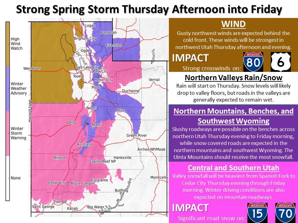
Snow levels are expected to start around 8500ft tonight and drop below 6000ft as the storm progresses.
Additional Storm Information:
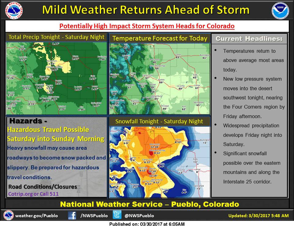
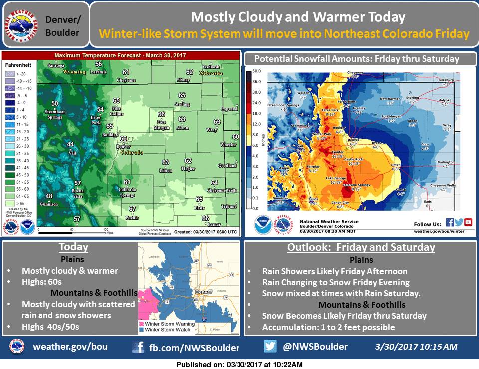
Colorado: 8-12+” of Snow Tonight-Saturday Morning
* SNOW ACCUMULATION...8 to 12 inches with locally greater amounts
  up to 18 inches possible over the higher terrain.
- NOAA Grand Junction, CO
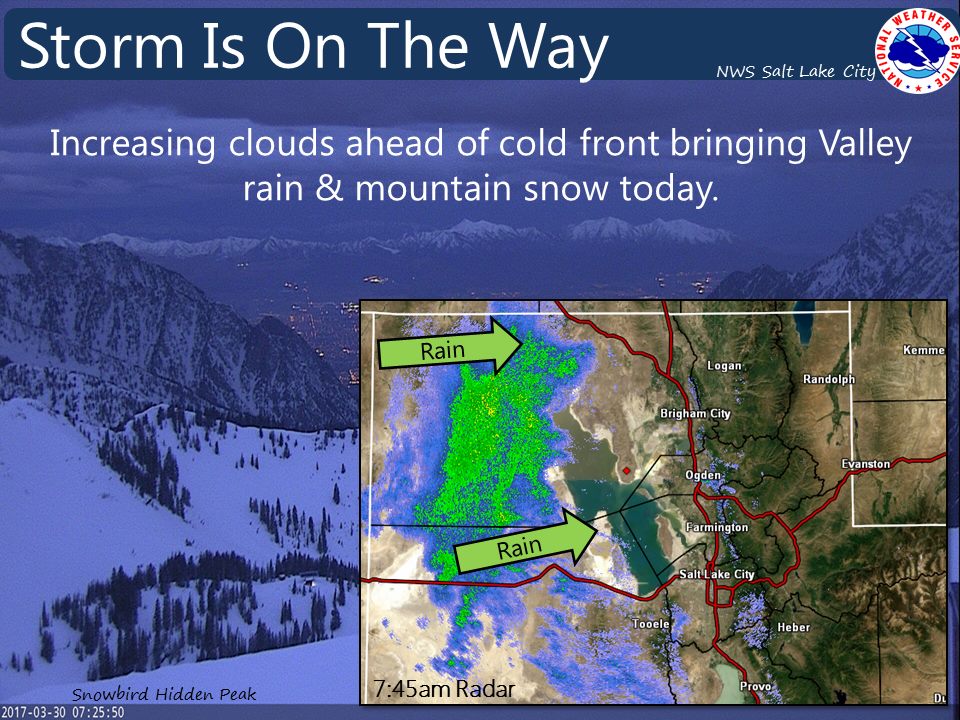
Utah: 10-20″ of Snow This Afternoon – Saturday Morning
* SNOW ACCUMULATIONS...10 to 20 inches.
- NOAA Salt Lake City, UT


Western Utah Winter Storm Warning:
URGENT - WINTER WEATHER MESSAGE
National Weather Service Salt Lake City UT
420 AM MDT Thu Mar 30 2017

Central Mountains-Southern Mountains-
Including the cities of Cove Fort, Koosharem, Fish Lake, Loa,
Panguitch, and Bryce Canyon

...WINTER STORM WARNING REMAINS IN EFFECT FROM 6 PM THIS EVENING
TO 6 AM MDT SATURDAY...

* AFFECTED AREA...Central and southern Utah Mountains.

* SNOW ACCUMULATIONS...10 to 20 inches.

* TIMING...Snow will develop this afternoon, then become
  widespread and locally heavy this evening. Periods of snow,
  heavy at times, will continue Friday into Friday night before
  diminishing Saturday morning.

* SNOW LEVELS...Near 8500 feet early this evening, falling below
  6000 feet by late evening.

* IMPACTS...Winter driving conditions can be expected across all
  routes through the central and southern mountains during this
  period including I-70 and the higher passes of I-15 across
  central and southern Utah.
