A strong spring storm is expected to hit Montana Monday Afternoon and stick around through Tuesday Afternoon. Strong winds and heavy snowfall will lead to difficult travel conditions and possible power outages.
12-18″ of snow is expected to fall Monday Afternoon – Tuesday Afternoon.
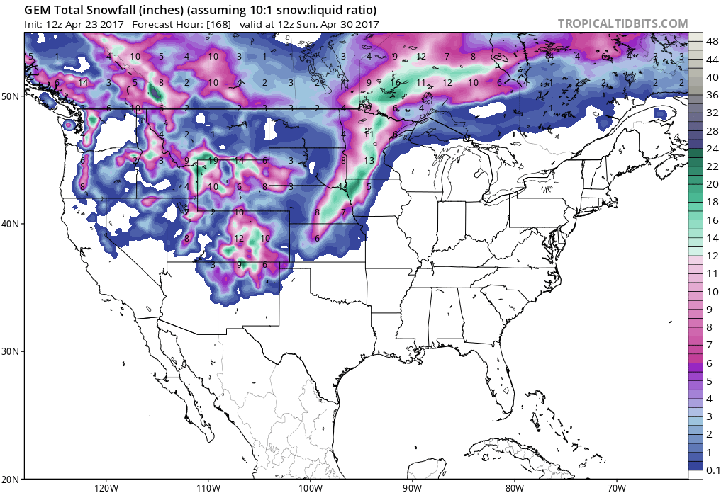
Snow levels are expected to be above 5000ft when this storm arrives on Monday Afternoon and they will drop down to 4000ft Tuesday.
Additional Storm Information:

Montana: 12-18″ of Snow Monday Afternoon- Tuesday Afternoon
* SNOW ACCUMULATION...12 to 18 inches.
- NOAA Billings, MT


Montana Winter Storm Watch:
URGENT - WINTER WEATHER MESSAGE
National Weather Service Billings MT
246 PM MDT Sun Apr 23 2017

Absaroka/Beartooth Mountains-
246 PM MDT Sun Apr 23 2017

...WINTER STORM WATCH IN EFFECT FROM MONDAY AFTERNOON THROUGH
TUESDAY AFTERNOON...

The National Weather Service in Billings has issued a Winter
Storm Watch...which is in effect from Monday afternoon through
Tuesday afternoon.

* IMPACTS...Difficult travel and recreation conditions. Possible
  power outages.

* TIMING...Snow increasing Monday afternoon and continuing through
  Tuesday. The heaviest snowfall is expected Monday night.

* SNOW ACCUMULATION...12 to 18 inches.