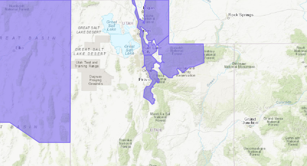
The National Weather Service has issued a Winter Weather Advisory for Utah that is in effect from Thursday Afternoon – Friday. A cold front is expected to move through that will turn rain to snow.
4-8″ of Snow is expected to fall above 7,000ft.
NOAA Has Issued A Winter Weather Advisory For:
- Utah
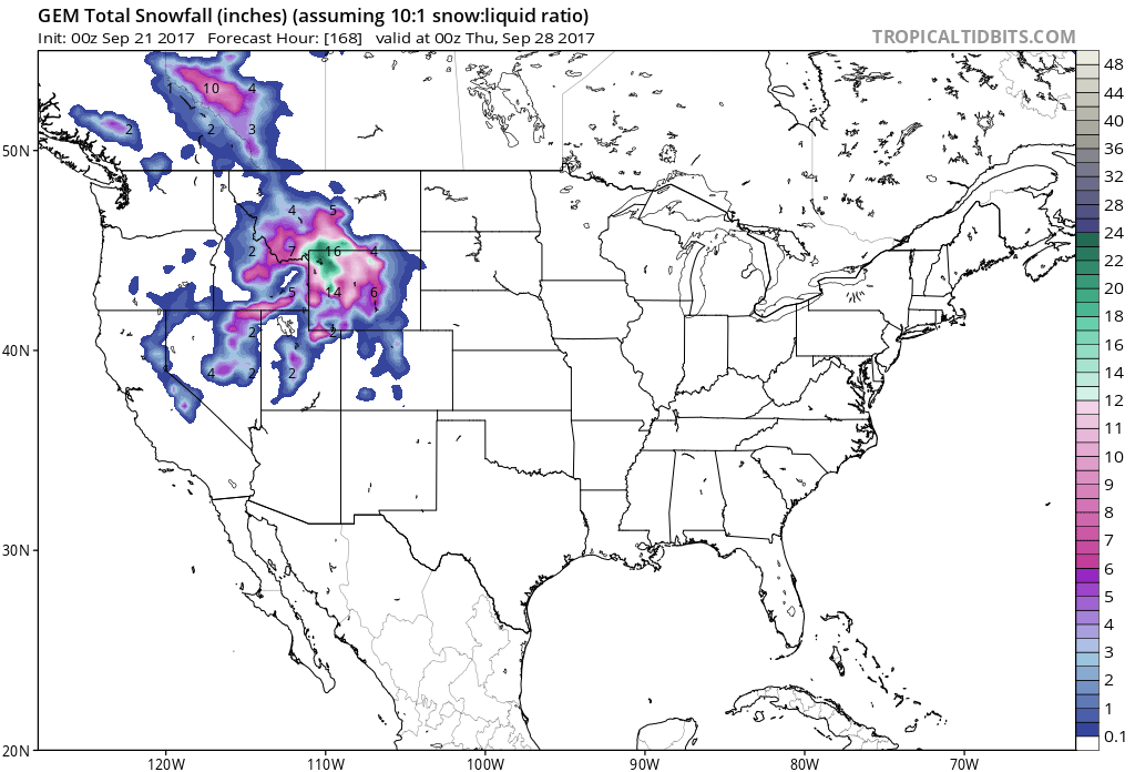
Snow levels are expected to start out around 9,000-10,000ft this afternoon, but they will drop to 6,500ft early Friday Morning.
Additional Storm Info:
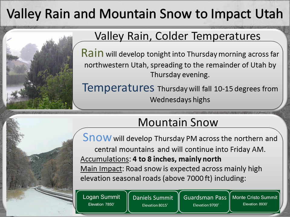
Utah: 4-8″ of Snow Above 7,000ft Tonight – Friday
* SNOW ACCUMULATIONS...4 to 8 inches, primarily above 7000 feet.
- NOAA Salt Lake City, UT


Utah Winter Weather Advisory:
URGENT - WINTER WEATHER MESSAGE
National Weather Service Salt Lake City UT
331 AM MDT Thu Sep 21 2017

Wasatch Mountains I-80 North-
Including the cities of Woodruff and Randolph

...WINTER WEATHER ADVISORY NOW IN EFFECT FROM 6 PM THIS EVENING
TO NOON MDT FRIDAY...

* AFFECTED AREA...The Wasatch Mountains north of Interstate 80.

* SNOW ACCUMULATIONS...4 to 8 inches, primarily above 7000 feet.

* TIMING...Snow will begin late this afternoon, with the heaviest
 snowfall expected this evening and overnight, before becoming
 more showery through the day Friday.

* SNOW LEVELS...Starting around 9000 to 10000 feet this afternoon,
 dropping to 6500 feet by early Friday morning.

* IMPACTS...Road snow accumulation is expected above 7000 feet,
 with the heaviest accumulation on high elevation seasonal
 roadways. Hunters and those recreating outdoors should be
 prepared for winter conditions.