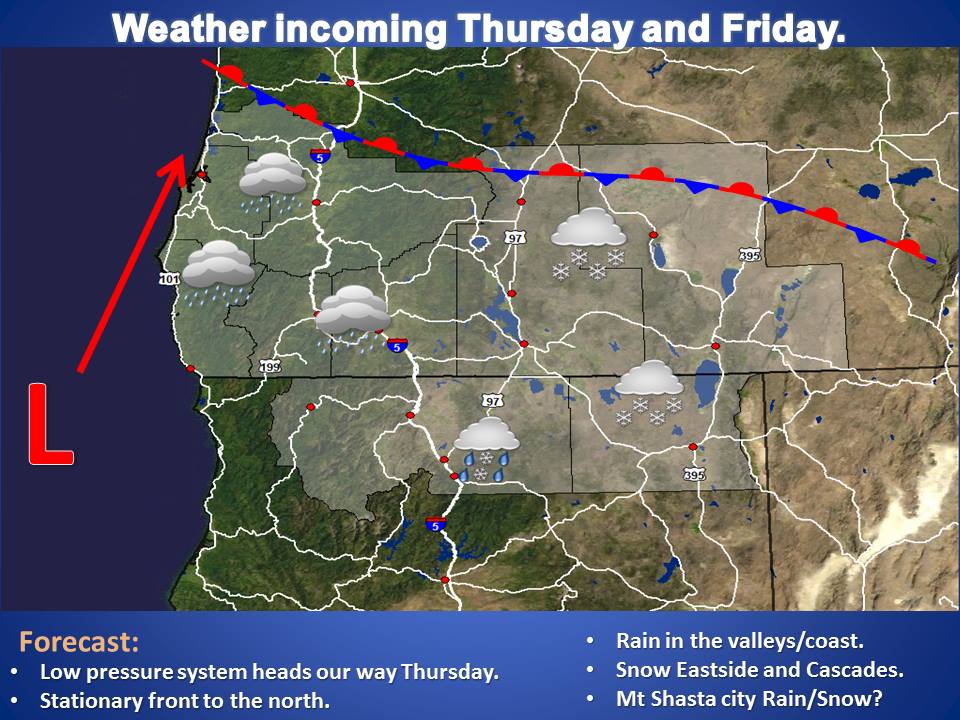
As we move towards the weekend, a strong storm system is expected to drop snow on the PNW from early Friday Morning through Saturday Afternoon.
10-18″ of Snow are forecasted in Oregon.
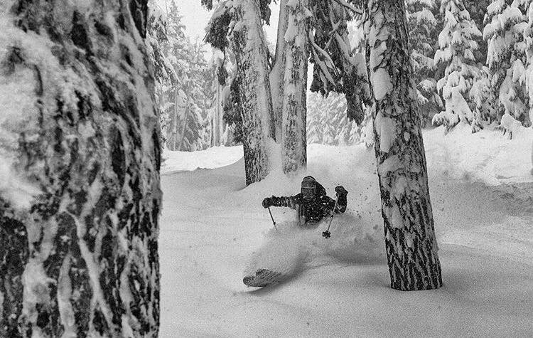
Powder turns are on tap at Mt. Bachelor this weekend.
NOAA Has Issued Winter Storm Warnings For:
- Oregon
- Washington
NOAA Has Issued Winter Weather Advisories For:
- Oregon
- Washington
(NOAA has also issued Winter Storm Watches For: Oregon and Washington)

HUGE precipitation totals are expected for the PNW throughout the next week. Snow levels are relatively low for this storm, on Friday they are below 1000ft, but they will move to around 2000-3000ft Saturday.
More Storm Information:
Oregon: 10-18″ of Snow
* SNOW ACCUMULATIONS...4 TO 8 INCHES OF SNOW IN THE VALLEYS AND IN THE MOUNTAINS 10 TO
 18 INCHES.
- NOAA Medford, OR
Washington: 7-12″ of Snow
* SNOW ACCUMULATIONS...7 TO 12 INCHES FOR THE EAST SLOPES OF THE WASHINGTON CASCADES
SOUTH OF WHITE PASS...WITH 5 TO 10 INCHES NORTH OF WHITE PASS. 5 TO 9 INCHES EXPECTED IN THE SIMCOE HIGHLANDS.
- NOAA Seattle, WA


Oregon Winter Storm Warning:
...WINTER STORM WARNING IN EFFECT FROM 2 AM FRIDAY TO 1 PM PSTSATURDAY...THE NATIONAL
WEATHER SERVICE IN PENDLETON HAS ISSUED A WINTERSTORM WARNING FOR HEAVY SNOW AND ICE...WHICH IS IN EFFECT FROM 2AM FRIDAY TO 1 PM PST SATURDAY. THE WINTER STORM WATCH IS
NO LONGER IN EFFECT.

* ICE ACCUMULATIONS...UP TO TWO TENTHS OF AN INCH.

* LOCATIONS...ENTERPRISE...JOSEPH...WALLOWA.

* SNOW ACCUMULATIONS...4 TO 8 INCHES OF SNOW IN THE VALLEYS ANDIN THE MOUNTAINS 10 TO
18 INCHES.

* TIMING...STEADY SNOW DEVELOPS EARLY FRIDAY MORNING AND CONTINUESTHROUGH THE DAY
BEFORE MIXING WITH RAIN...FREEZING RAIN ANDSLEET FRIDAY NIGHT AND SATURDAY MORNING.

* IMPACTS...ROADS WILL BE SNOW COVERED AND SLICK. SOME LOCALIZEDBLOWING SNOW WILL BE
POSSIBLE.

* WINDS...SOUTHEAST 5 TO 15 MPH WITH GUSTS UP TO 30 MPH.