
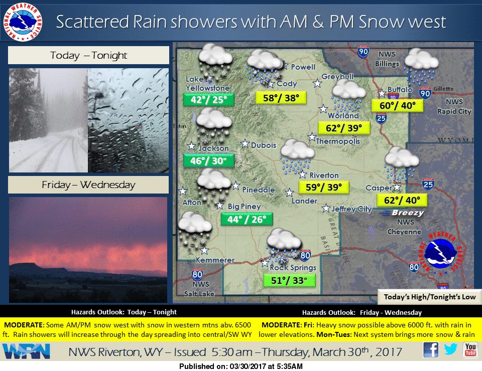
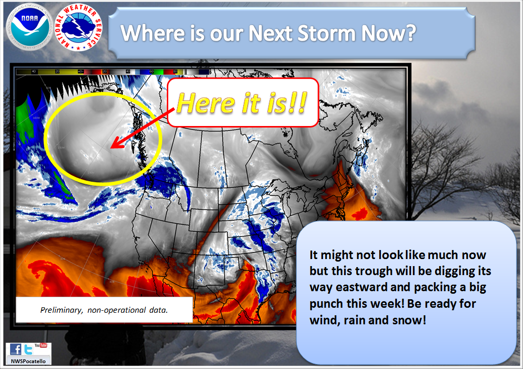
A Strong Winter Storm is hitting the west hard. Wyoming, Idaho, and Montana are going to experience heavy snow and high winds Today through Friday Night.
1-2 FEET of Snow is forecasted for Central Wyoming Today – Saturday Morning.
NOAA Has Issued Winter Storm Warnings For:
- Wyoming
- Montana
NOAA Has Issued Winter Weather Advisories For:
- Idaho
- Wyoming
- Montana
(NOAA Has Also Issued Winter Storm Watch For Montana)

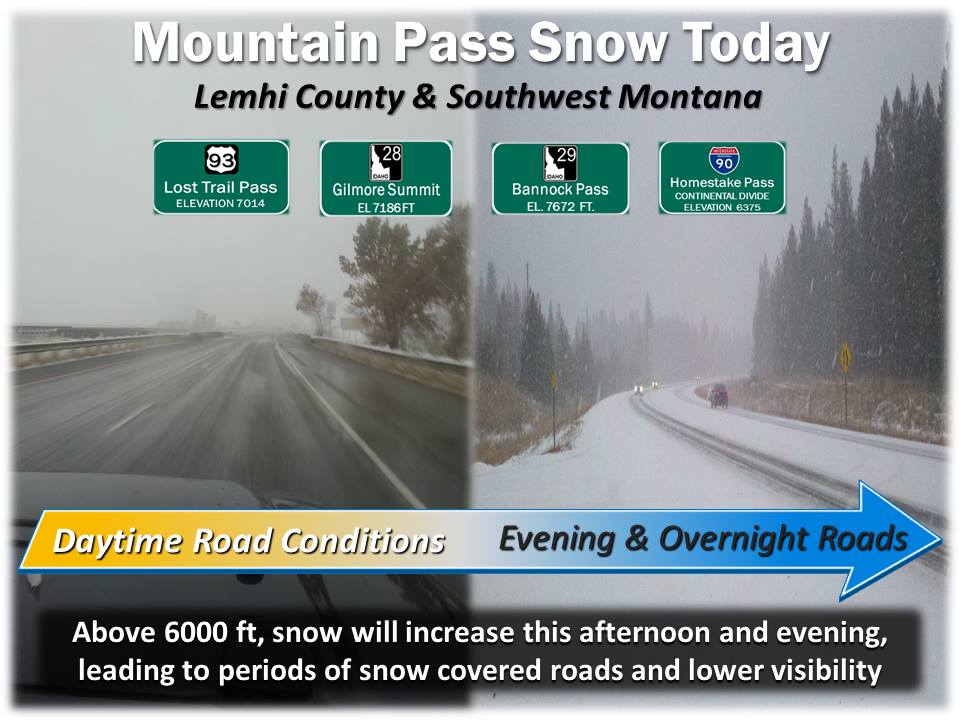
Snow levels for these storms are expected to hover around 6000-6500ft, which will lead to substantial snowfall for ski areas.
Additional Storm Information:
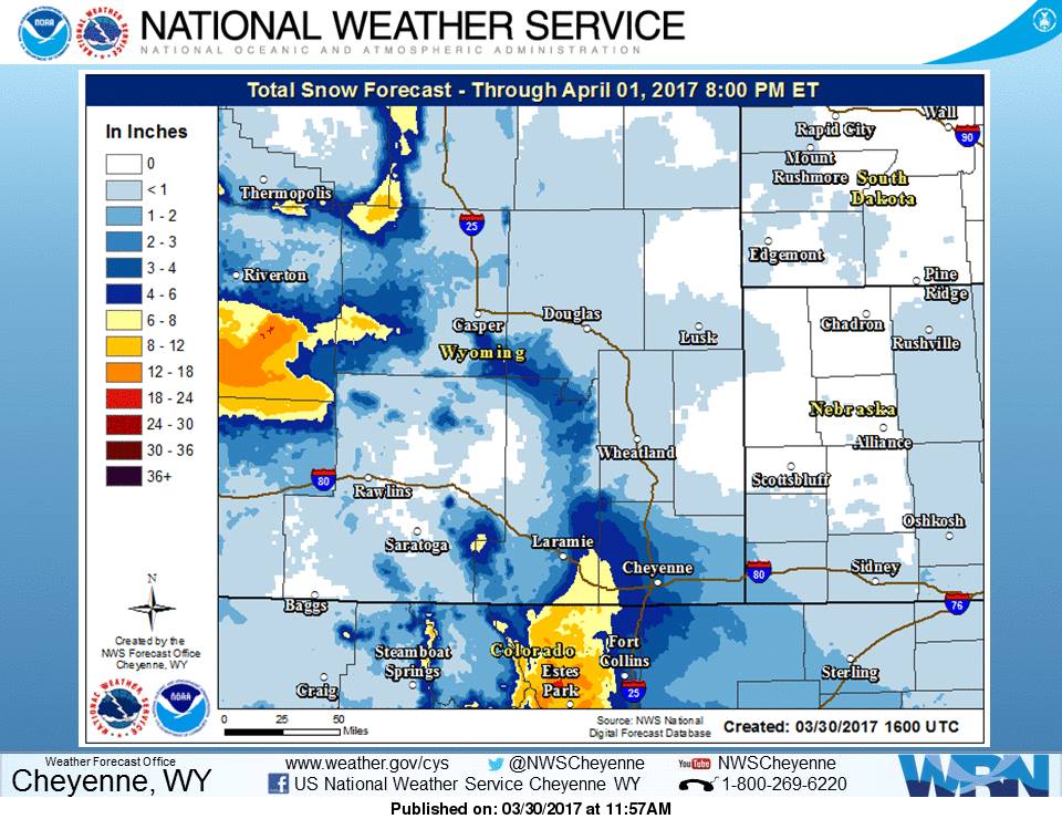
Wyoming: 1-2 FEET of Snow Today – Saturday Morning
* SNOWFALL...1 to 2 feet with locally higher amounts.
- NOAA Riverton, WY
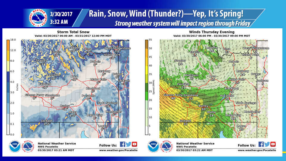
Idaho: 8-12″ of Snow Today-Friday Morning
* SNOW ACCUMULATIONS...8 to 12 inches.
- NOAA Pocatello, ID
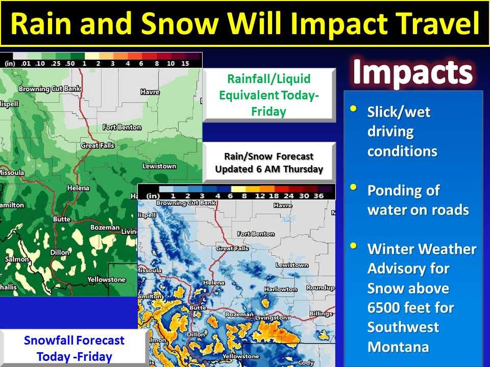
Montana: 10-16″ of Snow Today-Friday Night
* SNOW ACCUMULATION...10 to 16 inches. Greatest amounts will fall
  on northeast facing slopes above 6000 feet. This includes the
  mountains above Red Lodge.
- NOAA Billings, MT


Winter Storm Watch For Central Wyoming:
URGENT - WINTER WEATHER MESSAGE
National Weather Service Riverton WY
150 AM MDT Thu Mar 30 2017

...Heavy snow and strong wind expected across the Wind River
mountains, Green and Rattlesnake Ranges and Lander Foothills tonight
through late Friday Night...

.A strong upper level low is expected will bring a return to
winter weather for many areas. Heavy wet snow and very strong
northeast wind is expected to develop across the mountains and
higher elevations between the Wind River Mountains and Beaver Rim
and possibly into the Lander Foothills.

Wind River Mountains West-Wind River Mountains East-
150 AM MDT Thu Mar 30 2017

...WINTER STORM WATCH REMAINS IN EFFECT FROM LATE TONIGHT THROUGH
LATE FRIDAY NIGHT...

* TIMING...Snow...heavy at times...is expected to develop quickly
  late this evening and continue through late Friday night.

* SNOWFALL...1 to 2 feet with locally higher amounts.

* WIND AND VISIBILITY...Northeast 35 to 55 mph combined with
  heavy snow will likely produce near zero visibility at times
  in blizzard conditions.

* MAIN IMPACT...Travel over South Pass may become impossible by
  Friday due to heavy snow and 50 mph plus wind gusts.