Colorado just saw big snow yesterday and they’ll see more big snow this week beginning Friday. Yesterday’s storm dropped the most snow the Denver International Airport has ever seen. That snow closed the airport as well as over a dozen highways in CO. Colorado ski resorts saw up to 22″ in the past 3-days.
“As one storm exits…another moves in. Expect a very short break in snowfall today across the northern mountains in western Colorado as another fast moving Pacific storm brings more snow into the area this afternoon and continues through Friday. Yet another storm will help drive snow south into west-central and southwest Colorado by Friday afternoon and this system will keep snow flying through Saturday!!! If you are planning to travel across eastern Utah or western Colorado through this weekend, make sure you get the latest forecast by visiting www.weather.gov/gjt. In addition, the latest road reports can be obtained by calling 511 or visiting www.cotrip.org in Colorado or udottraffic.utah.gov in Utah.
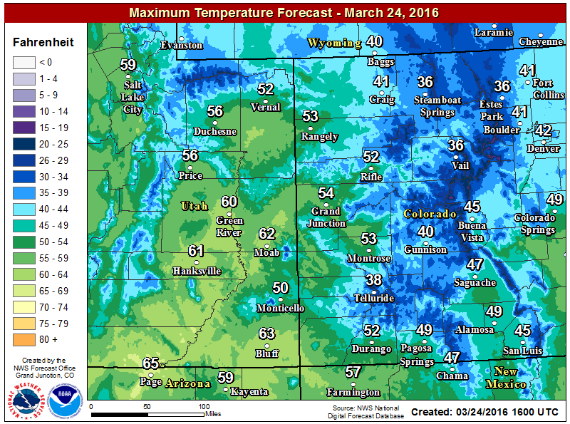
Below are a couple of maps showing the expected snowfall through Friday evening and Saturday evening and the high-temperature forecast for today.” – NOAA, Denver, CO today
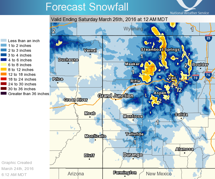
Notice how the heaviest snowfall is located over the mountains of northern Colorado” – NOAA Denver, CO today
3-Day Snowfall Totals at CO Ski Resorts:
- Telluride = 22″
- Steamboat = 18″
- Beaver Creek = 17″
- Powder Horn = 17″
- Vail = 16″
- Winter Park = 15″
- Breckenridge = 15″
- Silverton = 14″
- Monarch = 12″
- Loveland = 12″
- Keystone = 11″
- Aspen = 11″
- Copper = 10″
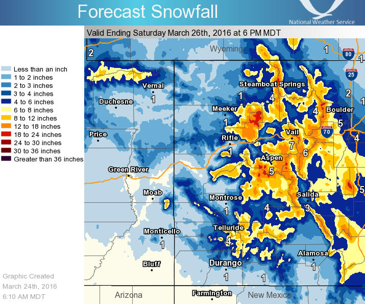
Notice how the heavier snowfall is shifting south! ” – NOAA Denver, CO today