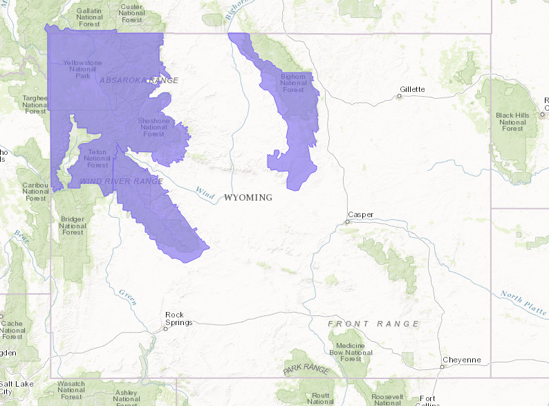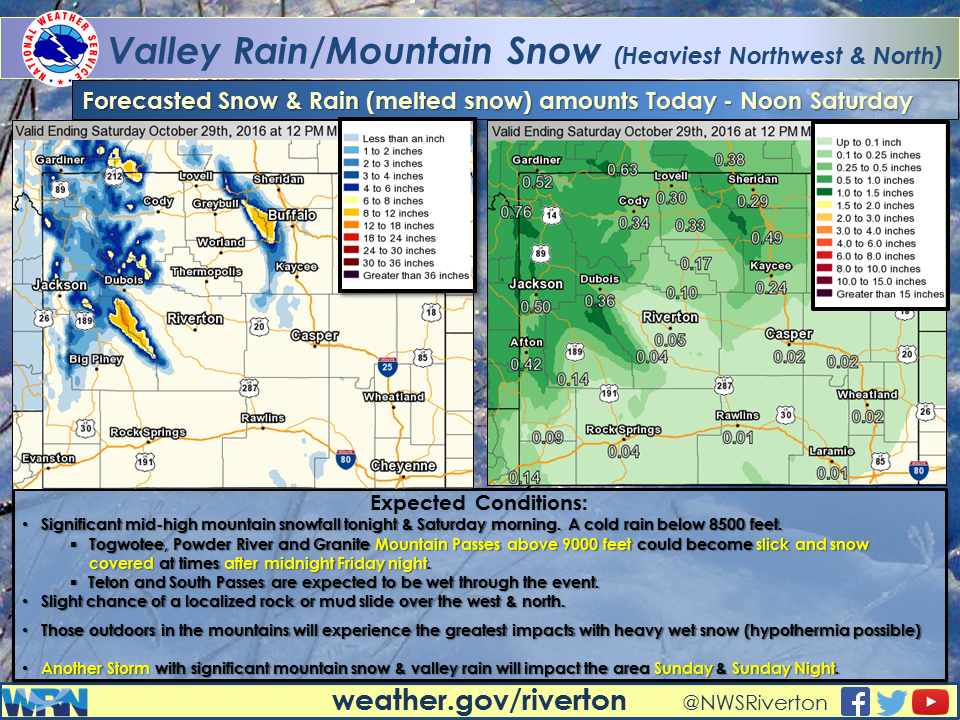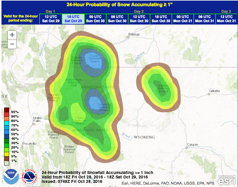
NOAA has issued a Winter Weather Advisory for Wyoming today that is calling for 4-8″ of snow above 8,500′.
* TOTAL SNOWFALL AMOUNTS...4 TO 8 INCHES ABOVE 8500 FEET.
  - NOAA Riverton, WY today
Snow levels will start high today before dropping as low as 8,000′ tonight.
  SIGNIFICANTLY INCREASING SNOWFALL WILL BEGIN THIS
  EVENING AND CONTINUE THROUGH SATURDAY MORNING. SNOW LEVELS WILL
  GENERALLY BEGIN ABOVE 10500 FEET LATE THIS AFTERNOON...FALLING
  TO AROUND 8000 FEET THROUGH THE OVERNIGHT PERIOD. BEST
  ACCUMULATING SNOW OCCUR ABOVE 8500 FEET.
  - NOAA Riverton, WY today

Jackson Hole & Grand Targhee ski resorts have been seeing above average snowfall this October. Both resorts have had enough snow for powder skiing this October.
- Oct. 4th, 2016: VIDEO: Skiing Powder in Jackson Hole, WY Today!
Grand Tarhgee has already seen 53″ of snow this season.
Jackson Hole has already seen 50″ of snow this season.

“Rain and snow showers will move into northwest Wyoming Friday morning and continue through midday Saturday. The precipitation will spread south into western Wyoming late Friday afternoon and become heavy at times with over an inch of rain expected in some areas, along with high elevation snow. Friday night into Saturday morning will see precipitation spread to the northern two thirds of the state, as the storm center moves through western and northern Wyoming, and a weak cold front moves in from Montana. Conditions will improve Saturday afternoon, only to have more storminess move into western Wyoming Sunday through Monday morning.” – NOAA Riverton, WY today

WINTER WEATHER ADVISORY for WYOMING:
URGENT - WINTER WEATHER MESSAGE...CORRECTED
NATIONAL WEATHER SERVICE RIVERTON WY
543 AM MDT FRI OCT 28 2016

...HIGH ELEVATION SNOW RETURNS TO PORTIONS OF NORTHWESTERN...
NORTHERN AND CENTRAL WYOMING BEGINNING TONIGHT...

.A FAST MOVING VIGOROUS UPPER LEVEL STORM SYSTEM WILL MOVE
THROUGH PORTIONS OF WESTERN...CENTRAL...AND NORTHERN WYOMING
LATER TODAY...TONIGHT...AND THROUGH SATURDAY MORNING. ALTHOUGH
SOME RAIN MIXED WITH SNOW MAY OCCUR THIS AFTERNOON...MOST
SIGNIFICANT ACCUMULATING SNOW WILL OCCUR ABOVE 8500 FEET LATER
THIS EVENING THROUGH SATURDAY MORNING. THIS SYSTEM WILL QUICKLY
MOVE OUT OF THE REGION BY SATURDAY AFTERNOON.

YELLOWSTONE NATIONAL PARK-ABSAROKA MOUNTAINS-
TETON AND GROS VENTRE MOUNTAINS-
INCLUDING THE CITIES OF...LAKE...MAMMOTH...OLD FAITHFUL

...WINTER WEATHER ADVISORY REMAINS IN EFFECT FROM 6 PM THIS
EVENING TO NOON MDT SATURDAY...

* TIMING...SIGNIFICANTLY INCREASING SNOWFALL WILL BEGIN THIS
  EVENING AND CONTINUE THROUGH SATURDAY MORNING. SNOW LEVELS WILL
  GENERALLY BEGIN ABOVE 10500 FEET LATE THIS AFTERNOON...FALLING
  TO AROUND 8000 FEET THROUGH THE OVERNIGHT PERIOD. BEST
  ACCUMULATING SNOW OCCUR ABOVE 8500 FEET. THE SNOW WILL TAPER OFF
  QUICKLY BY NOON ON SATURDAY.

* TOTAL SNOWFALL AMOUNTS...4 TO 8 INCHES ABOVE 8500 FEET.

* WIND AND VISIBILITY...SOUTHWEST WIND 10 TO PERHAPS 20 MPH WITH
  GUSTS TO 25 MPH AT THE HIGHER ELEVATIONS. VISIBILITY WILL BE
  REDUCED TO UNDER ONE MILE OCCASIONALLY.

* IMPACTS...HUNTERS AND OTHER OUTDOOR ENTHUSIASTS SHOULD BE
  PREPARED FOR WET SNOW AND COLD TEMPERATURES. HIGH ELEVATION
  ROADS...INCLUDING TETON AND TOGWOTEE PASSES...WILL BE SNOW OR
  SLUSH COVERED TONIGHT.