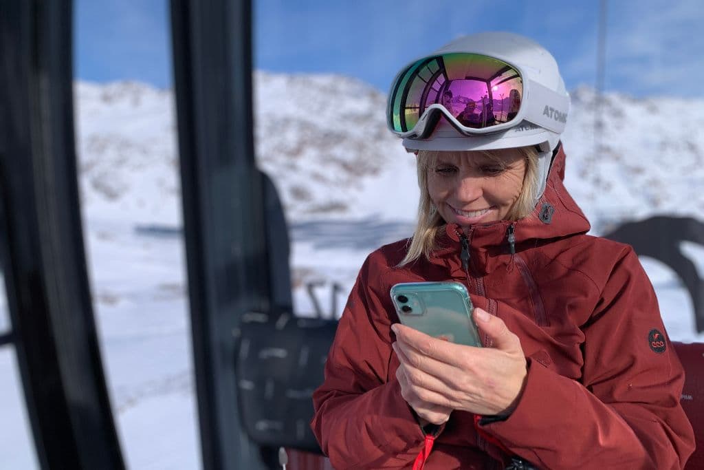
Thanks to constant upgrades in technology, many different apps for skiing and snowboarding have been developed and exist specifically to help skiers and snowboarders. User-friendly apps are regularly being designed for the millions of snow enthusiasts around the world who also always have a mini computer in their pocket with them. From tracking your friends or family’s locations on the mountain to detailed regional weather forecasts, many apps for skiing and snowboarding can help make the entire experience easy, efficient, and extra fun.
This list was compiled to include several categories covering everything from weather forecasting, GPS tracking, maps for resorts and backcountry, and the two mega-resort apps. Having one or an assortment of these apps can help enhance and add excitement to your time spent on and off the mountain this upcoming season.
OpenSnow
I have been an everyday winter reader of OpenSnow for years and find it incredibly helpful and worth the annual cost. For $29.99 a year for a single user or $39.99 to share with three others (four total users), OpenSnow keeps readers in the know on what kind of conditions to expect on the mountain and for your travels. Regional forecasters located all over the states and even worldwide provide in-depth write-ups and visuals on winter weather forecasts. The extremely user-friendly, easy-to-navigate app includes radars, maps, saved and favorite resorts, and endless amounts of useful information. Whether you are looking to travel and chase pow all season or get extremely accurate local weather and snow forecasts, OpenSnow is a must-have tool.
Ski Tracks/ Ski Tracks Lite
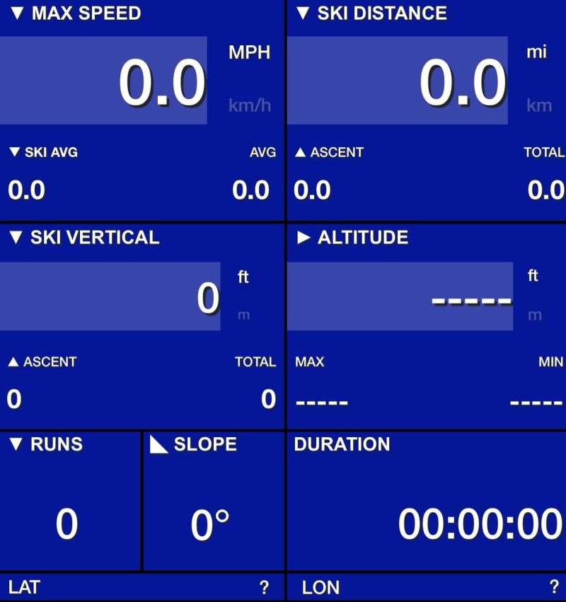
This GPS-tracking app is one of the most downloaded apps related to skiing and snowboarding. Ski Tracks is an easy-to-use app that efficiently tracks basic statistics such as speed, distance, vertical, number of runs, and time spent skiing. Also, the 3D map allows you to replay and see exact runs and lifts throughout any recorded day. Unlike most tracking apps, your phone’s battery life should see limited adverse effects while recording in cold temperatures. Get Ski Tracks Lite to try for free, or upgrade for a one-time cost of $1.99 and keep tabs and compare your stats all season long with Ski Tracks.
Slopes
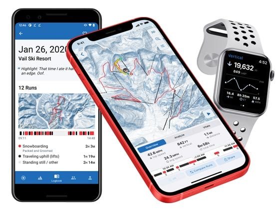
When it comes to skiing and snowboarding apps, this is another one centered around GPS tracking. Slopes’ basic, free version offers a simple interface like Ski Tracks that records common stats like speed, distance, vertical, number of runs, and time spent skiing. However, for $29.99 a year, users can upgrade to premium, which includes offline downloadable maps and the ability to connect to your health app, amongst many other things. From personal experience, recording and tracking a 6-hour day had a minimal-to-moderate impact on my phone’s battery life. Slopes also donate 2% of their annual revenue to Protect Our Winters (POW).
FatMap
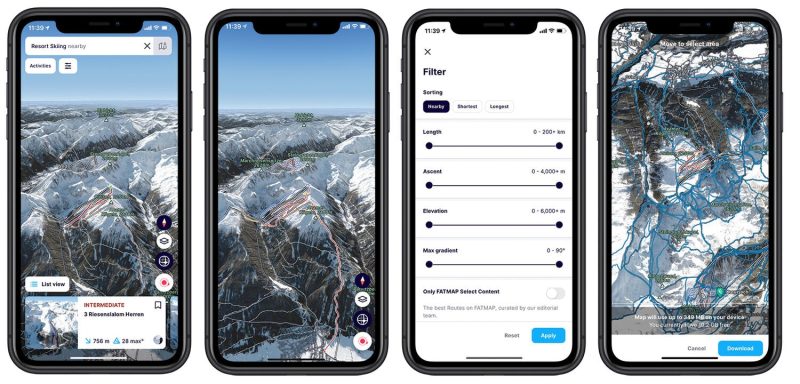
For anybody venturing out into the backcountry of any sort, this awesome and convenient app can surely come in handy. Now powered by Strava, FatMap is looking to essentially be the Google Maps of outdoor sports. Using layered 3D maps it allows users to explore gradient, elevation, avalanche terrain, and aspect while familiarizing and scoping an area or objective beforehand, all in the palm of your hand. The stat tracking is relatively basic with time, distance, ascent, and descent, but it has great GPS tracking abilities. Upgrade with a Strava subscription and also receive access on FatMap to downloadable maps, live snow conditions, live resort lift and piste conditions, and route mapping and planning.
Epic/Ikon
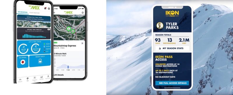
Two mega-passes that own over 100 combined ski resorts worldwide also have apps that are a must-have if skiing or riding at any of their resorts. The Epic Mix and Ikon Pass apps offer pass holders and users a bit of everything within just a few clicks. Enjoy stat tracking and sharing, live resort webcams, conditions, and weather reports and updates, and don’t forget to turn on notifications to be the first to know. These essentially all-in-one apps are super beneficial to ensure a smooth day on the slopes, from parking, lift, and conditions updates to live location tracking of friends and families when you ditch them to find freshies.
You and your associates might be interested in knowing about a new smartphone compass app (Android & iOS) capable of compensating residual (after calibration) azimuth deviation errors caused by adverse environmental magnetic / electromagnetic influences – TruPath Compass (soon to be released).
TruPath Compass is capable of a) assessing the accuracy [or lack thereof] of any electronic compass – rangefinders, standalone electronic compass units, and smartphone compass apps – and b) providing compensation parameters for those instruments/apps evaluated.
Visit “http://www.tru-path.org” to see examples of some third party electronic compass units and smartphone compass apps.
Contact me for more information.