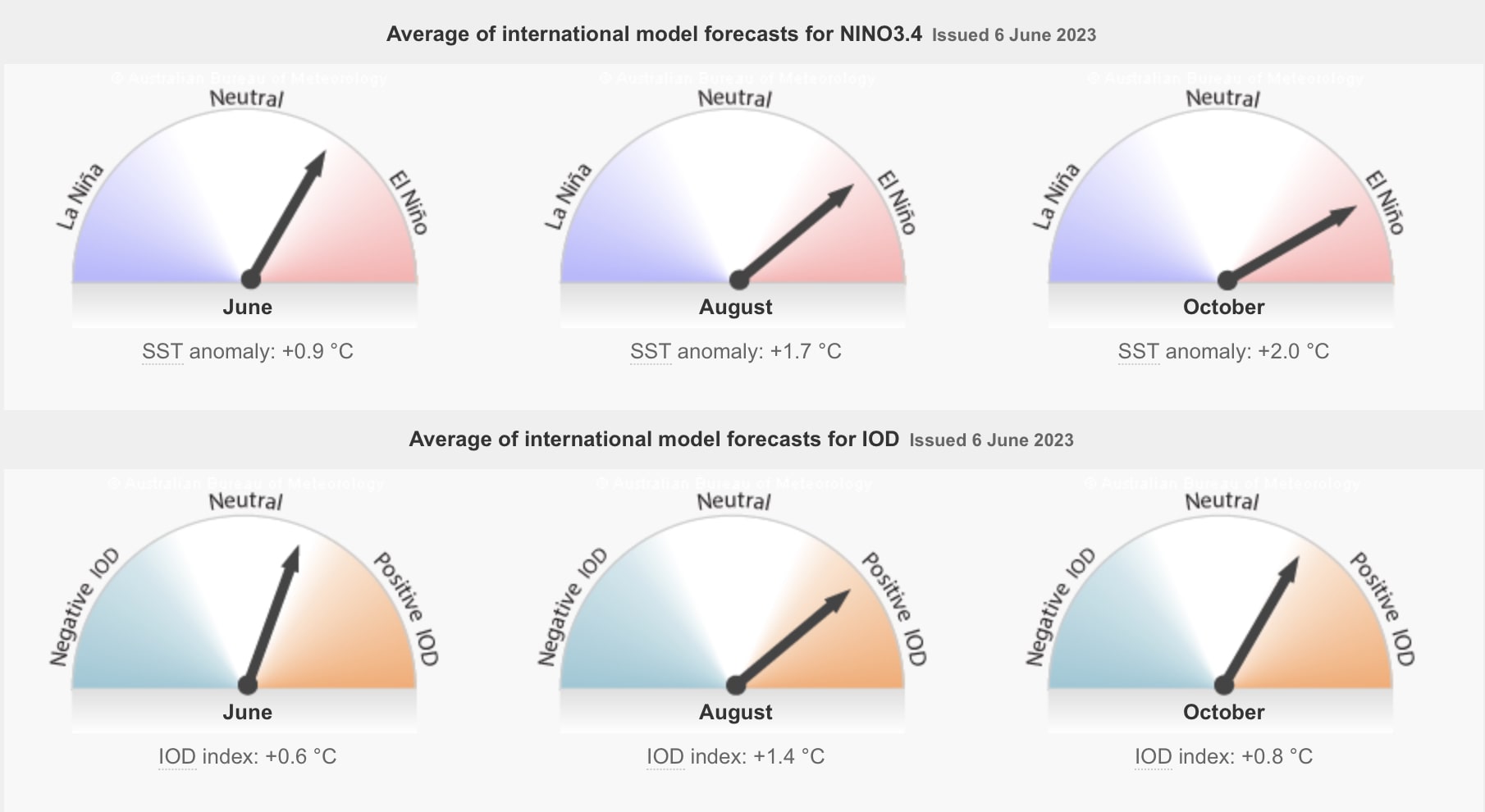
The Australian Bureau of Meteorology (‘BOM’) has shifted its ENSO Outlook to El Niño alert, indicating a 70% chance of El Niño forming this year. This equates to roughly three times the normal chance of an El Niño forming. Central and Eastern Pacific sea surface temperatures (‘SSTs’) have warmed to El Niño thresholds. All models surveyed by the Bureau forecast the likelihood of further warming and that these SSTs will remain above El Niño thresholds at least into the southern hemisphere spring.
Some atmospheric indicators, such as the Southern Oscillation Index (‘SOI’), have shifted towards El Niño thresholds, but wind, cloud, and broad-scale pressure patterns indicate the Pacific Ocean and atmosphere are yet to reinforce each other, as occurs during El Niño events. El Niño typically suppresses rainfall in eastern Australia during the winter and spring months.
The current status of the ENSO outlook does not change the Bureau’s long-range forecast for drier and warmer conditions across much of Australia for winter. The Bureau’s climate model considers all influences from the oceans and atmosphere when generating its long-range forecasts.
The Indian Ocean Dipole (‘IOD’) is currently in a neutral phase, with the IOD index at +0.32 °C. All models suggest positive IOD event thresholds may be reached in winter. A positive IOD typically suppresses winter and spring rainfall over much of Australia, and if it coincides with El Niño, it can exacerbate El Niño’s drying effect. Long-range forecasts of IOD made at this time of the year have generally had low accuracy and thus should be viewed with caution beyond June.

A weakening Madden–Julian Oscillation (‘MJO’) pulse lies over the western hemisphere. Most models indicate the signal will become weak or indiscernible in the coming days. While some models indicate a pulse will strengthen over the eastern Indian Ocean or western Maritime Continent region, north of Australia, in about a week, others maintain a weak or indiscernible signal. The MJO has little influence on Australian rainfall patterns at this time of the year.
The Southern Annular Mode (‘SAM’) index is currently neutral and expected to hover around positive thresholds for three weeks. During winter, a positive SAM often has a drying influence for parts of southwest and southeast Australia.
Climate change continues to influence Australian and global climates. Global SSTs were the highest on record for the months of April and May. The Australian continent has warmed by around 1.47 °C from 1910 to 2021.
There has also been a trend towards a greater proportion of rainfall from high-intensity, short-duration rainfall events, especially across northern Australia. Southern Australia has seen a 10 to 20% reduction in cool season (April–October) rainfall in recent decades. This is due to a combination of natural variability on decadal timescales and changes in large-scale circulation caused by increased greenhouse gas emissions.
