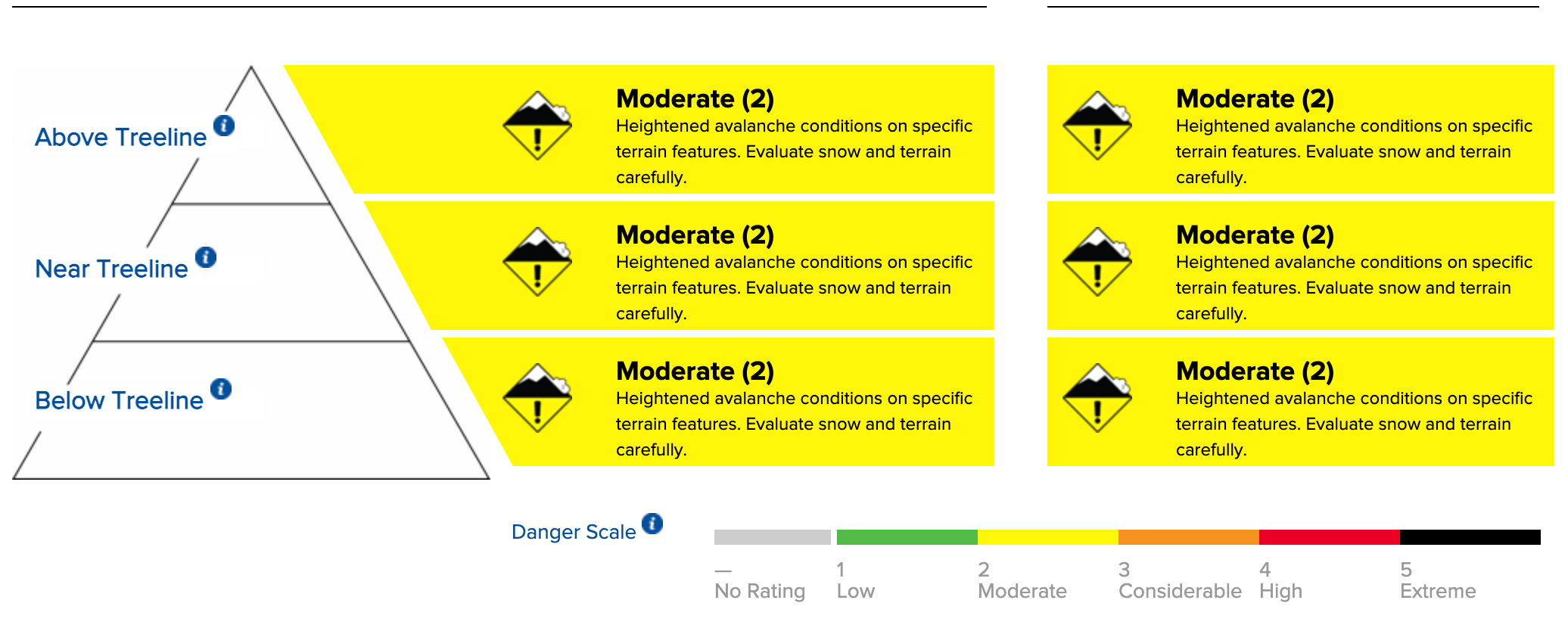
You could trigger an avalanche large enough to bury a person today in certain areas, especially at and below treeline. This is where problematic old weak snow exists below the new snow. Conditions are highly variable around the forecast area with uneven distributions of new snow and rain.
Areas of wind-drifted snow may be conducive to small avalanches today. Cohesive slabs of locally deeper wind-deposited snow could be encountered on the downwind side of ridge features. Look for cornices and snow drifts to help identify where wind slabs might exist. Move around these areas with caution and consideration for rocks and other downslope hazards that could cause injury from a small, otherwise inconsequential avalanche.

The size and distribution of wind slab avalanches are expected to increase tonight and tomorrow. The biggest concern for an avalanche that could bury a person or worse is the failure of old, weak, faceted snow. This weak layer is located beneath the new snow around crust layers in the lower portion of the snowpack and at the ground. The locations of greatest concern are near the treeline and below the treeline across NW-N-NE aspects above about 7,500′ to 8,000′. These are the places that held the most early-season snow, which sat on the ground and became weak. This weak snow will continue to receive load and stress today, tonight, and tomorrow, likely taking it to the breaking point sometime before this series of storms is over. New snow thus far has been unevenly distributed around the forecast area, creating uncertainty for exactly when and where avalanches will occur within the forecast area.
Snowpack collapse, shooting cracks, and avalanches will be the signs that the snowpack is approaching or is at its breaking point. Be careful when interpreting snowpit tests right now. You could easily get “false-stable” results if you don’t dig in the right place. Move carefully around the NW-N-NE aspect locations of concern. You could trigger an avalanche from low on the slope due to the type of weak layer.
Weather Forecast
Snowfall amounts from Wednesday night into Thursday morning were unevenly distributed around the forecast area. Donner Summit was the epicenter, with 16 to 22 inches of snowfall accumulated before the rain/snow level climbed to at least 8,700′ yesterday afternoon. Other areas to the south and east received substantially less new snow, with just a trace to five inches of new snow followed by rain. Ridgetop winds have been out of the SE at strong to gale force speed for the past 24 hours. Winds are forecast to shift to SW later this morning and continue at strong to gale force speed. Following a break in precipitation last night, rain and snow will resume today, with an expected start time around 8 to 10 am. High-intensity precipitation is expected tonight. Snowfall is expected to continue tomorrow. Snow level lowers gradually tonight and tomorrow from around 7,500′ today to nearly 6,000′ tomorrow.
For more information, visit Sierra Avalanche Center’s website.
