Brought to you by Ikon Pass
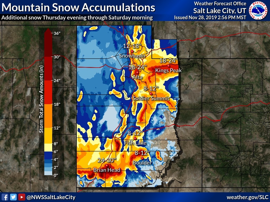
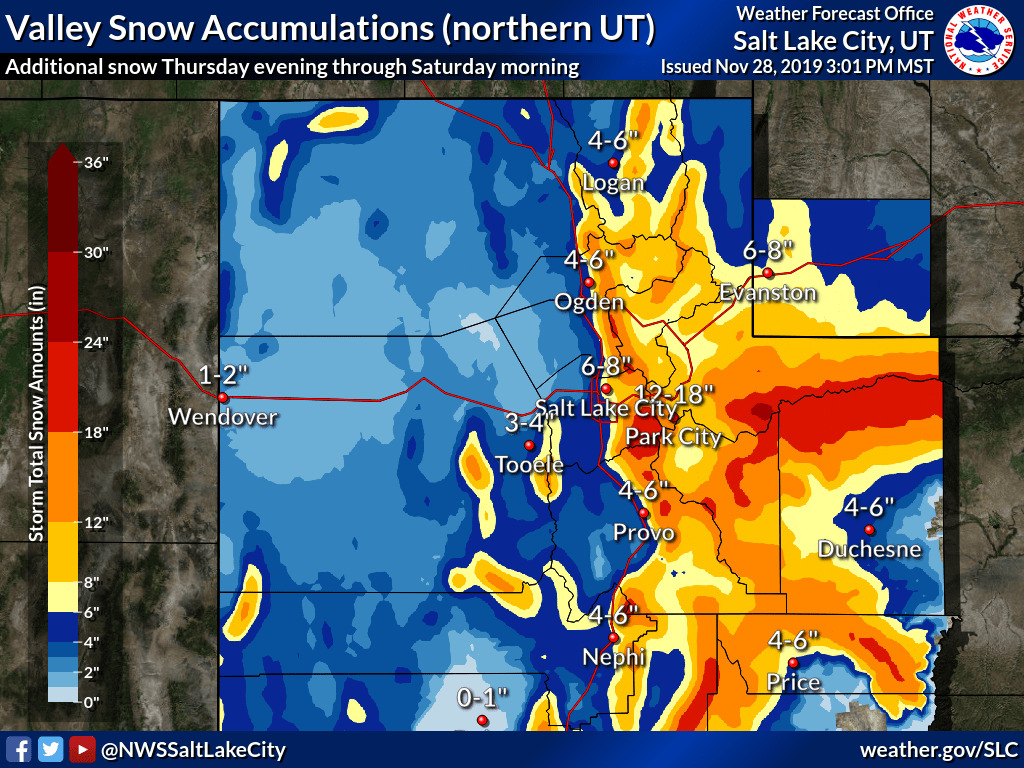
The NOAA has issued a winter storm warning for the Wasatch, with Utah ski resorts set to benefit with up to 2-FEET of fresh snow. More importantly, there is also an avalanche watch warning, from 6 am Friday through 6 am Saturday. Probably a weekend for skiing in a resort…
Snowbird, who are opening for the season today, advised last night that due to ‘natural avalanche activity’ the resort will be delaying opening until their operations crews can safely prepare the mountain.
...WINTER STORM WARNING REMAINS IN EFFECT UNTIL 10 AM MST
SATURDAY...

* WHAT...Heavy snow. Additional snow accumulations of 1 to 2 feet.

* WHERE...Wasatch Plateau/Book Cliffs, Western Uinta Mountains,
  Wasatch Mountains South of I-80, Wasatch Mountains I-80 North
  and Central Mountains.

* WHEN...Until 10 AM MST Saturday.
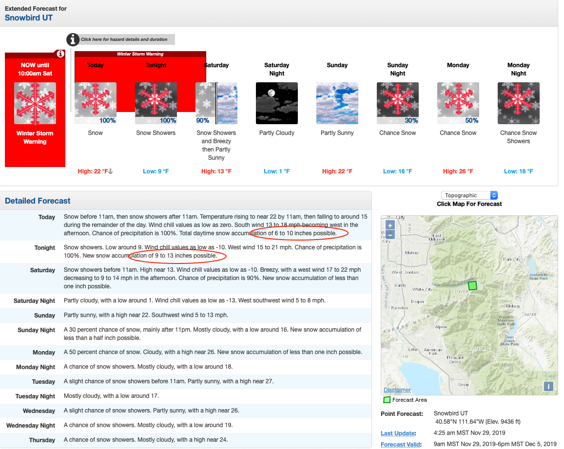
So far this storm has brought 3-4 feet to Brighton, Snowbird, and Alta, and with one last hurrah, we should see another couple of feet added to those totals. Not a bad week for Utah where many resorts delayed opening day last week due to ‘warm weather’.
Heavy snow will continue right through Friday until late Saturday morning. Expect a cold couple of days with temperatures dropping to the low single digits, and wind chill as cold as -10ºF. It’ll be fairly windy too until Saturday afternoon.
Snowbird and Alta should both see 18-24″ from this storm, with Solitude and Brighton up to 18″ each. Not bad for November! Light snow could return Sunday.
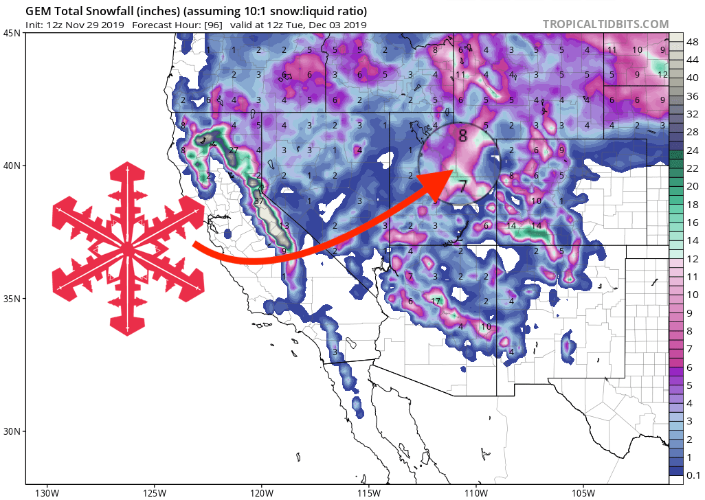
GEM Total Snowfall Forecast
Other Info
