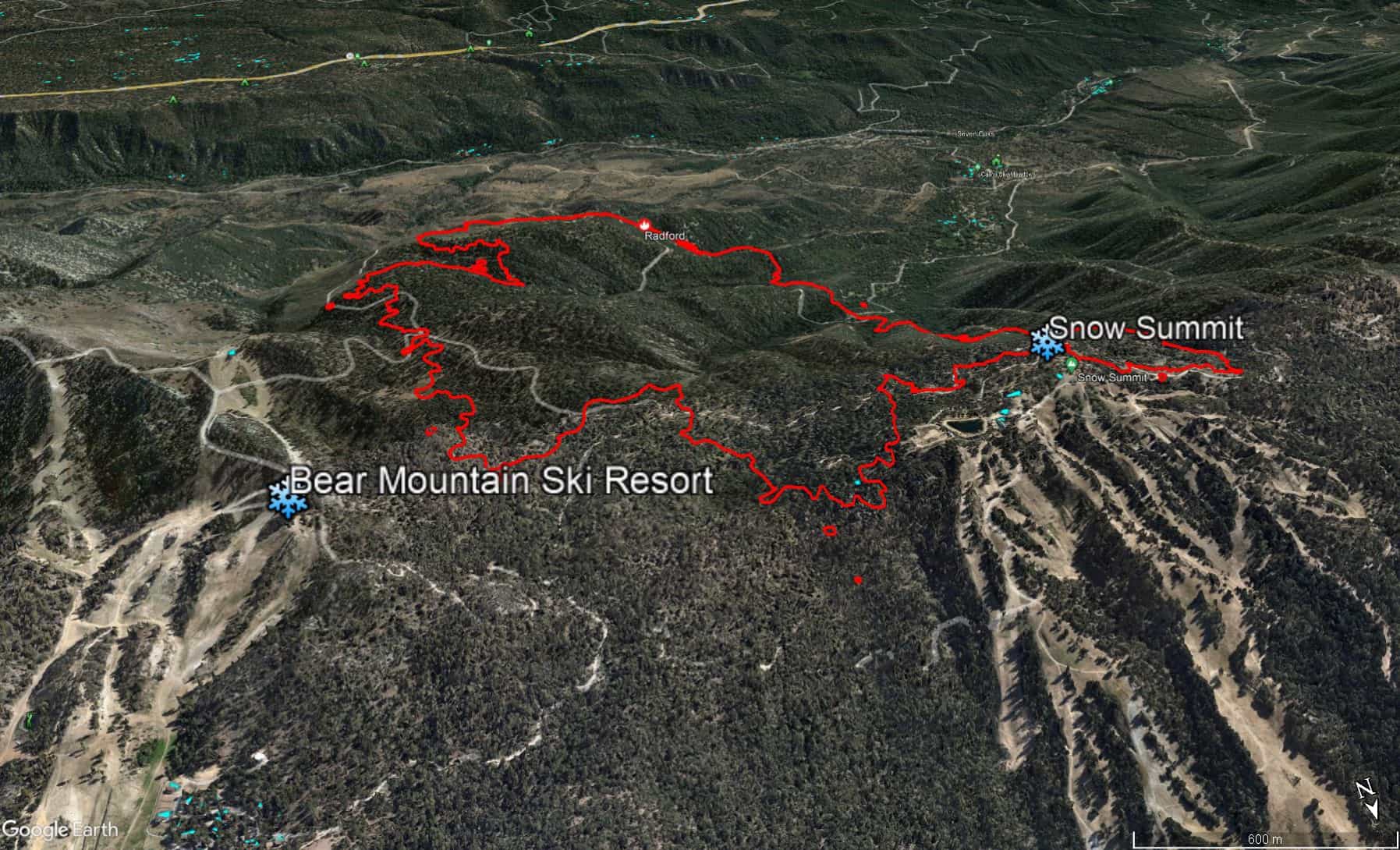
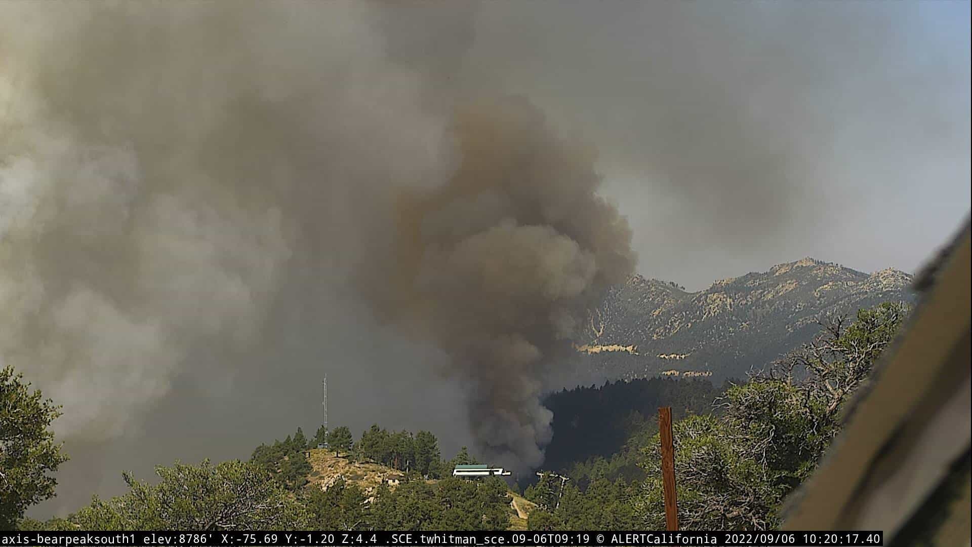
Big Bear using its snow making sprinklers in an effort to slow the encroaching #RadfordFire as seen from an @AlertWildfire camera at the resort pic.twitter.com/P7bbzW2peP
— Travis Schlepp (@travischlepp) September 6, 2022
The Radford fire threatening Big Bear and Snow Summit ski areas in California almost tripled in size yesterday to 977 acres. It is currently just 2% contained.
The Radford Fire was reported at 1:30 in the afternoon on September 5th by a Forest Service Helicopter while doing lightning reconnaissance. The fire is located north of Highway 38 in the Barton Flats Area. A full response of engines and aircraft responded to the fire.
The #RadfordFire has now crossed Forest Service Road 2N10 just west of 2N06. This video was taken moments before fire crews had to pull out of this location. pic.twitter.com/li31WUdROO
— SoCalFirePhoto (@SoCalFirePhoto) September 6, 2022
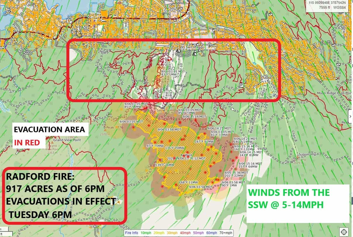
The fire is still perilously close to passing over the ridge to Snow Summit. Both Big Bear and Snow Summit are using snow guns in an attempt to save their buildings and infrastructure.
It’s at the edge of the resort. My son is an employee and they were called in at 3am to use the snow making system to help protect the resort property.
He sent me this video around 8am from the top. pic.twitter.com/FRlhvfux8w
— Steve Famiano (@SFamiano) September 6, 2022
Evacuations:
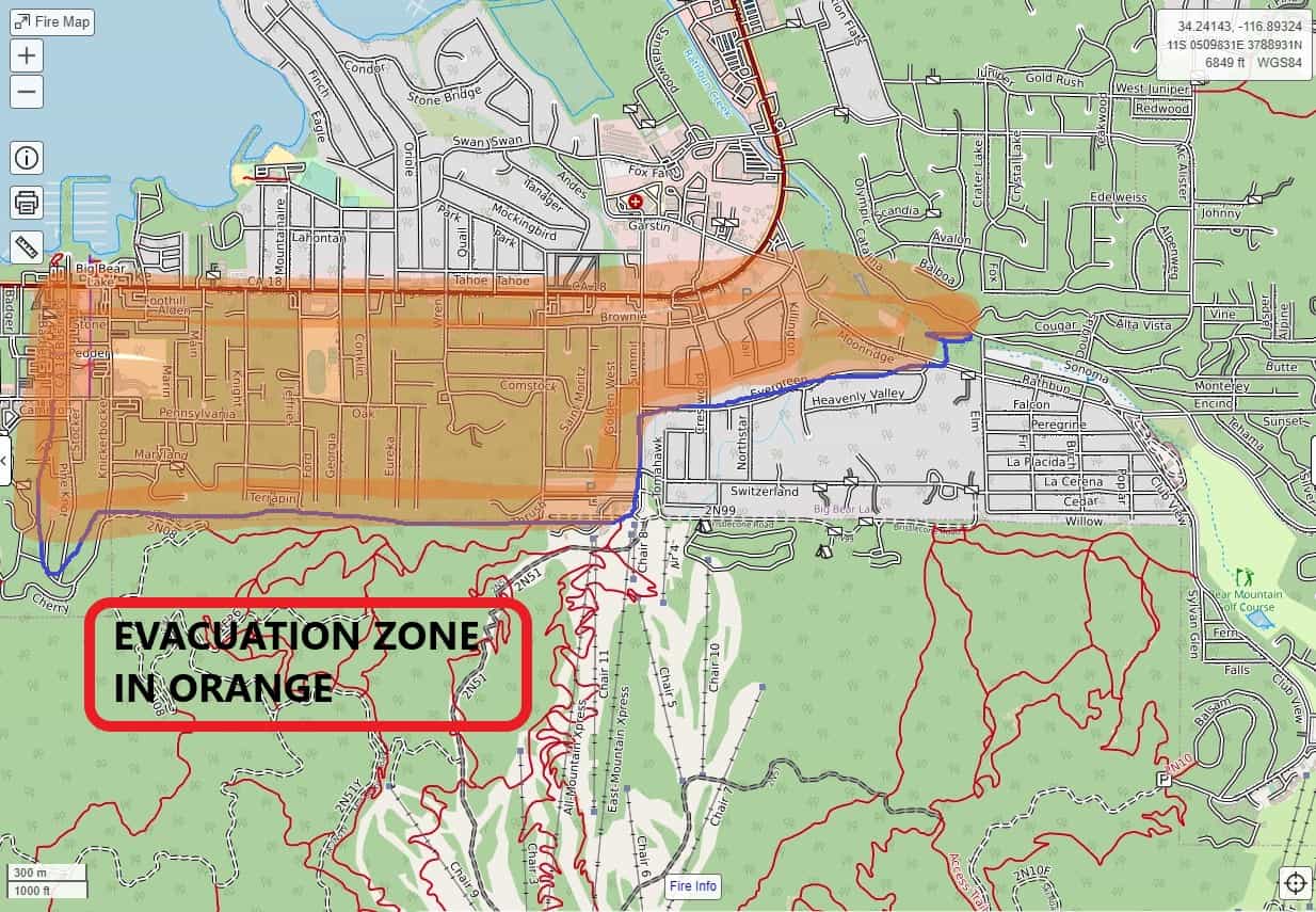
At 5:30 pm the San Bernardino County Sheriff added an evacuation warning for additional areas from Club View to Angels Camp from Vine to Lassen; and for Summit Blvd to McAllister Rd to Hwy 18 between Fox Farm and Evergreen. Interactive Map of the Closure Orders for detailed information.
At 4:00 pm the San Bernardino County Sheriff added an evacuation area south of Evergreen /South of Moon Ridge between Summit Blvd and Club View Drive. Please view the Interactive Map of the Closure Orders for detailed information.

At 11:00, the San Bernardino Sheriffs Department issued an evacuation area from Knickerbocker Road west to Castle Rock, and from Pine Knot Road South to the 2N10 road.
Evacuation orders remain in effect for the area between Glass Road and South Fork River Road along the Hwy 38 corridor.
To receive evacuation notices on your cell phone, please visit the San Bernardino County Fire Telephone Notification System.

Evacuation Center: The American Red Cross will be opening an evacuation center at the Big Bear High School, 351 Maple Lane, Big Bear, CA. The center will open at 1:30. For assistance with animal evacuations, contact SB County Animal Care and Control at 800-472-5609.
Road Closures: Highway 38 is closed from Valley of the Falls Drive east to Lake Williams Drive. Residents of the mountain communities (Angelus Oaks, Etc.), will be allowed through the closure with proof of residency.

Aviation / Drone Restrictions: The Federal Aviation Administration (FAA) has issued Temporary Flight Restriction (TFR) and any private aircraft or drone that violates the TFR could face serious criminal charges. For more information on drones, the public can visit the FAA’s website at www.KnowBeforeYouFly.org. “If you fly, we can’t!”
Smoke: The Southern California Air Quality Management District has issued smoke advisories for fires in Riverside and San Bernardino National Forest. Please visit their website at Air Quality Advisories (aqmd.gov).
For local smoke information, you can also visit http://Airnow.gov.
There are currently 44 engines, 10 crews, 8 water tenders, and 2 dozers assigned, along with aircraft.

simple but smart. my family defended its cabin from wild fire in a similar move.