The Colorado Avalanche Information Center yesterday released its full report from the fatal slide on Berthoud Pass, CO, on December 26th, 2022. The findings can be a learning opportunity for all of us.
The full report is below:
Avalanche Details
|
Number
|
Avalanche
|
Site
|
Avalanche Comments
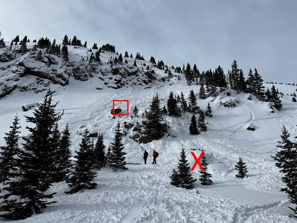
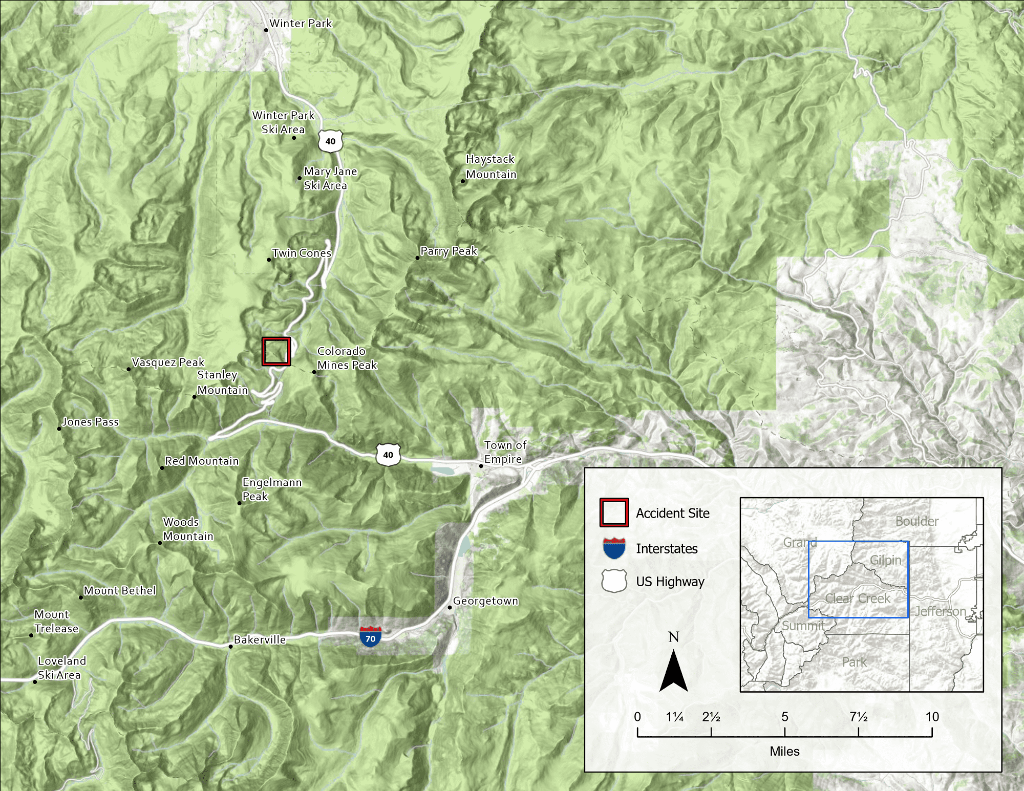
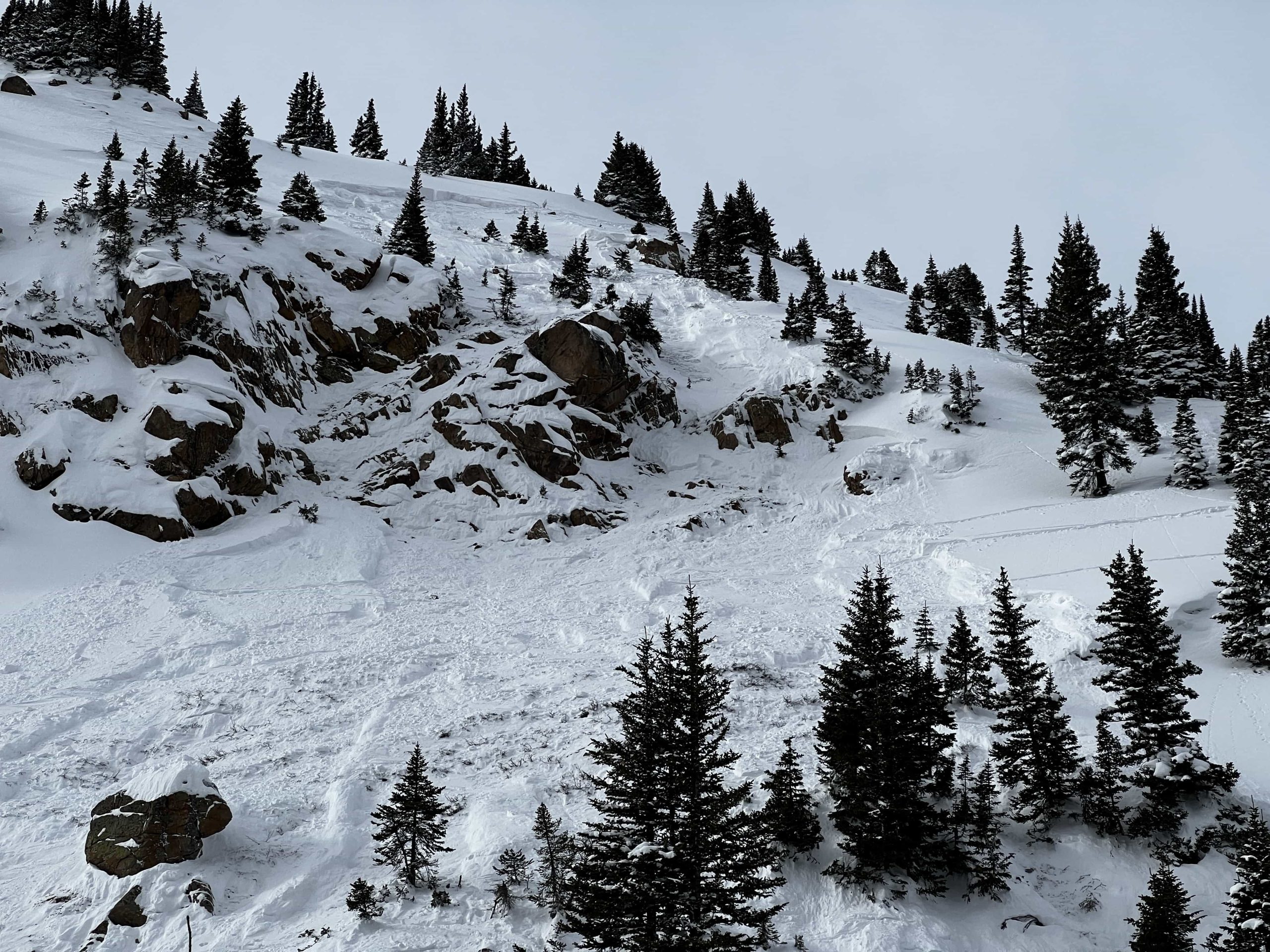
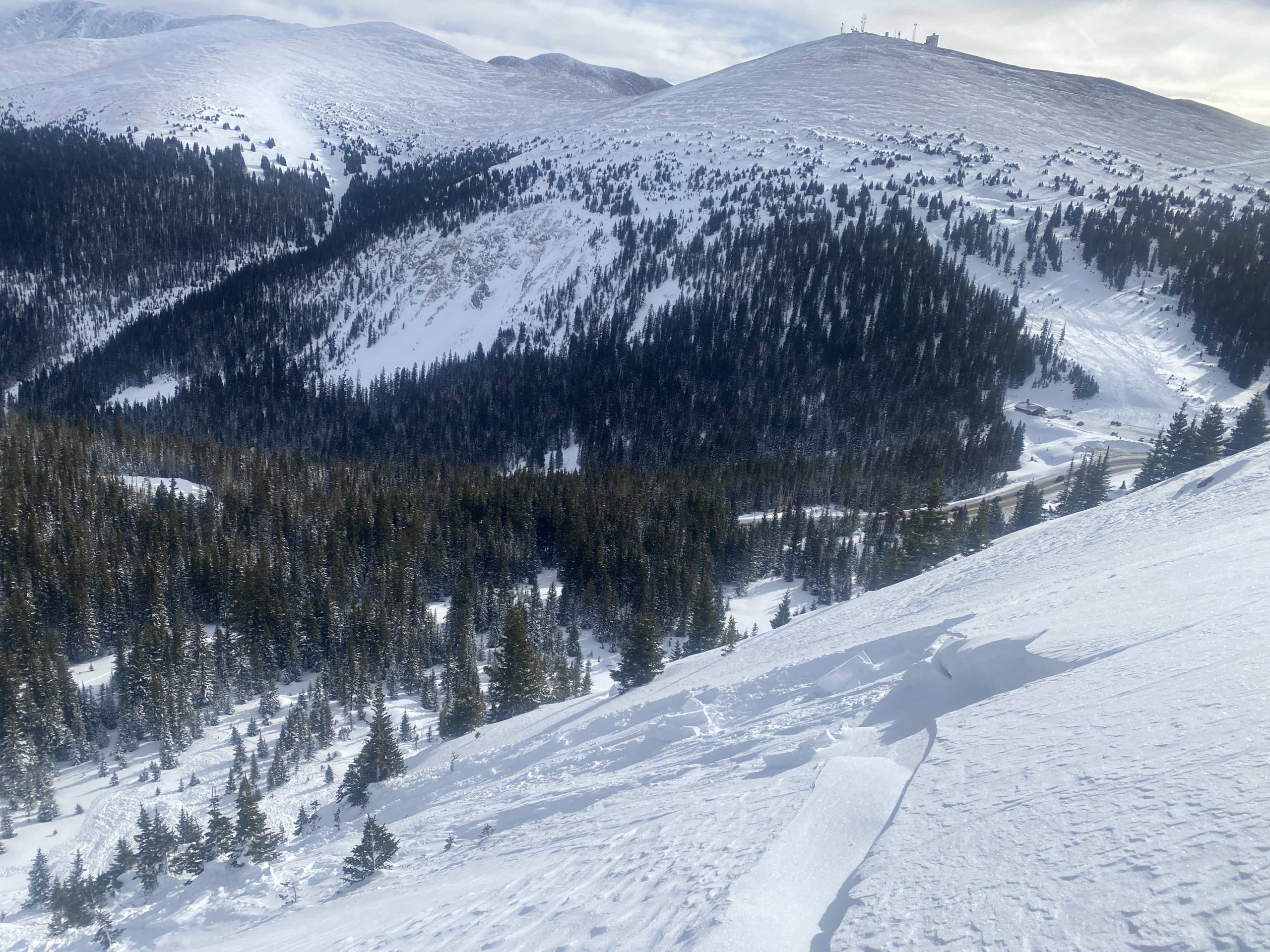
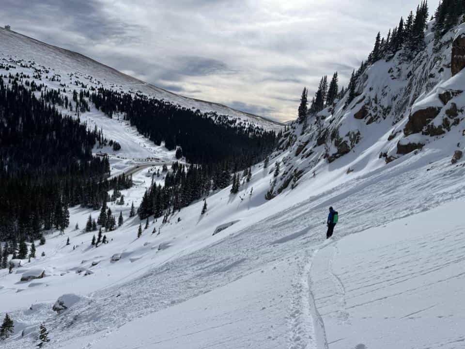
This avalanche occurred in an area locally known as Nitro Chute, about three-quarters of a mile north of the summit of Berthoud Pass. Nitro Chute is a steep east-facing chute in the near treeline elevation band. It was a soft slab avalanche unintentionally triggered by a snowboarder. It was small-size relative to the path and produced enough destructive force to bury, injure, or kill a person. It broke into old snow layers and stepped down to the ground in places. The avalanche broke 1 to 3 feet deep and about 80 feet wide in the starting zone but fanned out to about 150 feet wide below the cliff band. It ran about 300 vertical feet (SS-ARu-R2-D2-G).
Backcountry Avalanche Forecast
The Colorado Avalanche Information Center’s (CAIC) forecast for the area around Berthoud Pass for Monday December 26, 2022, rated the avalanche danger at MODERATE (Level 2 of 5) at all elevations. Persistent Slab avalanches with a likelihood of Possible were highlighted on all elevations on northwest, north, northeast, and east-facing aspects, and on southeast-facing aspects near and above treeline. The expected avalanche size was Small to Large (up to D2). The summary stated:
You can trigger a large avalanche on any slope where you find a slab of dense wind-drifted snow resting on weak snow below. Northerly and easterly-facing slopes at upper elevations are the most suspect, but use caution on any slope that shows signs of recent wind loading. New snow may hide these recently wind-drifted slopes. To manage this issue, avoid pillows of snow below ridgelines, in gullies, and just downhill of convex rollovers. If you are traveling over slopes that sound hollow under the new snow, move to low-angle slopes not connected to steeper slopes above for safer travel options.
Weather Summary
The season’s first measurable snow fell on Berthoud Pass in the last week of October. A few storms at the beginning of November pushed the total height of snow on the ground to around a foot. A storm at the end of November doubled the depth of snow on the ground. Periods of clear weather during the first part of November and the beginning of December faceted the snowpack, a weak base for future snowfall.
A low-pressure trough moved through the area on December 21. Winds started out of the southwest ahead of the trough axis and shifted northwesterly as the low-pressure system moved east. Winds were very strong during this period. In the 48 hours between December 21 and 23, the average hourly wind speed at the CAIC weather station, about 1,500 feet west of the accident site at 11,800 feet, never dropped below 20 miles per hour, with many hours averaging above 30 miles per hour. Maximum hourly wind gusts were in the 50 to 70-mile-per-hour range for multiple hours. On the morning of December 23, CAIC forecasters measured a storm total of 11 inches of snow with 0.85 inches of snow water equivalent (SWE) at the Berthoud Pass highway study plot, less than a quarter of a mile east of the accident site. With plenty of snow on the ground to transport, another wind event overnight on December 25 into the morning hours of December 26 continued to deposit wind-drifted snow onto easterly-facing aspects.
December 26, the day of the accident, started mostly clear. Winds began to decrease around 11:00 AM. By noon, low clouds began streaming over the pass, and the cloud ceiling dropped to just above pass level. Daytime temperatures hovered right around 20 degrees Fahrenheit.
Snowpack Summary
On December 1, the Berthoud Summit SNOTEL, less than a quarter of a mile east of the accident site, measured a snow height of 20 inches. The snowpack was almost entirely composed of weak faceted crystals. There was very little snowfall until December 21.
In the five days preceding the accident, around 11 inches of snow fell around Berthoud Pass. Strong winds shifted from the southwest to the northwest and drifted the new snow into thick, dense slabs on easterly-facing aspects. There was now a dense slab about 30 inches (80 centimeters) thick resting on a layer of weak, well-formed, chained, striated depth hoar crystals. The avalanche danger rose to CONSIDERABLE (Level 3 of 5) on December 22 and remained elevated until December 25, when the loading event finished, and natural avalanche activity ended.
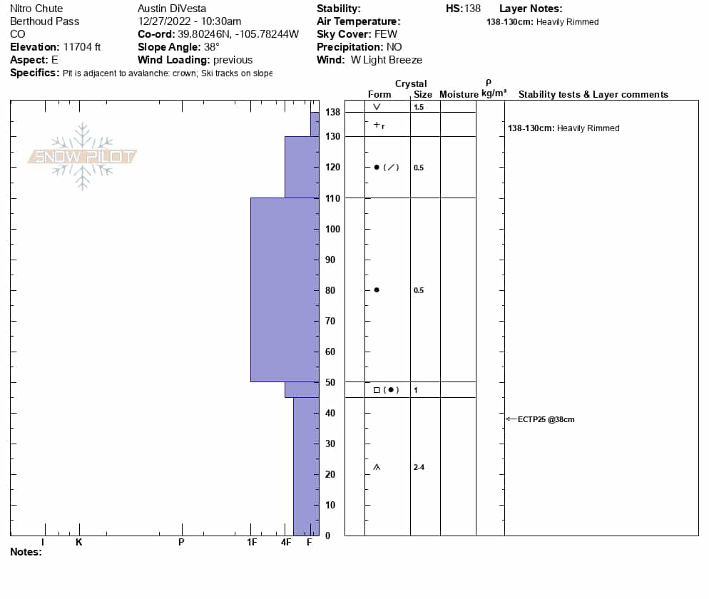
On December 27, CAIC investigators observed a crown profile in Nitro Chute. They found a 55-inch (140 centimeter) deep snowpack. The bottom 18 inches (45 centimeters) was composed of two to four-millimeter chains of depth hoar. The depth hoar was Fist hard on the Hand Hardness Scale. On top of the depth hoar was a 2-inch (5 centimeter) crust that was breaking down and faceting. A One-finger hard slab of small (0.5 millimeter) rounded crystals made up the next 25 inches (60 centimeters) of the snowpack. The snowpack’s top 8 inches (20 centimeters) was composed of broken stellar crystals with a thin layer of heavily rimed new snow just below the surface. Snowpack stability tests produced propagating (ECTP25) planar sheers in the depth hoar layer about 15 inches (38 centimeters) above the ground.
Events Leading to the Avalanche
A father and his three teenage sons left Winter Park on the morning of December 26 and drove to the top of Berthoud Pass. They parked just below the summit on the north side. The three sons planned to build a jump while their father (Rider 1) made some laps on his split-board. The teenagers (Riders 2 and 3, and Skier 1) traveled into the Nitro Chute area – one with a split-board, one with a snowboard, and one with skis. They chose a spot about midway up the track of Nitro Chute and began to dig and pack snow for the jump. Rider 1 skinned up and rode down through an area locally known as Big Roll, which is less steep than Nitro Chute and sees quite a bit more backcountry traffic.
Several hours before the fatal avalanche, another group of backcountry travelers triggered a large (Destructive size 2) avalanche in an area locally known as Lift Gully. This avalanche ran over a commonly used route below the West Side cliffs. Lift Gully is about 500 feet south of Nitro Chute, with a similar aspect and elevation to the accident site. Investigators do not know if the father and sons noticed the avalanche in Lift Gully.
Accident Summary
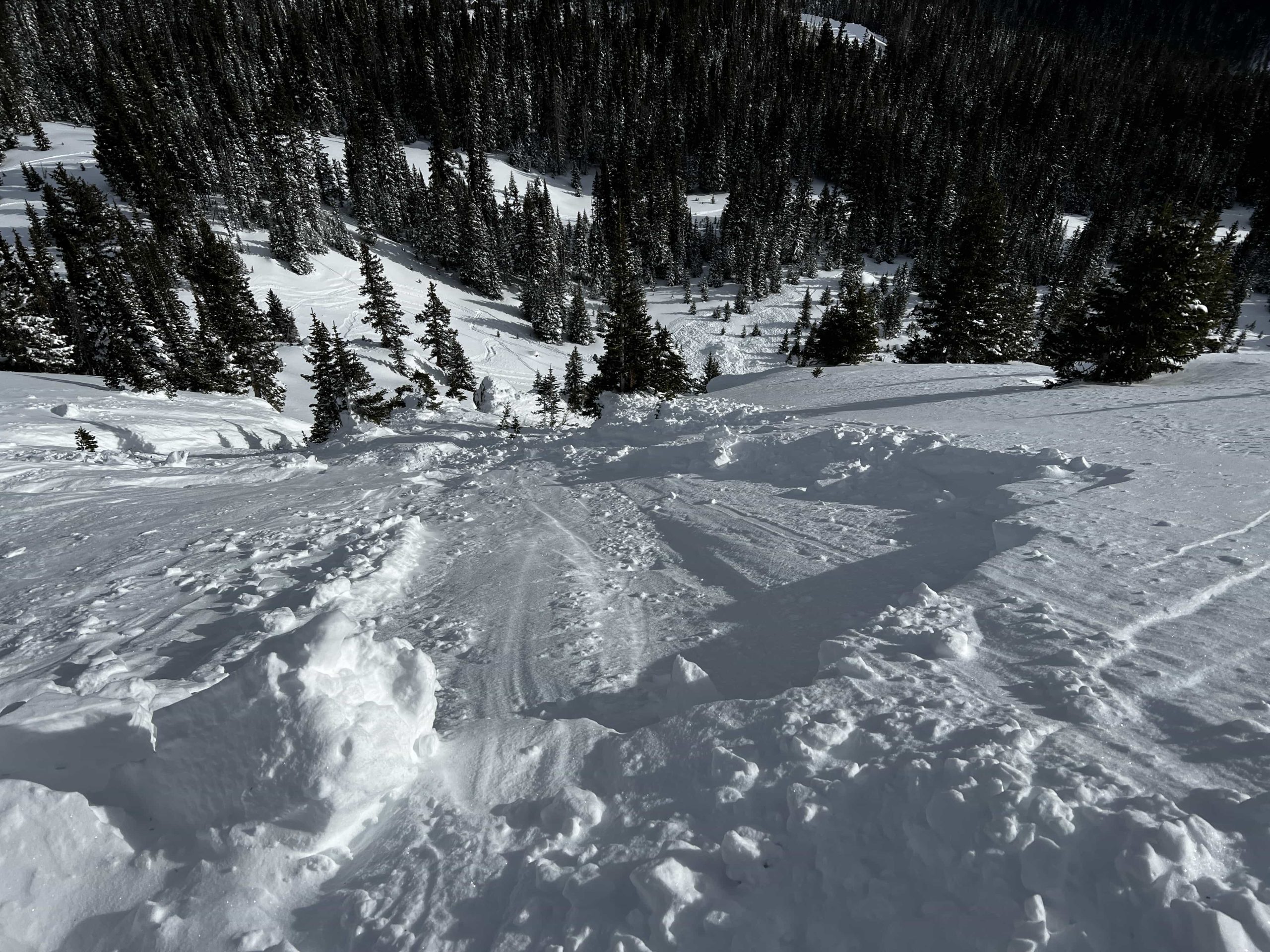
At about 12:40 PM, Rider 1 rode onto Nitro Chute. As he descended the avalanche released washing him downhill. Riders 2 and 3 were on foot, and Skier 1 was wearing his skis. All three were on the slope in the avalanche track. The teens saw the flowing snow and tried to get out of the way, but were all caught in the moving debris. Skier 1 moved downhill and to the side and managed to get out of the flowing snow. Riders 2 and 3 tried to run out of the avalanche path. Rider 2 managed to get to the edge and was just partially buried when the debris stopped. Rider 3 was pushed downhill in the moving snow. When the avalanche stopped, Riders 1 and 3 were missing.
Rescue Summary
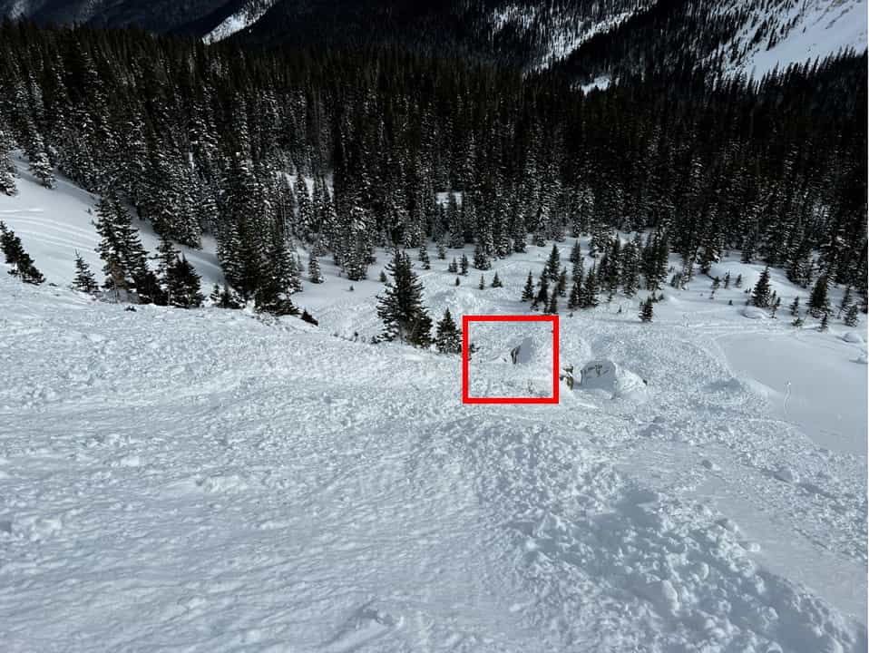
Rider 2 and Skier 1 turned their avalanche transceivers to receive and began to search for their father and brother. They followed the signals to the uphill side of a large boulder in the runout zone. They were able to pinpoint one signal and began to dig. After digging down about two feet, they located Rider 3 and were able to excavate his head from the snow. He was buried vertically with his head toward the surface. He was alert and breathing.
A group of two backcountry tourers saw the avalanche and came to help. Another group of three tourers in the trees below heard people yelling, asked if the group needed help, and skinned uphill to the accident site. A third group of two people in the parking lot on the east side of the Pass saw the fresh avalanche. One headed toward the accident site while the other waited for emergency personnel to arrive. All three groups arrived on the avalanche debris within a few minutes of each other, around 12:45 PM. The two boys had just uncovered their brother’s head, but their father was still missing. The responders decided to leave Rider 3 partially buried in place and start searching for the Rider 1.
Grand County Dispatch received a 911 call about the avalanche at 12:50 PM. Grand County Search and Rescue and the Alpine Rescue Team were alerted. Search and rescue (SAR) personnel made their way to Berthoud Pass.
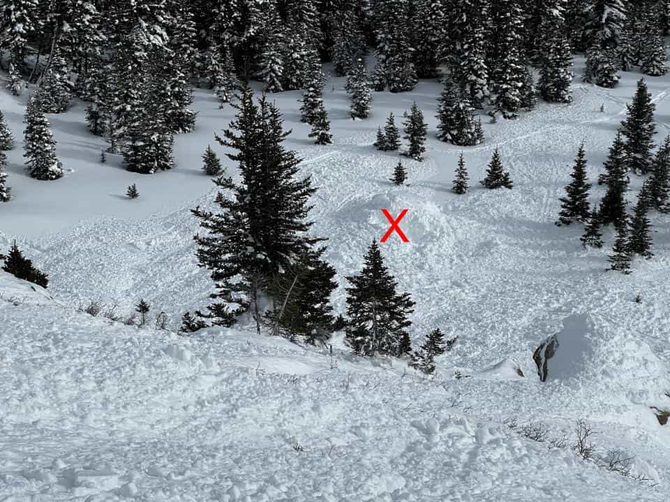
The responders spread over the debris to search for the Rider 1’s transceiver signal. After several minutes they realized they were getting two transceiver signals close to where Rider 3 was still partially buried. One responder dug down and turned Rider 3’s transceiver off. The father’s transceiver signal indicated he was buried very close. The responders were then able to pinpoint the second transceiver signal and locate Rider 1 with a probe. They uncovered his snowboard, and then quickly moved to digging him out of the snow. Rider 1 was buried about one and a half feet deep, face down, with his head downhill. When they reached his head and turned him over, he was cyanotic and not breathing. It was around 1:10 PM.
A CAIC forecaster was in Lift Gully investigating the earlier avalanche and saw the toe of the new avalanche at 1:15 PM. He alerted the CAIC dispatcher and made his way to the avalanche. The other responders were performing CPR on the father when he arrived.
A Flight For Life helicopter took off at 1:28 PM with an estimated flight time of 12 minutes to the avalanche. The first SAR personnel arrived at Berthoud Pass just before 1:40 PM and staged in the parking lot.
The responders performed CPR for almost 40 minutes. They discontinued CPR around 1:50 PM. It had been about an hour since the avalanche occurred.
The responders descended to the search and rescue staging area at the highway. At around 3:00 PM, rescuers recovered the father’s body from the field.
Comments
All of the fatal avalanche accidents we investigate are tragic events. This one seemed especially so because the accident involved a family with teenage children. We do our best to describe each accident to help the people involved, and the community as a whole better understand them. We offer the following comments in the hope that they will help people avoid future avalanche accidents.
It is a standard avalanche safety practice to expose just one person at a time to any avalanche hazard. The most common way to do this is to travel through avalanche paths or sections of avalanche terrain one at a time. In this case, all four group members ended up in the same avalanche path. Three by deciding to build a jump below an avalanche-prone slope, and one by riding through the area while other people were in it. When the avalanche released, it caught all four people in the group and completely buried two.
Minimizing the time exposed to a hazard decreases the risk of that hazard. By building a jump in an avalanche track, the teens spent a significant amount of time exposed to potential avalanches. A standard avalanche safety practice is to avoid waiting or regrouping in the avalanche track or runout zones. Choose places to eat lunch or build jumps outside of terrain connected to steep slopes above. Watch from a distance when others are riding and limit the amount of time you are exposed to avalanche terrain whenever possible.
Rescue becomes much more complex if an avalanche catches multiple people. Fewer members of the group are available to perform a rescue. Searching for multiple people is always more complicated than searching for one. The chance of a close proximity burial increases if people are caught within a short distance from each other. Close proximity burials can make transceiver searches more difficult and increase the time of rescue. After the rescue, responders who assisted in the search said they wished they had practiced complex scenarios when doing rescue drills. Knowing how to use your rescue equipment in complex situations and practicing with it often increases the chance you will be about to use the equipment effectively in a real rescue.
Recent avalanche activity on similar slopes is a primary indication of unstable conditions. The triggered avalanches in Lift Gully and Nitro Chute occurred within a few hours and a few hundred feet of each other. The slopes are similar in elevation, aspect, and slope angle. Investigators do not know if the four family members saw the avalanche in Lift Gully. If they did, they did not recognize the implications of other avalanches in similar terrain features.
Ya, the learning experience is stop treating, promoting mid-continental snowpack of January like it’s anything but unstable! I know it’s groovy right now but it’s getting sad out there l