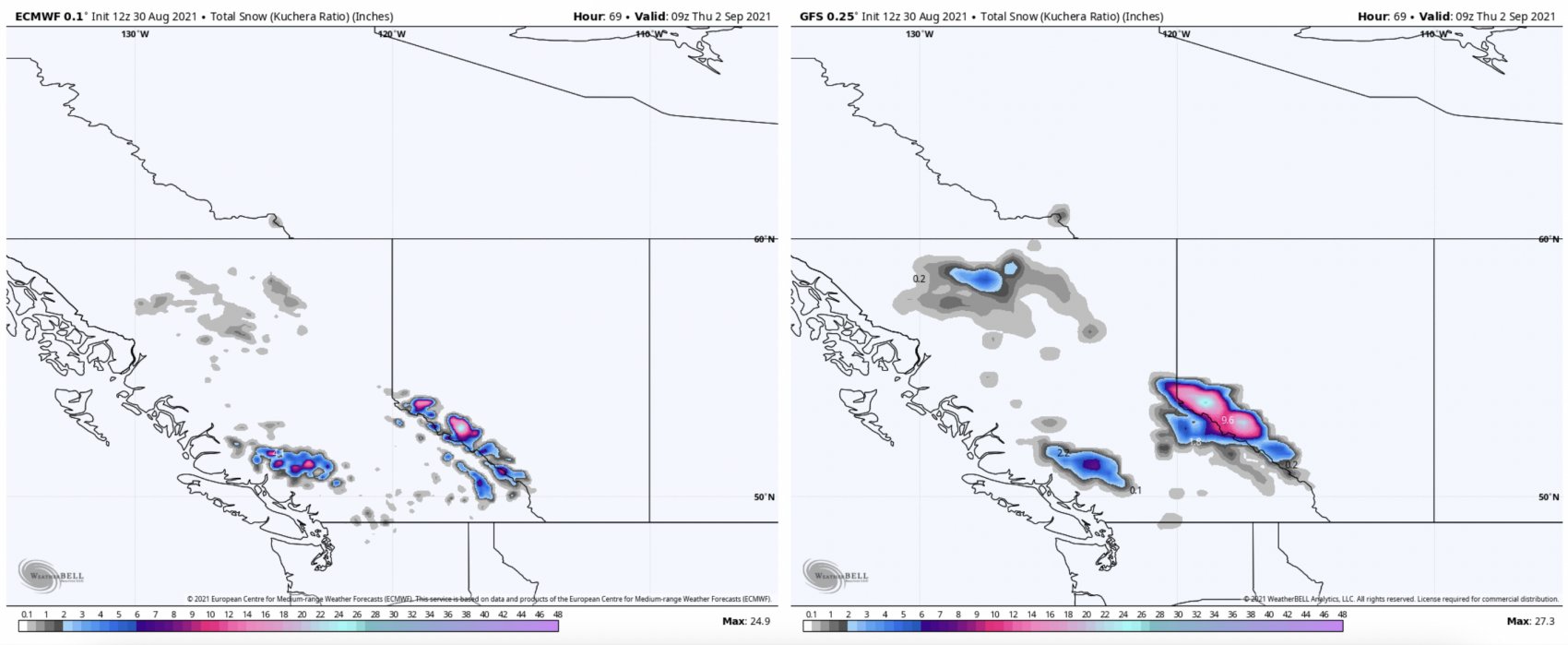
It feels like winter is right around the corner, and the models certainly agree. Both the major global models, American GFS and European ECMWF, both agree on several feet of snow for the Canadian Rockies and Coastal Range.
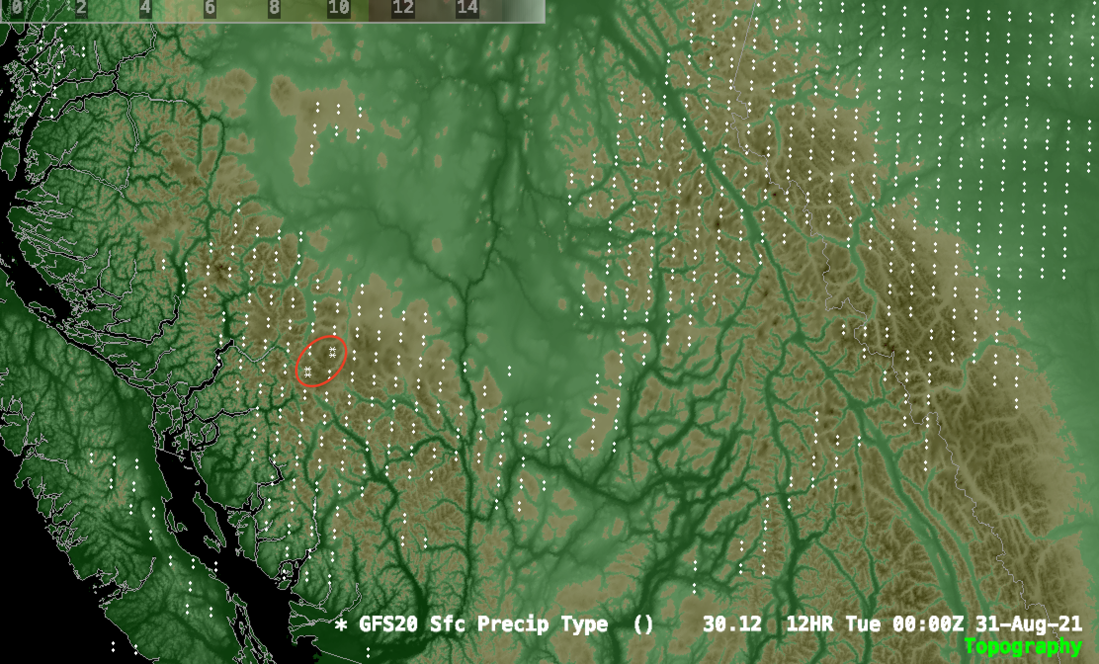
The first snowfall is forecasted to begin falling in Western British Columbia at about 5 pm on Tuesday, August 31. The first flakes will fall on the upper peaks of the Coastal Range.

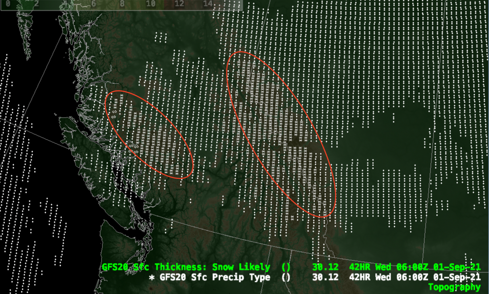
This is an arctic low pressure system which is forecasted to move from West to East, so the snow will quickly find itself into the Canadian Rockies shortly after the Coastal Range.

Most snowfall in the Coastal Range will fizzle out by mid-morning on Wednesday, but flakes will still accumulate in the Canadian Rockies until the early hours of Thursday.
In terms of accumulation, both the GFS and ECMWF are pointing towards the highest accumulations being in the Rockies, with totals of up to 25-30 inches possible. However, many areas will more likely than not receive totals of 5-10 inches.
A plume of moisture associated with a warmer system will push through on Friday afternoon, which may melt the new snow at lower elevations. However, much of the higher-elevation accumulations should still remain relatively intact heading into the weekend.
