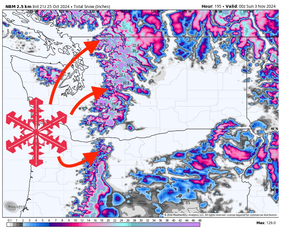
Storm 1: Warm & Wet Double Hitter
The Pacific Northwest will experience two overlapping storm systems this weekend. The first arrives early Saturday morning, followed by a secondary pulse on Sunday, resulting in continuous precipitation into Tuesday morning. The precipitation will not cease between these systems but will instead fluctuate in intensity, with lighter periods between the primary moisture surges.
Snow levels will initially be high, around 7,000 to 9,000 feet depending on how far north or south a location is (higher in the south), before gradually dropping to around 4,000 feet as colder air moves in. Further south, near Mt. Bachelor, snow levels will start higher at 9,000 feet before dropping to 4,000 feet. Resorts located between these two points, such as Stevens Pass and Crystal Mountain, will see snow levels somewhere within this gradient.
Accumulations will predominantly occur towards the latter half of the storm (Sunday & Monday) as early precipitation will likely be rain or a mix at lower elevations. Higher elevations will transition to snow earlier, allowing more time for snow accumulation, resulting in greater totals:
- Mt. Baker: 6-10″
- Stevens Pass: 4-7″
- Alpental: 1-3″
- Crystal Mountain: 3-6″
- Mt. Hood: 12-18″
- Mt. Bachelor: 8-14″
Storm 2: Midweek System Overview
The second system is expected to arrive midday Wednesday, with precipitation continuing until Thursday night or possibly Friday morning. Although the specifics are still evolving, models currently indicate that this will be a significant system, with substantial moisture content. Importantly, this storm appears to be colder than the first, which could enhance snow accumulation potential.
Snow levels will range between 3,000 and 4,000 feet in the northern part of the region (Mt. Baker), and between 3,000 and 5,000 feet further south (Mt. Bachelor). Resorts located between these areas should anticipate snow levels falling within this range. Given the inherent uncertainty at this stage, further updates will be necessary as the event approaches.
Long-Range Outlook: Persistent La Niña Pattern
Following these two systems, the extended forecast suggests a sustained stormy pattern typical of La Niña, characterized by frequent storms targeting the Pacific Northwest before sliding southeast into the intermountain West. Temperatures are expected to be on the colder side for this time of year, which could favor snow accumulation at many resorts. Current model projections hint at another potential storm late Friday or Saturday next week, and possibly another system later in the weekend. However, long-range forecasts should be treated with caution due to their inherent uncertainty.
Temperatures are expected to be on the colder side for this time of year, which could favor snow accumulation at many resorts. As more observational data is incorporated into the models, expect refinements in these forecasts.