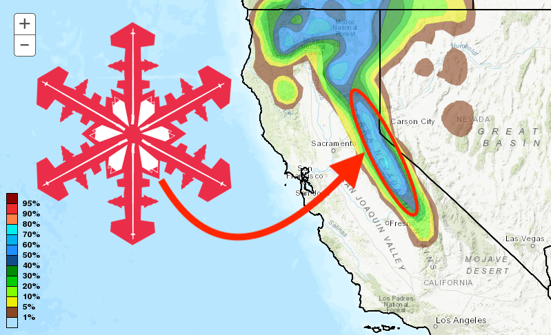
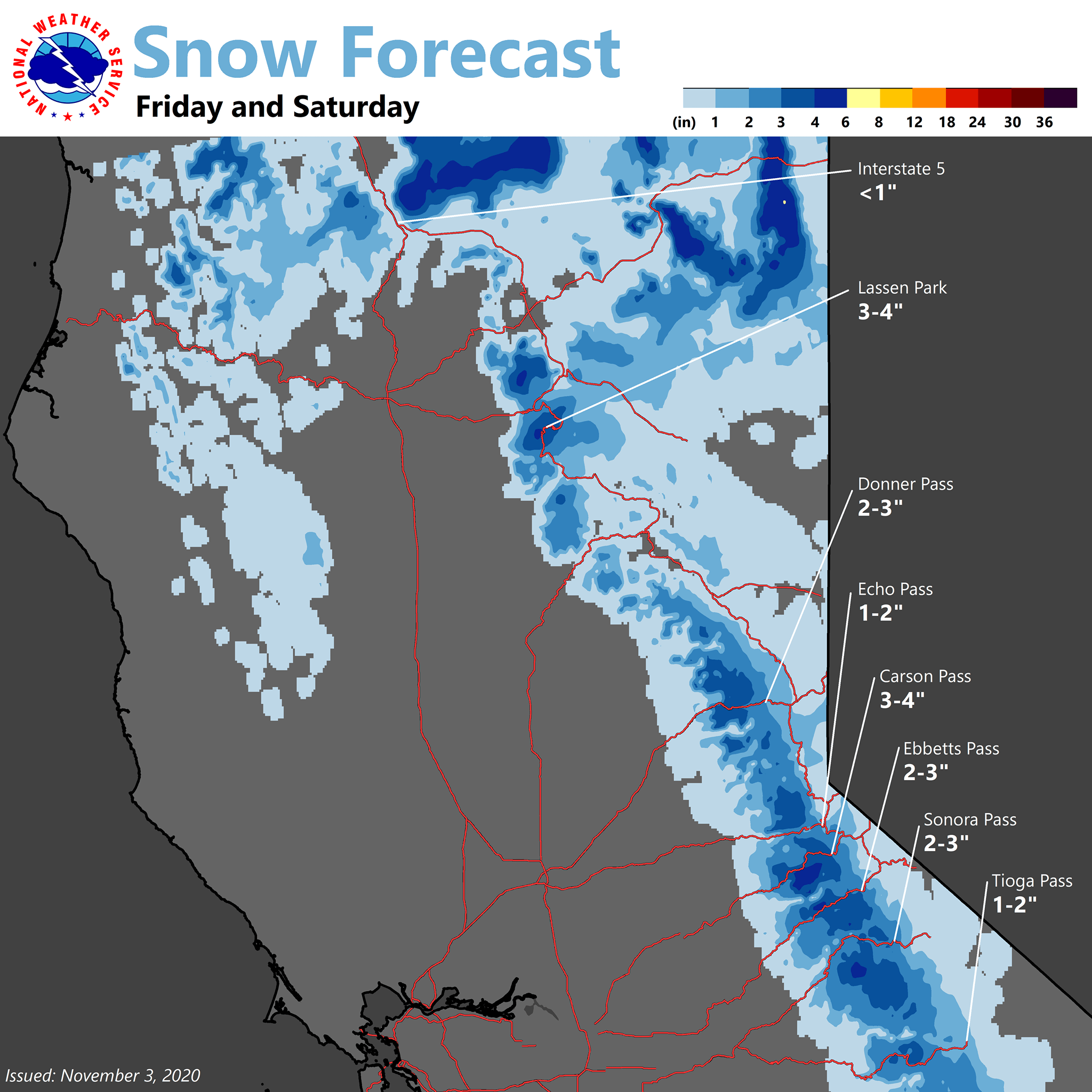
The first big snow of the season is heading to the Sierra Nevada this weekend, with ski resorts hoping to see up to a foot of fresh snow before the weekend is out.
- You might also like: The SnowBrains Podcast | Episode #3 | “Why Do Skiers Tear Their ACL’s So Frequently”
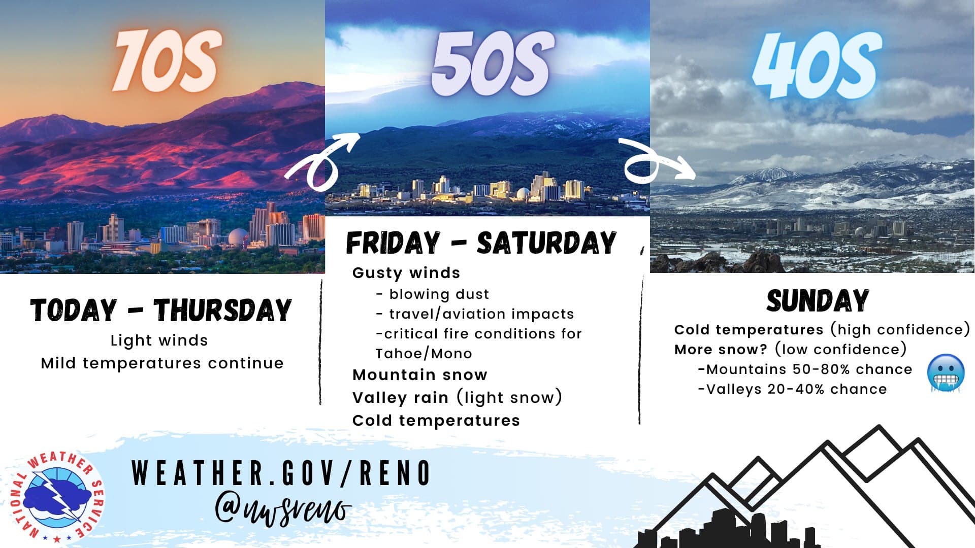
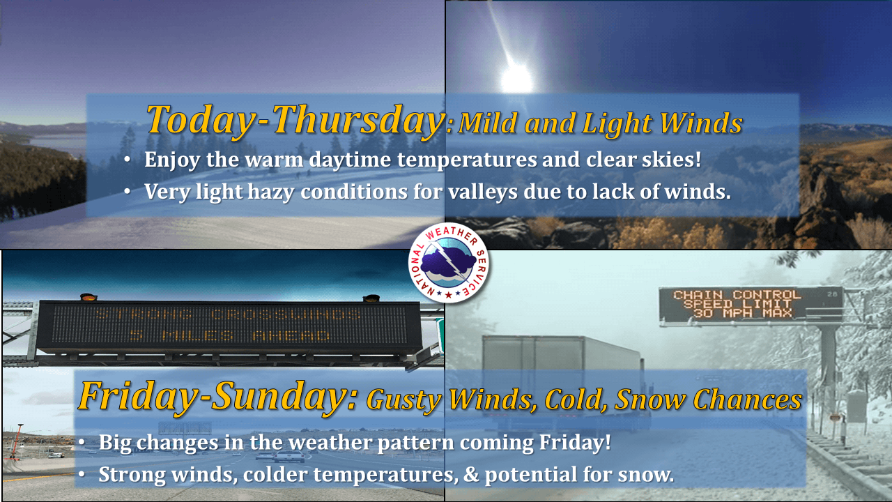
...Big Changes in the Weather Pattern for This Weekend...

A strong cold front will push through the Sierra and western
Nevada on Friday bringing gusty winds, much colder temperatures,
and chances for rain and snow showers. This storm does appear to
herald in a pattern that may possibly stick around through much of
November with the potential for lingering cold temperatures and
maybe even additional chances for rain and snow.

WINDS: Winds will increase significantly Thursday night into Friday
morning with a quick burst of winds that may produce areas of
blowing dust, choppy lake conditions, as well as a brief period of
fire weather concerns. Gusts up to 45 mph are possible for most
areas, with up to 60 mph in wind prone spots, and up to 100 mph
for exposed areas along the Sierra Crest.

COLD: Afternoon temperatures will drop significantly from Friday to
Saturday, with western Nevada and Sierra valleys in the 30s and 40s.
Overnight lows will be well below freezing with a few single digit
and sub zero readings possible in the colder Sierra valleys.

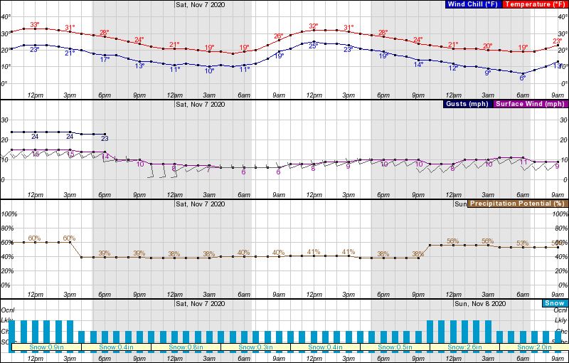
PRECIPITATION: A quick burst of rain and snow is likely behind the
cold front Friday with a couple inches of snow possible above 6000
feet. While light snow showers are likely most of the weekend with
little accumulation, a second burst of accumulating snow may occur
Sunday morning. Sunday is currently the best shot at lower valley
snowfall accumulations.

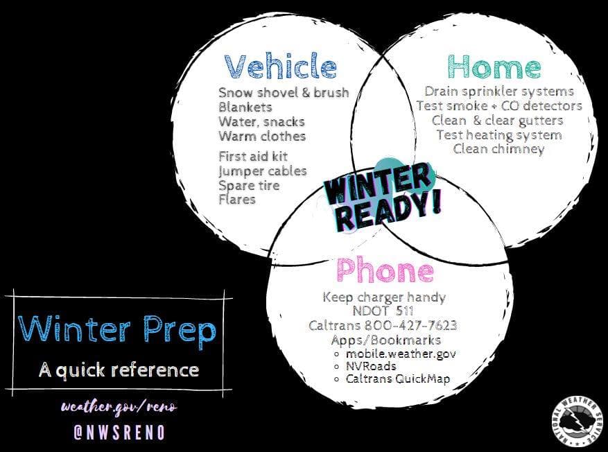
If you haven`t put that winter travel kit in your car, then
now is the time make it happen. It`s that time of the year where
conditions can rapidly change along the Sierra passes so being in
tune with all the weather updates as well as Caltrans and NDOT
will save you a lot of headaches.
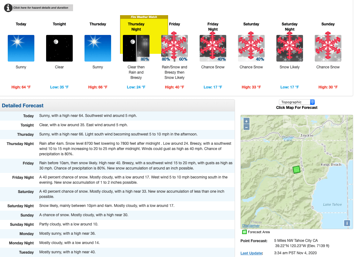
According to the NOAA discussion, precipitation will move into the Sierra early Friday morning with travel impacts from snow likely over Sierra passes and light accumulations probable into the lower Sierra valleys. Current projections are for the upper elevations to pick up a quick 2-4+ inches of snow with a dusting to an inch or so in the lower elevations of the Sierra.
BOTTOM LINE: Be prepared for periods of travel impacts due to snow
along the higher elevation highways and Sierra passes through the
weekend. Lower elevation travel impacts due to snow may occur by
Sunday.
Saturday will be quite cold with brisk northwest winds and continued chances for snow showers across the Sierra. There will be potential for heavier snow showers throughout the day.
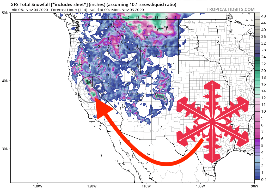
Lake Tahoe Resorts could see 6-12″ and Mammoth Mountain, who’s opening day is just nine days away, could see 6-9″, with maybe more higher up.
Other Info:
Could be a dangerous and pose a weak bonded layer as cold temps as well mean it will possibly be 4-7% moisture content and not heavy sierra cement that bonds to dry surface netter.
Add the warm ground temps right until snowfall due to an unseasonally warm October and it could be a set up for early season back country avalanche dangers as were the few.
Jeremy Jones n crew last mid december ‘19 Basin Peak, John Morrison Mt Tallac Dec ‘18 and Glen Poulsen with Jim Zellers n crew Tamarack Peak Nov ‘17.
See any pattern there?
Be smart and have some common sense, warm ground temps and cold dry snowfall means weak underlayer come heavier snowfall amounts especially in the bc.
And yes I was witness to a bc avalanche late Nov ‘01 Elephants Back near Round top, fortunately person who was swept was ok.
Don’t need to trigger anything if youre smart and paying attention to past events and sudden cooler temps on warm ground.