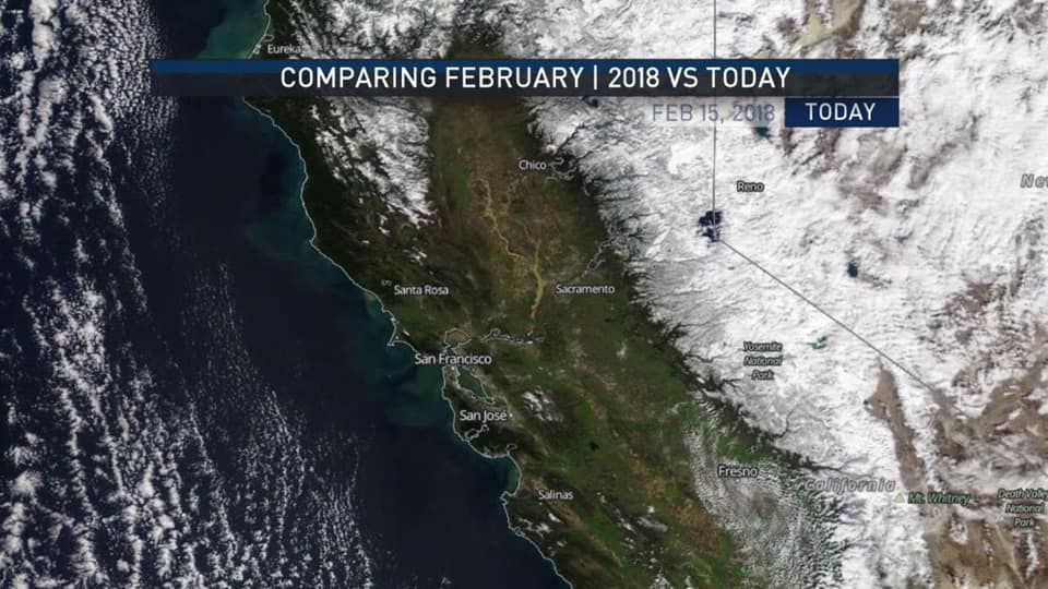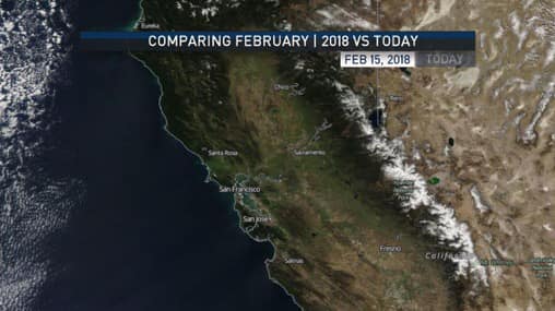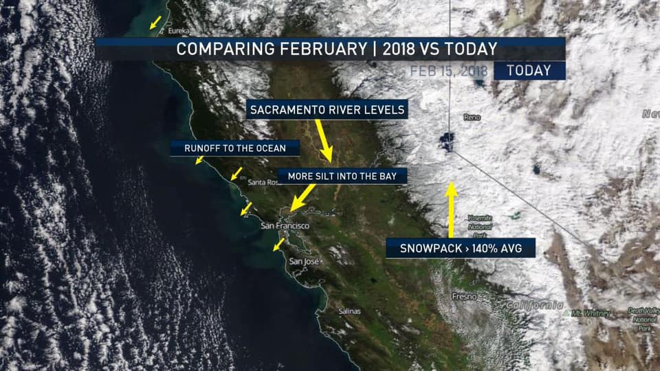
What a difference a year makes! Check out these contrasting satellite images of the snowpack in northern California from 2018 and 2019.

It’s clear to see the vast changes in the Sierra snowpack, which is 140% of average this year, compared to just 21% last year.

The Sacramento River is much higher, causing sediment runoff into the ocean/bay, and the Golden State, in general, is looking way more green.

It helps that this was taken right after a huge and unusually cold series of storm systems. The snowy peaks on the Diablo and Santa Lucia mountains are *not* normal even during the best years.
True. These images are actually showing snow coverage, not snowpack. A couple inches doesn’t look any different than several feet of depth. In any case, it’s good to see.