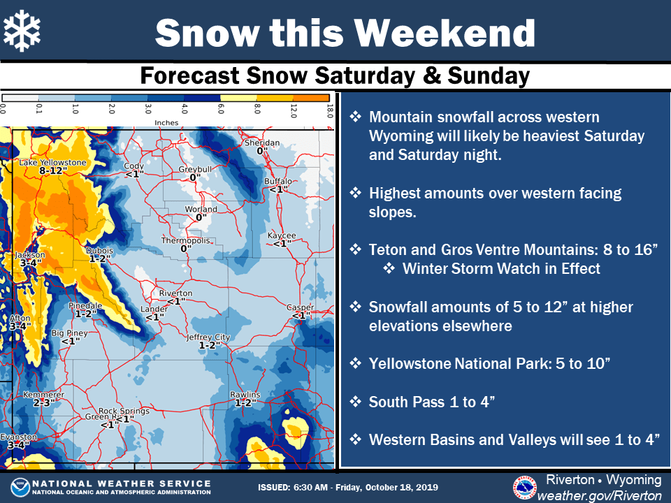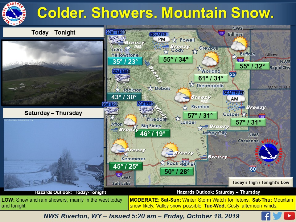
A cold front will bring snow to the Tetons later today, lasting through the weekend, bringing double-digit snow totals. A winter storm watch begins Saturday morning, until Sunday afternoon, for western Wyoming and Jackson Hole Resort.
A fall storm system will impact western Wyoming Saturday and
Sunday with significant snowfall expected especially in the higher
elevations. The heaviest snowfall is expected over the Teton
Mountains.
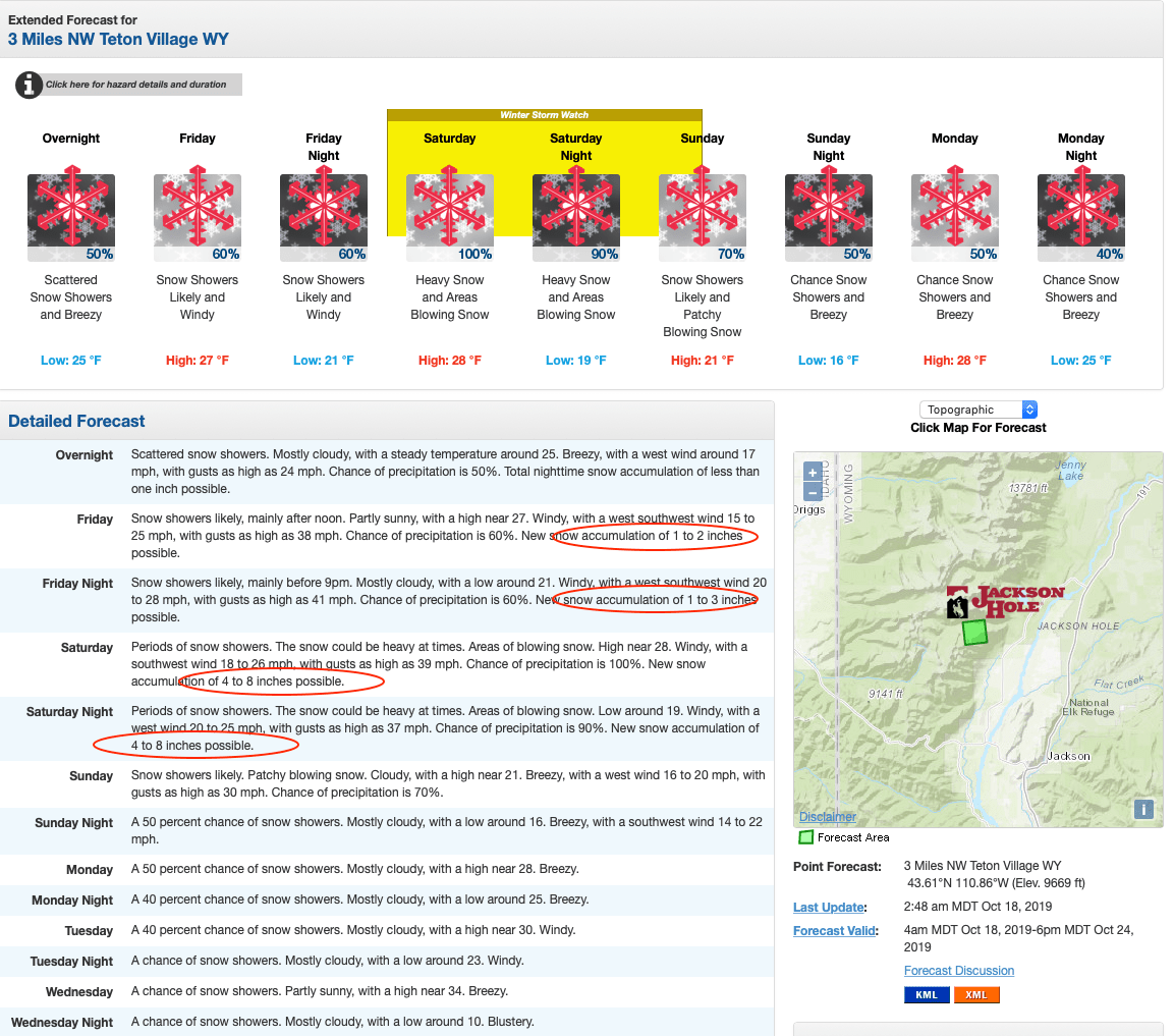
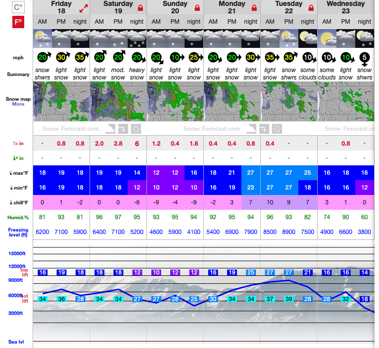
The heaviest snow is expected Saturday across the western mountains, and Jackson Hole Mountain Resort could receive well over a foot of fresh snow, and potentially up to 16″ at higher elevations. Snow levels will drop below 5,000-feet on Saturday evening.
...WINTER STORM WATCH IN EFFECT FROM SATURDAY MORNING THROUGH
SUNDAY MORNING...

* WHAT...Periods of heavy snow with areas of blowing snow. Total
  snow accumulations of 8 to 16 inches possible.

* WHERE...Teton and Gros Ventre Mountains.

* WHEN...Saturday morning through Sunday morning. The heaviest
  snowfall looks to occur Saturday afternoon and evening.
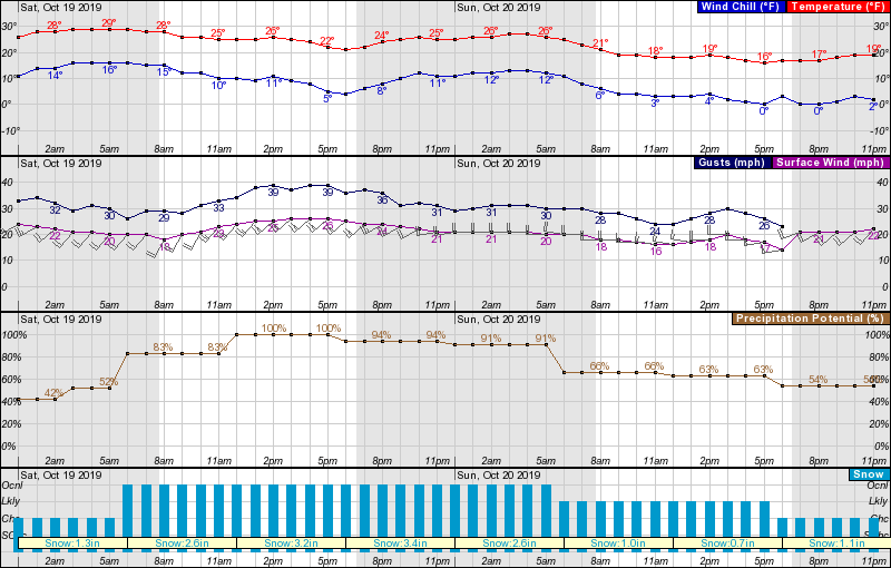
Temperatures will drop to the low 20s by Saturday afternoon, and then into the teens on Sunday afternoon. Expect it to be super windy, gusts reaching almost 40-mph at their strongest, on Saturday afternoon/evening.
Already this ‘winter’ Jackson Hole has seen 9″ of snow at the summit, and has an 8″ base. Add this latest storm and hopefully, we could see a pretty special opening day on November 28th.
Temperature / Wind / Snowfall data
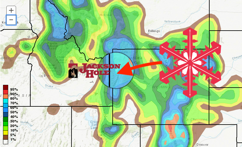
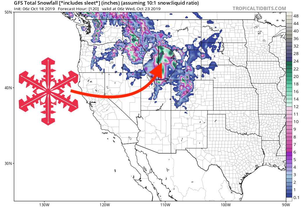
GFS 5-Day Snowfall Forecast Model
Other Info
