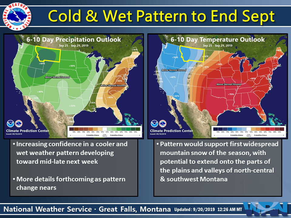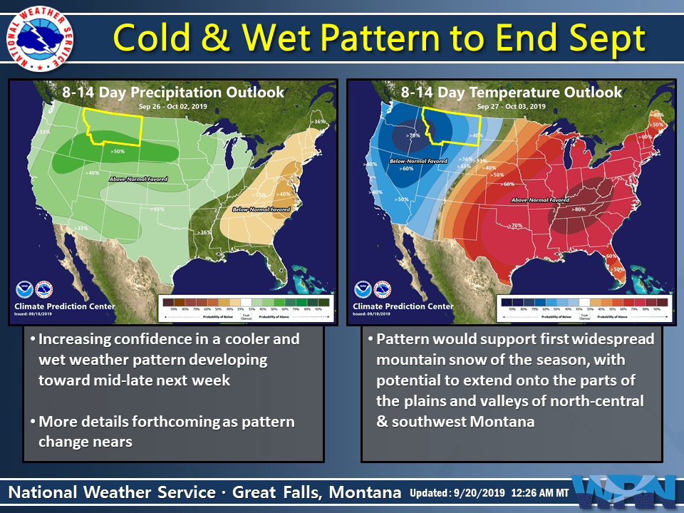
There is increasing confidence that a much cooler and unsettled weather pattern will develop over Montana late next week into the early part of the following week.
“…snow levels should lower again, which may bring another round of measurable mountain snow…”
This likely means an increased potential for the first widespread mountain snow event across the region, with higher elevations of the plains and southwest valleys also having some potential for snow and/or a rain-snow mix.
- Related: NOAA: Winter Weather Advisory Tomorrow for Montana | Big Sky Resort Might See 10-Inches SNOW

Meanwhile, there is currently a Winter Weather Advisory in effect through tomorrow. Higher mountain elevations could see up to 12″ of fresh snow.
* WHAT…Wet snow expected above 8000 feet. Total snow
accumulations of mostly 3 to 7 inches above 8000 feet, but up to
12 inches possible on higher peaks.* WHERE…Elevations above 8000 feet in Madison and Gallatin
Counties. This does not include the cities of Bozeman, Ennis,
or West Yellowstone.* WHEN…Until 6 AM MDT Saturday.
* ADDITIONAL DETAILS…Recreationalists should be prepared for
wet and raw conditions in the backcountry, with accumulating
snow above 8000 feet.
We will continue to monitor hone in on the details over the next week leading up to this potentially significant weather pattern change to end September.