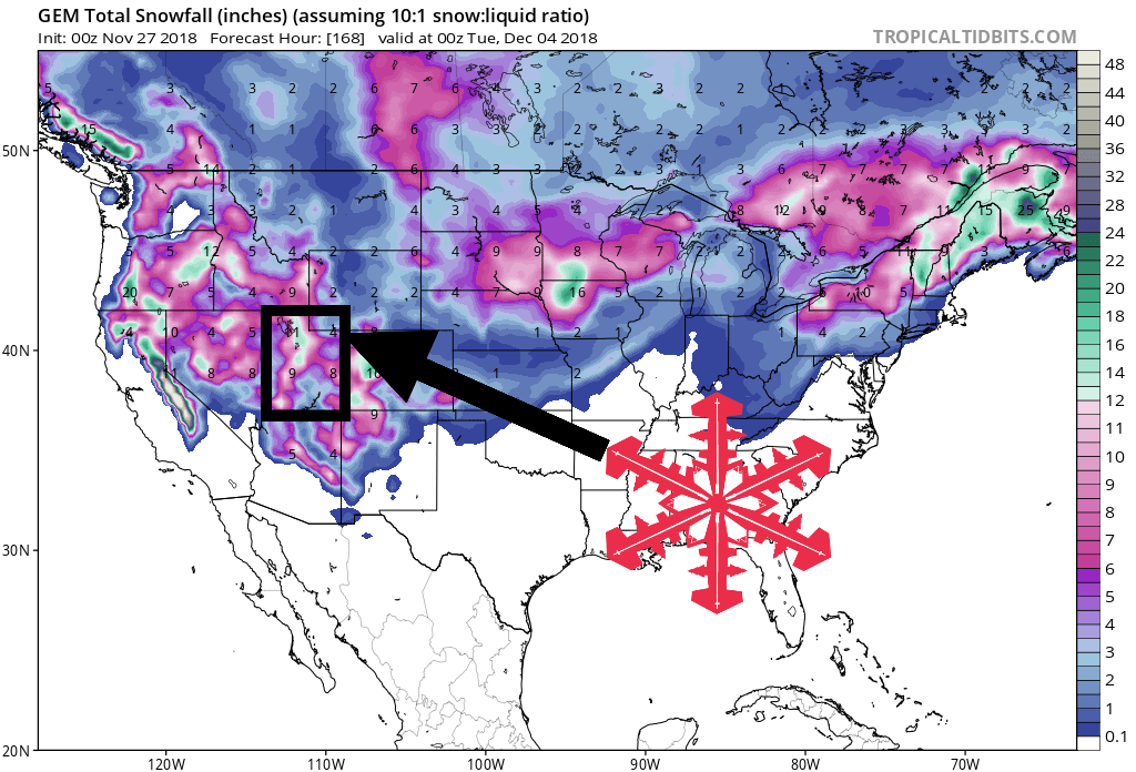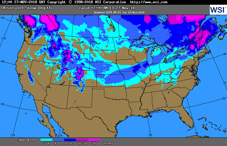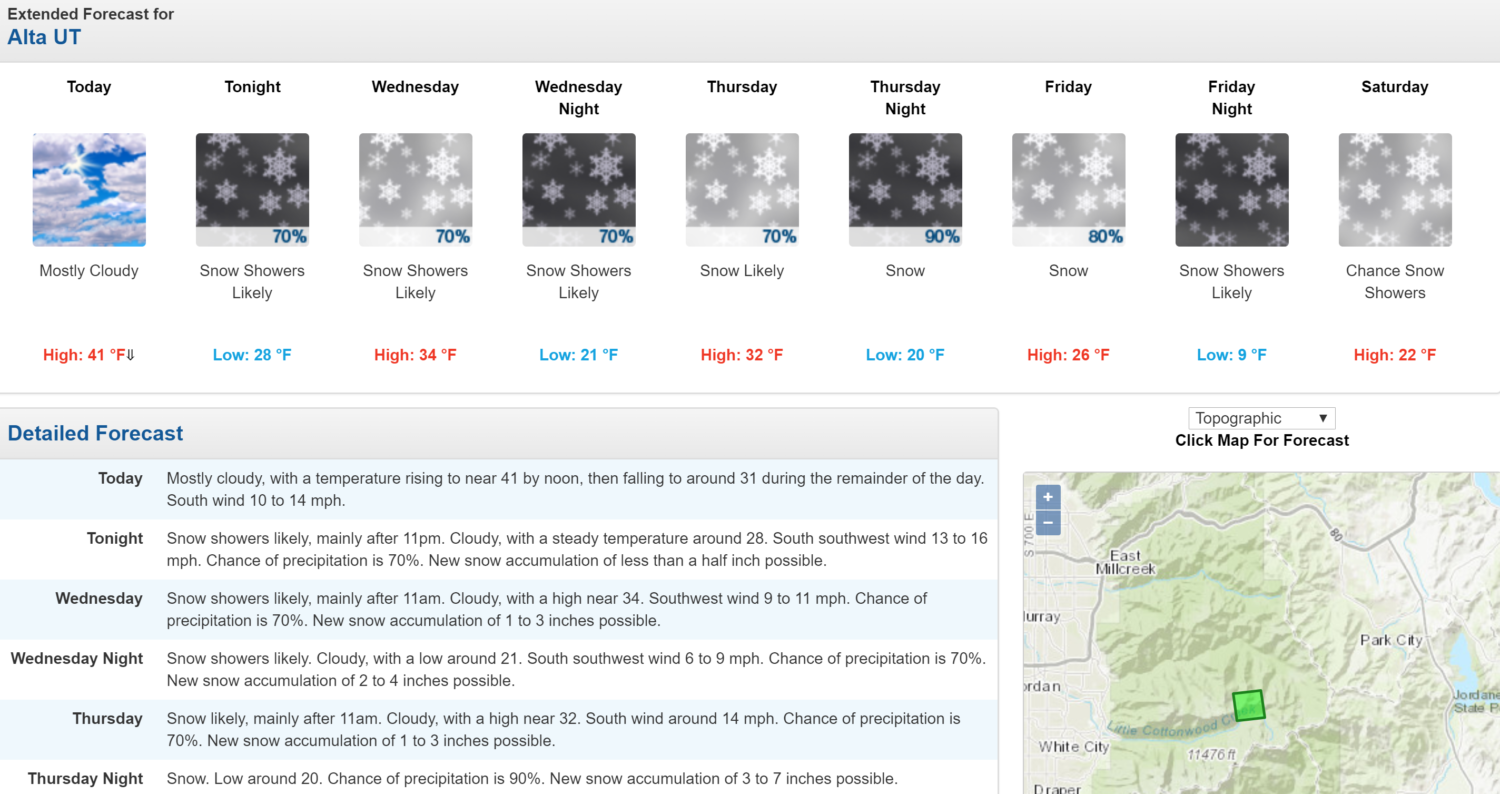
The National Weather Service is calling for 4 storm systems to hit Utah ski resorts Today – early next week. While snowfall totals are uncertain, the heaviest of which is expected to occur Thursday into Early Friday.
Forecasts are calling for 4-10″ of Snow on Thursday.
Utah:
- 4 Storm Systems Today – Early Next Week
“A stronger system will impact the outlook area Thursday into early Friday, bringing another round of valley rain and accumulating mountain snow, with snow levels again fluctuating between 5500 and 6500 feet.”
– NOAA Salt Lake City, UT Today

Snow is forecasted to be confined to ski resorts for the first system.
The second and third systems are forecasted to have snow levels between 5,500ft and 6,500ft.
The fourth system is forecasted to be the coldest of the season thus far, so snow is forecasted to fall in the valley floors.
The 6-10 day outlook calls for above average precipitation and below average temperatures in Utah.

Ski Resorts Open in Utah:
- Brighton
- Brian Head
- Snowbasin
- Park City
- SnowBird
- Alta
Additional Info:

Utah: 4 Storm Systems Today – Early Next Week
* A stronger system will impact the outlook area Thursday
  into early Friday, bringing another round of valley rain
  and accumulating mountain snow, with snow levels again
  fluctuating between 5500 and 6500 feet.
- NOAA Salt Lake City, UT

Hazardous Weather Outlook:
Hazardous Weather Outlook
National Weather Service Salt Lake City UT
526 AM MST Tue Nov 27 2018

Cache Valley/Utah Portion-Northern Wasatch Front-
Salt Lake and Tooele Valleys-Southern Wasatch Front-
Great Salt Lake Desert and Mountains-Wasatch Mountain Valleys-
Wasatch Mountains I-80 North-Wasatch Mountains South of I-80-
Western Uinta Mountains-Wasatch Plateau/Book Cliffs-
Western Uinta Basin-Castle Country-San Rafael Swell-
Sanpete/Sevier Valleys-West Central Utah-Southwest Utah-
Utahs Dixie and Zion National Park-South Central Utah-
Glen Canyon Recreation Area/Lake Powell-Central Mountains-
Southern Mountains-Southwest Wyoming-

This Hazardous Weather Outlook is for the western two thirds of
Utah and southwest Wyoming.

.DAY ONE...Today and Tonight

A weak weather system will cross northern Utah and southwest
Wyoming late this afternoon through tonight, bringing a period of
light snow to the higher terrain primarily north of I-80. Any
accumulation is expected to remain minor.

.DAYS TWO THROUGH SEVEN...Wednesday through Monday

The next in a series of storm systems is expected to bring valley
rain and mountain snow Wednesday into Wednesday evening, with snow
levels expected in the 5500 to 6000 foot range.

A stronger system will impact the outlook area Thursday into early
Friday, bringing another round of valley rain and accumulating
mountain snow, with snow levels again fluctuating between 5500
and 6500 feet.

A colder storm system is expected to impact the region during the
upcoming weekend, however the track of this system remains
uncertain at this time. By early next week the coldest airmass of
the season thus far will move into the outlook area, with high
temperatures likely struggling to reach the freezing mark across
many valley locations of northern, central, and southwest Utah.

Be sure to monitor later forecasts for additional details on
these upcoming storm systems.

