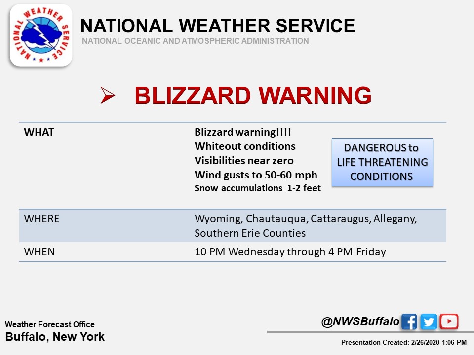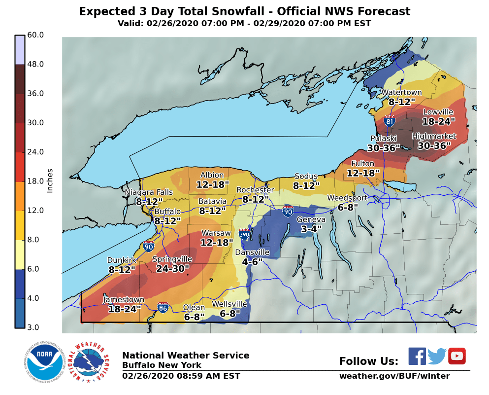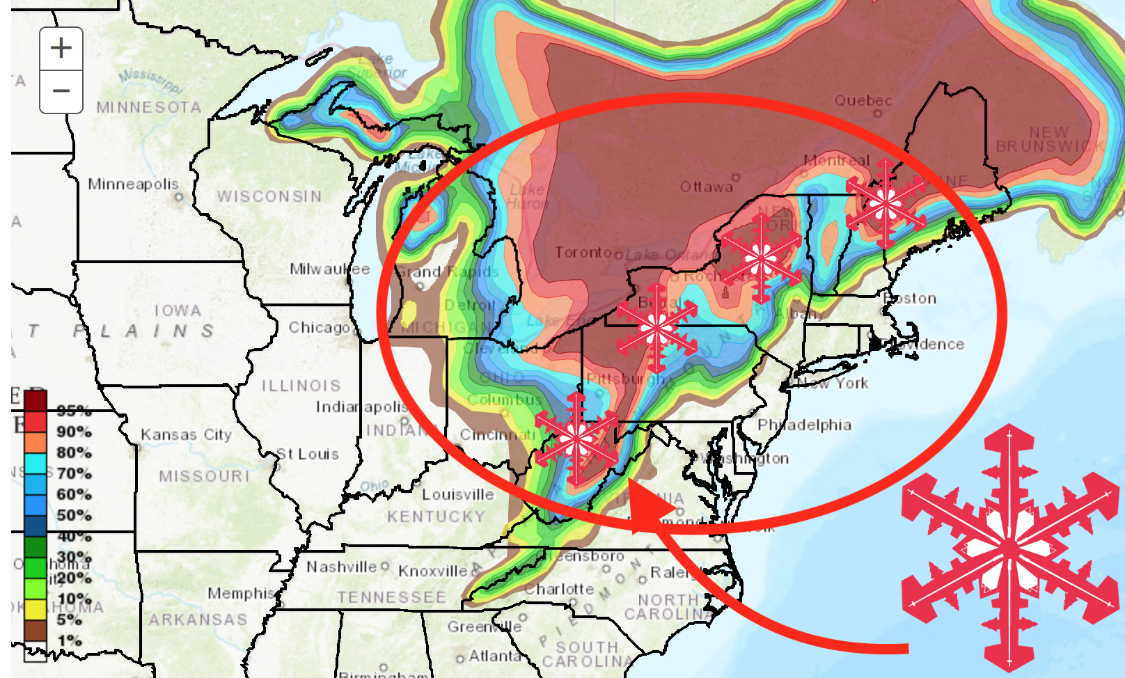
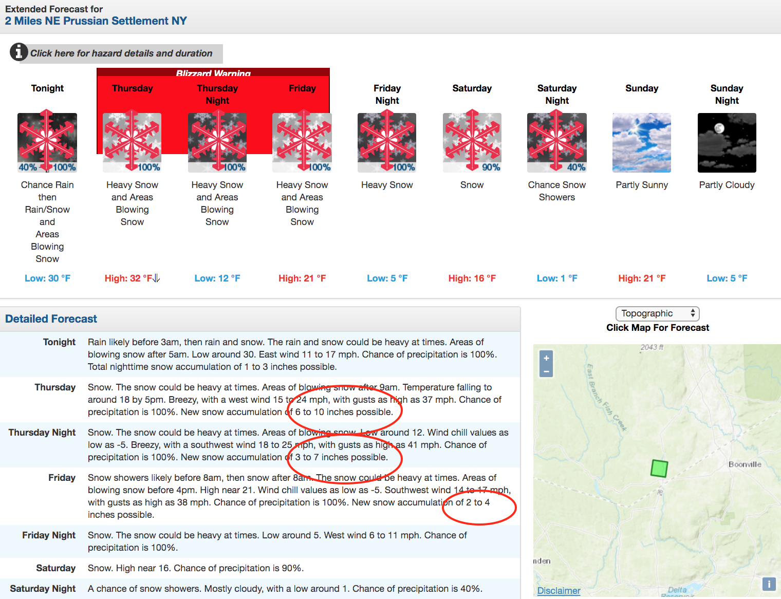
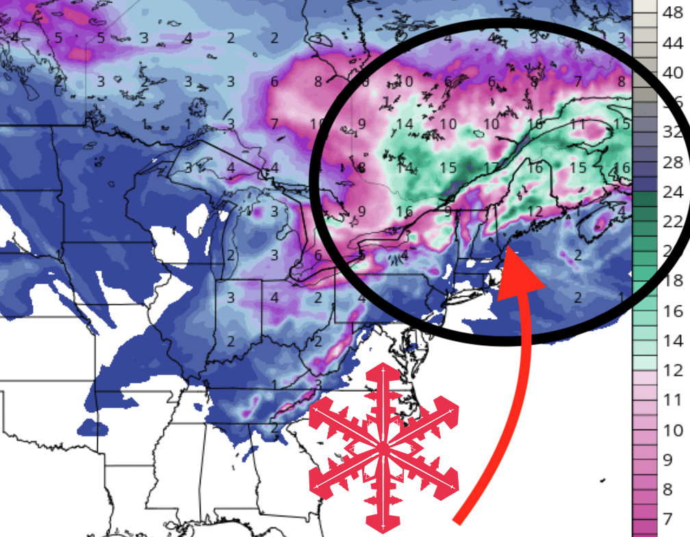
A blizzard warning has been issued by the NOAA for parts of upstate New York that could see 3 to 4 FEET of snow by Thursday, Feb. 27. Several ski areas in the eastern U.S. are expected to get new snow this week.
* WHAT...Blizzard conditions expected. Total snow accumulations of
3 to 4 feet across the Tug Hill Plateau, and 1 to 2 feet for
surrounding lower elevations. Winds gusting as high as 60 mph
will result in severe blowing and drifting snow.

* WHERE...The Eastern Lake Ontario Region.

* WHEN...From 7 AM Thursday to 4 PM EST Friday.

* IMPACTS...Travel could be very difficult to impossible. Areas
of blowing snow will produce near zero visibility. The
hazardous conditions will impact the morning and evening
commutes Thursday and Friday. Strong winds could cause some
tree damage and scattered power outages. - NOAA 2/26/20
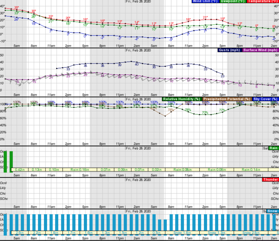
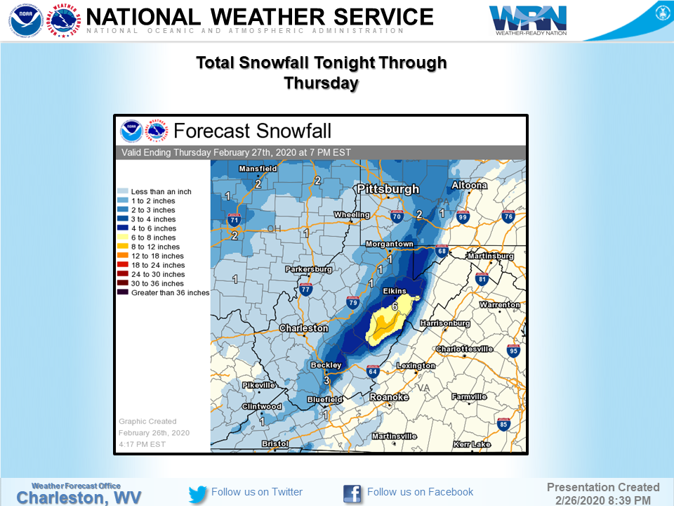
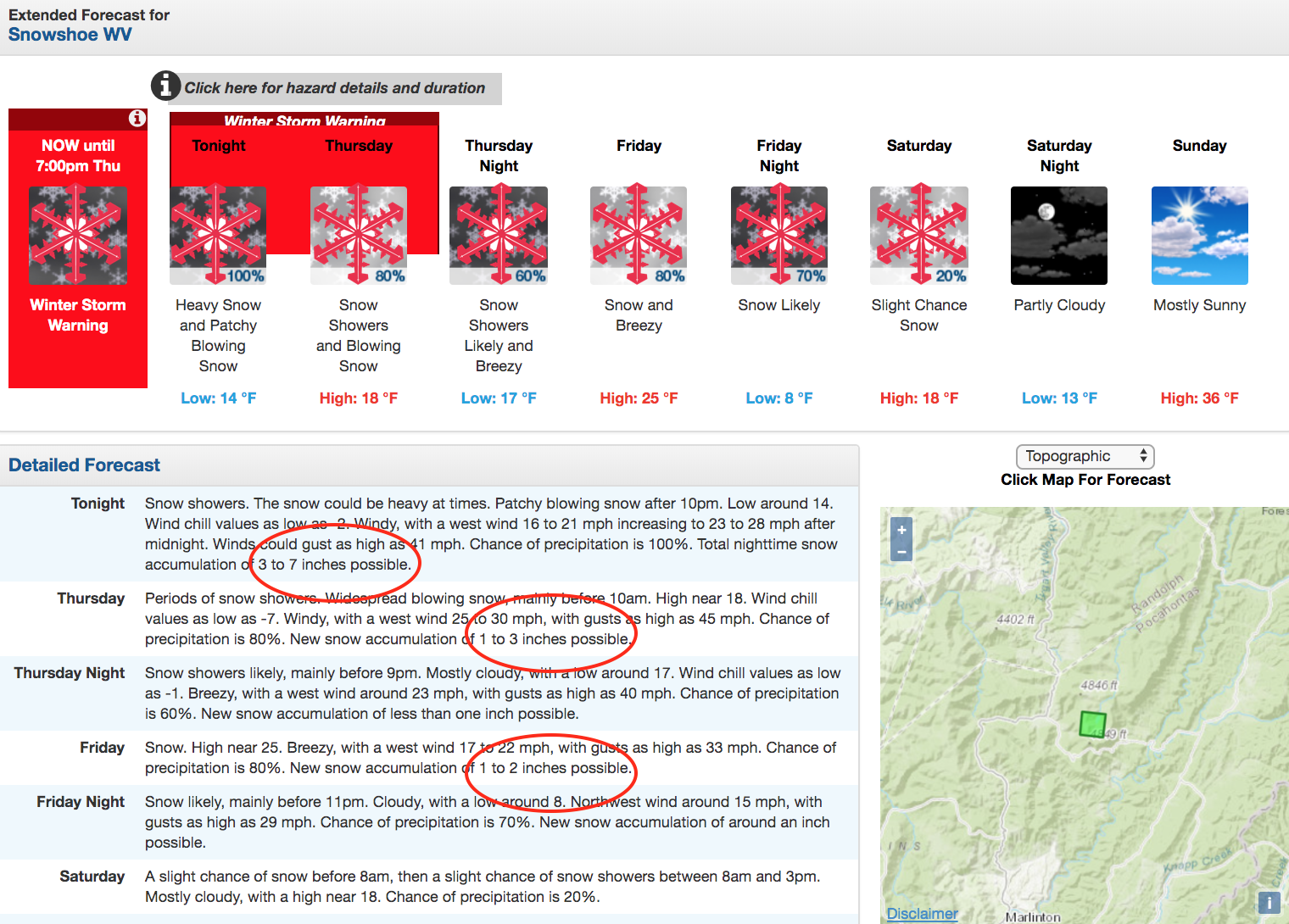
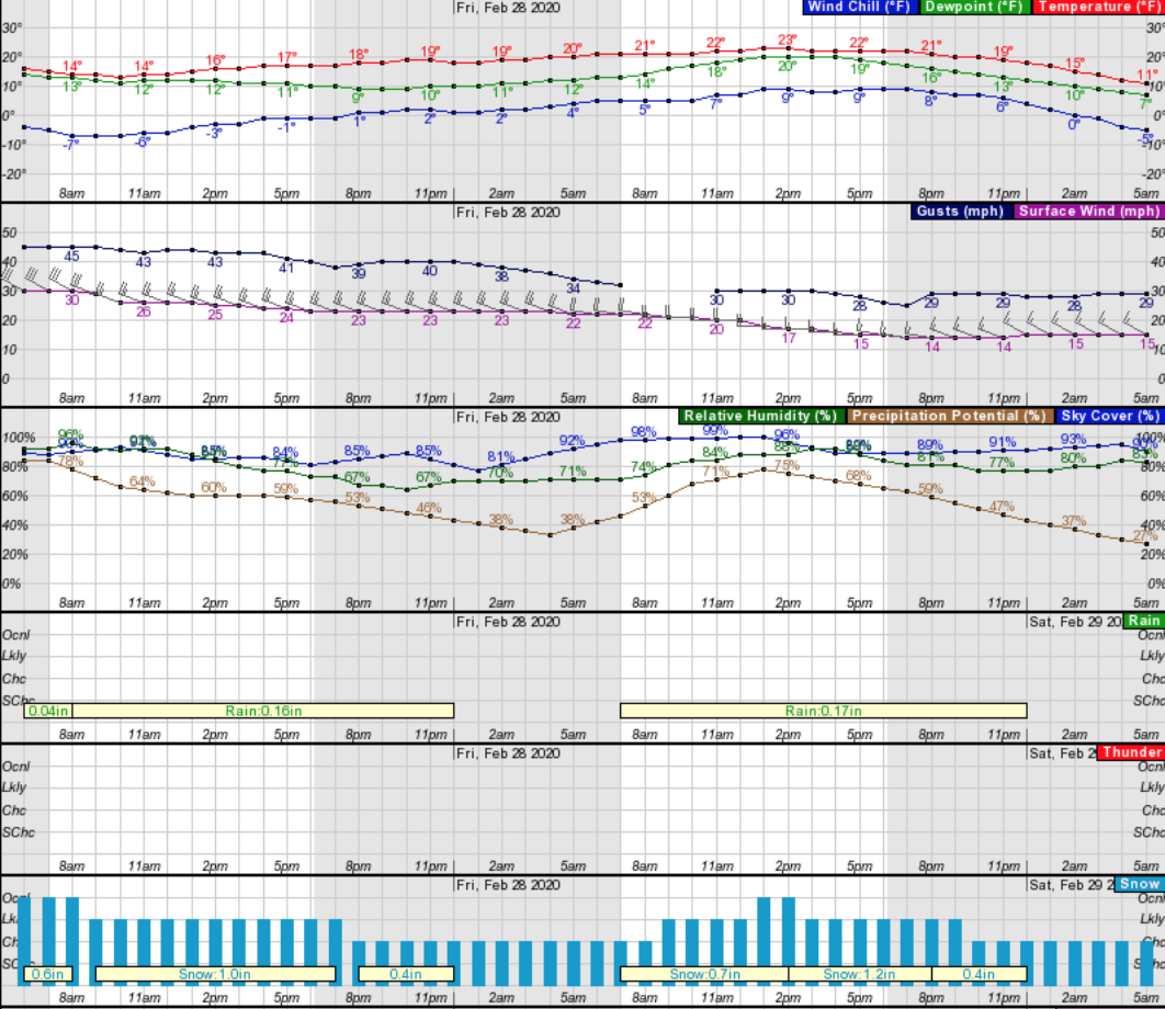
Snowshoe Mountain, WV, in particular has been issued a winter storm warning by the NOAA and will see snowfall for the rest of the week. By Thursday, Feb. 27, the West Virginia ski area could see up to 8″ of new snow.
..WINTER STORM WARNING IN EFFECT FROM 7 PM THIS EVENING TO 7 PM
EST THURSDAY...

* WHAT...Heavy snow expected. Total snow accumulations of 5 to 8
  inches. Winds gusting as high as 45 mph.

* WHERE...Southeast Webster, Northwest Pocahontas and Southeast
  Randolph Counties.

* WHEN...From 7 PM this evening to 7 PM EST Thursday.

* IMPACTS...Travel will be very difficult. Areas of blowing snow
  will significantly reduce visibility. The hazardous conditions
  could impact the morning commute. Isolated power outages will
  also be possible due to gusty winds bringing down trees or
  limbs. - NOAA 2/26/20
GEM Snowfall Total Forecast Model:
Other Info:
