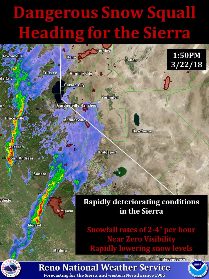
NOAA is forecasting extreme snowfall rates in the Sierra Nevada mountains this afternoon/evening.
“Extreme snowfall rates in the Sierra for the next few hours.
Bands of strong convection are headed towards the Sierra and will create dangerous, rapidly deteriorating conditions.” – NOAA Reno, NV today
NOAA is saying roads may become impassable.
"Near zero visibility will make roads almost impassable."
- NOAA Reno, NV today

Please use extreme caution on the roads or simply avoid travel all together this afternoon.
"These strong convective snow squalls will produce areas of near zero visibility, occasional lightning, and extreme snowfall rates." - NOAA Reno, NV today
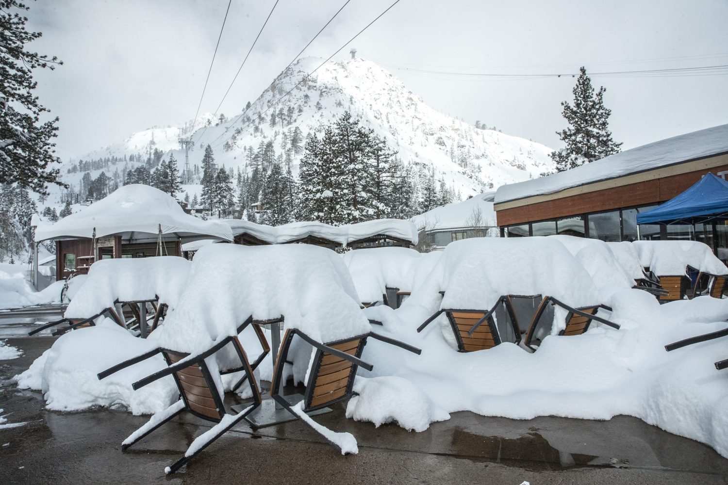
Squaw Valley, CA has already seen 200″ of snowfall this month and there is much more on the way tonight and this weekend.
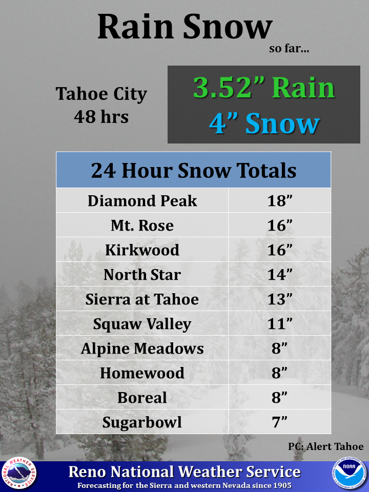
Tahoe resorts have already seen up to 18″ of snow since yesterday.

SPECIAL WEATHER STATEMENT:
Special Weather Statement
 National Weather Service Reno NV
 147 PM PDT THU MAR 22 2018

 Lassen-Eastern Plumas-Eastern Sierra Counties-Greater Lake Tahoe
 Area-Mono-Greater Lake Tahoe Area-Greater Reno-Carson City-Minden
 Area-

 ...DANGEROUS SNOW SQUALLS WILL AFFECT PLUMAS...MONO...ALPINE...
 PLACER...EL DORADO...SIERRA...NEVADA...SOUTHERN WASHOE...AND DOUGLAS
 COUNTIES AND WESTERN CARSON CITY...

 At 137 PM PDT, dangerous snow squalls were advancing towards the
 Sierra from as far north as Sierraville to as far south as Mammoth
 Mountain. These strong convective snow squalls will produce areas of
 near zero visibility, occasional lightning, and extreme snowfall
 rates. Travelers on Sierra roadways, Caltrans/NDOT employees, and
 outdoor enthusiasts should be aware of very rapidly deteriorating
 conditions over the next couple of hours.

 Use extra caution if you must travel into the Sierra over the next
 several hours. Consider delaying travel until the heavier snow
 squalls have exited the region. Near zero visibility will make
 roads almost impassable.