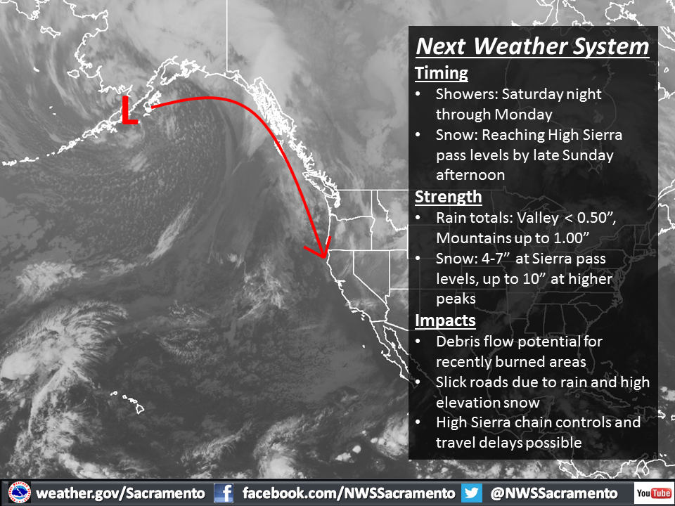
NOAA is currently forecasting a cold Gulf of Alaska storm to drop down from Alaska, slide along the British Columbia coast, and slam into Lake Tahoe, CA this Sunday and Monday. This storm will bring up to a foot of snow to the Sierra crest and snow levels as low as 4,500 feet. This storm is forecast to be colder than the last storm, with higher snowfall ratios, but less precipitation overall.
Right now in Lake Tahoe we have Mt. Rose and Boreal ski resorts open daily. Rose opened up more terrain today with the new Wizard chairlift up and running.

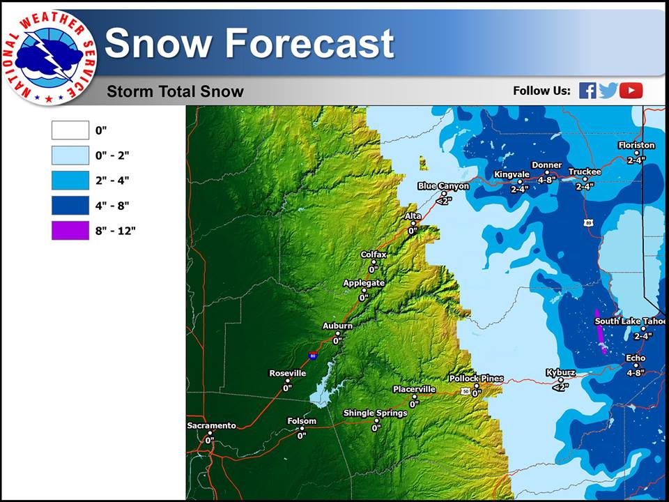
NOAA is calling for 4″ at the lake and up to a 12″ of snow on the Sierra crest.
SNOW AMOUNTS OF UP TO A FOOT NEAR THE
SIERRA CREST INTO MONDAY AND TO 4" AROUND LAKE LEVEL STILL SEEM
REASONABLE. - NOAA Reno, NV
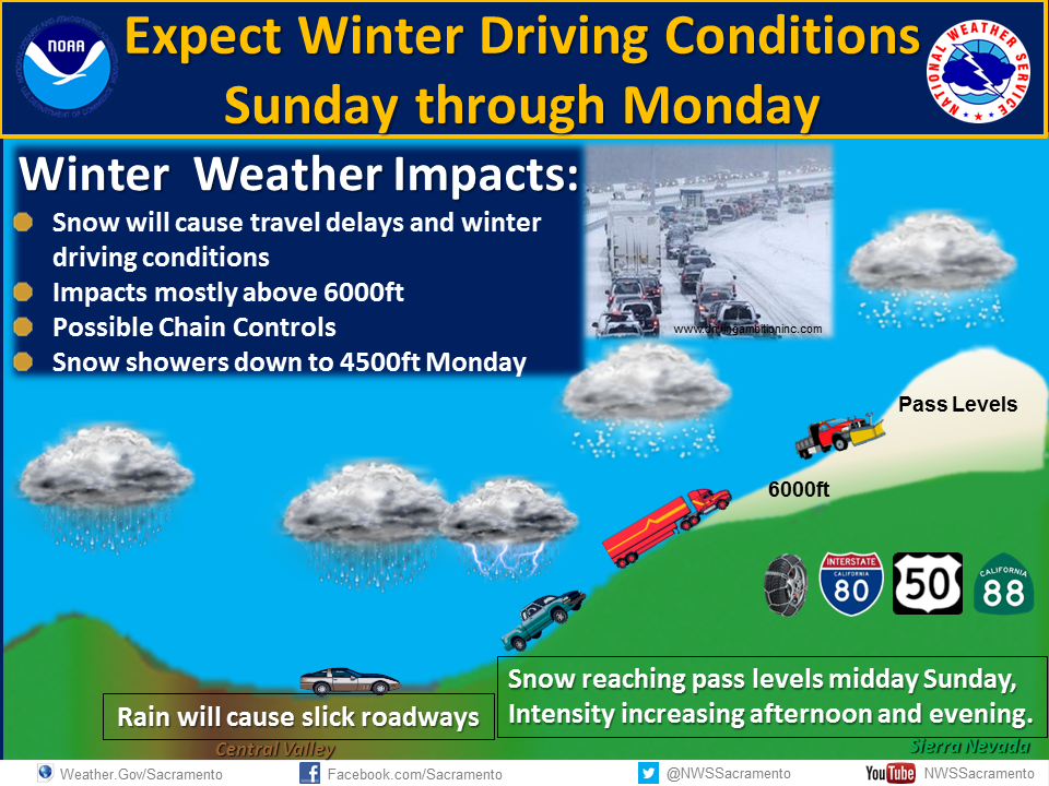
Snow levels will start out higher than expected but will drop to as low as 5,500-feet by midnight on Sunday night.
SNOW LEVELS TO START
6000-6500 FEET BEFORE SLOWLY FALLING. THE MAIN FRONT MOVES THROUGH
SUNDAY EVENING WITH SNOW LEVELS THEN FALLING TO NEAR THE VALLEY
FLOORS AFTER MIDNIGHT. MOST OF THE PRECIP STILL LOOKS TO FALL AS
SNOW ABOVE 5500 FEET OR SO. SNOW AMOUNTS OF UP TO A FOOT NEAR THE
SIERRA CREST INTO MONDAY AND TO 4" AROUND LAKE LEVEL STILL SEEM
REASONABLE.

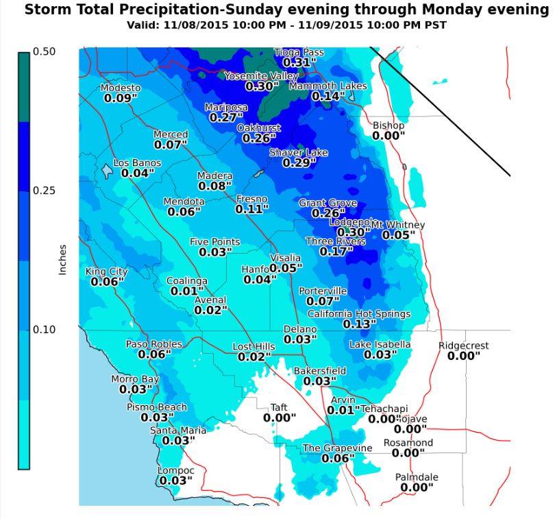
Mammoth isn’t forecast to get as much snow as Tahoe, but they still may make out with 6″ of snow if all goes well. See the map above.

If you head up to Tahoe this weekend, please be real careful coming back down the hill as snow is forecast for the mountain passes of highways 80, 50, and 88.