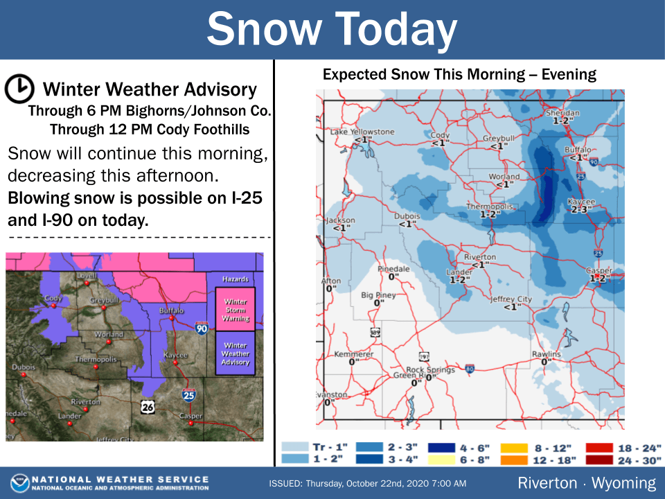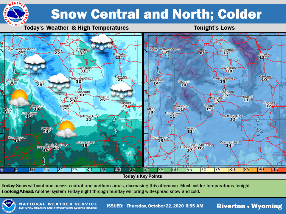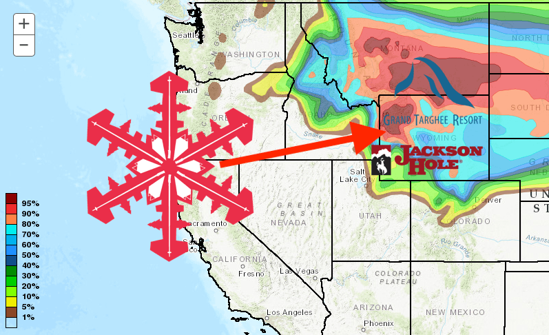
Winter has arrived in Wyoming, with the northern mountains receiving an inch or two yesterday before the storm tracks south, dropping at least a foot of fresh snow on Jackson Hole Mountain Resort and Grand Targhee.
The NOAA has issued a hazardous weather warning for the frigid temperatures and high winds that will accompany the snow.
This Hazardous Weather Outlook is for Western and Central
Wyoming.

.DAY ONE...Today and Tonight.

Cold front continues across the state today, with light to
moderate snow east of the Divide. Blowing snow will be an issue
for the I-90 corridor.

.DAYS TWO THROUGH SEVEN...Friday through Wednesday.

Saturday and Sunday, another system will move across the state,
with widespread snow expected across the state. This front will
also bring even colder temperatures, with overnight lows around
zero Saturday night and Sunday night.
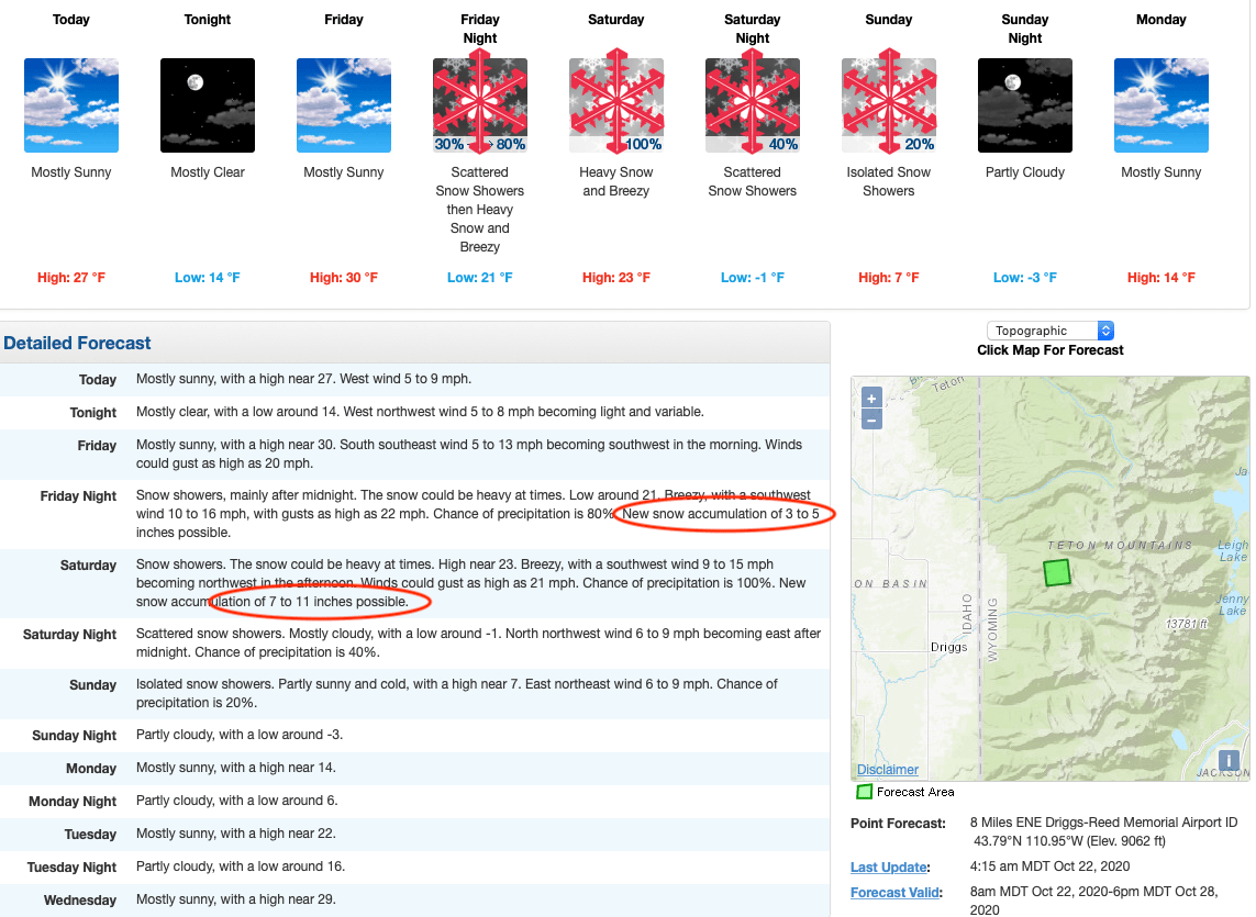
Snow will begin Friday night and continue through Sunday morning, with the heavier snow falling on Saturday. Jackson Hole Mountain Resort could see 7-13″ and Grand Targhee 10-16″. Were the resorts open, we would be talking about free refills all day Saturday and a pretty deep power day Saturday and Sunday.
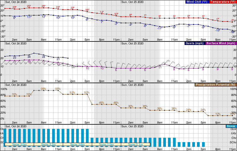
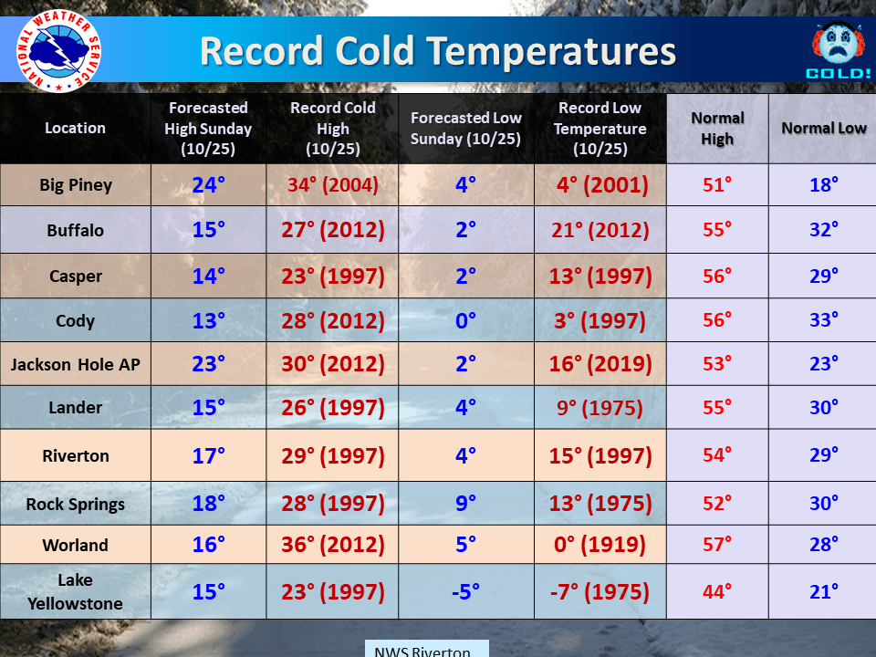
The main talking point of this system is the frigid temperatures expected. Mountain temperatures could drop below 0ºF, and even in the valleys, we could see temperatures not get much higher than single digits. See the graphic below of expected temperatures and current records. We could definitely see a few of those smashed this weekend.
With opening day only a month away (JHMR opens on 11/26, and Grand Targhee on 11/20), the snow comes at just the right time for resorts to start preparing and making snow and for skiers and riders to get excited!
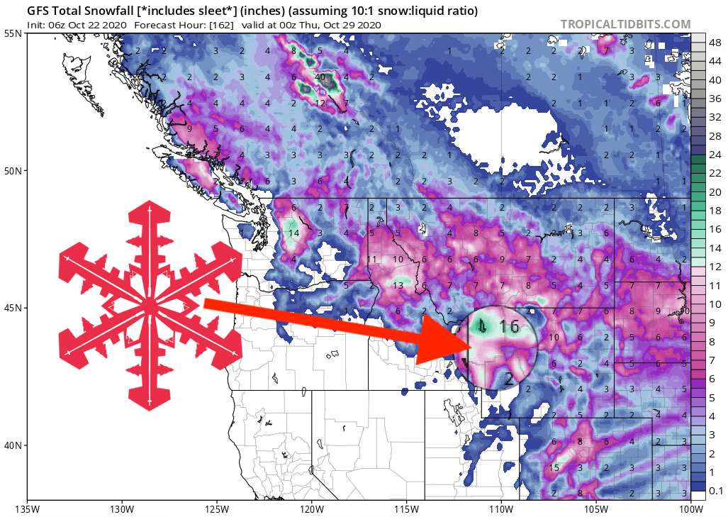
GEM Snowfall Accumulation Model:
Other Info:
