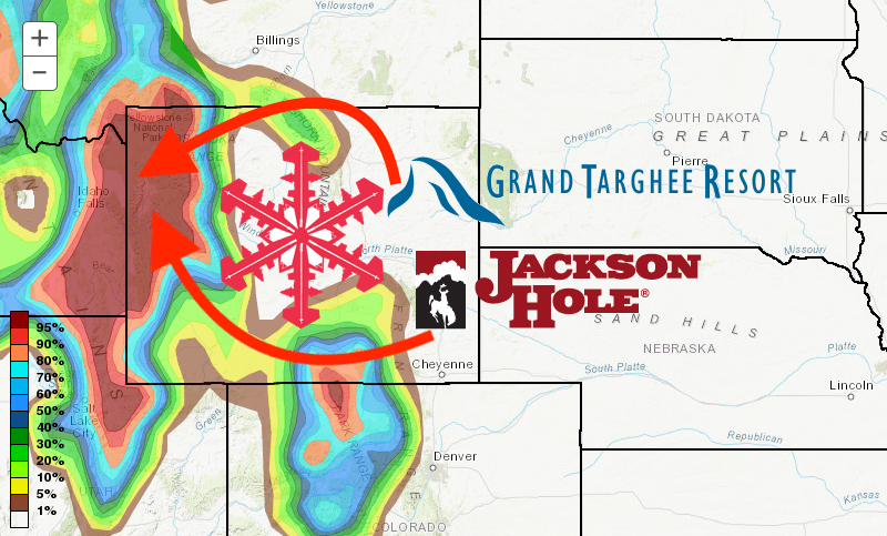
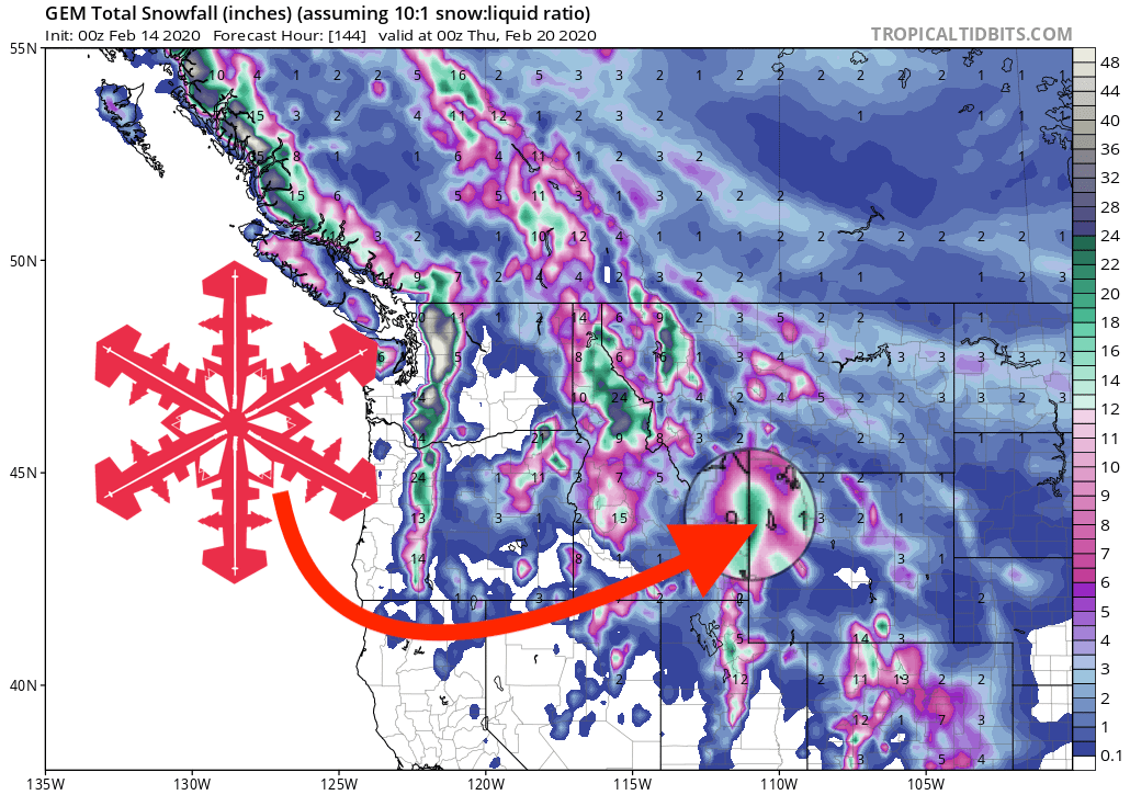
A storm is heading to Wyoming this weekend that will dump significant snowfall on the mountains and ski areas. Grand Targhee and Jackson Hole Mountain Resort could each see in excess of 2-FEET of fresh snow.
- Conditions yesterday: Grand Targhee WY, Conditions Report: Floaty Fun! // VIDEO: 1 Ridiculously-Long Powder Run in The Teton Range, WY Yesterday
...Significant Snow Saturday Night thru Sunday Night over Far
Western Wyoming...

This is a special weather statement from the National Weather
Service Office in Riverton.

* WHAT...Significant snow possible. Significant blowing snow is
  also expected in the mountains.

* WHERE...Far western Wyoming.

* SNOW AMOUNTS...Preliminary snowfall totals of 5 to 8 inches in
  the far west valleys. For the mountains, 10 to 20 inches is
  possible.

* WHEN...Saturday night through Sunday night. The heaviest snow
  looks to occur during the predawn hours Sunday through the
  afternoon Sunday.
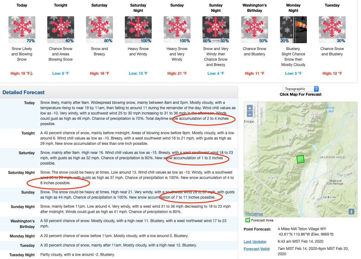
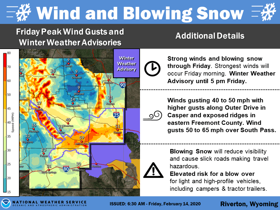
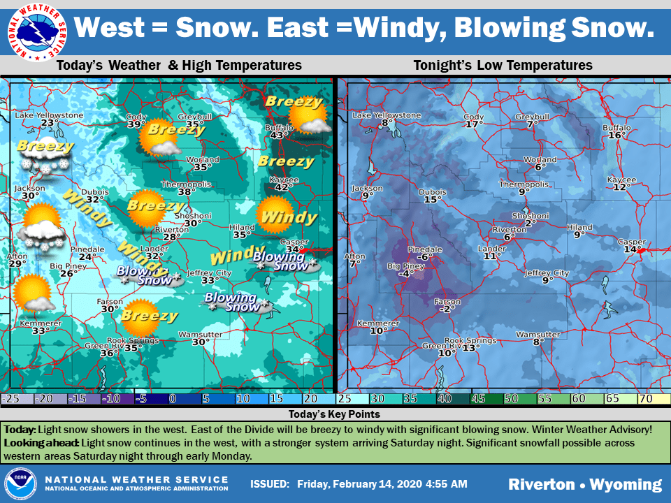
The NOAA short-term forecast discussion calls for mainly clear skies this morning with a few clouds in the northwest. Windy in the wind corridor, with a hazardous weather warning in effect, of central WY with blowing and drifting snow occurring. A large spread of temperatures over the area from 10 below zero to mid-30s above zero.
The discussion goes on to say that today, snow in the west will be on the light side for the most part and will taper off this evening with lingering snow in the higher mountain elevations through the night. The rest of the region will be dry, but windy, today and tonight. Lows tonight will range from zero to the upper teens with some colder valleys below zero once again.
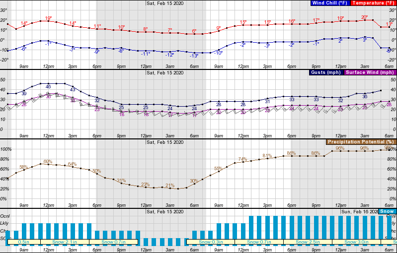
Snow increases in the west Saturday night ahead of the next weather system that moves toward the Rockies. Up to a foot of fresh snow on Saturday night will mean Sunday morning is the best time to ski, and with a further foot falling during the morning Sunday, free refills will be the order of the day!
A few inches Sunday night to top up and President’s Day will also be pretty sweet.
GEM Forecast Model:
Other Info:
