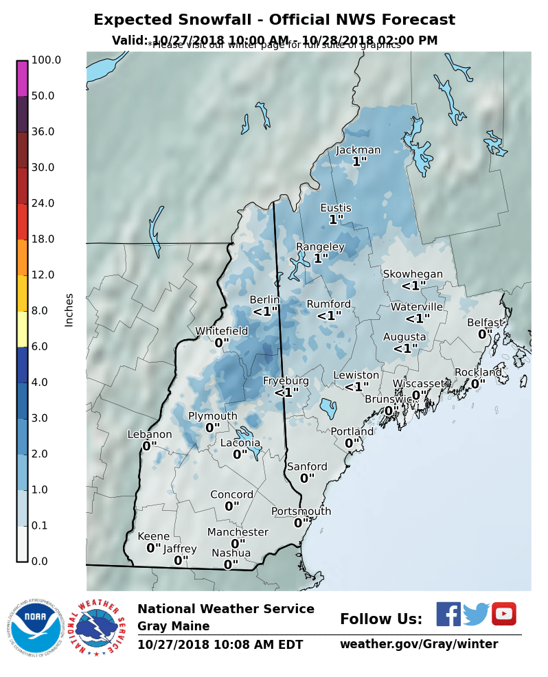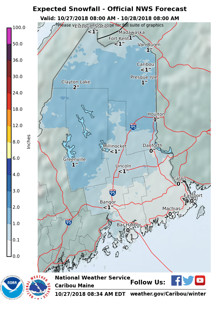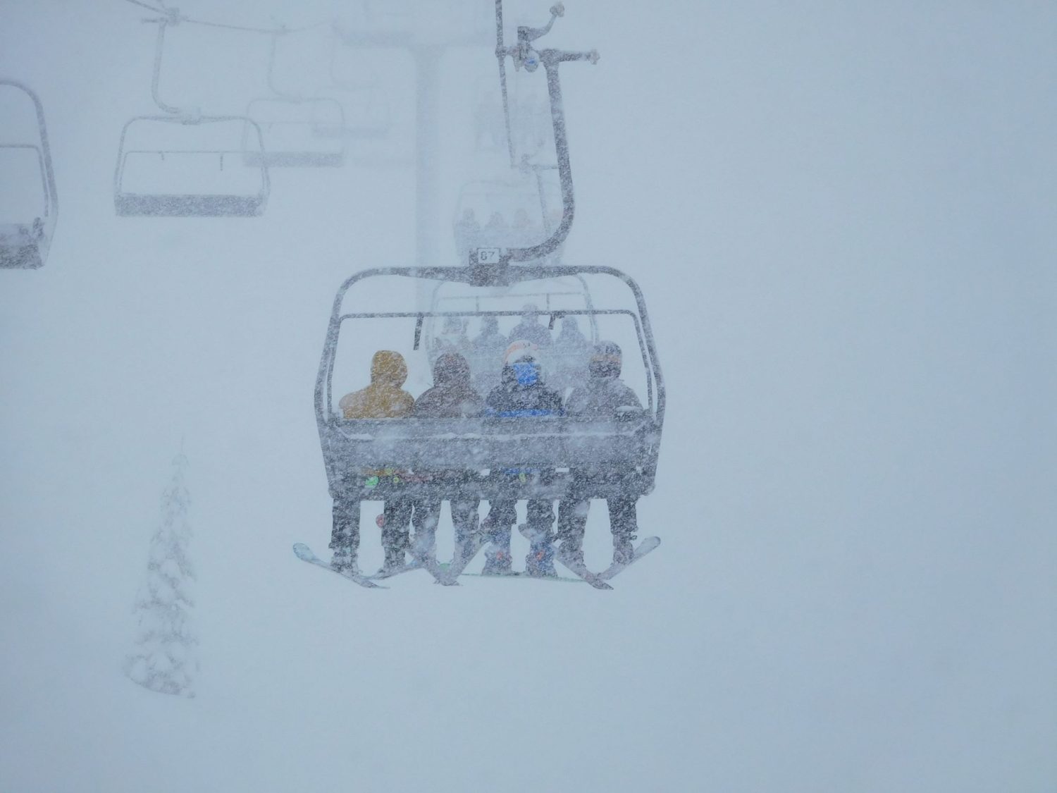
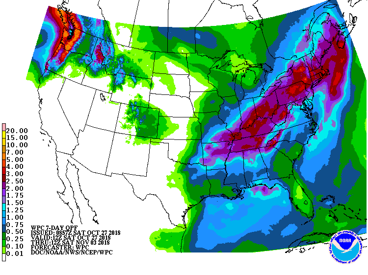
The East Coast is in for some fresh snow today – tomorrow. A few inches of snow is forecasted to fall in Maine, New Hampshire, and Vermont.
* WHAT...Mixed precipitation expected. Total snow accumulations
  of up to two inches and ice accumulations of a tenth to two
  tenths of an inch are expected.
- NOAA Caribou, ME
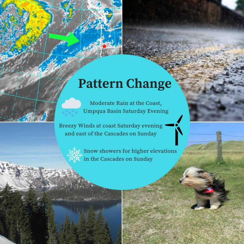
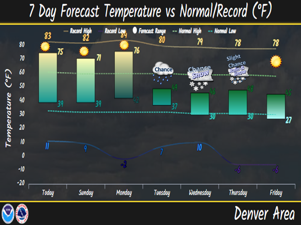
A pattern change is forecasted to occur in the West next week. Wet and cool conditions are expected to return.
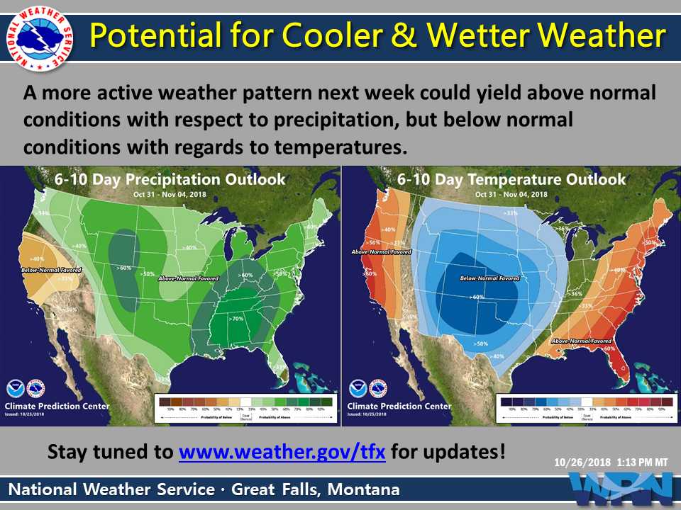
 "A more active weather pattern next week could yield
  above normal conditions with respect to precipitation,
  but below normal conditions with regards to temperatures."
- NOAA Great Falls, MT
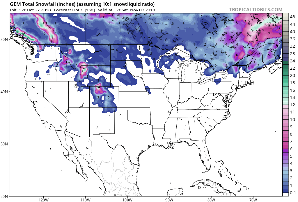
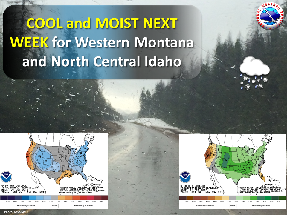
The 6-10 day outlook calls for below average temperatures and above average precipitation in the West.
In the East, it looks like above average temperatures and above average temperatures will impact the region.
Additional Info:
West:
MT Forecast Discussion:
  Another surge of Pacific moisture will also return Sunday afternoon and
  into the the day on Monday along the Continental Divide and over
  Southwest/Central Montana, which will lead to another round of
  precipitation. Falling snow levels Sunday night will lead to
  precipitation changing over to snow over most mountainous
  locations over the previously mentioned regions, with snow
  continuing into the day on Monday over the mountains as cooler air
  filters south from Canada.

  Monday night through Friday...large scale troughing followed by
  northwest flow aloft will bring unsettled conditions and a return to
  normal and/or slightly below normal temperatures for all of North
  Central and Southwest Montana. While moderate to high confidence
  continues to exists in this return to a wetter and cooler pattern,
  timing/location of the future precipitation events remains somewhat
  low due to continued model differences. However, at this time, it
  appears that Southwest and Central Montana have the best chance of
  seeing appreciable valley rainfall and mountain snowfall. Those with
  outdoor plans/interests should continue to monitor future forecasts,
  especially those planning to recreate/hunt in the higher elevations.
- NOAA Great Falls, MT
East:
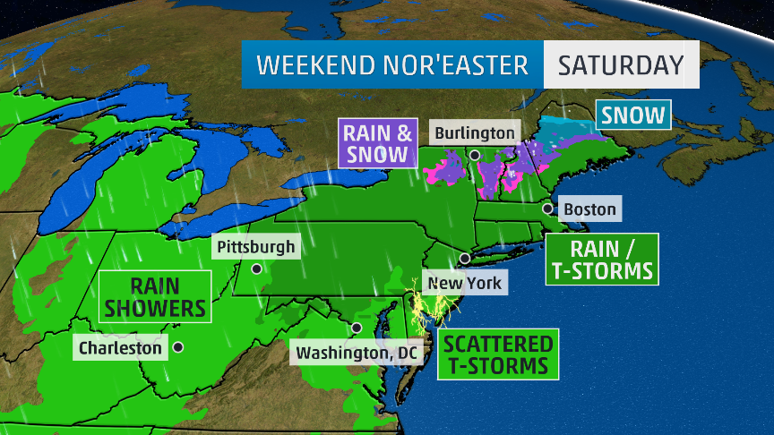
ME Winter Weather Advisory:
URGENT - WINTER WEATHER MESSAGE
National Weather Service Caribou ME
1252 PM EDT Sat Oct 27 2018

Northwest Aroostook-Northeast Aroostook-Northern Somerset-
Northern Piscataquis-
Including the cities of Allagash, Clayton Lake, Madawaska,
Fort Kent, Frenchville, Presque Isle, Caribou, Van Buren,
Mars Hill, Baker Lake, Billy-Jack Depot, Baxter St Park,
Chamberlain Lake, Churchill Dam, and Mount Katahdin
1252 PM EDT Sat Oct 27 2018

...WINTER WEATHER ADVISORY REMAINS IN EFFECT FROM 6 PM THIS
EVENING TO 11 AM EDT SUNDAY...

* WHAT...Mixed precipitation expected. Total snow accumulations
  of up to two inches and ice accumulations of a tenth to two
  tenths of an inch are expected.

* WHERE...Northwest Aroostook, Northeast Aroostook, Northern
  Somerset and Northern Piscataquis Counties.

* WHEN...From 6 PM this evening to 11 AM EDT Sunday.

* ADDITIONAL DETAILS...The ice will result in difficult travel
  conditions. Expect reduced visibilities at times.
