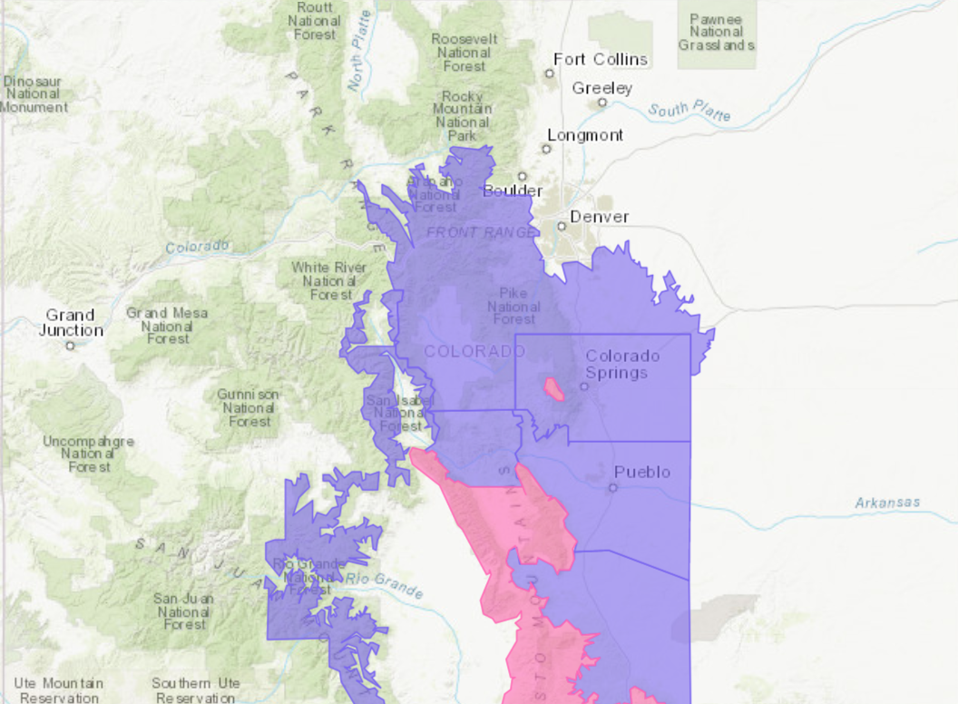
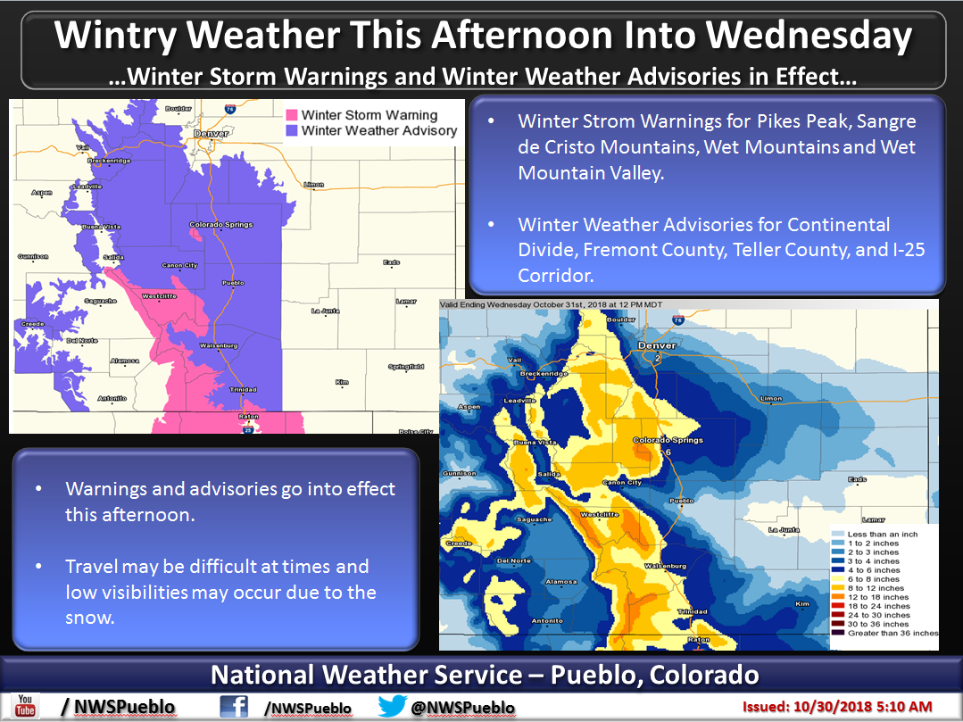
The National Weather Service has issued Winter Storm Warnings and Winter Weather Advisories for Colorado. They are in effect until Wednesday. Heavy snow is forecasted to impact the area throughout that time.
Winter Storm Warning:
- 7-15″ of Snow Today – Wednesday
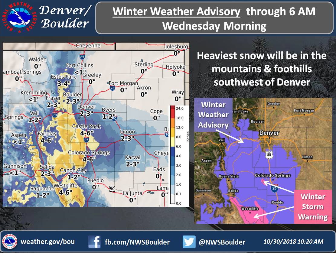
Winter Weather Advisory:
- 5-12″ of Snow Today – Wednesday Morning
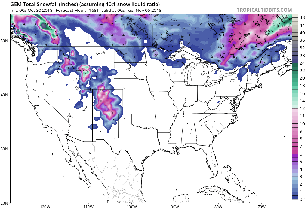
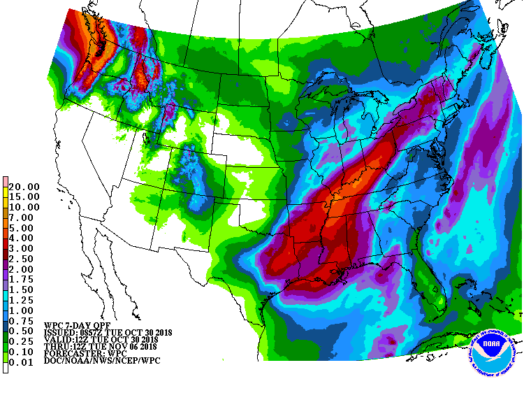
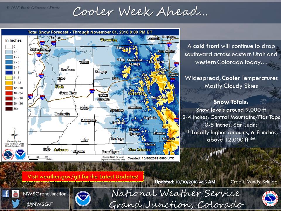
Snow levels are expected to start out around 9,000ft, but they are forecasted to drop as the storm progresses.
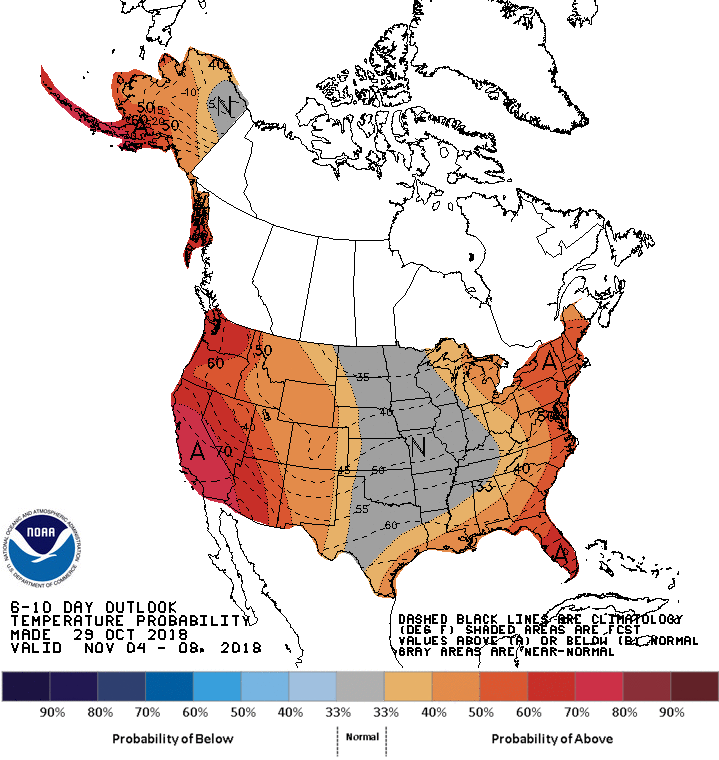
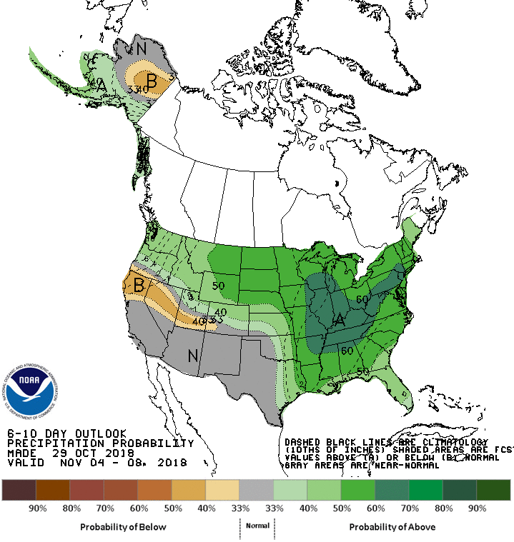
The 6-10 day outlook is calling for above average temperatures and above average precipitation in Colorado.
Additional Info:
CO Winter Storm Warning:
URGENT - WINTER WEATHER MESSAGE
National Weather Service Pueblo CO
1027 AM MDT Tue Oct 30 2018

Northern Sangre de Cristo Mountains Between 8500 And 11000 Feet-
Northern Sangre de Cristo Mountains Above 11000 Feet-
Southern Sangre de Cristo Mountains Between 7500 and 11000 Feet-
Southern Sangre de Cristo Mountains Above 11000 Feet-
Wet Mountain Valley Below 8500 Feet-
Wet Mountains between 6300 and 10000 Feet-
Wet Mountains Above 10000 Feet-

...WINTER STORM WARNING REMAINS IN EFFECT FROM 3 PM THIS
AFTERNOON TO 3 PM MDT WEDNESDAY...

* WHAT...Heavy snow expected. Total snow accumulations of 7 to 15
  inches expected.

* WHERE...Wet Mountains, Sangre de Cristo Mountains and Wet
  Mountain Valley.

* WHEN...From 3 PM this afternoon to 3 PM MDT Wednesday.

* ADDITIONAL DETAILS...Travel will become hazardous over the
  mountain passes tonight through Wednesday due to poor
  visibilities and snowpacked and icy roads.
CO Winter Weather Advisory:
URGENT - WINTER WEATHER MESSAGE
National Weather Service Denver CO
1037 AM MDT Tue Oct 30 2018

...Return to Winter...

.A storm system will move across the Central and Southern Rockies
through tonight. Snow will continue over the Front Range Mountains
Foothills, and Palmer Divide, while a mix of rain and snow
changes to all snow across the nearby adjacent plains and I-25
Urban Corridor. The heaviest snow is expected to occur south of
Interstate 70 and east of the Continental Divide. Roads in the
Mountains, Foothills, and Palmer Divide are expected to become
snowpacked and slippery, especially this evening when the sun sets
and temperatures cool. Lighter snow accumulations can be expected
along the I-25 Corridor from Denver north, with perhaps a little
slush on bridges and overpasses later tonight.

The Mountains of Summit County, the Mosquito Range, and the
Indian Peaks-
Including the cities of Berthoud Pass, Breckenridge,
East Slopes Mosquito Range, East Slopes Southern Gore Range,
Eisenhower Tunnel, Indian Peaks, Kenosha Mountains, Mount Evans,
Williams Fork Mountains, and Winter Park

...WINTER WEATHER ADVISORY REMAINS IN EFFECT UNTIL 6 AM MDT
WEDNESDAY...

* WHAT...Snow. Total snow accumulations of 5 to 12 inches on the
  eastern slope of the Front Range, but 2 to 5 inches west of the
  Eisenhower Tunnel.

* WHERE...The Mountains of Summit County, the Mosquito Range,
  and the Indian Peaks.

* WHEN...Until 6 AM MDT Wednesday.

* ADDITIONAL DETAILS...Plan on slippery road conditions.
