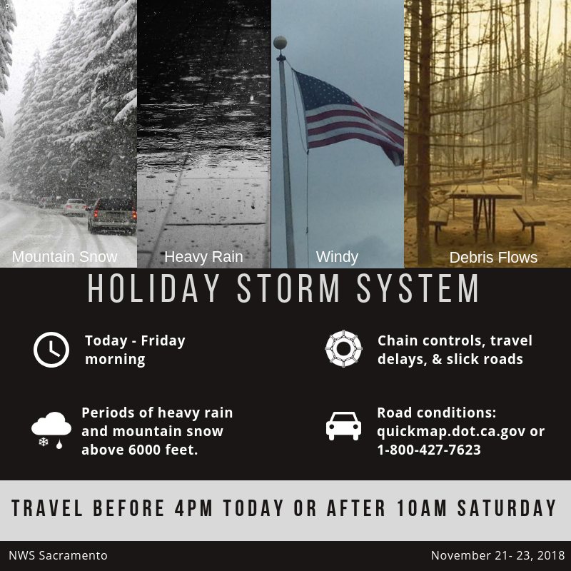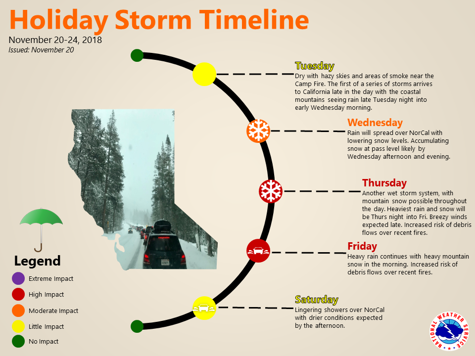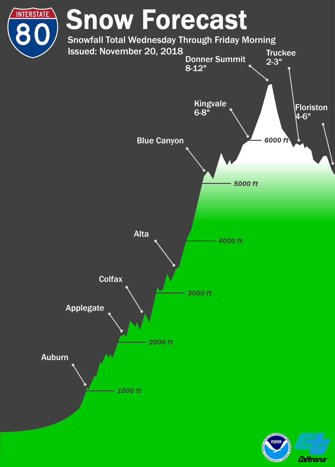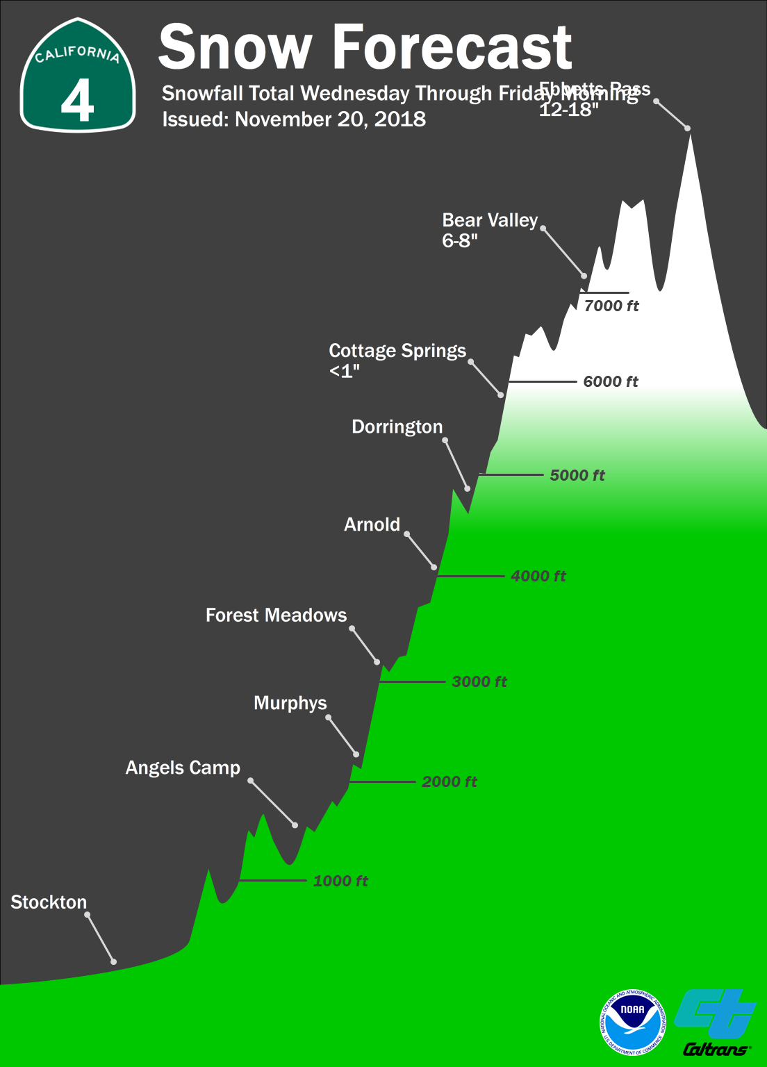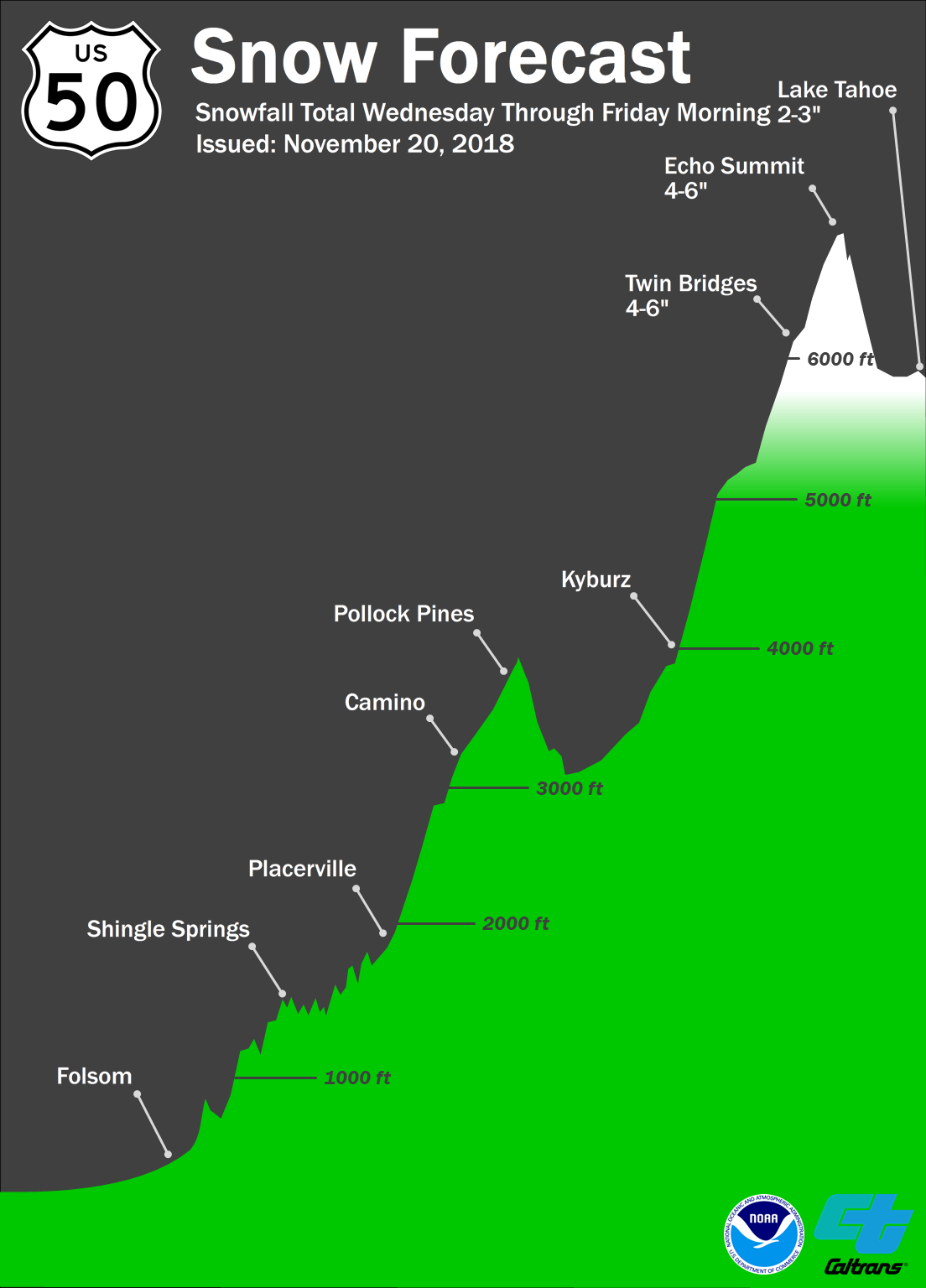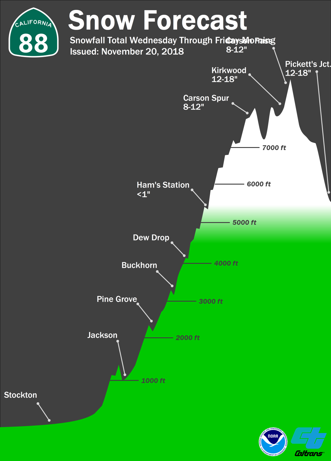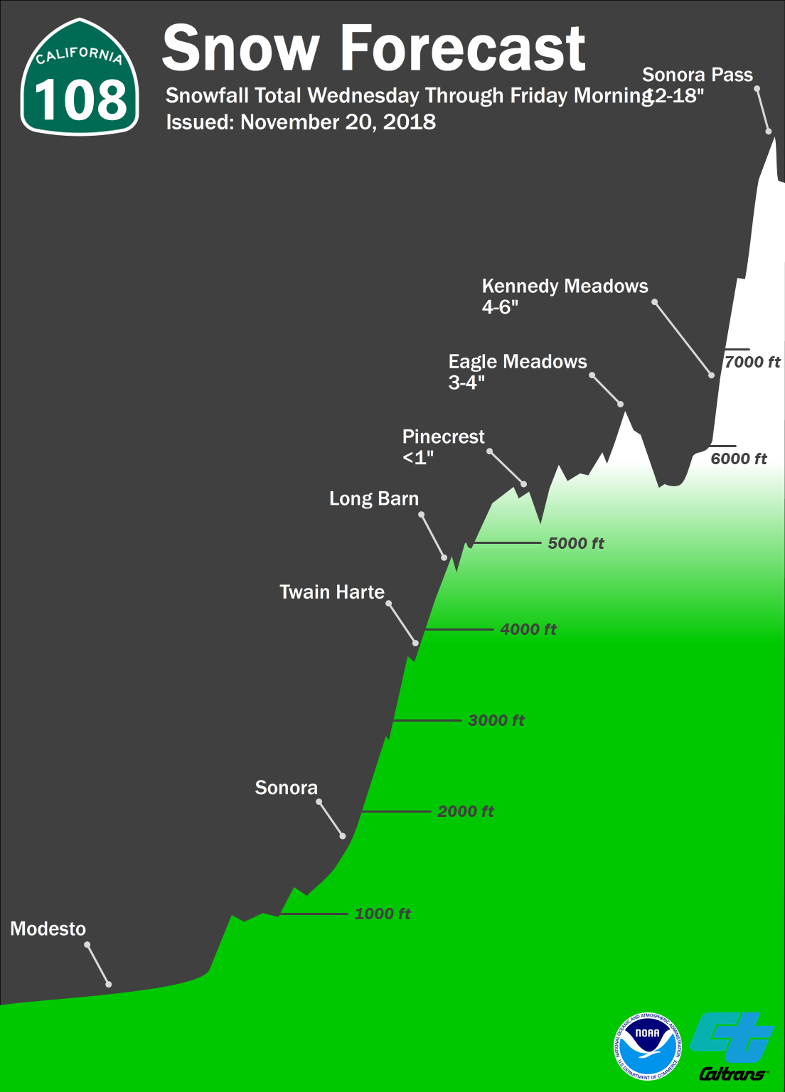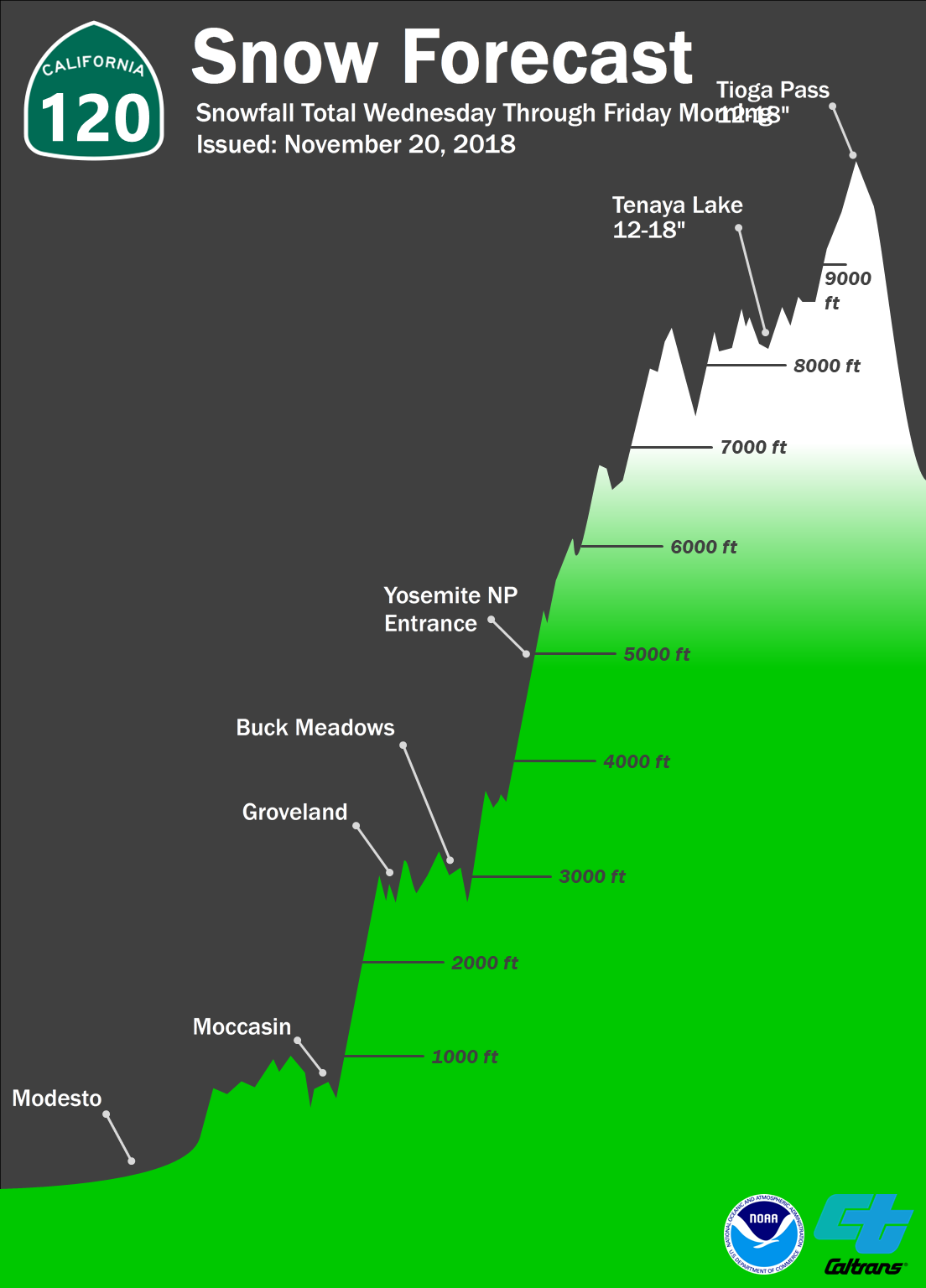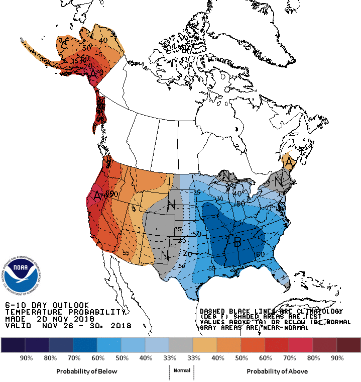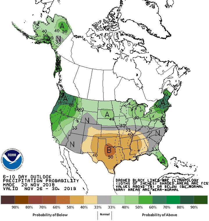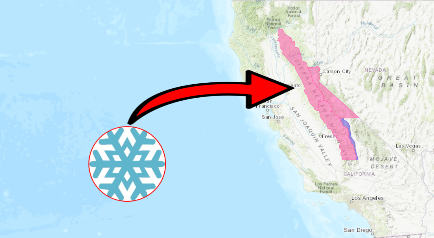
The National Weather Service has issued a Winter Storm Warning for California. It’s in effect from Wednesday afternoon through Thursday morning. Heavy snow and high winds are forecasted to impact the mountains throughout that time.
California:
- 6-15″ of Snow Today – Thursday Morning
“The first significant snow of the season is on the way and it will occur during the busiest travel time of the year!”
– NOAA Sacramento, CA
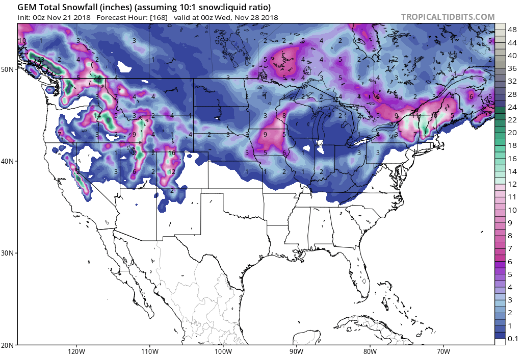
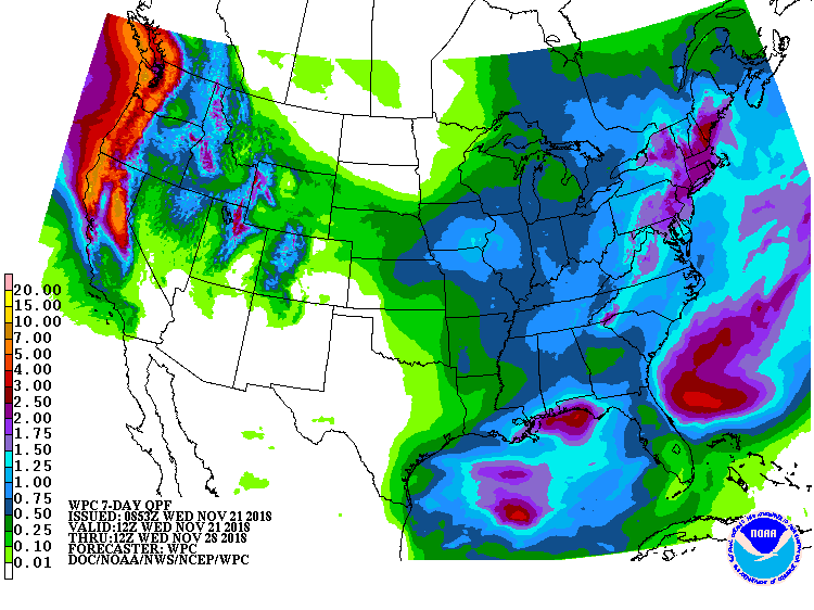
Precipitation is forecasted to change from rain to snow below 7,000ft on Wednesday night into Thursday Morning.
The 6-10 day outlook calls for above average temperatures and above average precipitation in California.
Ski Resorts Open In California:
- Mammoth Mountain
- Squaw Valley
- Alpine Meadows
- Boreal
- Northstar
- Heavenly
- Snow Summit
- Soda Springs
- Mt. Rose, NV
Additional Storm Info:
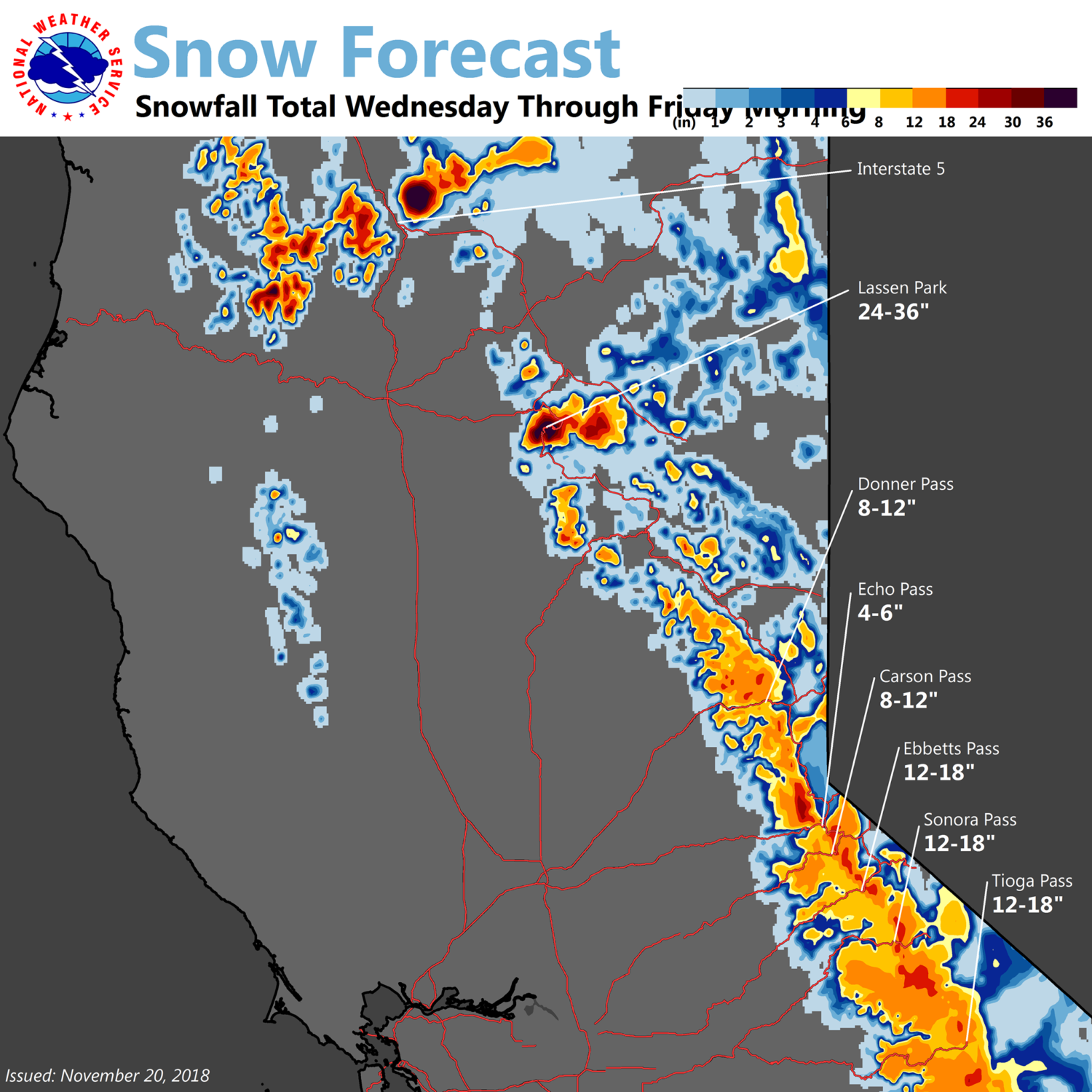
California: 6-15″ of Snow Today – Thursday Morning
* Moderate to heavy snow expected above 7000 feet, with
  rain changing to snow below 7000 feet Wednesday night
  and early Thanksgiving morning. Total snow accumulations
  of 6 to 15 inches above 7000 feet, with up to 4 inches
  below 7000 feet.
- NOAA Reno, NV
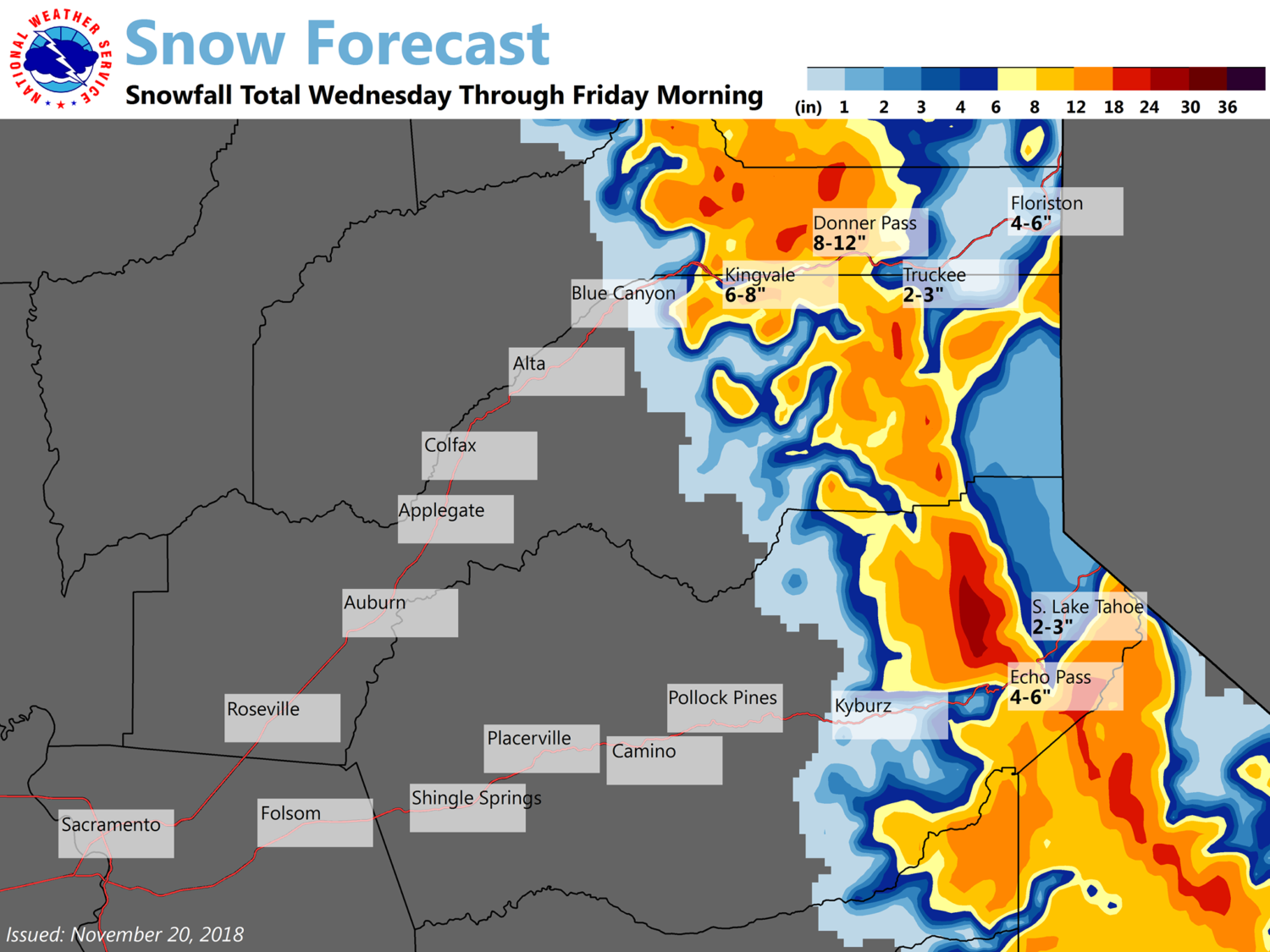
Winter Storm Warning:
URGENT - WINTER WEATHER MESSAGE
National Weather Service Reno NV
344 PM PST Tue Nov 20 2018

Greater Lake Tahoe Area-

...WINTER STORM WARNING IN EFFECT FROM 3 PM WEDNESDAY TO 6 AM PST
THURSDAY ABOVE 7000 FEET...

* WHAT...Moderate to heavy snow expected above 7000 feet, with
  rain changing to snow below 7000 feet Wednesday night and early
  Thanksgiving morning. Total snow accumulations of 6 to 15 inches
  above 7000 feet, with up to 4 inches below 7000 feet.

* WHERE...Greater Lake Tahoe Area.

* WHEN...From 3 PM Wednesday to 6 AM PST Thursday.

* ADDITIONAL DETAILS...Travel could be very difficult, especially
  given the higher than usual traffic volume Wednesday. DELAYS OF
  MANY HOURS is possible for travelers over Tahoe area passes late
  Wednesday afternoon and Wednesday night. Rough conditions are
  expected on Lake Tahoe Wednesday afternoon into the evening.
