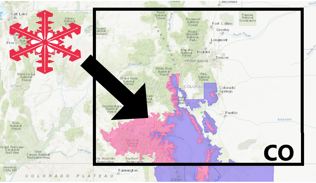
The National Weather Service has issued a Winter Storm Warning for Colorado.
It’s in effect until 6:00am Saturday morning.
Heavy snowfall is expected to impact the area throughout that time.
Colorado:
- 6-10+” of Snow Tonight – Saturday Morning
“A large area of low pressure over much of the western and central United States will continue to impact the weather of eastern Utah and western Colorado for a couple of days. High temperatures today will generally be 10 to 15 degrees cooler than average. Isolated to scattered showers and thunderstorms are on tap, with accumulating snow generally above 7500 feet elevation. Mountain travel will be impacted, especially over higher mountain passes. Please call 511 before setting out and be prepared for winter driving conditions.”
– NOAA Grand Junction, CO
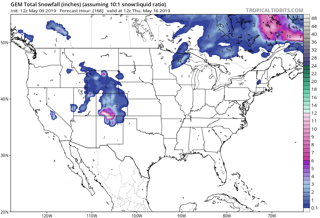
Accumulating snowfall is likely at elevations greater than 7,500ft.
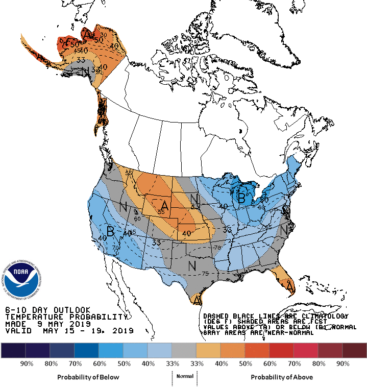
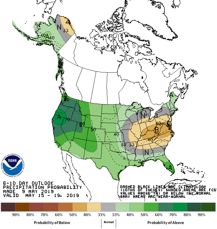
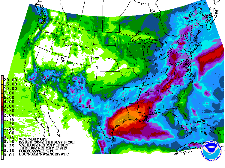
The 6-10 day outlook calls for above average precipitation and above average temperatures in Colorado.
Additional Storm Info:
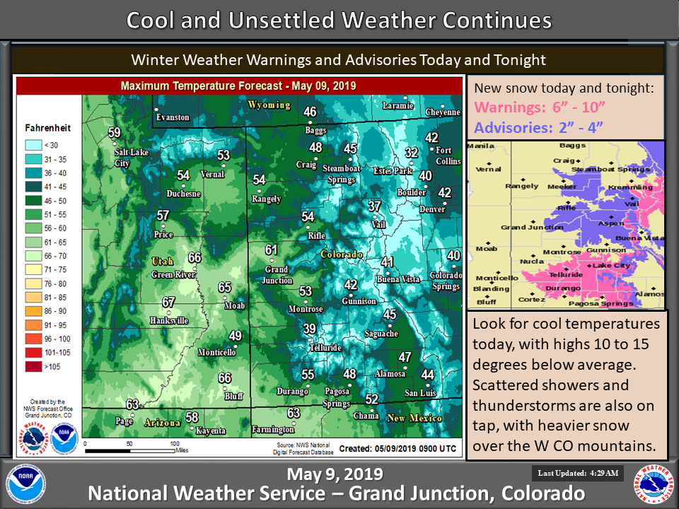
Colorado: 6-10+” of Snow Tonight – Saturday Morning
* Snow...heavy at times, will continue through Saturday morning.
  Additional snow accumulations of 6 to 10 inches are likely with
  the heaviest snowfall expected above 9,000 ft. Locally higher
  amounts are possible over the highest peaks.
- NOAA Grand Junction, CO
Winter Storm Warning:
URGENT - WINTER WEATHER MESSAGE
National Weather Service Grand Junction CO
316 PM MDT Thu May 9 2019

Northwest San Juan Mountains-Southwest San Juan Mountains-
Including the cities of Telluride, Silverton, and Rico

...WINTER STORM WARNING NOW IN EFFECT UNTIL 6 AM MDT SATURDAY
ABOVE 9000 FEET...

* WHAT...Snow...heavy at times, will continue through Saturday
  morning. Additional snow accumulations of 6 to 10 inches are
  likely with the heaviest snowfall expected above 9,000 ft.
  Locally higher amounts are possible over the highest peaks. The
  most significant impacts are expected to occur tonight.

* WHERE...Southwest San Juan Mountains and Northwest San Juan
  Mountains.

* WHEN...Until 6 AM MDT Saturday.

* ADDITIONAL DETAILS...Travel could be very difficult. The
  hazardous conditions could impact the morning or evening
  commute. A detailed map of the snowfall can be found at:
  www.weather.gov/gjt/winter.
