
The National Weather Service has issued a Winter Storm Warning for Maine, New Hampshire, and Vermont. It’s in effect through Thursday. The heaviest snowfall is expected to occur throughout the night Tonight. During which, snowfall rates could exceed 1″ per hour.
10-18″ of Snow Today – Thursday.
NOAA Has Issued A Winter Storm Warning For:
- Maine
- New Hampshire
- Vermont
Snow is expected to fall at all elevations, but as you travel lower in elevation, the snow is expected to be wetter and heavier.
Additional Storm Info:
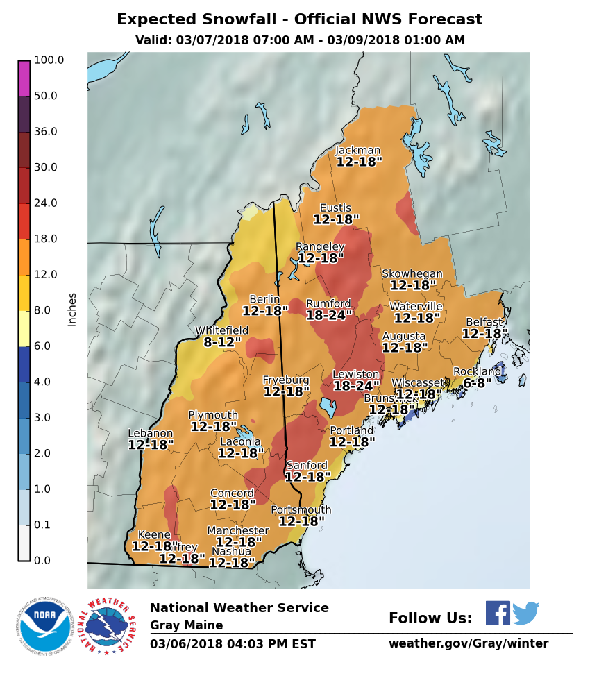
Maine: 12-18″ of Snow Today – Thursday
* Total snow accumulations of 12 to 16 inches, with
  localized amounts up to 18 inches, are expected.
- NOAA Gray, ME
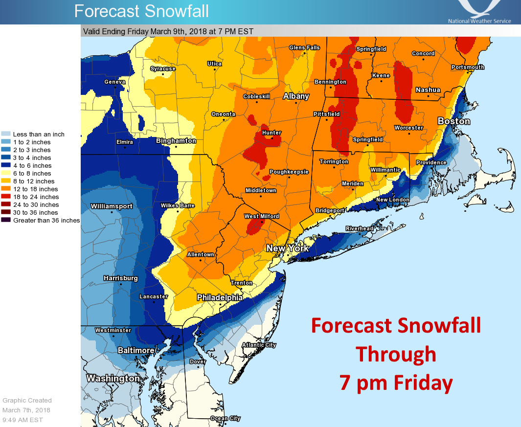
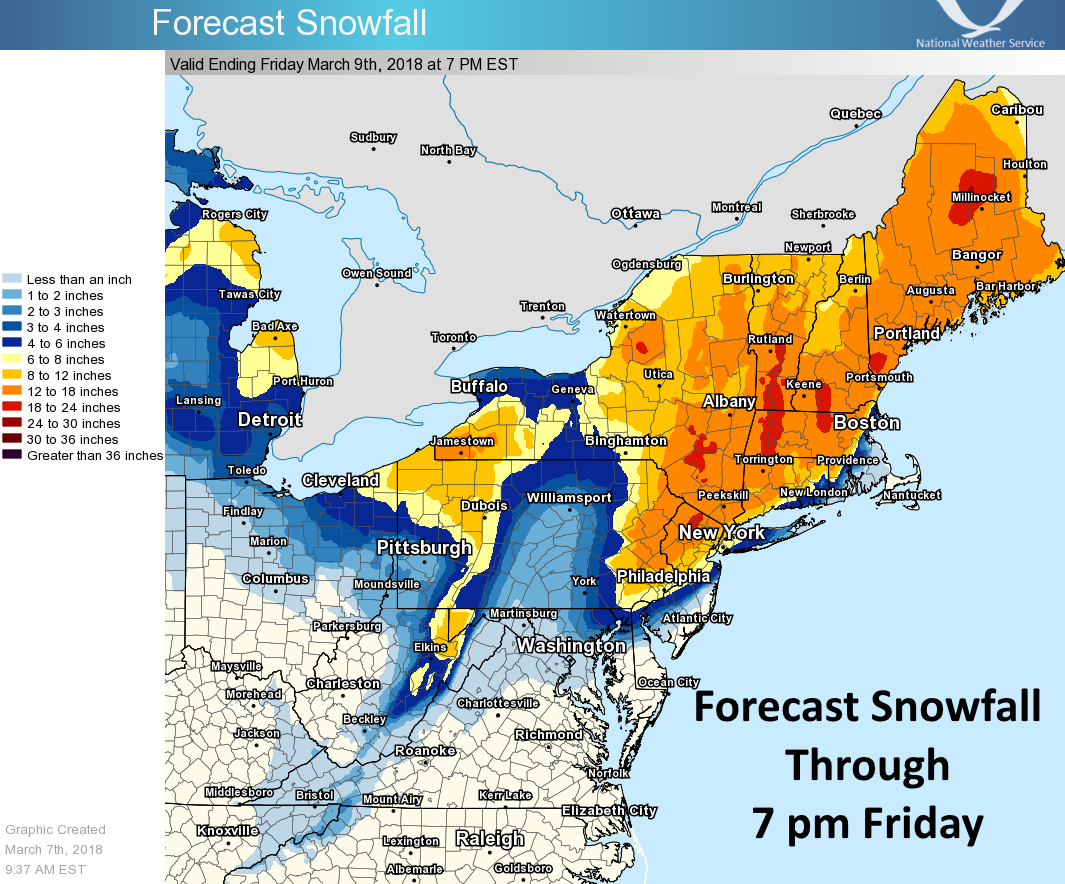
New Hampshire: 12-18″ of Snow Today – Thursday
* Total snow accumulations of 12 to 16 inches, with
  localized amounts up to 18 inches, are expected.
- NOAA Gray, ME
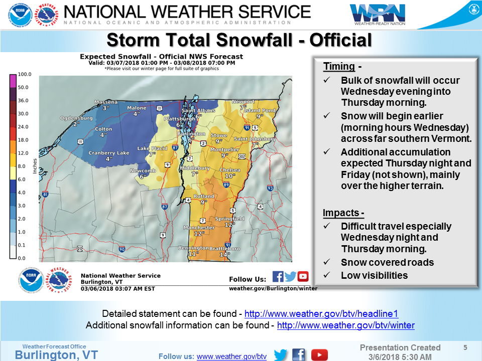
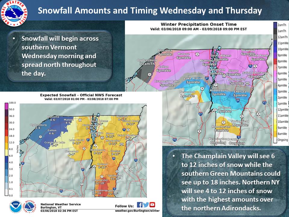
Vermont: 10-17″ of Snow Today – Thursday
* Total snow accumulations of 10 to 14
  inches, with locally higher amounts up
  to 17 inches possible in the southern
  Green Mountains.
- NOAA Burlington, VT
Vermont Winter Storm Warning:
URGENT - WINTER WEATHER MESSAGE
National Weather Service Burlington VT
329 AM EST Wed Mar 7 2018

Orange-Western Rutland-Windsor-Eastern Rutland-
Including the cities of Bradford, Randolph, Rutland, Springfield,
White River Junction, East Wallingford, and Killington

...WINTER STORM WARNING REMAINS IN EFFECT FROM 4 PM THIS
AFTERNOON TO 7 PM EST THURSDAY...

* WHAT...Heavy snow expected. Total snow accumulations of 10 to 14
  inches, with locally higher amounts up to 17 inches possible in
  the southern Green Mountains.

* WHERE...Orange, Rutland and Windsor Counties.

* WHEN...From 4 PM this afternoon to 7 PM EST Thursday. The
  heaviest snowfall is expected during the evening and overnight
  hours tonight.

* ADDITIONAL DETAILS...Snowfall rates of one to two inches per
  hour are expected tonight. Plan on difficult travel conditions,
  especially tonight and the morning commute on Thursday. Be
  prepared for significant reductions in visibility, down to one-
  quarter mile at times.