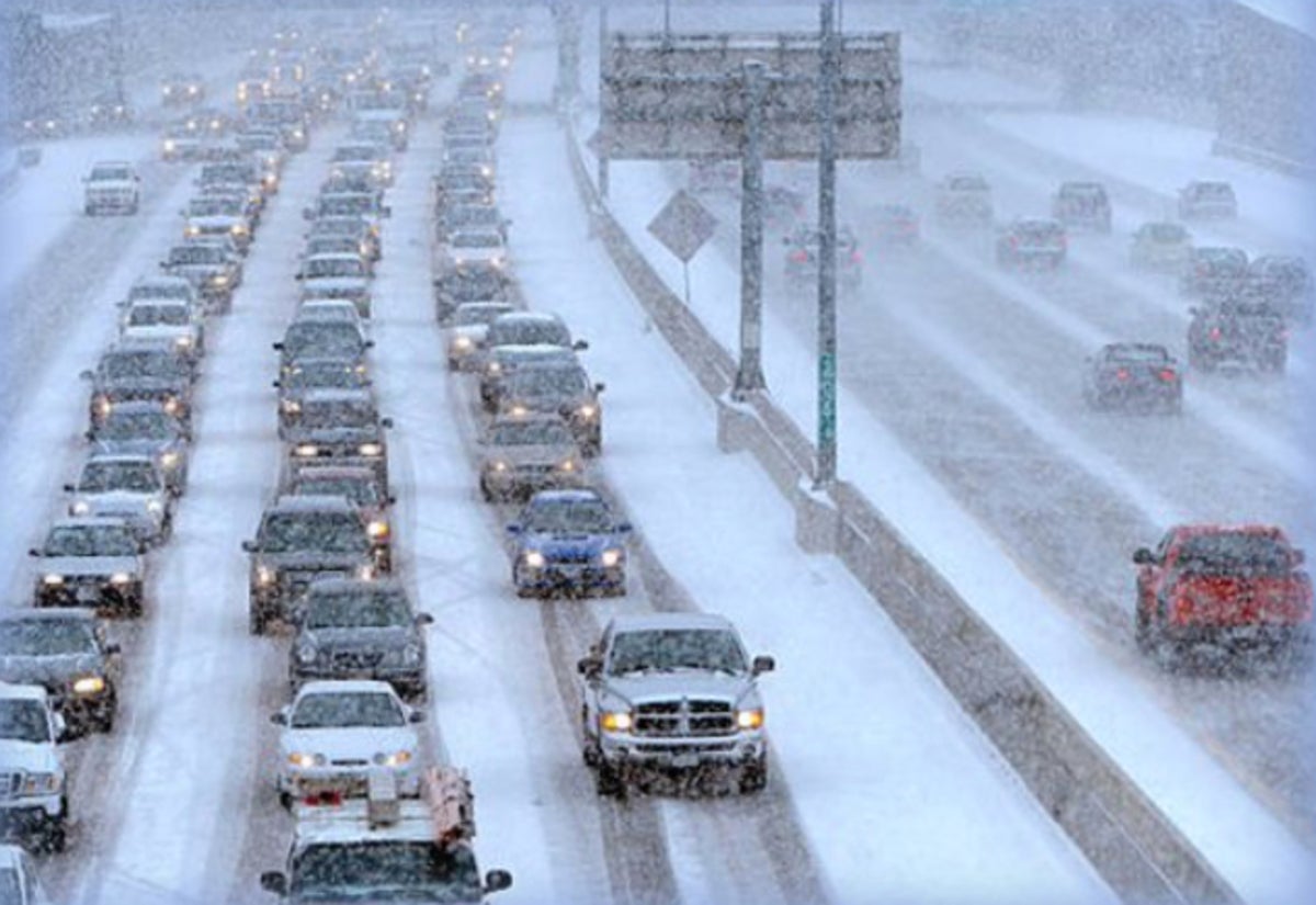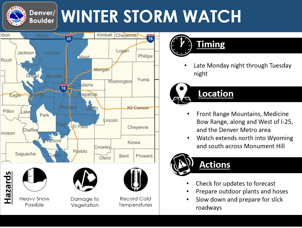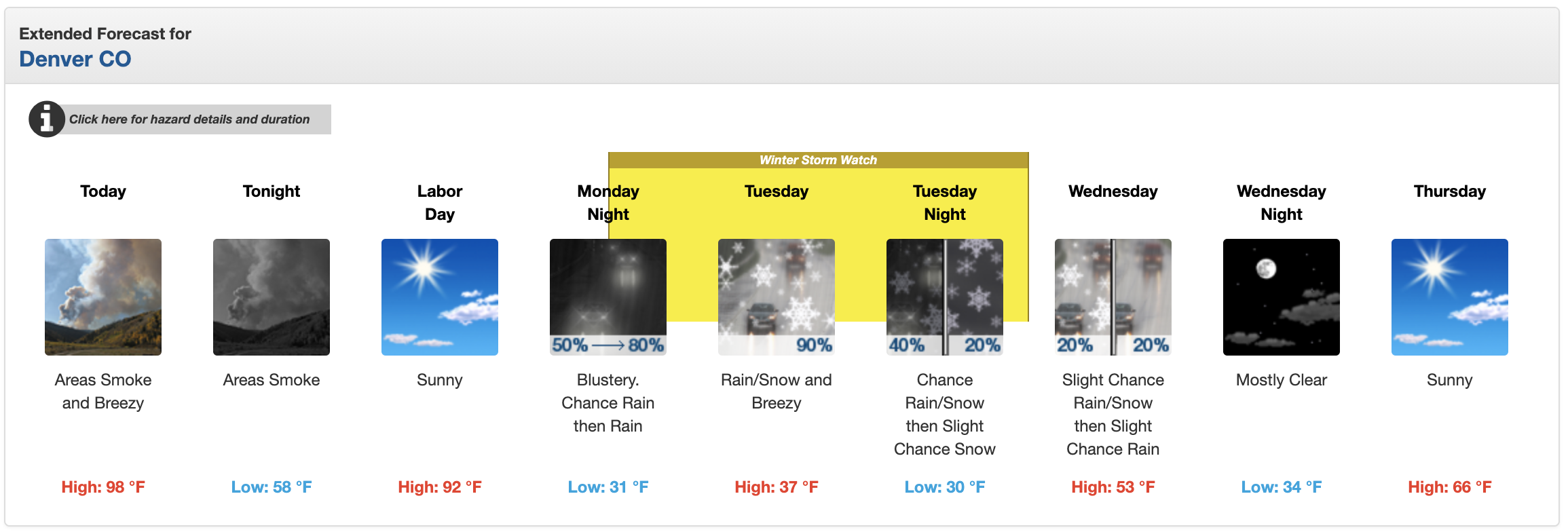
NOAA has issued a Winter Storm Watch for Denver and the Front Range, CO for Tuesday that is calling for “heavy snow”.
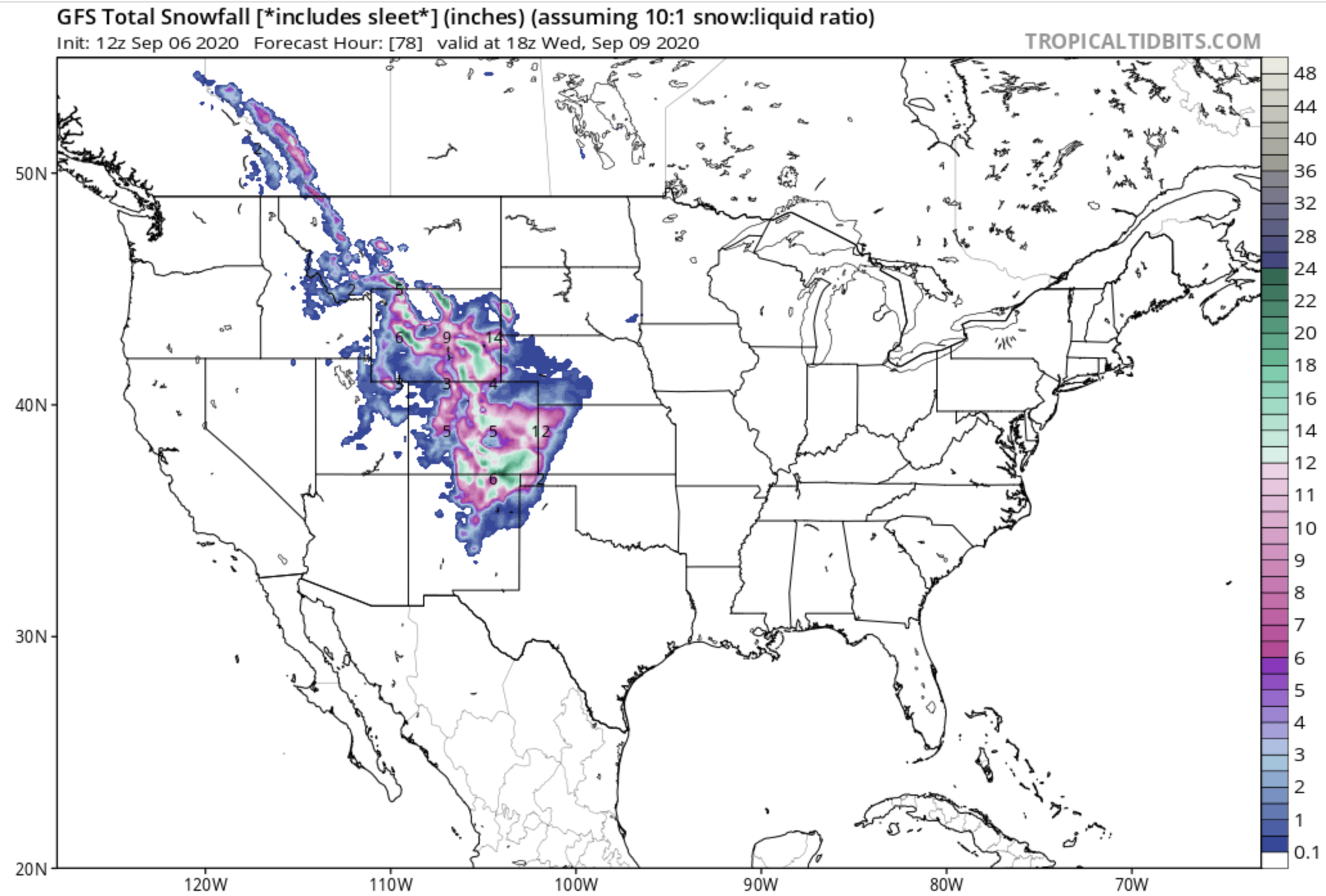
NOAA is forecasting 3-6″ of snow in Denver.
NOAA is forecasting 6-14″ of snow in the higher elevations of the Front Range.
* WHAT...Heavy snow possible. The Denver metro area and I-25
  corridor could see accumulations of 3 to 6 inches by late
  Tuesday.

- NOAA, Denver 9/6/20
* WHAT...Heavy snow possible. The higher elevations and Front
  Range could see 6 to 14 inches. The Palmer Divide could see 6 to
  8 inches, with winds gusting as high as 40 mph.

- NOAA, Denver, 9/6/20

This is the 1st Winter Advisory of the 2020/21 season in the USA along with the advisories currently in place in Montana and Wyoming.
Yesterday, September 5th, was Denver’s latest 100ºF day in history.
Today, September 6th, Denver is forecast to see a high of 98ºF.
“100° in Denver! This is the latest date Denver has hit 100° breaking the record set last year when Denver reached 100° on September 2nd. This ties the monthly record high and breaks the daily record which was set last year at 98°”
– NOAA, Denver, 9/5/20

“A big change in the forecast starting Monday night with cold temperatures and snow for much of the Front Range and mountains to include the Denver Metro area. Heavy snow will be possible over the higher elevations and foothills with accumulating snow possible across the lower elevations of the Urban Corridor into Tuesday evening. Snow could impact vegetation along with the morning and evening commute. Check back for updates to the forecast.”
- NOAA, Denver, 9/6/20
This mountain snow will most likely mostly melt away in the coming week when high temps rebound to 52ºF at 12,000′ by Saturday.

Winter Storm Watch for Denver, CO
URGENT - WINTER WEATHER MESSAGE
National Weather Service Denver CO
748 AM MDT Sun Sep 6 2020

...MUCH COLDER TEMPERATURES WITH HEAVY SNOW POSSIBLE TUESDAY...

.Winter will make an early arrival as a strong system from the
north will bring much colder temperatures as well as accumulating
snow to the region. Temperatures will drop quickly behind a cold
front Monday night with snow starting shortly after midnight over
the higher terrain and foothills. Snow levels are expected to drop
Tuesday morning, with accumulating snow possible for the Front
Range, I-25 corridor and Metro areas. Snow falling on trees in
full leaf may cause branches to break or other tree damage.
Roadways could become slippery and slushy across the higher
terrain. The system will move out by Wednesday with snowfall
coming to an end and conditions improving.

Larimer County Below 6000 Feet/Northwest Weld County-
Boulder And Jefferson Counties Below 6000 Feet/West Broomfield
County-
North Douglas County Below 6000 Feet/Denver/West Adams and
Arapahoe Counties/East Broomfield County-
Central and South Weld County-
Including Fort Collins, Hereford, Loveland, Nunn, Arvada,
Boulder, Golden, Lakewood, Longmont, Aurora, Brighton,
City of Denver, Denver International Airport, Highlands Ranch,
Littleton, Parker, Eaton, Fort Lupton, Greeley, and Roggen

...WINTER STORM WATCH REMAINS IN EFFECT FROM LATE MONDAY NIGHT
THROUGH LATE TUESDAY NIGHT...

* WHAT...Heavy snow possible. The Denver metro area and I-25
  corridor could see accumulations of 3 to 6 inches by late
  Tuesday.

* WHERE...The Front Range urban corridor.

* WHEN...From late Monday night through late Tuesday night.

* IMPACTS...Accumulating snow will impact area vegetation causing
  damage to trees and possible power outages.

* ADDITIONAL DETAILS...Overnight low temperatures Tuesday night
  into Wednesday will drop below freezing which could be harmful
  to crops and plants.
With wind transport, I’m sure spots could see up to 30″ at least. Pretty surreal considering it’s early September!!