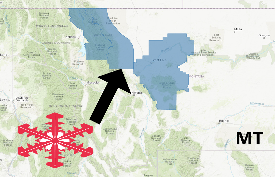
The National Weather Service has issued a Winter Storm Watch for Montana.
It’s in effect from Saturday afternoon through Sunday morning.
High winds and heavy snowfall are forecasted to impact the area throughout that time.
Montana:
- 4-8″ of Snow Saturday – Sunday Morning
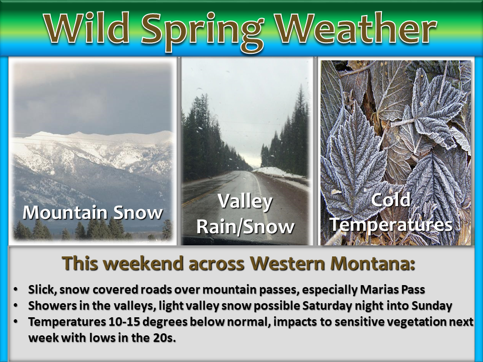
“The rollercoaster ride known as “spring weather” will continue Friday through the weekend. It’s a good thing we’re no stranger to it here in the Northern Rockies! Expect a combination of windy, rainy, and/or snowy conditions across western Montana.”
– NOAA Missoula, MT
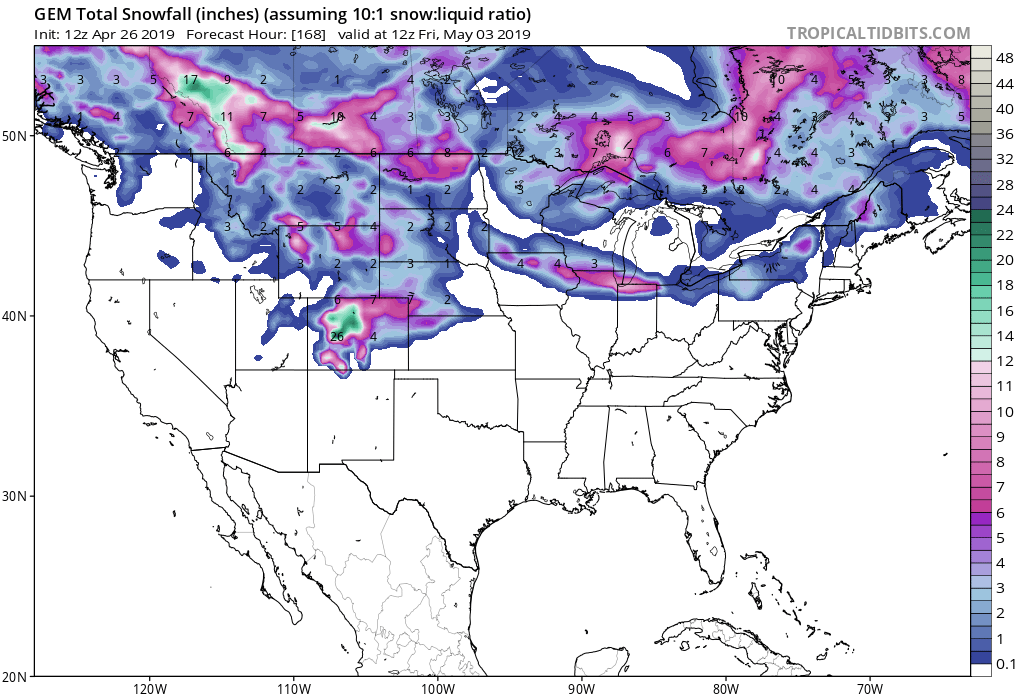
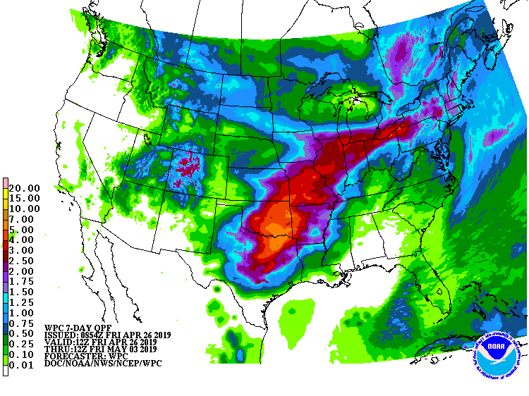
Snow is likely in the mountains with mixed precipitation at lower elevations.
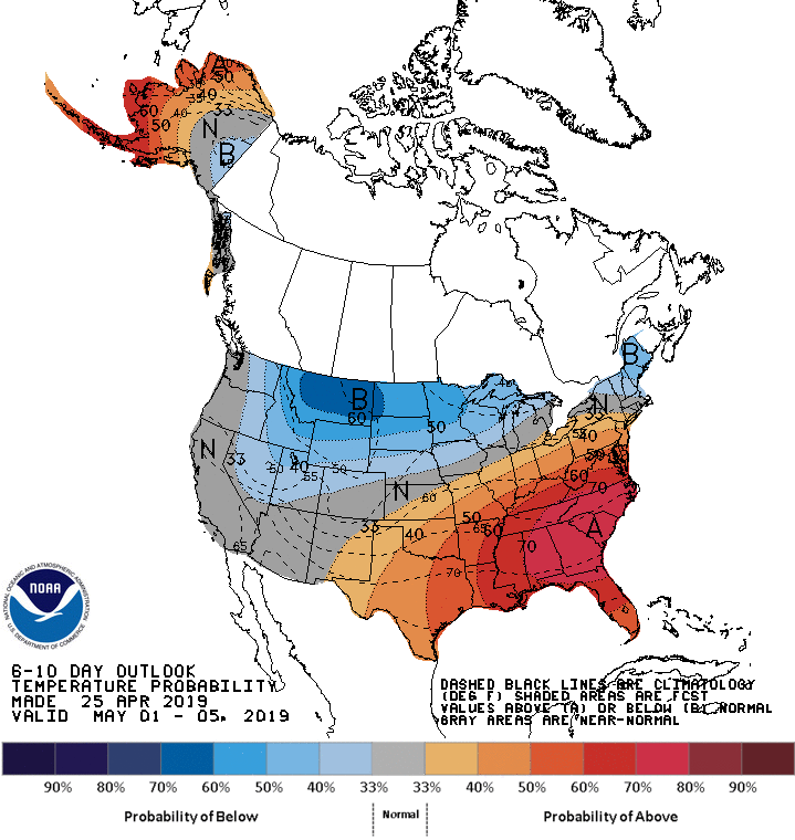
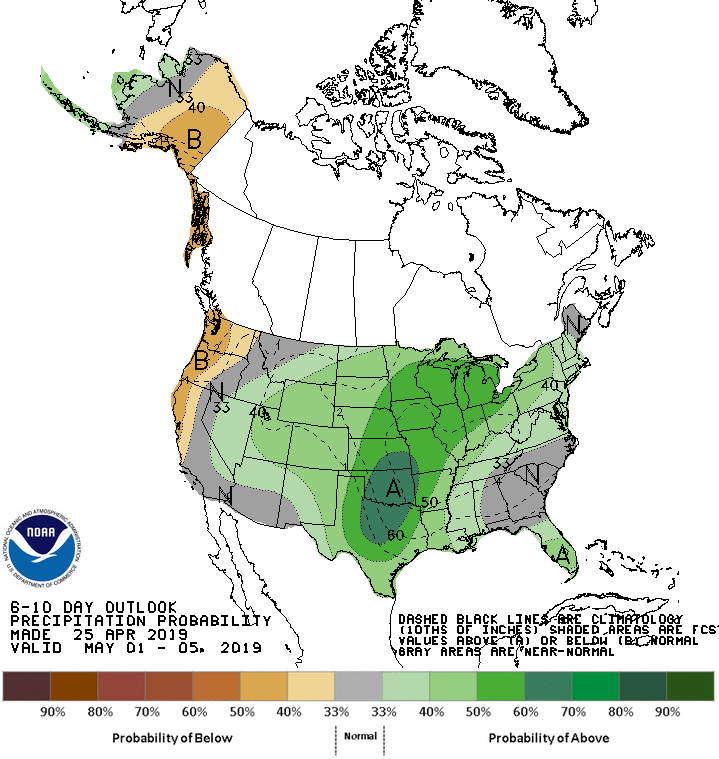
The 6-10 day outlook calls for above average precipitation and below average temperatures in Montana.
Additional Storm Info:
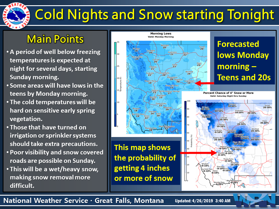
Montana: 4-8+” of Snow Saturday – Sunday Morning
*  Total snow accumulations of 4 to 8 inches possible,
   with isolated higher amounts over Marias Pass.
- NOAA Missoula, MT
Winter Storm Watch:
URGENT - WINTER WEATHER MESSAGE
National Weather Service Missoula MT
345 AM MDT Fri Apr 26 2019

West Glacier Region-

...WINTER STORM WATCH IN EFFECT FROM SATURDAY AFTERNOON THROUGH
SUNDAY MORNING...

* WHAT...A late season snow storm may bring heavy snow to areas
  of Glacier National Park and Highway 2 from Essex to Marias Pass
  Saturday evening through Sunday morning. Total snow
  accumulations of 4 to 8 inches possible, with isolated higher
  amounts over Marias Pass. Winds could gust as high as 40 mph
  further reducing visibility. Lower elevations could see 1 to 4
  inches.

* WHERE...Highway 2 from Essex to Marias Pass.

* WHEN...From Saturday afternoon through Sunday morning.

* ADDITIONAL DETAILS...Travel could be very difficult.
