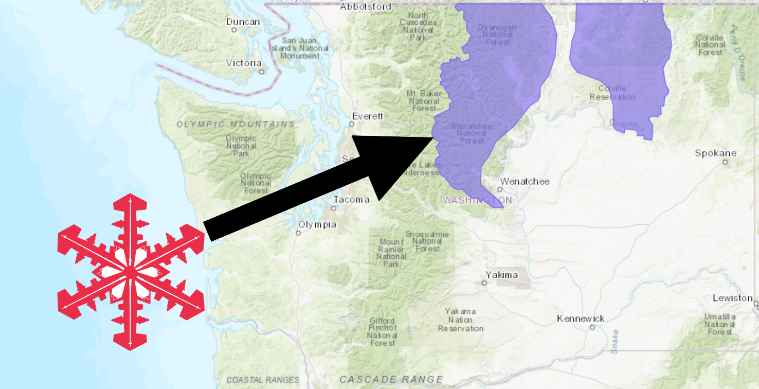
The National Weather Service has issued a Winter Weather Advisory for Washington. It’s in effect until Thursday morning. Mixed precipitation and snow are forecasted to impact the area throughout that time. The heaviest precipitation is expected to occur tonight.
Washington:
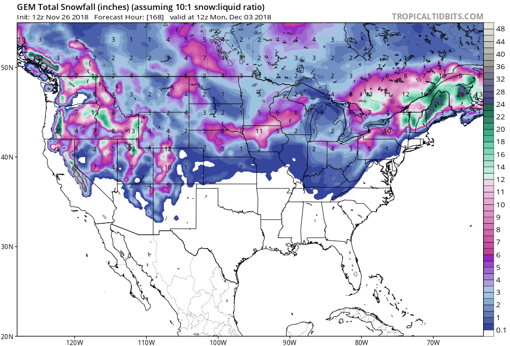
- 2-6+” of Snow Today – Tuesday Morning
“Areas of northcentral and northern Washington may see a wintery mix today into Tuesday morning. This may include pockets of freezing rain, sleet, and snow. Roads can become slippery. Use caution when driving and check road conditions before traveling.”
– NOAA Spokane, WA Today
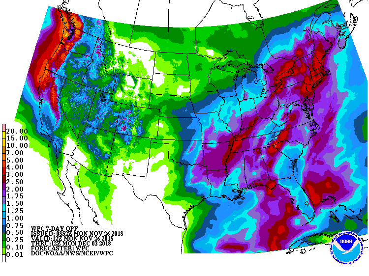
Snow levels are forecasted to drop just below 5,000ft tonight.
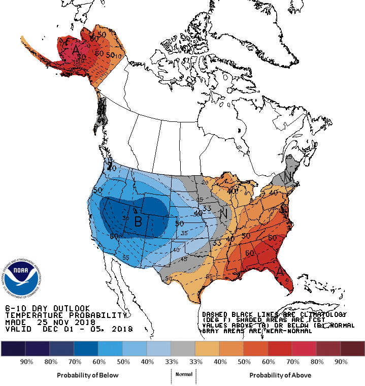
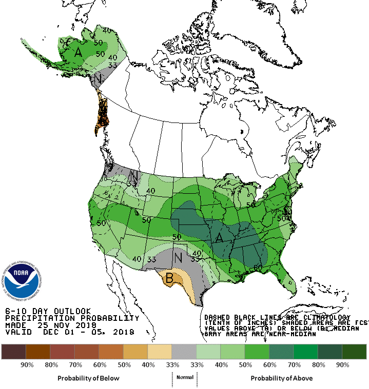
The 6-10 day outlook calls for average precipitation and below average temperatures in Washington.
Additional Storm Info:
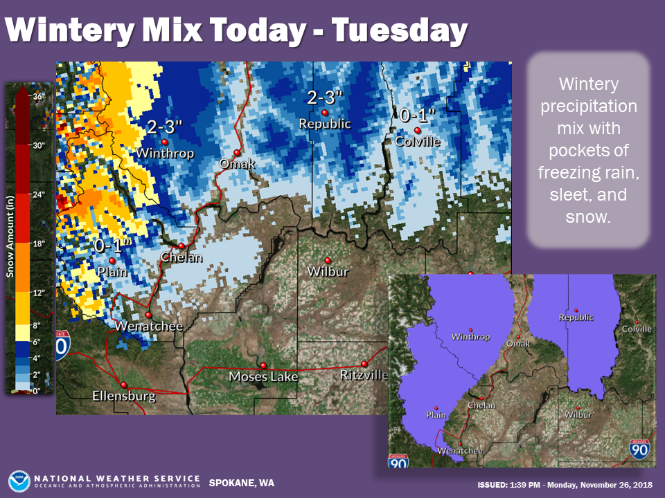
Washington: 2-6+” of Snow Through Tuesday Morning
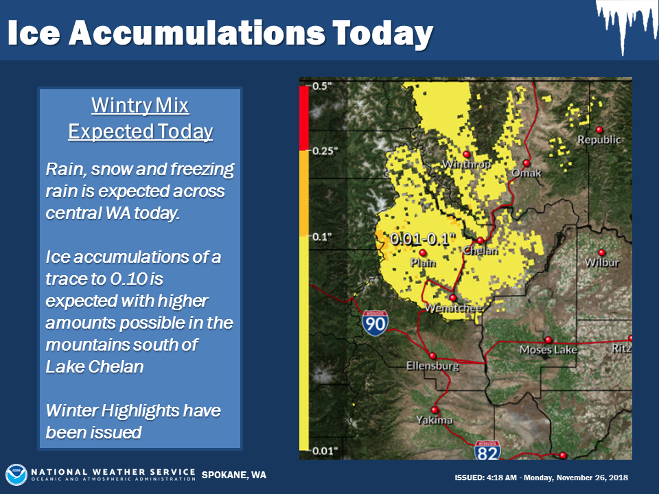
* Mix of freezing rain, sleet, and snow. Potential ice
  accumulations between a few hundreths to quarter of
  an inch. Total snow accumulations of 2 to 6 inches
  with locally higher amounts above 4000 feet.
- NOAA Spokane, WA
Winter Weather Advisory:
URGENT - WINTER WEATHER MESSAGE
National Weather Service Spokane WA
1101 AM PST Mon Nov 26 2018

...WINTRY MIX OF FREEZING RAIN AND SNOW TODAY THROUGH TUESDAY...

.A fetch of subtropical moisture will move into the region
tonight and linger over Central WA through Tuesday. A combination
of freezing rain, sleet, and snow is expected and will lead to
hazardous travel conditions at times. Precipitation will begin
this morning and increase this afternoon then become heavy at
times tonight night into Tuesday morning.

East Slopes Northern Cascades-
Including the following locations Leavenworth, Mazama, Twisp,
Winthrop, Stehekin, Conconully, Blewett Pass, and Loup Loup Pass

...WINTER WEATHER ADVISORY REMAINS IN EFFECT UNTIL 10 AM PST
TUESDAY...

* WHAT...Mix of freezing rain, sleet, and snow. Potential ice
  accumulations between a few hundreths to quarter of an inch.
  Total snow accumulations of 2 to 6 inches with locally higher
  amounts above 4000 feet.

* WHERE...Leavenworth, Mazama, Twisp, Winthrop, Stehekin,
  Conconully, Blewett Pass, and Loup Loup Pass.

* WHEN...Until 10 AM PST Tuesday.

* ADDITIONAL DETAILS...Travel could be very difficult. Freezing
  rain can form a glaze on cold surfaces such as roads,
  walkways, and cars. Drivers should be prepared for sudden
  slick road conditions, especially on bridges, ramps, and
  overpasses. Check the latest road conditions before heading
  across mountain passes.
