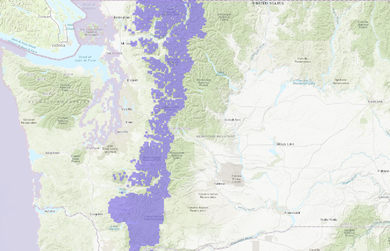
The National Weather Service has issued a Winter Weather Advisory for Washington. It’s in effect from 6:00am Today through 6:00am Tuesday Morning. Snow levels are expected to rise throughout the day today.
6-18″ of Snow Today – Tuesday Morning.
Snow levels are forecasted to start out at 1,500ft this morning, but they will rise to 3,000ft – 3,500ft by this evening.
Additional Storm Info:
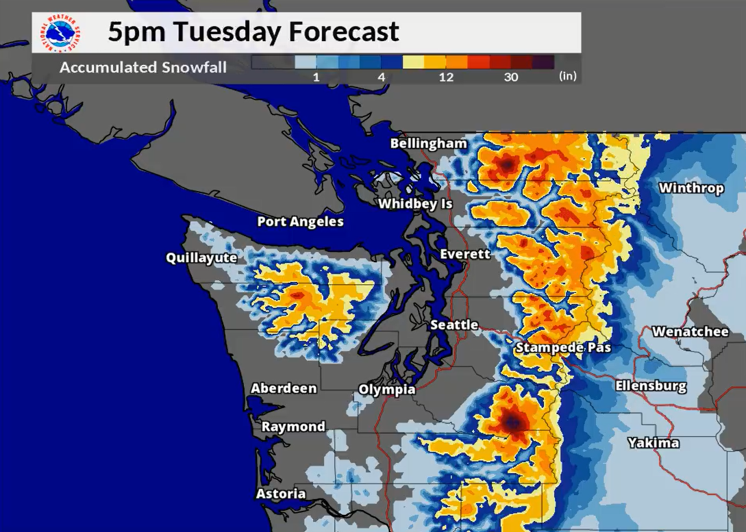
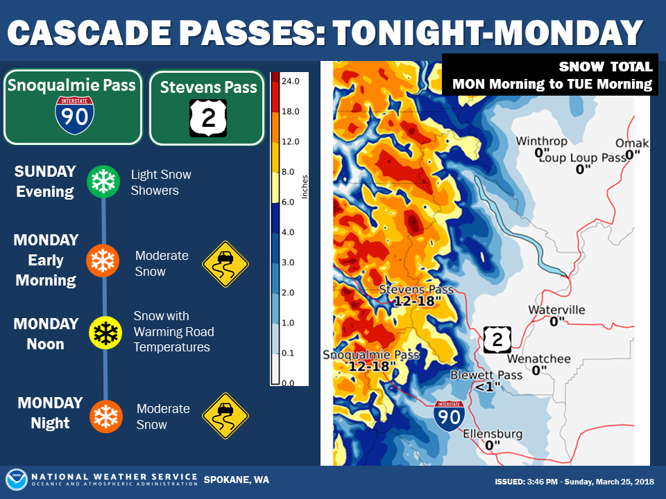
Washington: 6-18″ of Snow Today – Tuesday Morning
* Total snow accumulations of 6 to 18
  inches are expected.
- NOAA Seattle, WA
WA Winter Weather Advisory:
URGENT - WINTER WEATHER MESSAGE
National Weather Service Seattle WA
345 AM PDT Mon Mar 26 2018

Cascades of Whatcom and Skagit Counties-
Cascades of Snohomish and King Counties-
Cascades of Pierce and Lewis Counties-

...WINTER WEATHER ADVISORY NOW IN EFFECT FROM 6 AM THIS MORNING
TO 6 PM PDT TONIGHT ABOVE 2000 FEET...
...WINTER WEATHER ADVISORY IN EFFECT FROM 6 PM TONIGHT TO 6 AM
TUESDAY MORNING ABOVE 3000 FEET...

* WHAT...Snow expected. New snow totals of 4 to 9 inches today and
  2 to 9 inches tonight. Total snow accumulations of 6 to 18
  inches are expected.

* WHERE...Cascades of Whatcom, Skagit, Snohomish, King, Pierce
  and Lewis Counties. This includes Mount Baker, Stevens Pass,
  Snoqualmie Pass, Mount Rainier, and White Pass.

* WHEN...From 6 AM this morning to 6 AM PDT Tuesday.

* ADDITIONAL DETAILS...Snow levels will start near 1500 feet this
  morning rising to 3000 to 3500 feet by early this evening. Plan
  on difficult travel conditions. Be prepared for reduced
  visibilities at times.