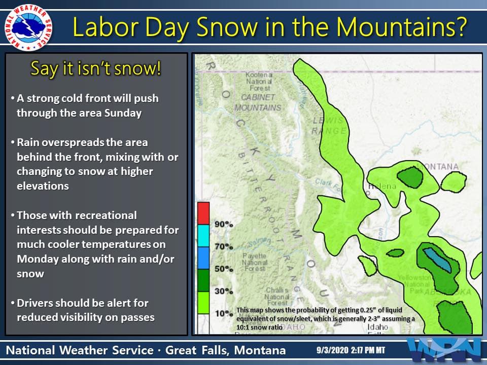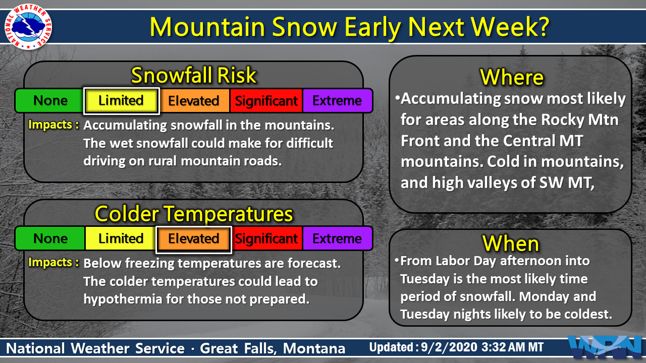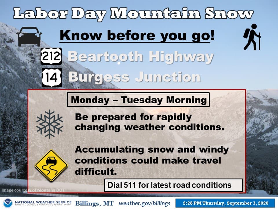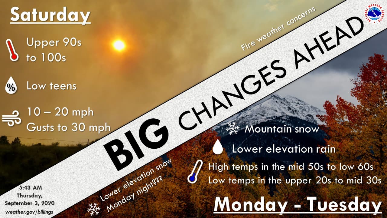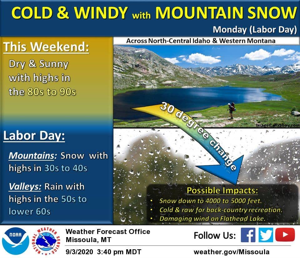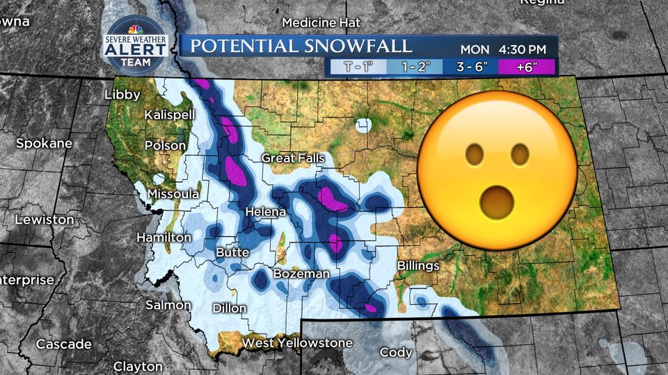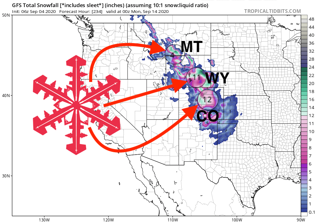
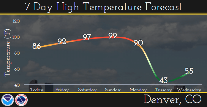
From weekend temperatures in the 90s, winter will hit the Rockies with a bang on Monday as a strong cold front moves in from the north. The mountains of Colorado, Wyoming, and Montana could see up to a FOOT of fresh snow.
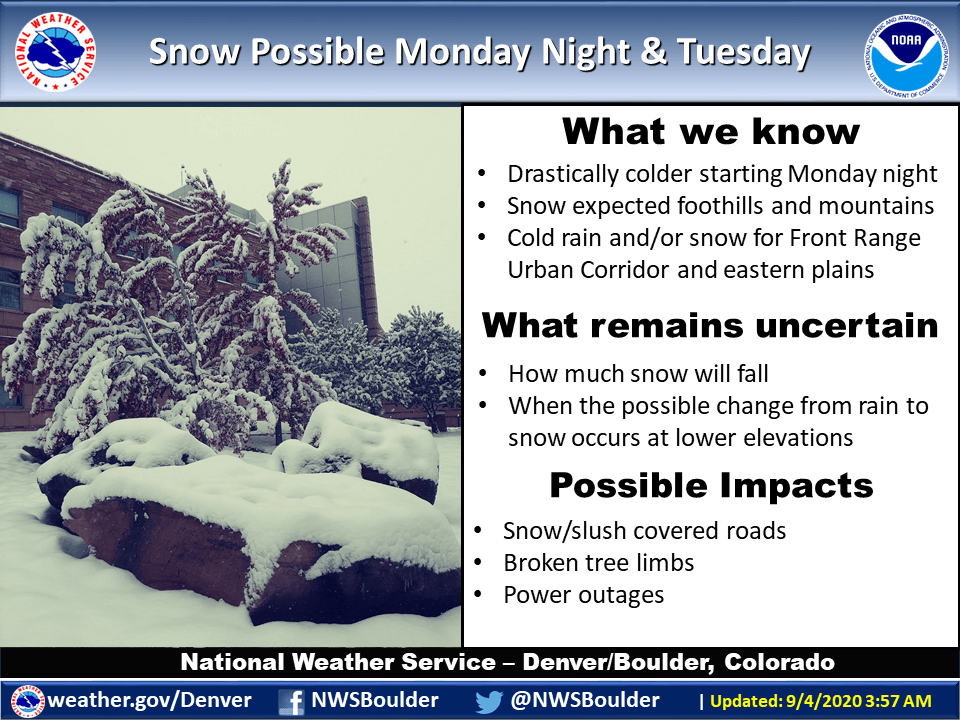
A significant change in the weather will occur late Monday into
Tuesday. Temperatures will plummet behind a strong cold front with
rain and snow forming. Snow levels will drop sharply and
accumulating snow will likely occur in the mountains and
foothills. We are still watching the track of this next storm
system and how much cold air arrives, but there is potential that
the I-25 Corridor, including the Denver metro area, sees snow as
well.
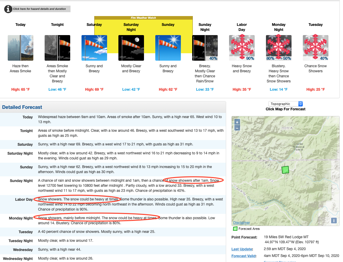
Temperatures will plummet into the mid-teens, and wind will pick up, with gusts up to 30mph. Denver meteorologist Chris Tomer says it best:
“Four more days in the 90s will rival daily records while tying the all-time number of 90-degree days in a single year at 73 followed by a 50-degree temp drop, rain and snow, and finally our first freeze of the season.”
Snow should fall in Colorado above 7,000-feet. With regards to ski areas, Eldora could see 3-6″, and Monarch, Winter Park, Steamboat, and Breckenridge up to 3″. Rocky Mountain National Park could see 8-12″ of fresh snow.
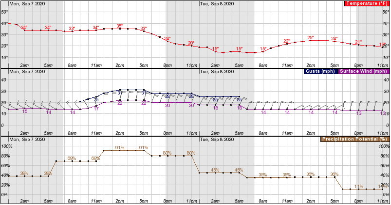
In Montana, Red Lodge Mountain could see decent amounts, with Big Sky in for a dusting. The Tetons in Wyoming could see a dusting, as could the Wasatch, Utah.
The system bringing about the pattern change will begin to move
south over MT Sunday, reaching the WY border Monday morning. The
associated cold front will proceed to move southward across the
Cowboy State through the day Monday, rapidly dropping temperatures
as it moves through the area. This front looks to bring the
best chance for wetting precipitation to much of the area in over a
month. Preliminary QPF continues to show half an inch to up to an
inch of QPF east of the Divide and about a quarter of an inch west
of the Divide. Rain will likely change to snow by this time and
begin to end from north to south through the day Tuesday.
Will enough drop for us to ski it? And should we even? Even so, the drop in temperatures will give us some respite from the recent heatwaves, and the precipitation will be welcomed by those areas fighting wildfires.
Other Info:
