UPDATED: 6/19/24 – 0530 am PST
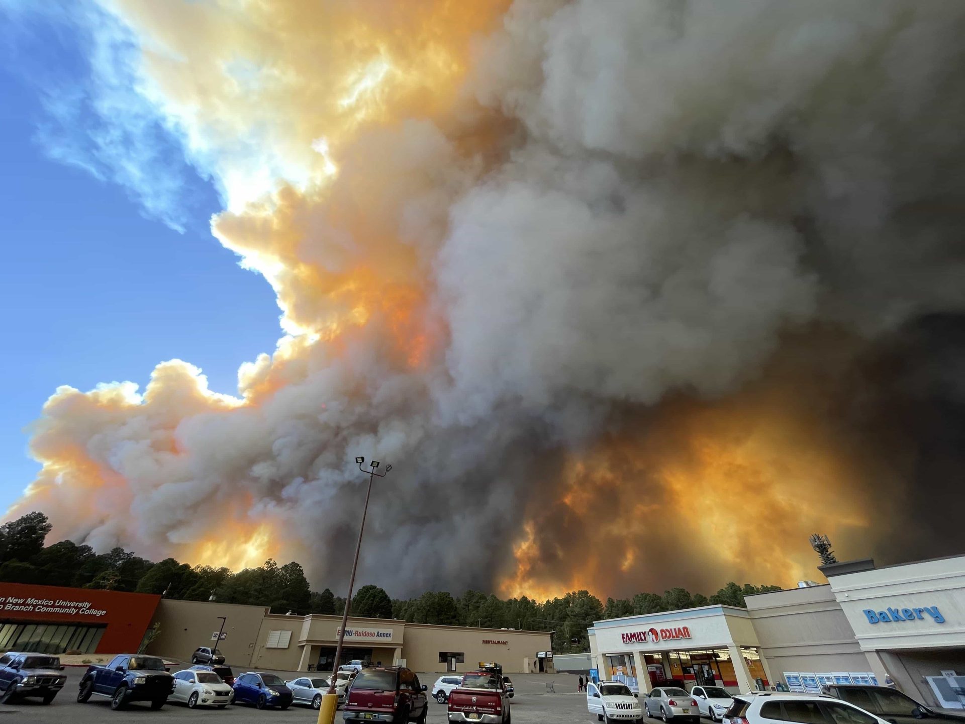
7,700 residents of Ruidoso, a ski town in southern New Mexico, were ordered to evacuate immediately on Monday as two rapidly spreading wildfires threatened the area. New Mexico Governor Michelle Lujan Grisham has declared a state of emergency.
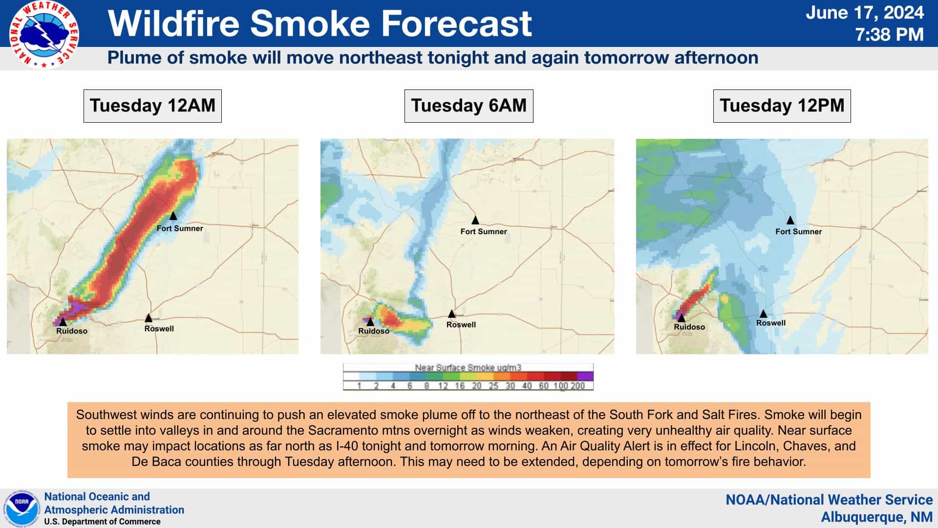
An update on the evening of Tuesday, June 18, reported that 15,276 acres and 1,400 structures have been burned by the South Fork Fire and 5,557 by the Salt Fire. Both fires are zero percent contained, and the state Department of Homeland Security and Emergency Management has confirmed one fatality.
🚨 Southfork Fire Ruidoso, New Mexico – People are fighting the fires with garden hoses side by side with Fire crews
-Phil Hamilton#Saltfire #NewMexico #NewMexicoWildfire #Southforkfire #nmwx #Ruidoso #Roswell #Mescalero #MescaleroFire #Incendio pic.twitter.com/iqVUdWdKJd
— T R U T H P O L E (@Truthpolex) June 18, 2024
“The South Fork fire is estimated at 15,276 acres and is zero percent contained. Fire activity included crowning and long-range spotting, which increased the fire’s footprint from this morning’s acreage total. Today, response crews were able to directly engage areas of the fire’s footprint when conditions allowed. Approximately 1,400 structures in the area have been lost.”
Ski Apache ski area has suspended summer operations while firefighters battle the blaze. Rain is not expected in the area until Friday.
On Monday evening, around 6:48 p.m. local time, officials issued a “GO NOW” mandatory evacuation order for the entire Village of Ruidoso, urging residents not to attempt to gather belongings or protect their homes.
Evacuation centers were established at the Inn of the Mountain Gods Convention Center, the Mescalero Community Center, and Eastern New Mexico University in Roswell. Residents were advised to seek shelter with loved ones outside the affected area or at the designated centers.
The South Fork Fire was first reported around 10:50 a.m. on Monday on the Mescalero Apache Reservation, west of Ruidoso. By 10:09 p.m., it had grown to an estimated 5,252 acres, with zero percent containment. The Salt Fire, also burning on the reservation, had reached an estimated 3,102 acres by 8:54 p.m.
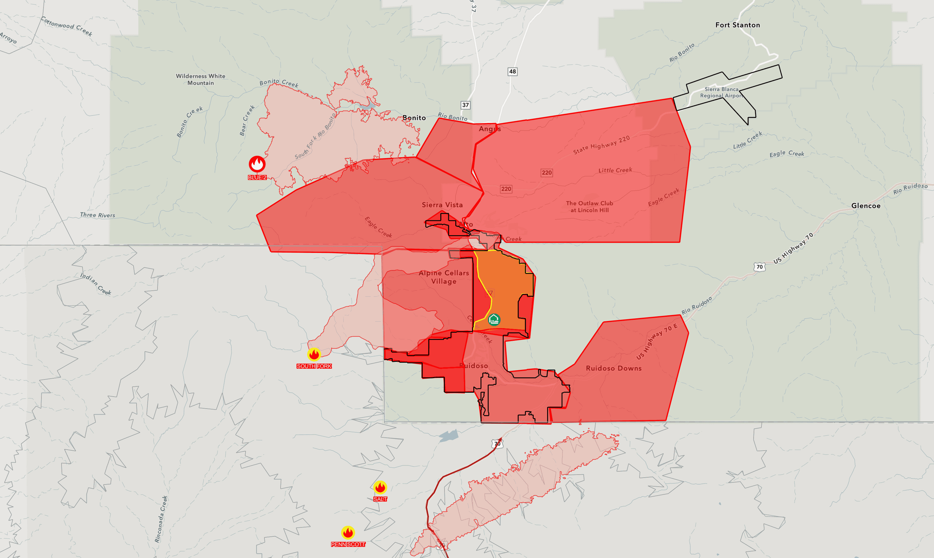
Both fires are managed by the Mescalero Apache Fire Rescue and the Bureau of Indian Affairs. Grindstone Lake operations were closed to facilitate an “air attack” on the wildfires with water-dropping helicopters.
#GOESWest satellite imagery captures the growing #SouthForkFire and nearby fire southwest of Ruidoso near Mescalero this afternoon. #NMwx #NMFire pic.twitter.com/SE529lhPfD
— NWS Albuquerque (@NWSAlbuquerque) June 17, 2024

Several roads were closed due to the fires, including Highway 48 and Highway 70 at Apache Summit. The only open evacuation route from Ruidoso was Sudderth to Highway 70, leading out to Roswell.
Residents in surrounding areas, such as West Gavilan Canyon, Sierra Vista, Villa Madonna, Ski Run Road, and Sun Valley, were placed on “SET” status, meaning they should be ready for potential evacuation orders.
Governor Michelle Lujan Grisham said, “My administration is in close contact with state, tribal, and federal officials about the status of these fast-moving fires, and we are quickly deploying as many resources as possible to protect people and property. I strongly urge residents of Ruidoso and the surrounding areas to remain calm and heed official instructions to help minimize risk.”

As the wildfires continue to rage, officials are working tirelessly to ensure the safety of residents and contain the blazes. Updates on the situation can be found on the Lincoln County New Mexico incident information website and by calling 575-258-6900.
View this post on Instagram