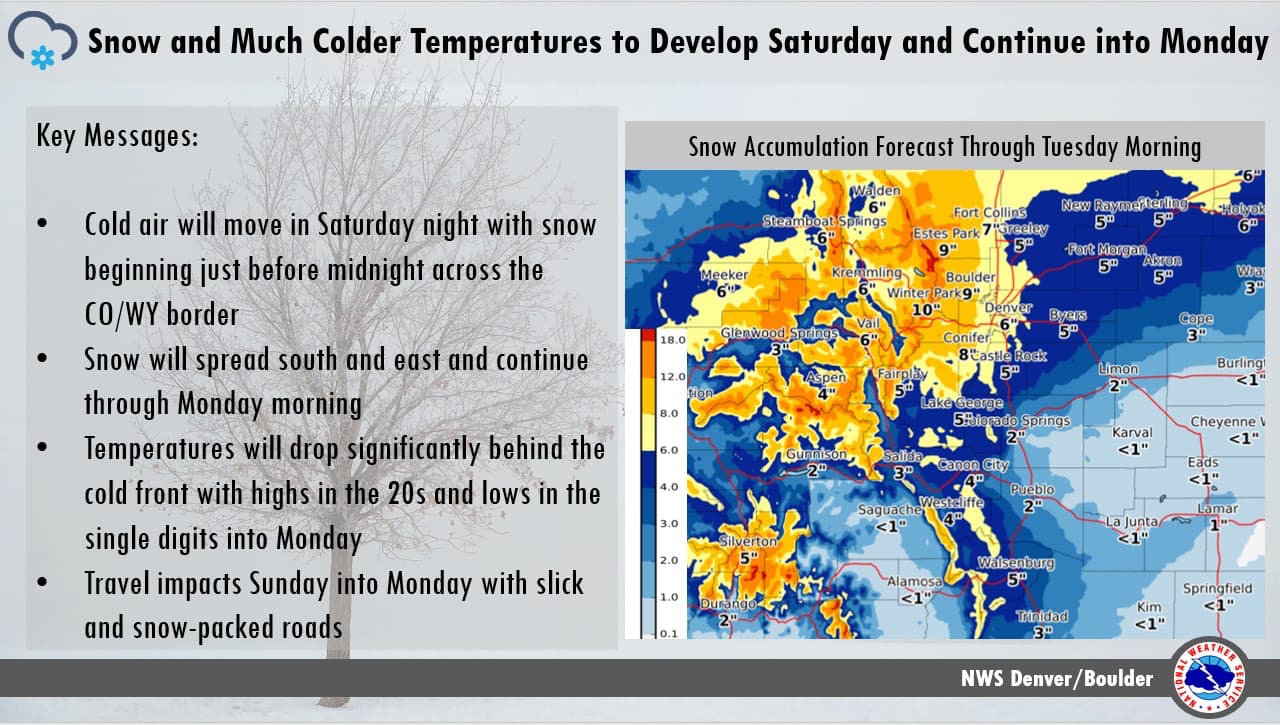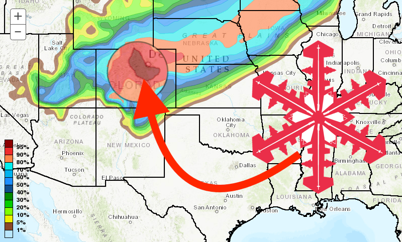
The precipitation can’t come soon enough for Colorado. Even the most staunch winter-weather-haters must be hoping for snow this weekend as wildfires continue to ravage the Centennial state. Thankfully, the forecast is calling for up to a foot of fresh snow for most mountains, and double that for Wolf Creek, a little further south.
- Related: Winter Park Resort, CO Opens Resort Hotel to Local Residents Evacuated From Nearby Wildfire
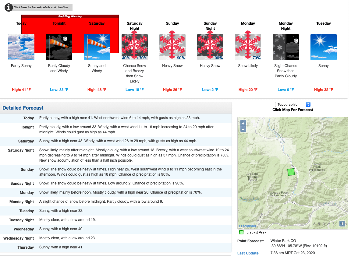
Winter returns with much colder temperatures and snow starting late Saturday night and continuing into Monday. Accumulating snow for most areas with highs only reaching into the teens and 20s with lows in the single digits for the lower elevations and urban corridor.
Although there is uncertainty regarding exact totals, the NOAA forecast discussion says:
2 to 5 inches across the plains and urban
corridor, 3 to 6 inches for the foothills and high mountain valleys
and up to a foot for the mountain ranges with adjustments possible.
Temperatures will reflect the pattern shift with conditions turning
very cold by Saturday night into Sunday with the onset of the cold
front.
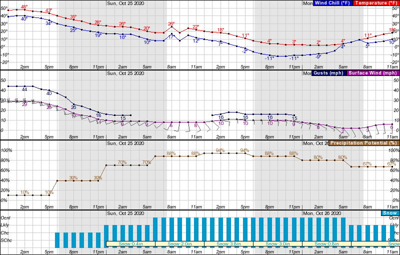
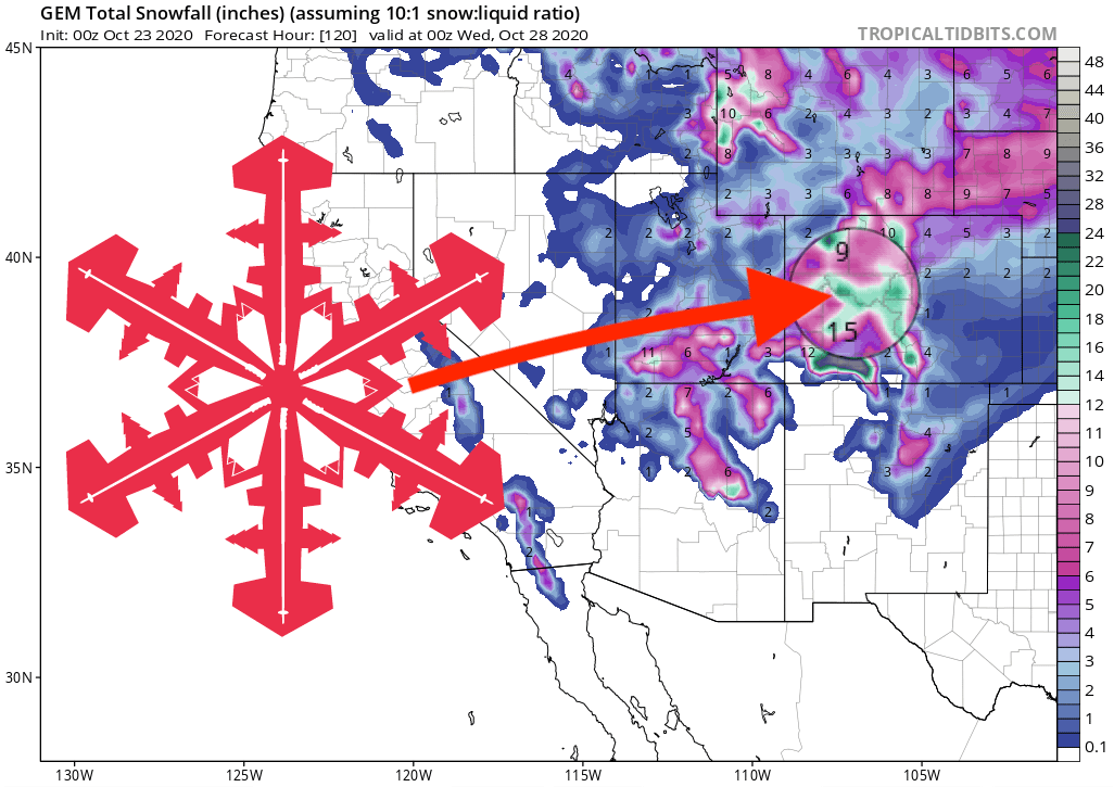
A-Basin, Aspen Snowmass, Beaver Creek, Breckenridge, Copper Mountain, Keystone, Steamboat, and Vail should all see 8-12″, and Eldora, Loveland, Monarch, and Winter Park can expect 14-16″. Wolf Creek is looking at up to 2-feet.
GEM Snowfall Total Model:
Other Info:
