Forecast By SnowBrains Meteorologist – Eric McNamee
10:25 AM MST, Dec. 18, 2020
Forecast Summary:
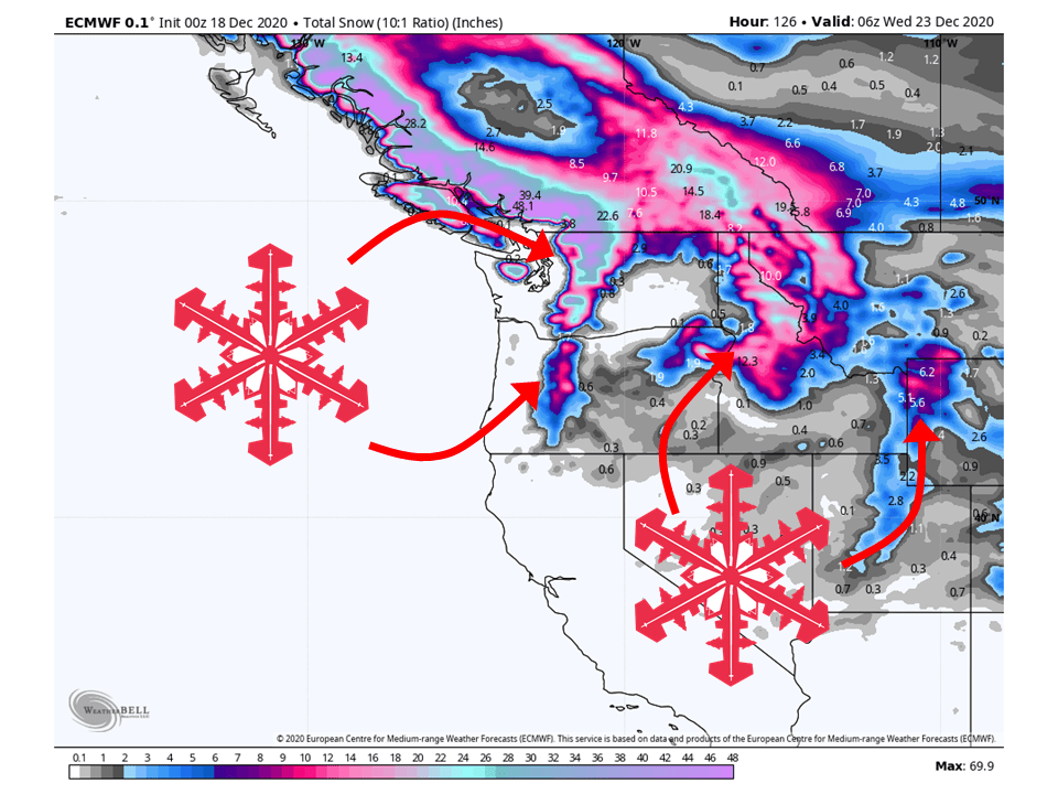
An active pattern will remain in place for the northwestern US through Tuesday, bringing 1-3 FEET snow.
This will come in three waves over the weekend and early next week.
Conditions look to dry out in the middle of next week as high pressure builds in.
Short-Term Forecast:
Friday-Sunday:
A shortwave trough will move into the region today, primarily bringing 8-12″ of snow to the Washington Cascades.
This same shortwave will move through the Northern Rockies and bring 2-6″ of snow to Northern Idaho and Western Montana.
The next shortwave trough looks to move in late Saturday, bringing an additional 8-12″ to the Washington Cascades and 6-10″ to the Northern Idaho/Western Montana through Sunday.
Long-Term Forecast:
Monday-Thursday:
Conditions will temporarily dry out Monday as a weak shortwave ridge builds over the region before another trough moves through late Monday and during the day Tuesday.
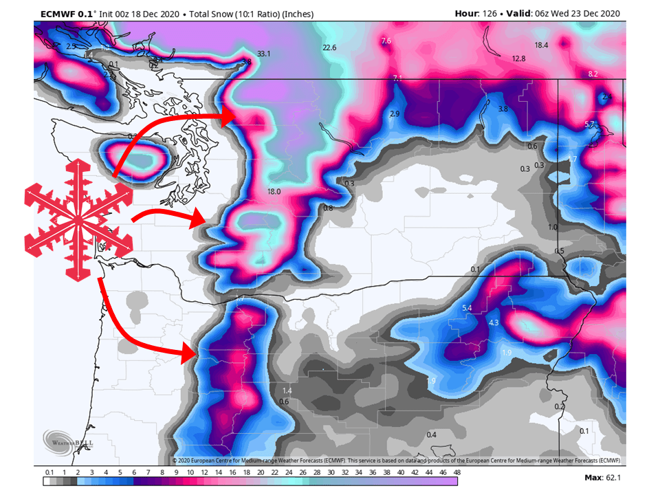
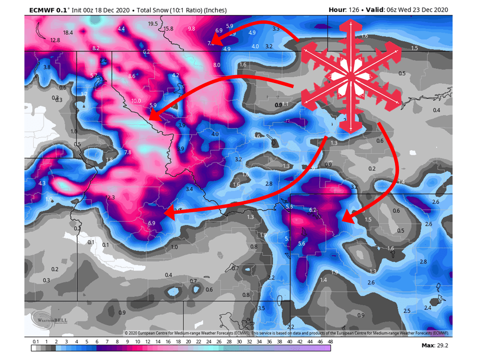
This shortwave looks like it could be fairly potent with 1-2 FEET of snow falling in the Cascades and 12-18″ across the Northern Rockies.
However, there is still some disagreement between models in how robust this system will be so snowfall numbers could change as we get closer.
By Wednesday, conditions look to dry out a highly amplified ridge builds over Western North America, blocking any storms coming through.
Extended Forecast:
Thursday and Beyond:
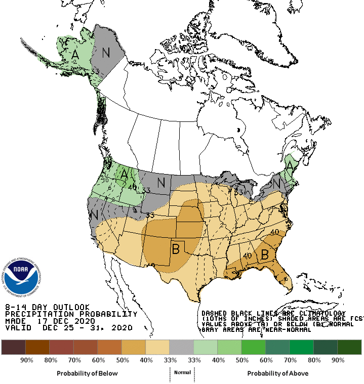
Global ensembles indicate a general La Niña pattern will continue through the extended period.
This means above-average precipitation will continue across the Northwest.
Pacific Northwest:
The Pacific Northwest looks to fair pretty well with 1-3 FEET of snow falling through Tuesday.
Resorts that look to see the most snow are Mt. Bachelor, Mt. Hood, Timberline Lodge, Crystal Mountain, Alpental, and Mt Baker.

Northern Rockies:
Like the Pacific Northwest, the Northern Rockies will fair pretty well through Tuesday with 1-3 FEET of snow falling.
Resorts that look to see the most snow are Jackson Hole, Targhee, Big Sky, Whitefish Mountain, and Schweitzer.

USA:
Global ensembles indicate a general La Niña pattern will continue through the extended period.
This means above-average precipitation will continue across the Northwest, with relatively drier conditions elsewhere.
