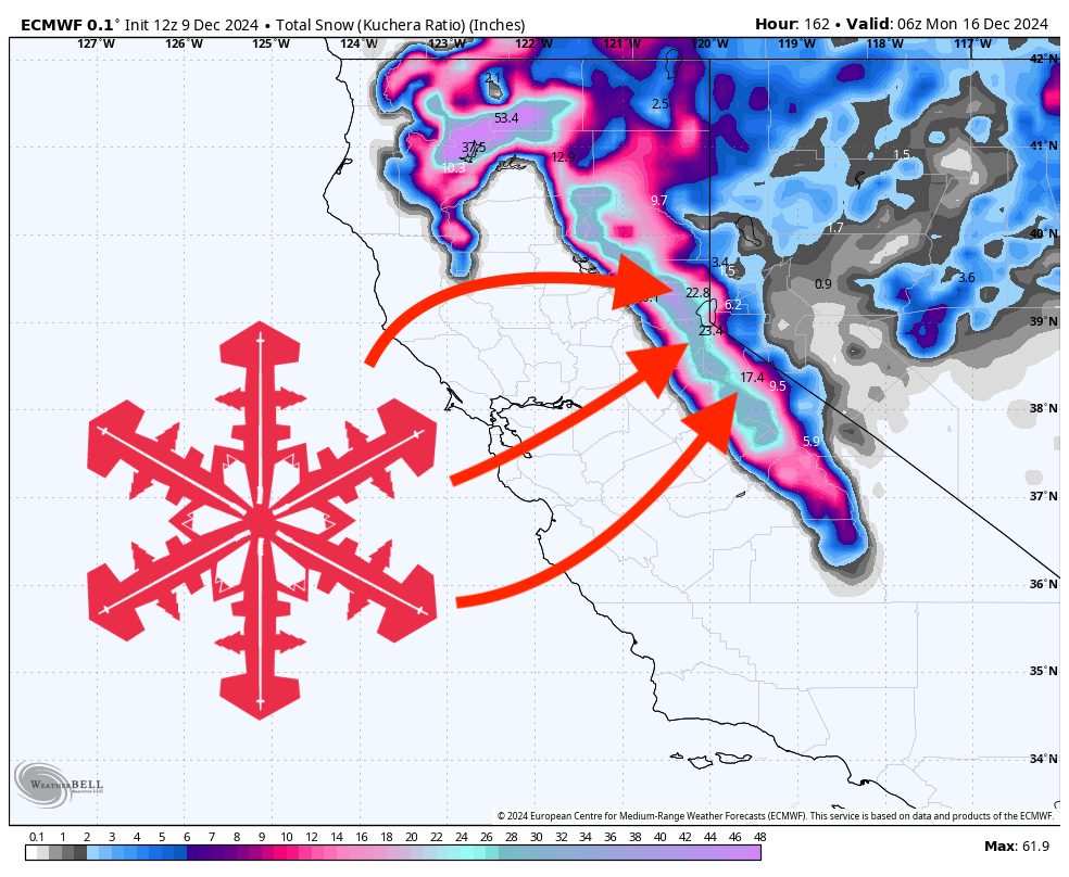
A broad area of unsettled weather is set to impact California’s mountains from late this week into the weekend. Conditions start out quiet with seasonable temperatures early in the period, but by late Thursday the first in a series of weather disturbances will begin to spread light to moderate snow into higher elevations. Following this initial round, a more potent system is anticipated to arrive from late Friday night through Sunday, potentially delivering heavier snowfall, particularly over the Sierra. Colder air and gusty winds along ridgelines will accompany both storms, with snow levels generally hovering around 5,000–6,000 feet for the bigger weekend system. After these two rounds, additional storms may continue to line up beyond the forecast window, setting the stage for a more active, snowier pattern heading toward mid-month.
A weaker mid-late week disturbance moves in Thursday, bringing light snow to many of the northern and central Sierra resorts. This first wave doesn’t look tremendously strong, but it should provide a modest refresh in the higher elevations. The pattern favors areas along and west of the Sierra Crest, though even resorts slightly east should pick up some accumulation. The bulk of this initial snowfall should fall Thursday into early Friday. Amounts look modest, but enough to warrant attention if you’re chasing soft turns before the weekend crowds.
After a brief lull on Friday, a stronger, wetter system takes aim for the weekend, pushing in late Friday night and continuing into Sunday. This system appears more capable of delivering significant snowfall, with deeper moisture and stronger dynamics. Northern and central Sierra resorts stand to gain the most, while those further south and east will also see respectable totals. The higher ridges and western slopes could be hit hardest, picking up notable multi-day accumulations. Snowfall rates may be heavy at times Saturday into early Sunday, with lingering showers possibly continuing through Sunday afternoon. Expect blustery conditions over exposed terrain as well, creating periods of reduced visibility and potentially challenging travel over mountain passes.
Resort totals for the first storm (Thursday through early Friday):
- Palisades Tahoe: 5–9″ (Thursday night through Friday night)
- Mammoth: 2–4″ (Thursday night through Thursday day)
- Northstar: 2–4″ (Thursday night through Thursday day)
- Heavenly: 2–3″ (Thursday night through Thursday day)
- Mt Rose: 1–2″ (Thursday day)
Resort totals for the stronger weekend system (Saturday through Sunday):
- Palisades Tahoe: 10–17″ (Saturday night through Sunday day)
- Mammoth: 8–14″ (Saturday night through Sunday day)
- Northstar: 6–10″ (Saturday night through Sunday night)
- Heavenly: 4–7″ (Saturday night through Sunday night)
- Mt Rose: 4–7″ (Saturday night through Sunday night)
Two resorts are projected to receive a prolonged period of snowfall spanning from the late-week wave straight through the weekend system as a single, long-duration event:
- Sugar Bowl: 19–31″ total (Thursday day through Sunday day)
- Kirkwood: 18–29″ total (Thursday day and night through Sunday day)
Keep in mind this storm is still pretty far out: totals can and will change before then. Stay tuned for an updated forecast as we near the forecast window.
Looking beyond Sunday, the pattern suggests the potential for continued storms rolling in from the Pacific. While details remain uncertain, the active flow hints that additional snow events may arrive next week, potentially reinforcing the fresh base and keeping conditions favorable heading deeper into December.