Forecast By SnowBrains Chief Meteorologist – Eric McNamee
5:30 pm MST, 12/11/2021
Forecast Summary:
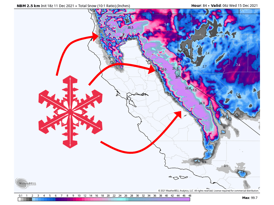
A trough over the eastern Pacific will slam moisture into the Sierra Sunday night and bring 2-5 FEET of snow to the high Sierra through Tuesday.
Over 6 FEET is likely above 6000′.
An active pattern looks to be in place in the long term and extended.
Resorts that will see the most snow are Heavenly, Homewood, June, Kirkwood, Palisades Tahoe, Alpine Meadows, Northstar, Sierra at Tahoe, Sugar Bowl, and Mammoth.
Short-Term Forecast:
Saturday-Tuesday:
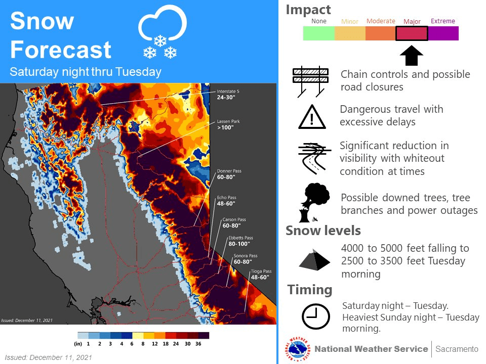
A trough over the eastern Pacific will draw moisture and slam it into the Sierra Sunday night and bring 2-5 FEET of snow to the high Sierra through Tuesday.
Over 6 FEET of snow is likely above 6000′ in the Sierra.
Snow will begin Sunday evening and fill in throughout the night Sunday and into the day Monday.
Snowfall rates will be the heaviest during this time.
Snow levels will start out in the 4000′-5000′ range to start out and then fall to 1000′ Tuesday night as the cold front associated with the trough moves through.
This has prompted NWS Sacramento and NWS Hanford to issue Winter Storms Warnings for the Sierra.
By Tuesday night, snow will taper off across the state as the system moves east.
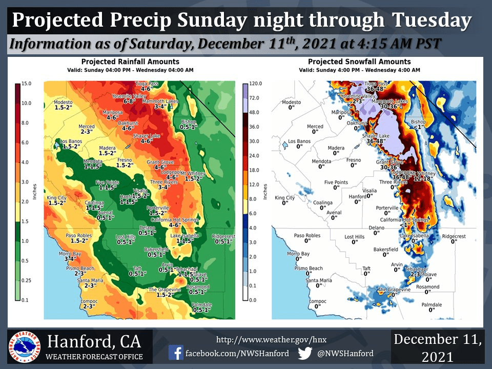
Rain totals with this system will range from 2.0 to 3.5" in the
Valley, less in shadowed areas and the foothills with an
impressive 4.0 to 8.0 inches. Snow totals are going to be even
more impressive with this system with multiple feet falling. Much
of the Sierra should see 2 to 5 feet with 6+ feet above 6000 feet.
-NWS Sacramento 12/11/2021
Long-Term Forecast:
Wednesday-Friday:
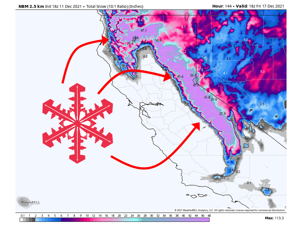
Getting into Wednesday another shortwave trough will move through California, bringing another round of snow through Friday morning
Totals are not completely certain at this time, but with cool air in place, another FOOT of snow is possible in some locations.
Extended Forecast:
Friday and Beyond:
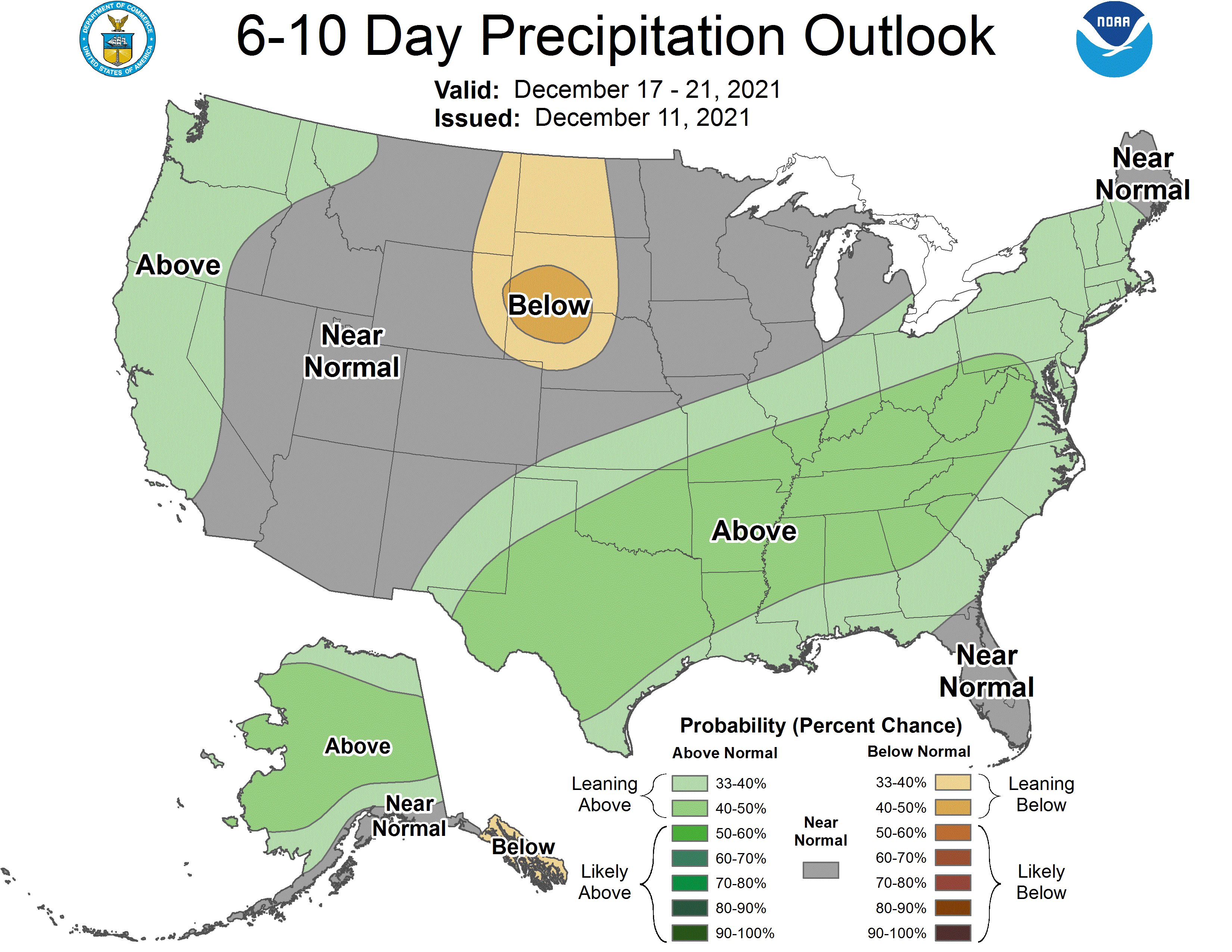
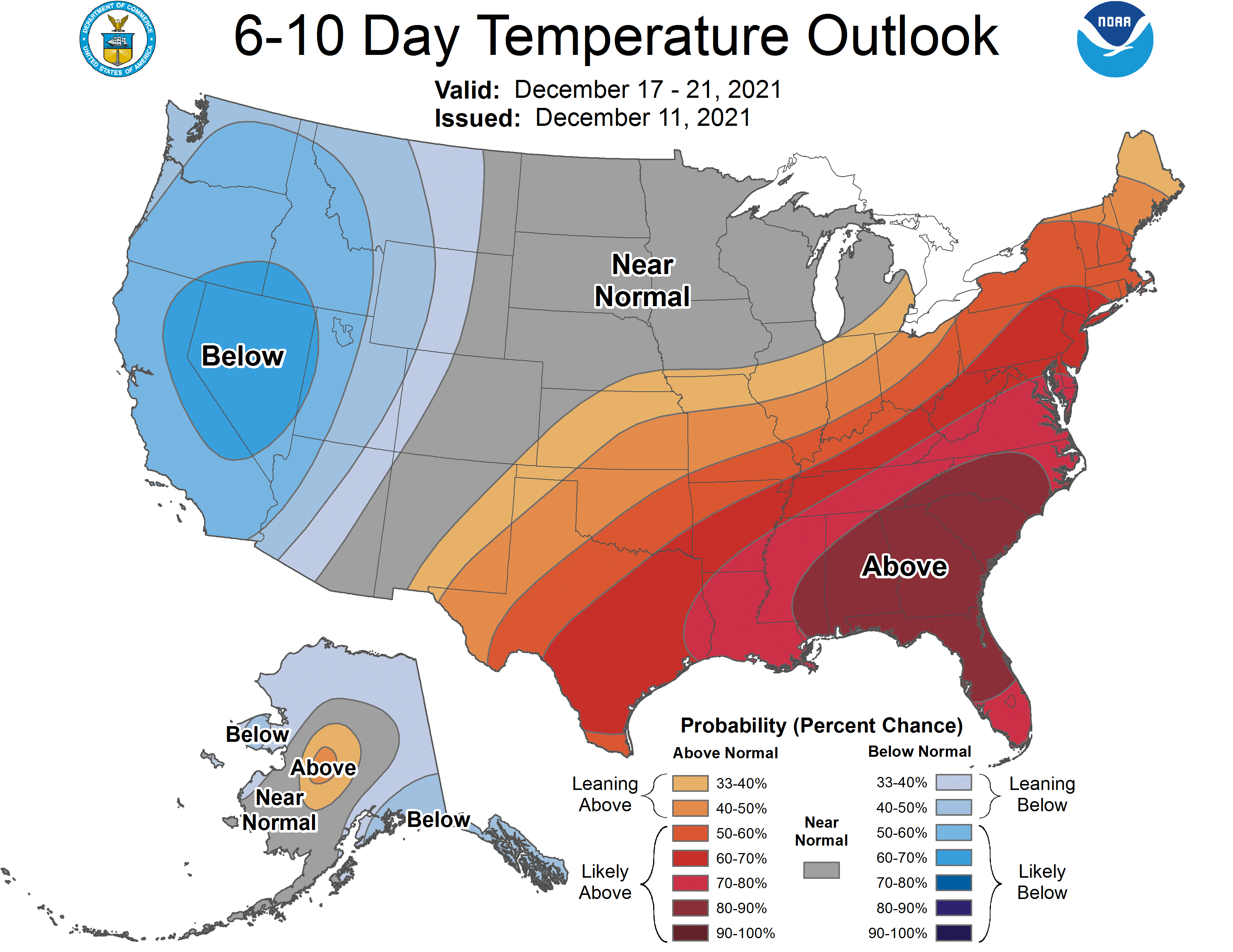
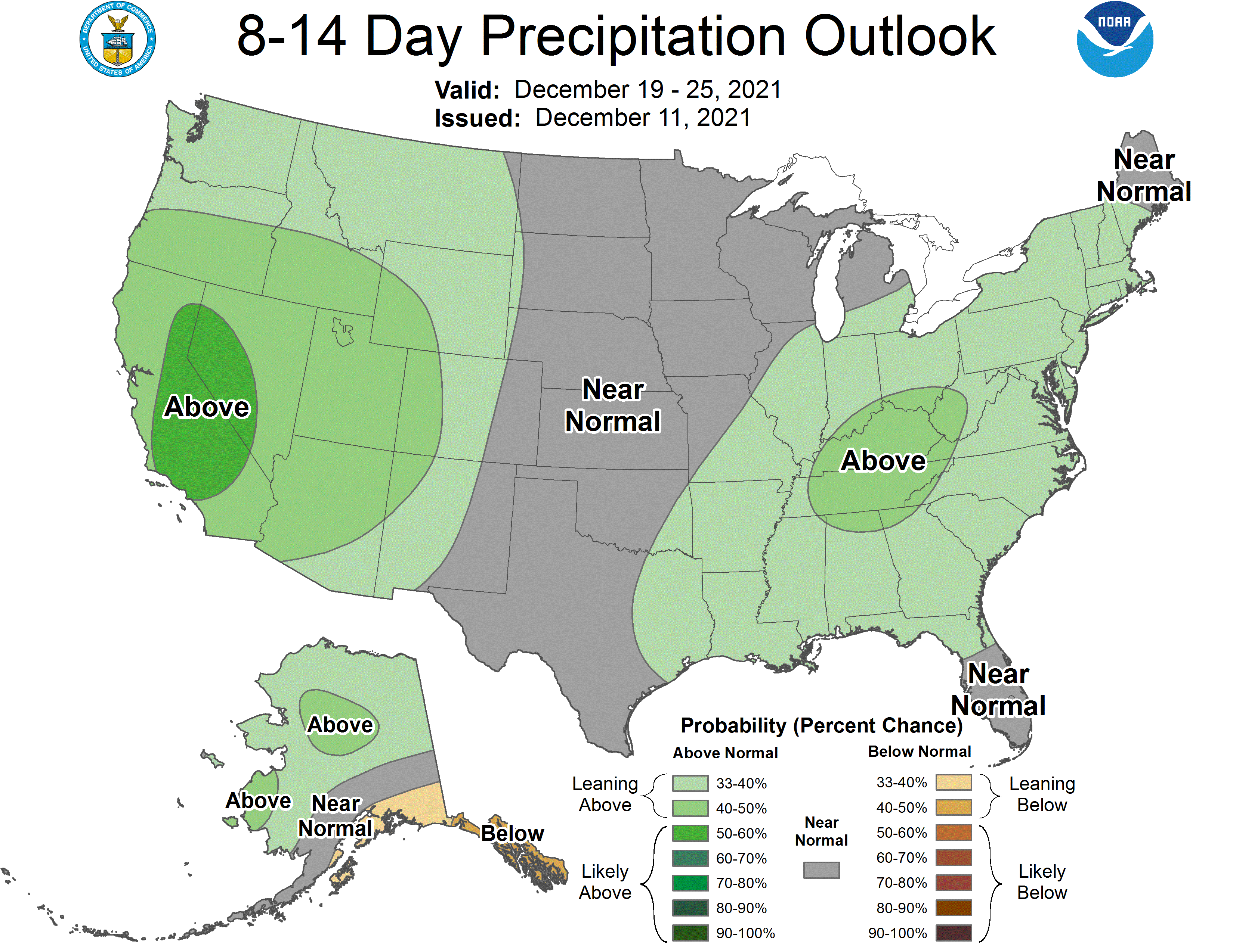
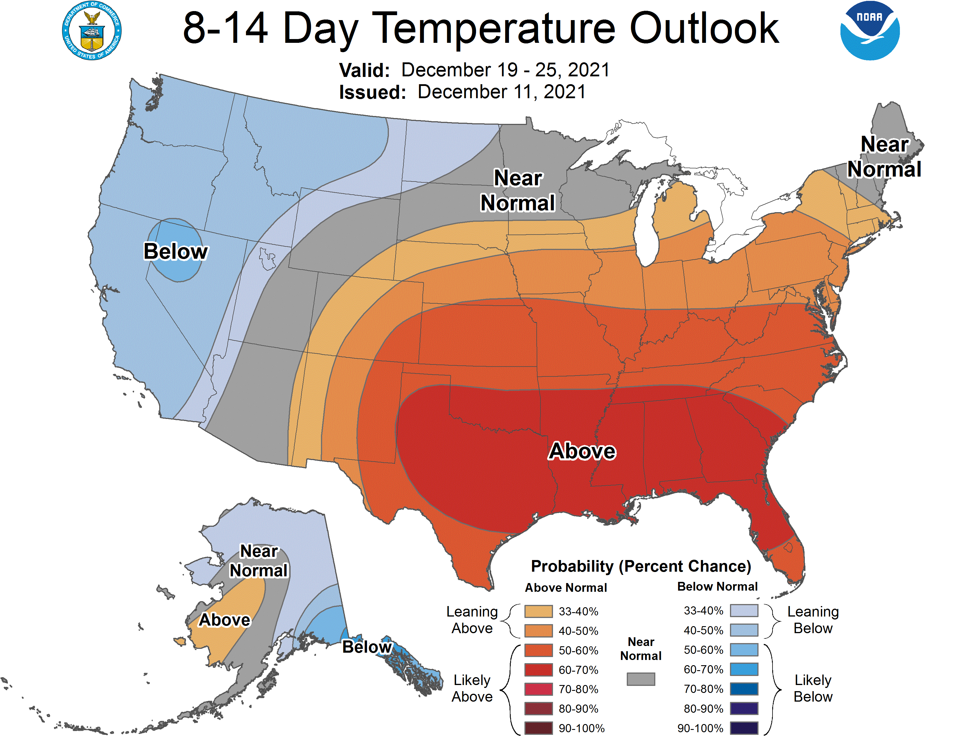
Global ensembles are indicating above-average precipitation and below-average temperatures across California through the extended.
