A series of major storms will roll through the Pacific Northwest this week, bringing several feet of snow to resorts around the region.
We’re currently on the tail end of the first wave of snow, which has already laid down solid accumulations around Washington and Oregon. Below is the HRRR forecast from 5 p.m. Monday evening through noon on Tuesday. Note widespread 1-5″ accumulations, with higher totals just north of the Oregon/Washington border:

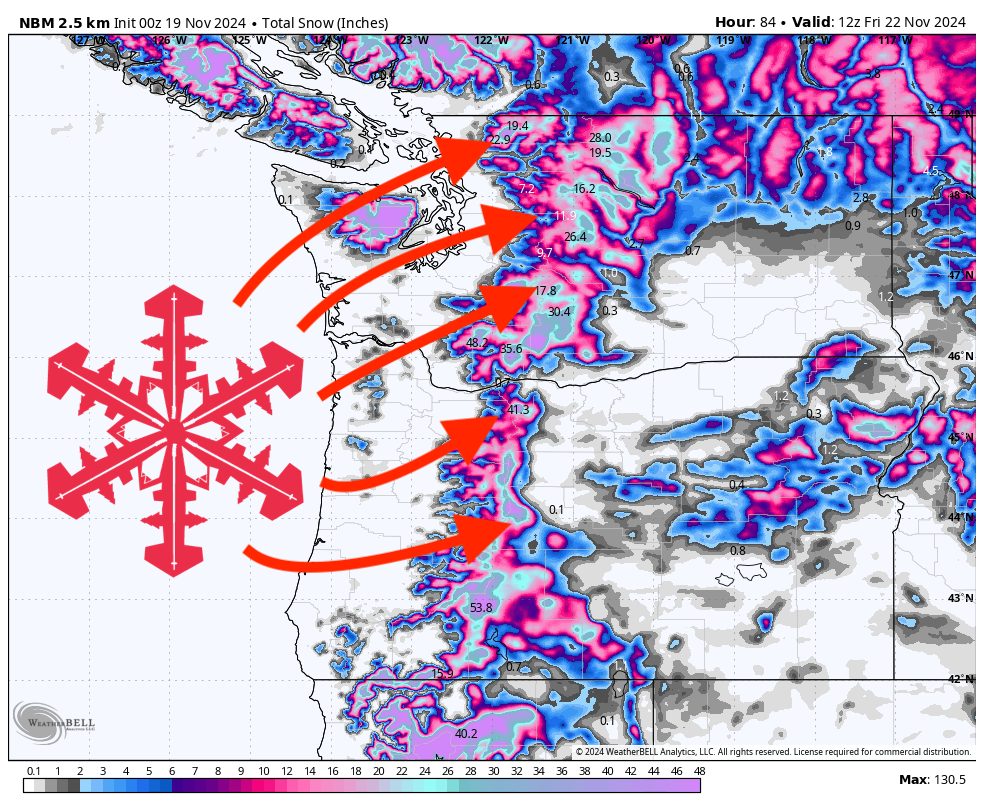
The next wave rolls into the region late Tuesday afternoon, with snowfall lingering around into Thursday morning (and beyond for resorts further south: Crystal, Timberline, Bachelor). Here are SnowBrains’ forecasted totals at mid-mountain elevations between Tuesday afternoon and Thursday morning:
- Mt Baker: 8-14″
- Stevens Pass: 4-8″
- Alpental: 3-7″
- Crystal Mountain: 10-16″
- Timberline: 12-20″
- Mt Bachelor: 15-25″
Below are the ECMWF (left) and GFS (right) forecasts by Thursday evening. Notice they’re in generally good agreement, with the ECMWF a little more aggressive near Mt Baker and also running a little colder in general:
Looking ahead, a warm and wet surge of moisture thrusts into the PNW from the Southwest on Thursday night and will bring lingering snow & rain into Sunday. Details remain vague, so pinning down exact numbers is impossible at this moment. Snow levels will likely spike above 6,000 feet and bring a major rain-on-snow event for many resorts in the region. Stay tuned for an updated SnowBrains Forecast later this week.
