Forecast completed 10 p.m., October 31
Forecast Summary
Last week’s storm produced moderate accumulations across the state, with most resorts reporting 4-10″ of fresh snow. Cold temps allowed for resorts to commence snowmaking operations, and it’s clear we’re getting close to the start of the 2024-25 ski season.
Two more storms are lined up to bring additional mountain snowfall across the state. The first arrives Saturday night through Monday a.m., and the second on Tuesday night. Neither storm will be huge, but steady accumulations will get us close to skiable coverage in the high terrain.
The long-range forecast is giving off mixed energy. It looks like we’ll see a break from snow late next week into the weekend, but things may trend more active after that.
Short Term Forecast (Saturday through Monday)
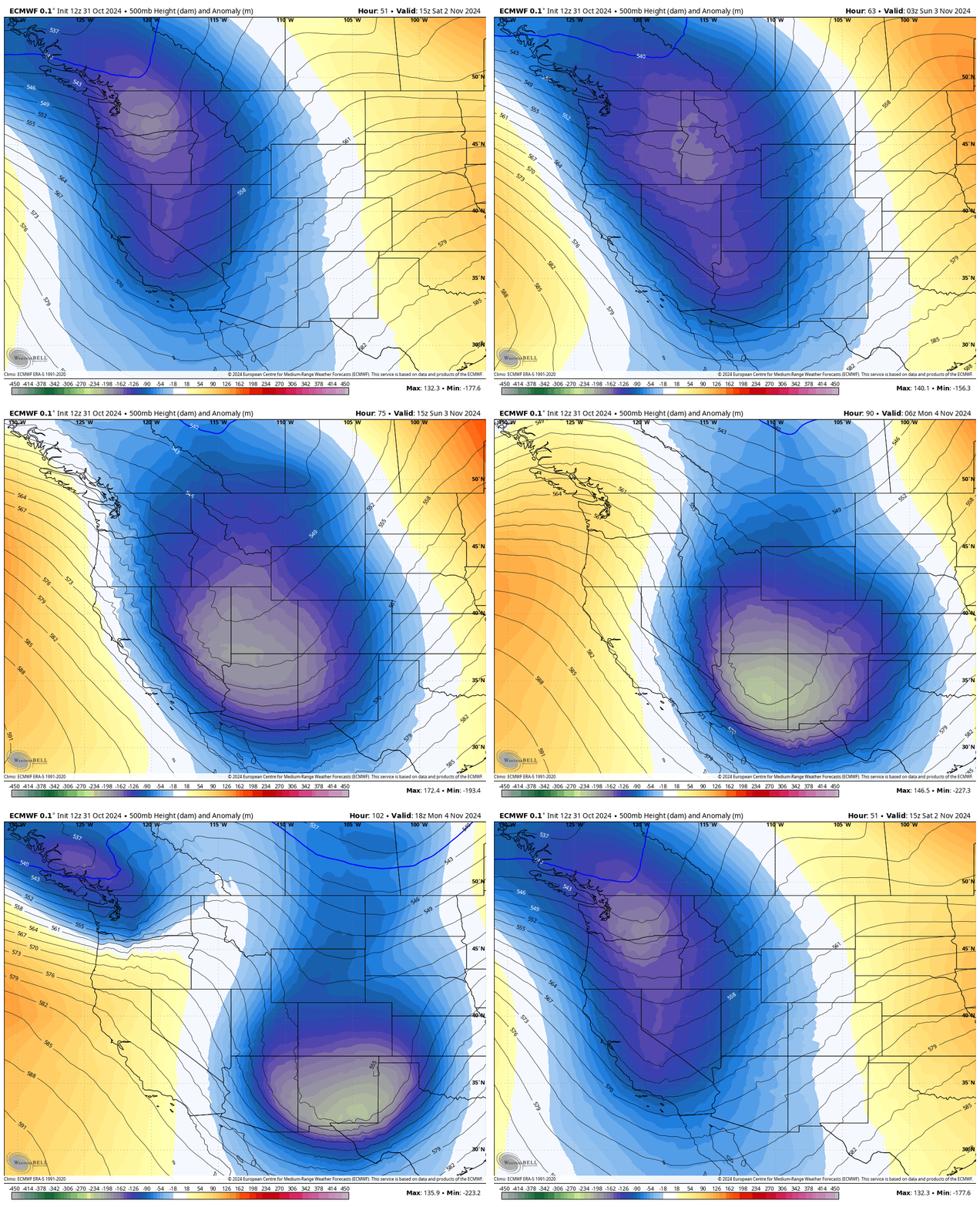
Another storm system will move across the area Saturday night. This won’t be a direct strike for the Central Wasatch, as the meat of the system slides just to our south and west & eventually ends up over Arizona & New Mexico:
Nevertheless, it’ll bring sharply colder air and some moisture into the area. Snowfall begins Saturday evening as a cold front moves in, with snow levels initially close to 6,500 feet.
Cold N-NW flow will support showery snowfall into Sunday and Sunday night, with snow levels sinking close to 5,000 feet.
This system will bring the coldest air of the season, which will almost certainly trigger another lake-effect event between Sunday p.m. and Monday p.m. Unfortunately, the northerly flow will likely send most of the lake-effect snow toward the Oquirrh range, where there are no ski resorts.
This storm feels like a 5-8 incher for most of Utah, with perhaps a little more (6-12″) in the upper Cottonwoods.
Storm #2 (Tuesday – Wednesday)
Another system will work its way into Utah by Tuesday p.m., driving another cold front through the state overnight. This system doesn’t look to bring much moisture but will bring an even chillier airmass into the area.
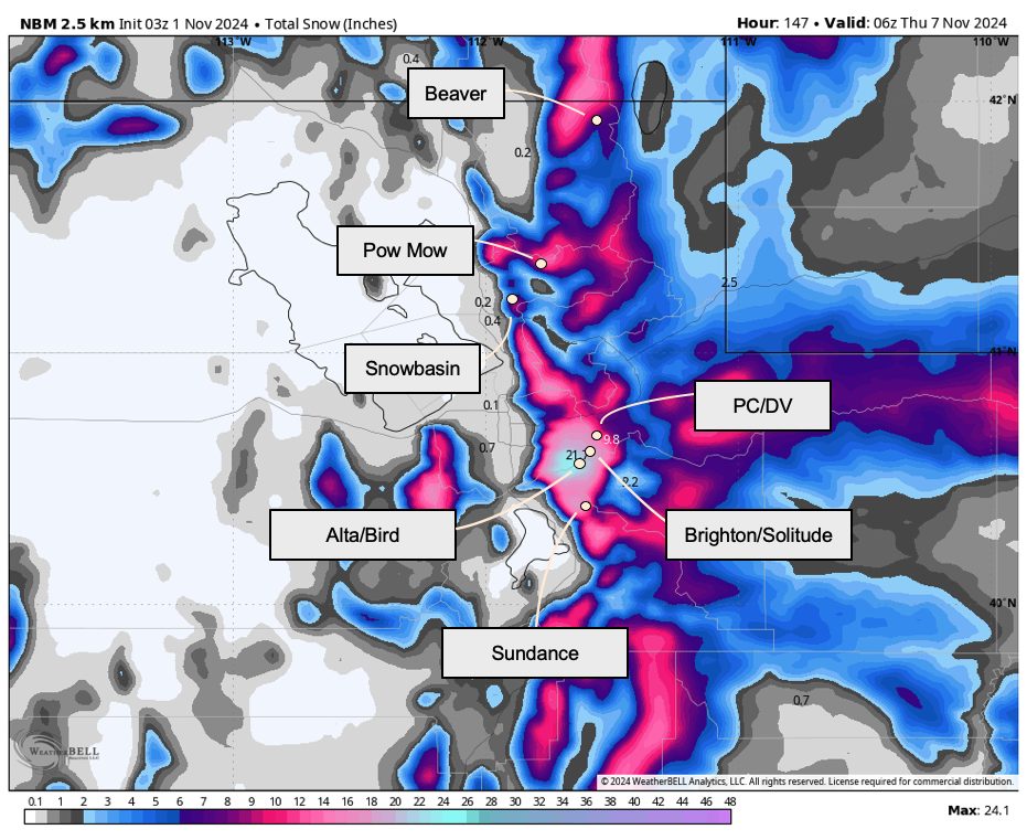
This system is still a while out, so I’ll avoid speculating too much on how much snow we might see. For now, expect another 4-7″ of snow across Utah’s ski country for week-long snow totals in the 10-16″ range.
I expect this storm will be barely enough to warrant some preseason skiing. I tentatively plan on earning my first turns of the season on Wednesday morning.
Extended Forecast
The second half of the upcoming workweek will likely feature a break from snowfall as a ridge develops over the Pacific Northwest and our midweek system exits toward the south and east.
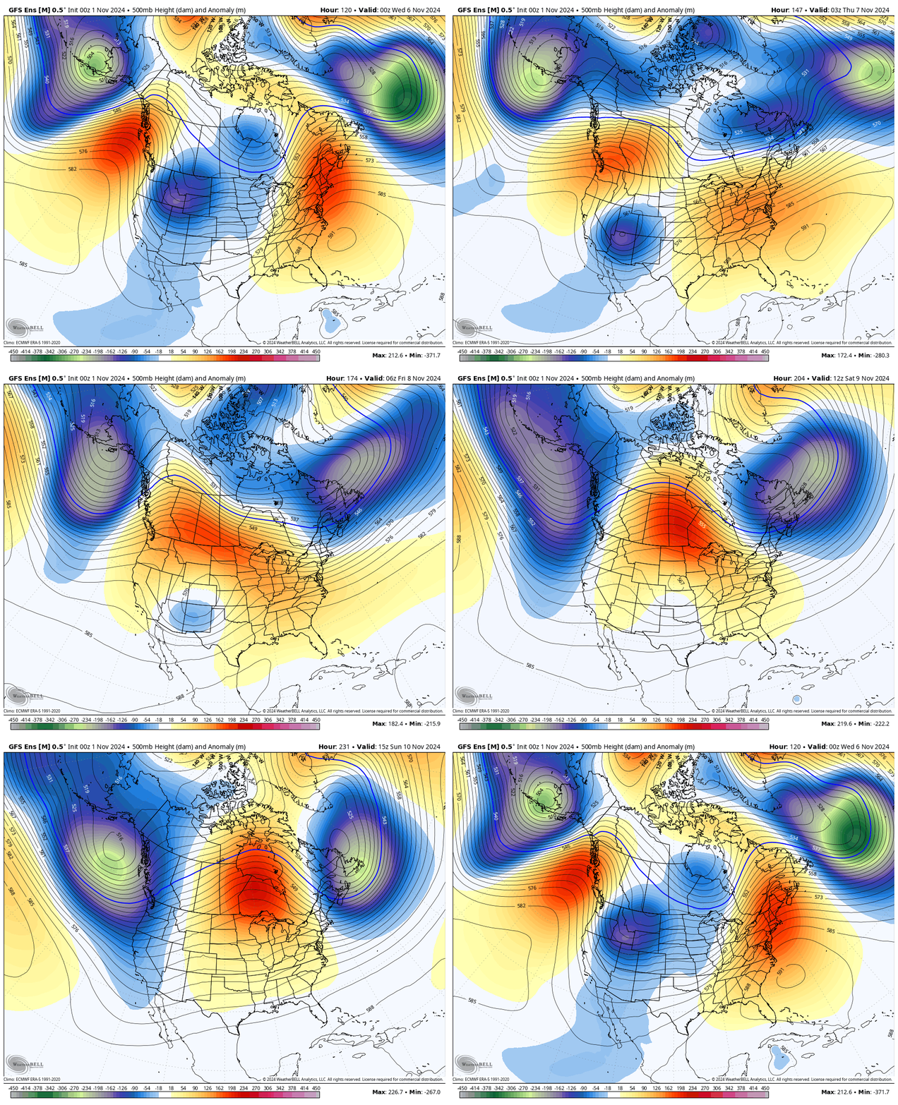
However, ensemble data suggests another trough will begin to displace the ridge sometime around November 11-12. You can see this evolution nicely here:
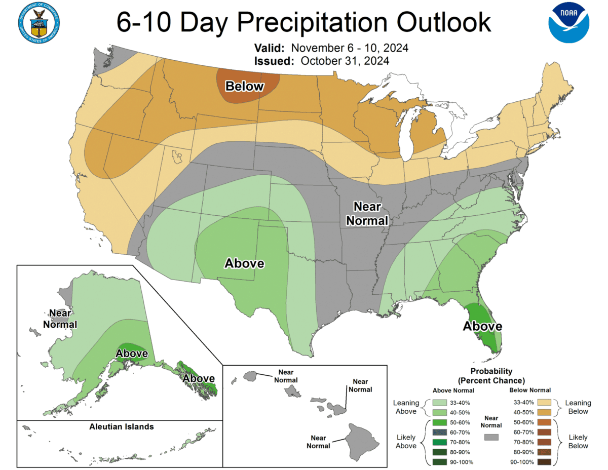
The CPC’s long-range forecast outlooks reflect this. Between November 6-10, they’ve got us pretty dry:
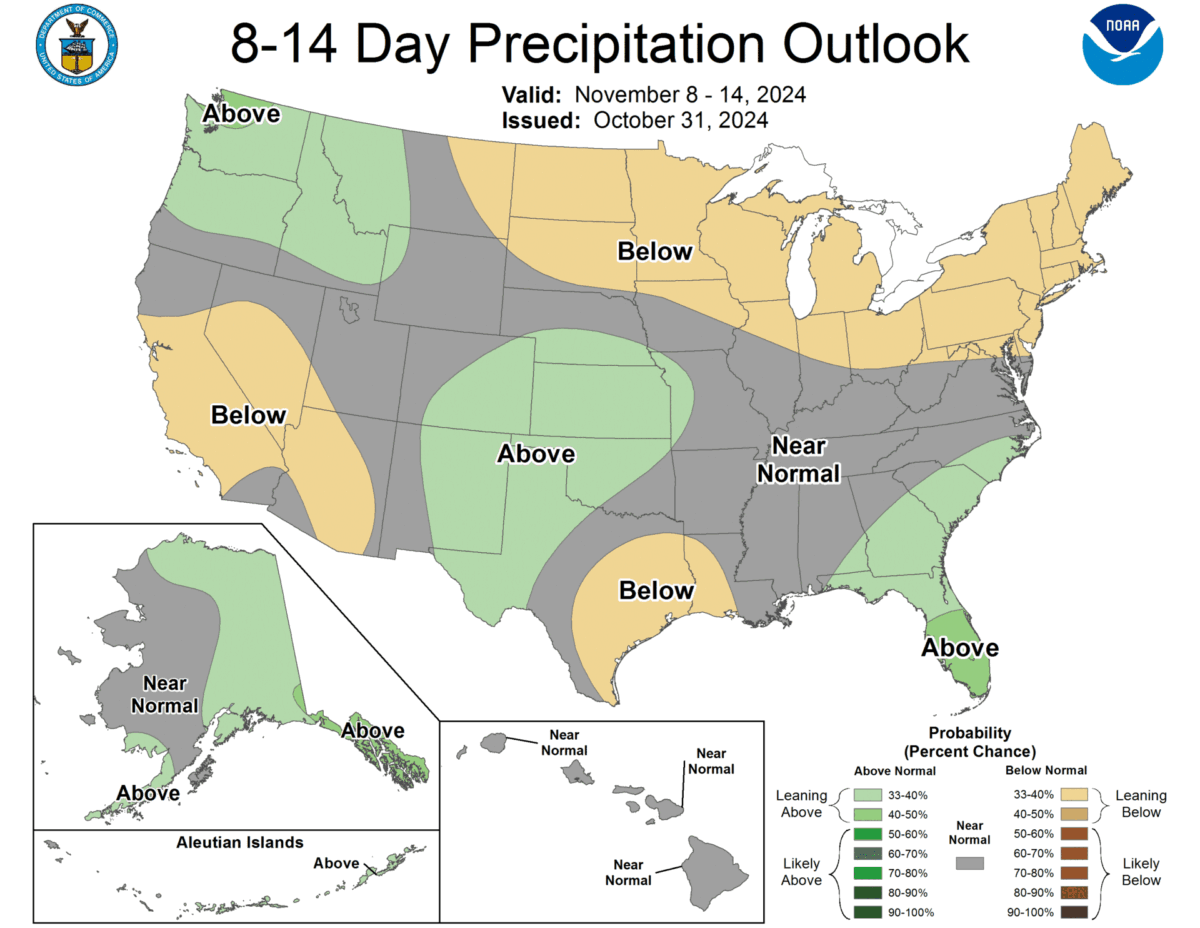
However, things begin to change as the trough I mentioned begins to progress inland:
Frankly, I have little confidence in what this will ultimately mean for ski conditions. We’ll have to wait and see.
