This SnowBrains Forecast was prepared at 6 a.m. MST on Monday, November 11, 2024
- Three storms will impact the Northern Rockies over the next week, the first of which arrives on Monday.
- The mountains of Northern Idaho and Northwestern Montana could see snow every day through next Tuesday, with snow showers filling in the gaps between several waves of more organized snow.
- Multiple feet of snow expected in spots, with generally higher snow totals further north towards Canada.
- Next week looks much drier but also colder.
Forecast Summary
The Northern Pacific Ocean storm track is very active this week, with three low-pressure systems moving down across the Pacific Northwest/British Columbia.
Trough after trough after trough forming west of the Rockies. Source: maps.weatherbell.com
The first system is a fast-moving storm that will deliver some mid- to high-elevation snow ahead of a cold front on Monday night-Tuesday evening. Most precipitation will fall ahead of the cold front, limiting snow to terrain above ~5,000ft. Snow will also be focused towards Northern Idaho, as this storm weakens quickly as it moves further south.
The second system is a much larger, slower-moving trough that will usher in an atmospheric river that targets the Cascades Tuesday night-Thursday. Over two days, more than 50″ of snow is forecast for parts of the Cascades.
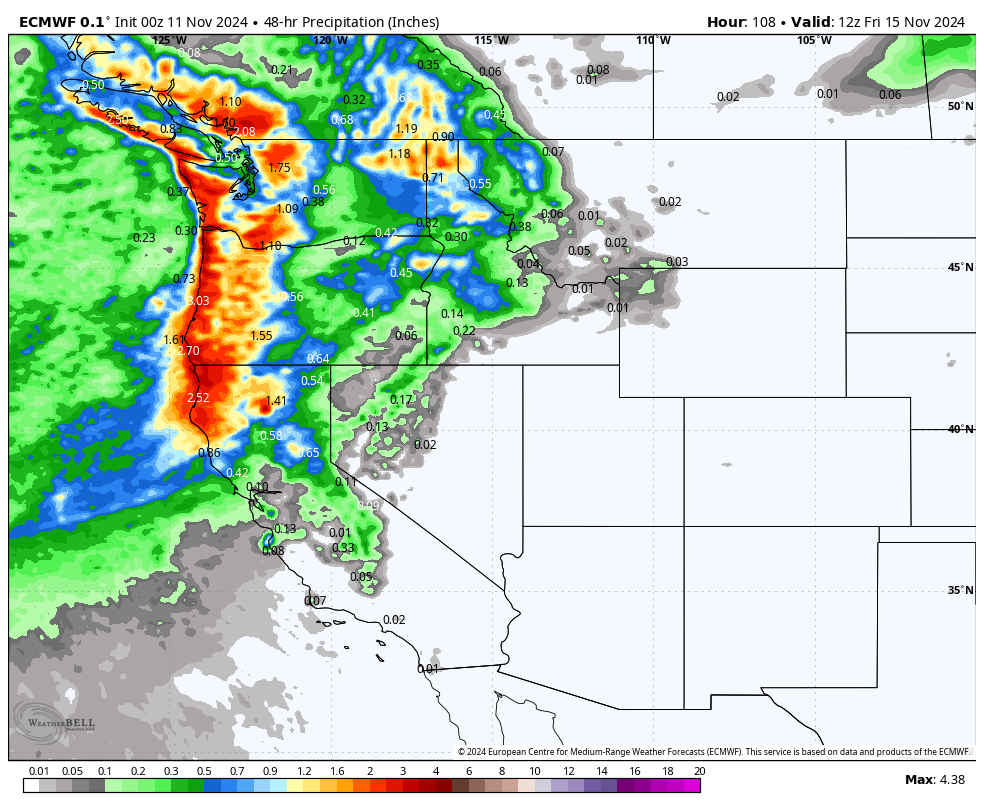
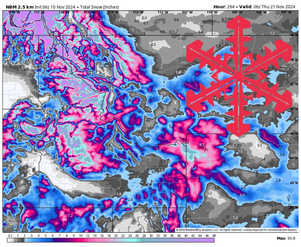
Despite the Cascades soaking up most of the precipitation from the atmospheric river, the Rockies in northern Idaho and Northwest Montana should still be able to squeeze out a fair amount of snow. For example, Schweitzer in far northern Idaho could see well over a foot of snow between Tuesday night and Thursday.
The atmospheric river mostly shuts off as the trough digs further south, but this will allow more snow to sneak around the Cascades and target Southern Idaho, Southwest Montana, and Northwest Wyoming on Friday/Saturday. We expect most terrain above 8,000ft in this area to see 6-12″ snow during this period.
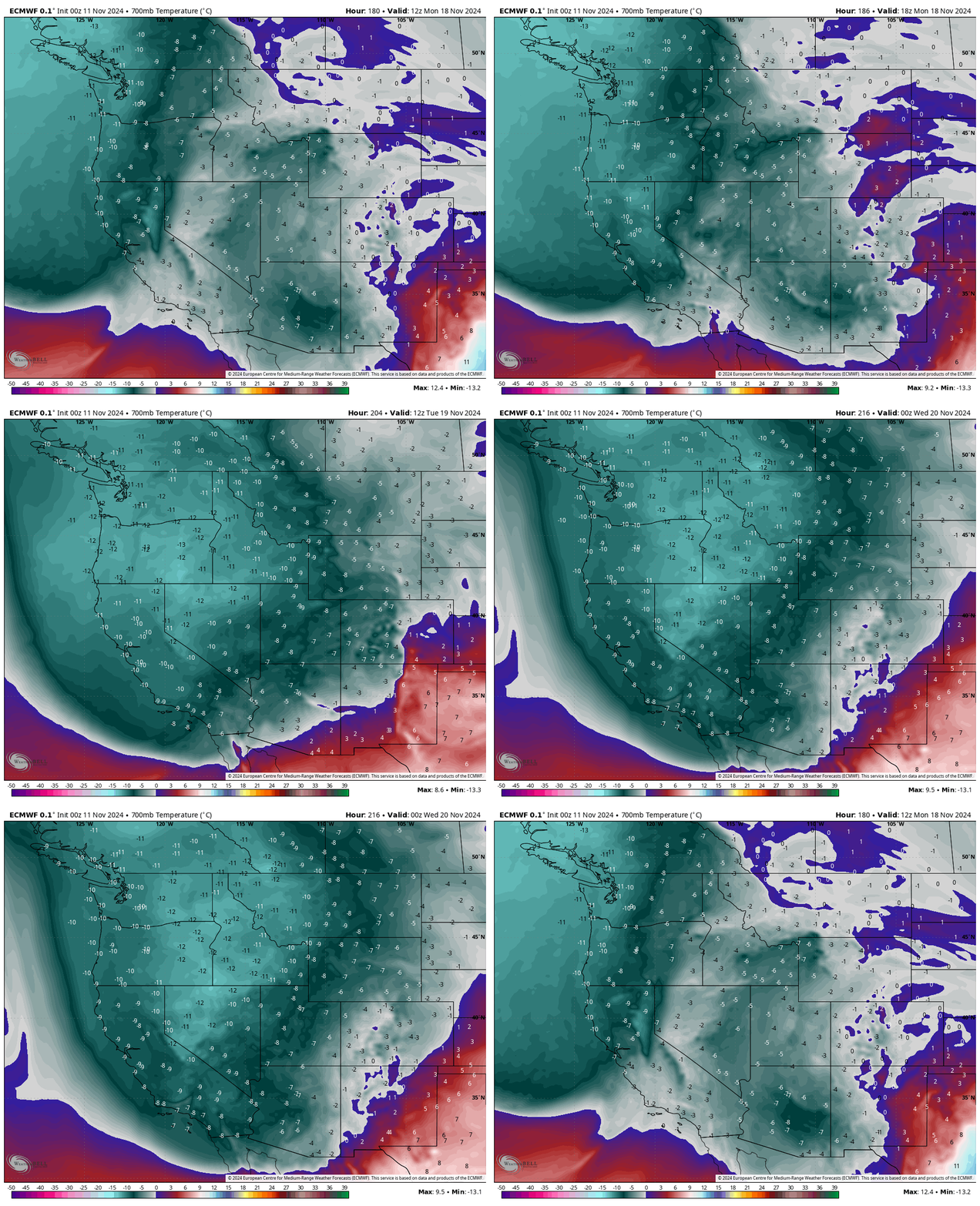
The final of these three storms arrives as a cold front between Monday afternoon and Tuesday morning.
Unlike the first two, this storm should target the entire Northern Rockies. While moisture isn’t nearly as abundant with this system as the previous one, the forecast storm track would partially avoid hitting the Cascades first, leaving relatively more moisture in place when it reaches the Rockies. We expect another 6-12″ of snow across terrain above 6,000′.
Combining all of these systems, here are some forecast snow totals for resorts in Idaho, Montana, and Wyoming:
- Tamarack (ID): 10-20″
- Schweitzer (ID): 18-30″
- Sun Valley (ID): 10-20″
- Big Sky (MT): 6-14″
- Jackson Hole (WY): 10-20″
- Grand Targhee (WY): 12-24″
Extended Forecast
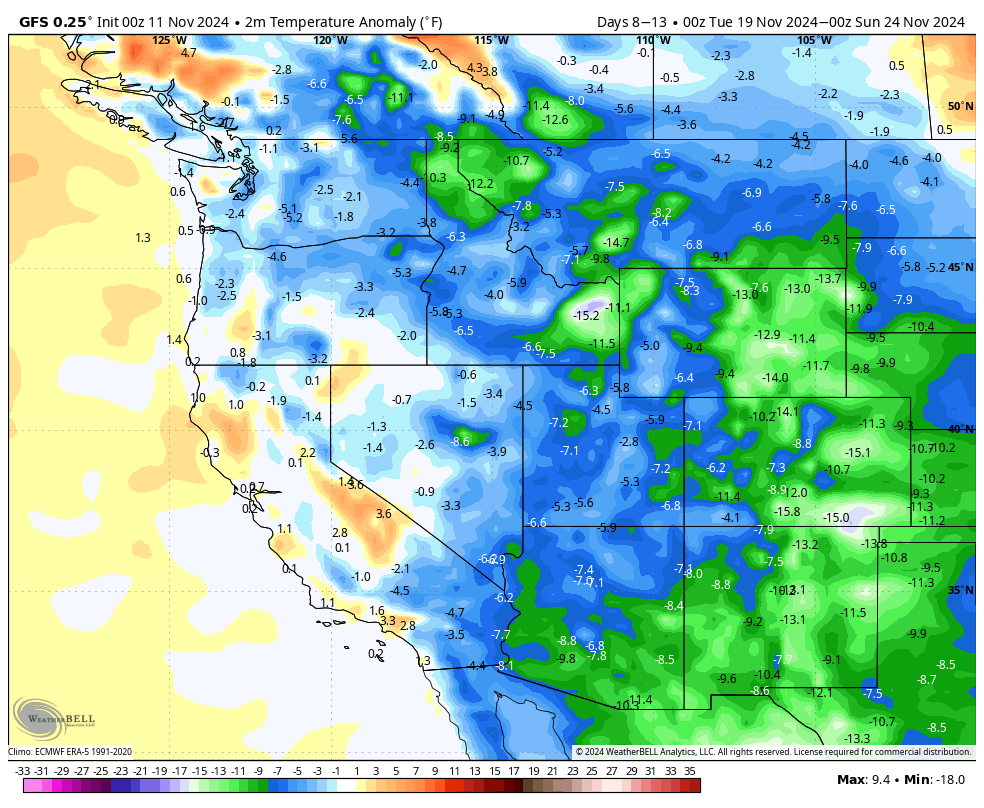
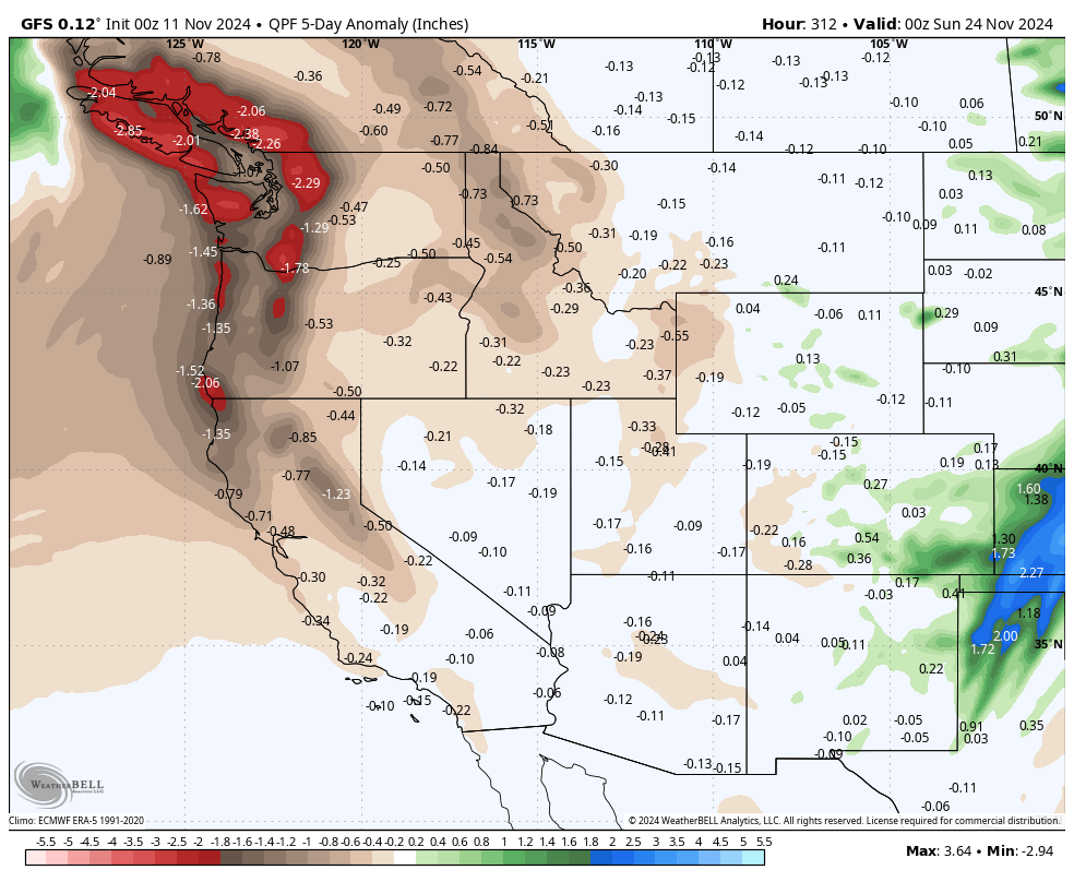
The following week appears mostly, if not entirely, dry across the Northern Rockies. However, snow will have a tough time melting because abnormally cold temperatures are also expected to overtake the region.
