Forecast By SnowBrains Chief Meteorologist – Eric McNamee
12:40 pm MST, 2/17/2022
Forecast Summary:
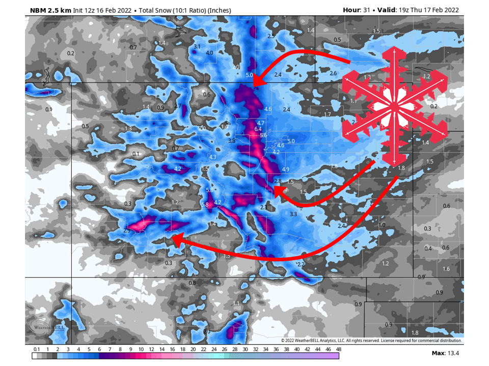
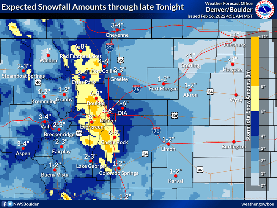
A quick-hitting system will move through Colorado and bring 4-12″ of snow to the mountains through Thursday morning.
Snow will continue to fill in Wednesday afternoon and become widespread.
Conditions dry out through the weekend with the next system coming next week.
Places to see the most snowfall are Steamboat, Winter Park, Loveland, Eldora Mountain, Keystone, Arapahoe Basin, and Telluride.
Short-Term Forecast:
Wednesday-Friday:
A quick-hitting will move through Colorado and bring 6-12″ of snow to the mountains through Wednesday.
Snow that has been falling will increase in coverage Wednesday afternoon/evening as more moisture is transported into the state.
This will continue through Thursday morning, with snowfall rates increasing during the day Wednesday night as the main core of moisture and dynamics moves in.
This has prompted the National Weather Service to issue a Winter Storm Warning and Winter Weather Advisories for the area.
Snow will taper off Thursday afternoon and conditions remain dry through Friday.
Long-Term Forecast:
Saturday-Tuesday:
Dry weather is expected through the weekend as high pressure builds back over the region.
Getting into next week there are indications of the next system moving in Monday/Tuesday.
Totals are unknown at this time but this system looks like it could be the first significant snow in a while.
We will see how this develops through the weekend.
Extended Forecast:
Tuesday and Beyond:
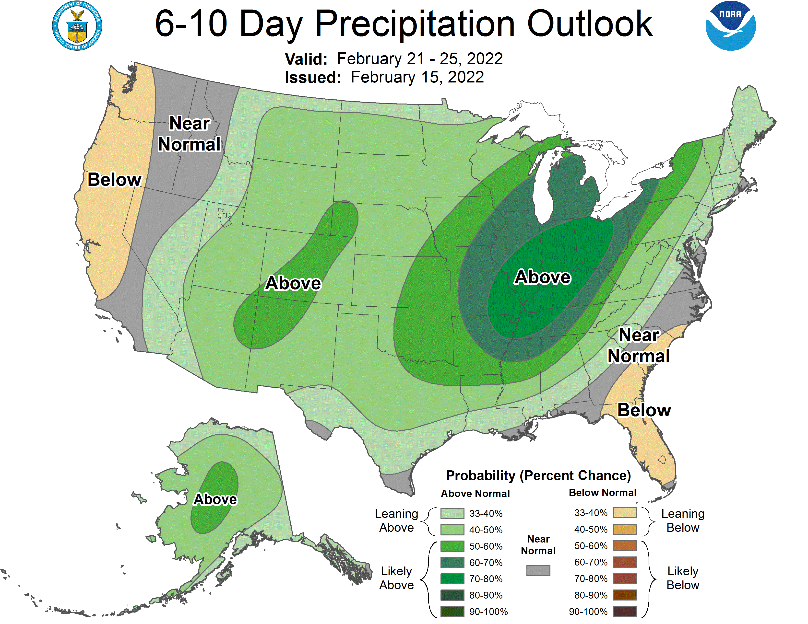
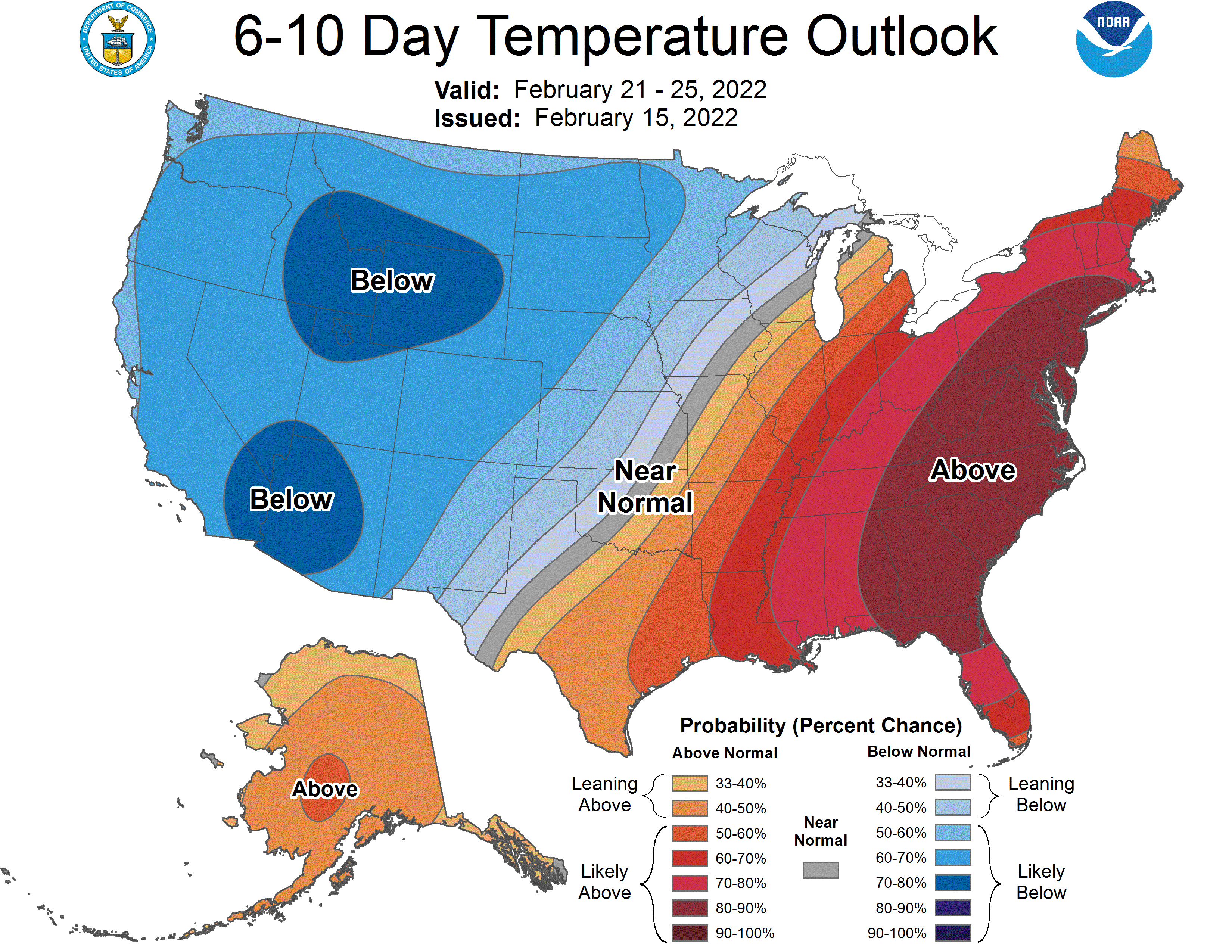
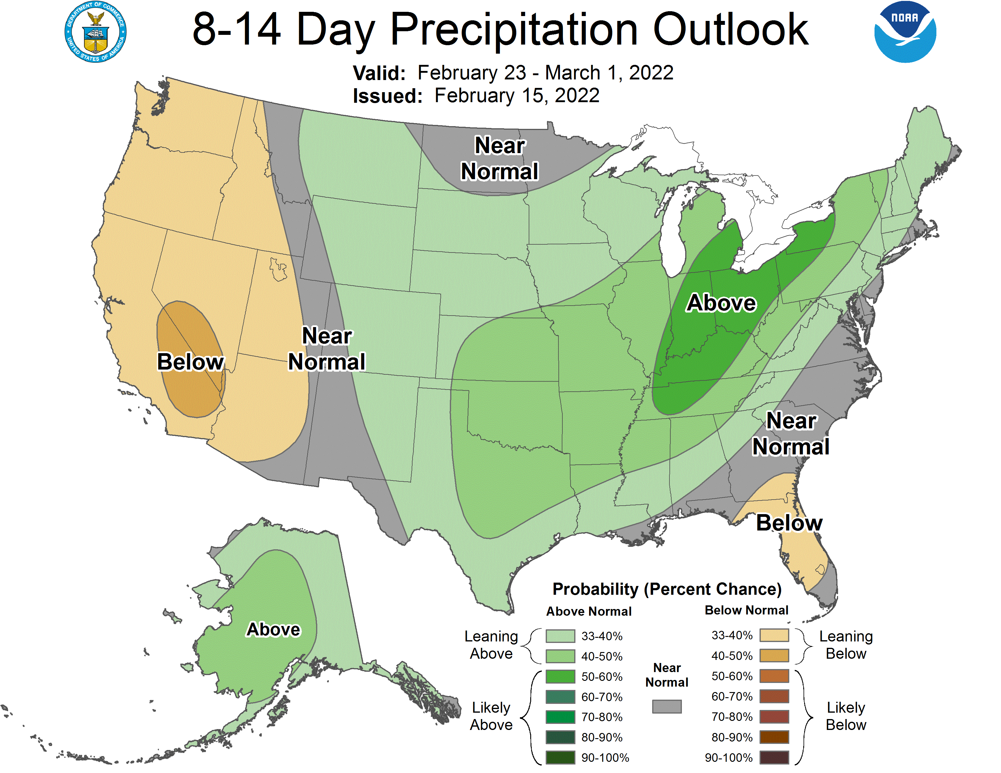
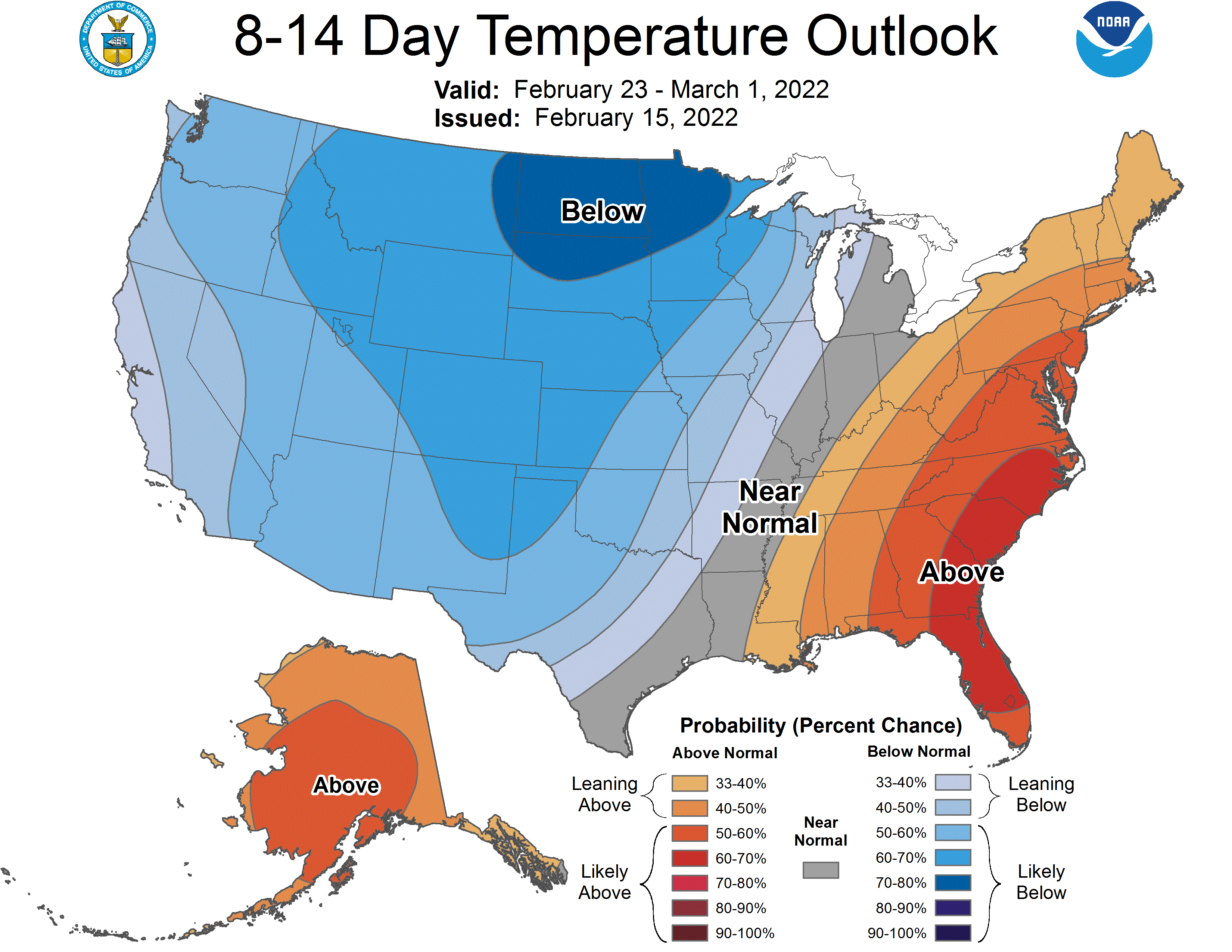
Global ensembles are indicating above-average precipitation and below-average temperatures across Colorado through the extended.
