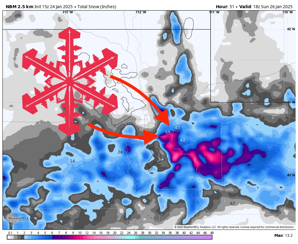
A stalled frontal boundary in Northern Utah this weekend will bring steadily accumulating snow to many northern mountain areas, with lighter amounts farther south and a secondary wave expected early next week in Southern Utah. Overall, the pattern then trends warmer and drier midweek before potentially shifting toward more active weather late next week.
The first wave arrives Friday into Saturday. Snow will begin late Friday across Northern Utah, focusing on higher elevations. Colder air settling in will keep snow levels down to most valley floors. The boundary is expected to stall, resulting in extended, moderate snowfall for the mountains along and just south of the frontal zone. While not overly intense, this lingering snowfall should freshen up the slopes for Saturday turns. Winds are not expected to be extreme, though localized gusts may accompany the frontal passage.
Soon after the weekend, a minor lull develops as the low tracks farther west. Lingering snow showers could persist into Sunday morning for the north, tapering off as the best support pivots away. By Monday, light snow becomes possible over Southern Utah as the system swings east. Accumulations there look modest, with the highest chance of measurable snow in the southern mountains. Temperatures across the state should remain chilly enough for quality snow at upper elevations, though totals will be more sporadic and generally on the lighter side.
Looking ahead mid to late-week, weak high pressure tries to build in. This should yield a gradual warming trend and reduced precipitation chances from Tuesday onward. Ensemble guidance suggests that after this brief quieter stretch, another system could approach from the northwest into next weekend, bringing the possibility of renewed snowfall. Long-range outlooks hint at a mix of near to slightly below-normal temperatures in the Intermountain West, along with a potential for more active weather at the very end of the period. Stay tuned for updates if that pattern materializes.
Resort Forecast Totals
- Alta/Snowbird – 5″–10” Fri Day (01/24)–Sat Night (01/25)
- Solitude/Brighton – 5″–10” Fri Night (01/24)–Sat Night (01/25)
- Park City/Deer Valley – 4″–8” Fri Night (01/24)–Sat Night (01/25)
- Eagle Point – 0″–3” total (0″–2” Sat Day (01/25)–Sat Night (01/25) + 0″–1” Mon Night (01/27))