Forecast By SnowBrains Chief Meteorologist – Eric McNamee
8:00 PM MST, 11/15/2021
Forecast Summary:
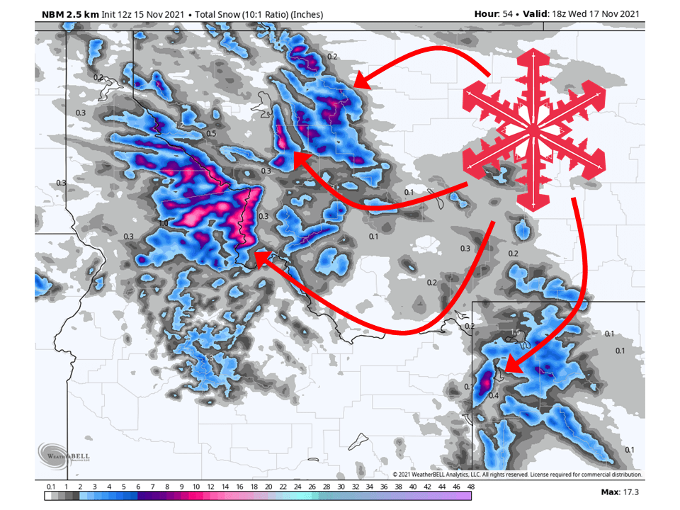
A shortwave trough will move through the Northern Rockies Tuesday/Wednesday and bring 6-18″ of snow.
Snow will initially start late Monday night and continue on and off through Wednesday morning.
Showers will taper off Wednesday, with another chance of snow later this week.
Resorts that will see the most snow are Jackson Hole, Grand Targhee, Flathead, Big Sky, and Bridger Bowl.
Short-Term Forecast:
Tuesday-Thursday:
A shortwave trough will move through the Northern Rockies Tuesday/Wednesday and bring 6-18″ of snow.
As mentioned snow will initially start Monday night as moisture is transported into the region.
The general flow of this moisture will be from the W-SW, so mountain ranges that run north-south will see the most snow, especially western slopes.
Winds will also be very strong, so an increase in avalanche danger is likely.
Snow will continue on and off through Wednesday morning and then dry out completely Wednesday afternoon.

Long-Term Forecast:
Friday-Monday:
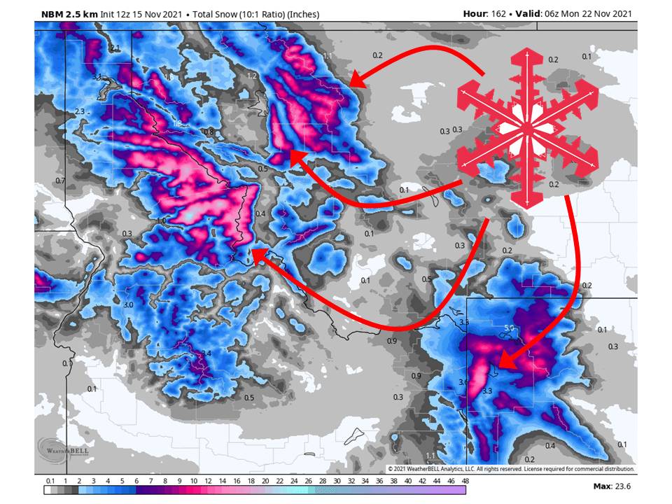
Another system will move through the area this weekend, bringing more chances of snow for the mountains.
Right now snowfall totals are not sure, but it looks like another healthy amount comparable to the Tuesday/Wednesday system.
Extended Forecast:
Sunday and Beyond:
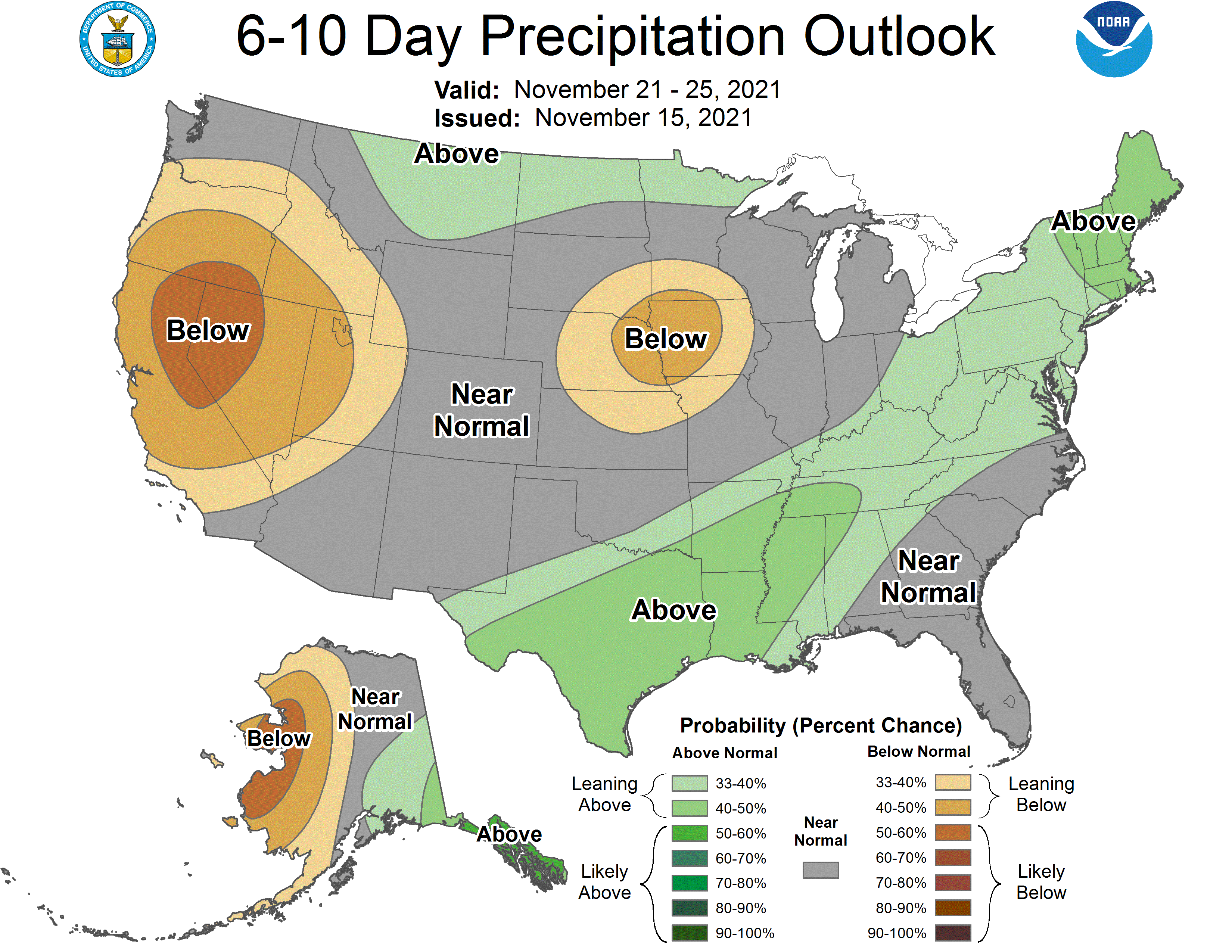
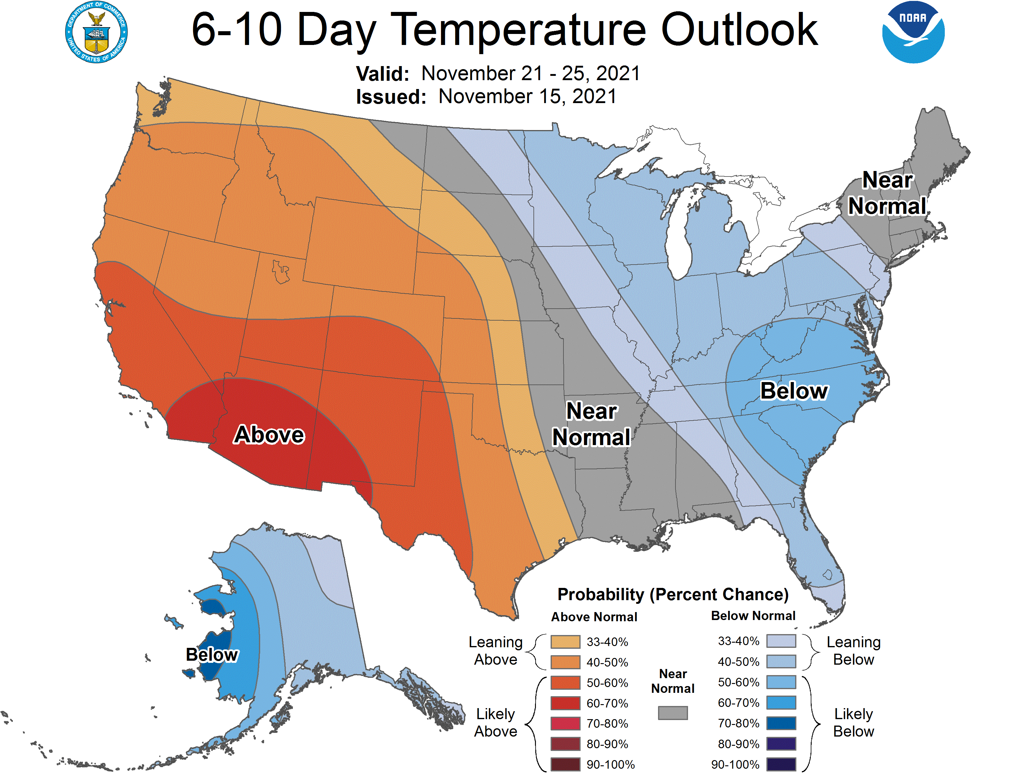
Global ensembles are indicating near to below-average precipitation and above-average temperatures across the region in the extended.
