Forecast By SnowBrains Meteorologist – Eric McNamee
Brought to you by Alta Ski Area
9:50 AM MST, 2/5/2021
Forecast Summary:
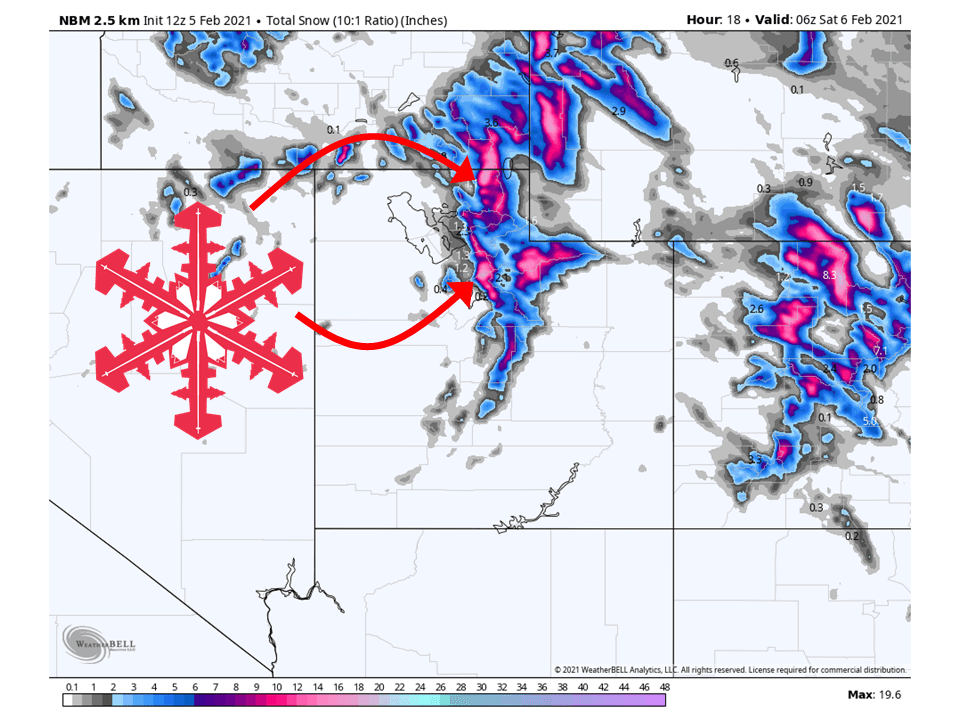
A quick-hitting shortwave trough currently over the northwest US will move through Utah today, bringing 8-16″ of snow to Utah’s Wasatch Mountains.
Snow will taper later this evening but will fall intensely over that period of time.
Conditions look to generally dry out getting into next week.
Resorts that look to see the most snow are Alta, Snowbird, Brighton, Solitude, Park City, Canyons, Deer Valley, Snowbasin, Powder Mountain, Sundance, and Beaver Mountain.
Short-Term Forecast:
Friday-Sunday:
8-16″ of snow is expected for the Wasatch through this evening as a quick-hitting shortwave trough moves through the state.
Snow has already started to fall across the higher terrain and far northern Utah and will fill in across the Wasatch as the day progresses.
Strong winds associated with this shortwave and a moisture-rich airmass are what will make the snowfall intense today.
By this evening, snow will taper off as this shortwave trough moves out of the state.
Conditions will remain dry through the weekend as dry air moves into the area.
Long-Term Forecast:
Monday-Thursday:
Conditions will remain generally dry during the long-term, with some snow possible over extreme northern Utah as moisture brushes by the state.
By Thursday, there are some indications of roughing over the west, but there is still a lot of disagreement in models about this.
Extended Forecast:
Wednesday and Beyond:
Global ensembles are indicating near-average precipitation and below-average temperatures over Utah in the extended portion of the forecast.
**Alta Forecast**
8-16″ of snow is likely to fall in the Cottonwoods today as a shortwave trough interacts with a very moist airmass.
Snow has already started over the Cottonwoods and will pick up in intensity as the center of the shortwave trough moves into the state.
Snow will taper off later this evening as the quick-hitting shortwave trough moves out of the state.
Winds will be strong at peak level so don’t surprised if there are some wind holds today.


