Forecast completed 6 a.m. MT, Friday, November 22
Summary
The short-term forecast for the Wasatch looks promising. Accumulating snow is expected Saturday night-Sunday & again Tuesday-Wednesday.
The long-range forecast looks a touch bleak.
Weekend Snow
A powerful trough has been offshore of the Pacific Northwest for the past few days. Heavy snow has been falling in the Cascades and Northern Rockies, while Utah has been on the outside looking in.
Eventually, the trough will eject inland in two pieces. The first will drive a cold front through Utah on Saturday night.
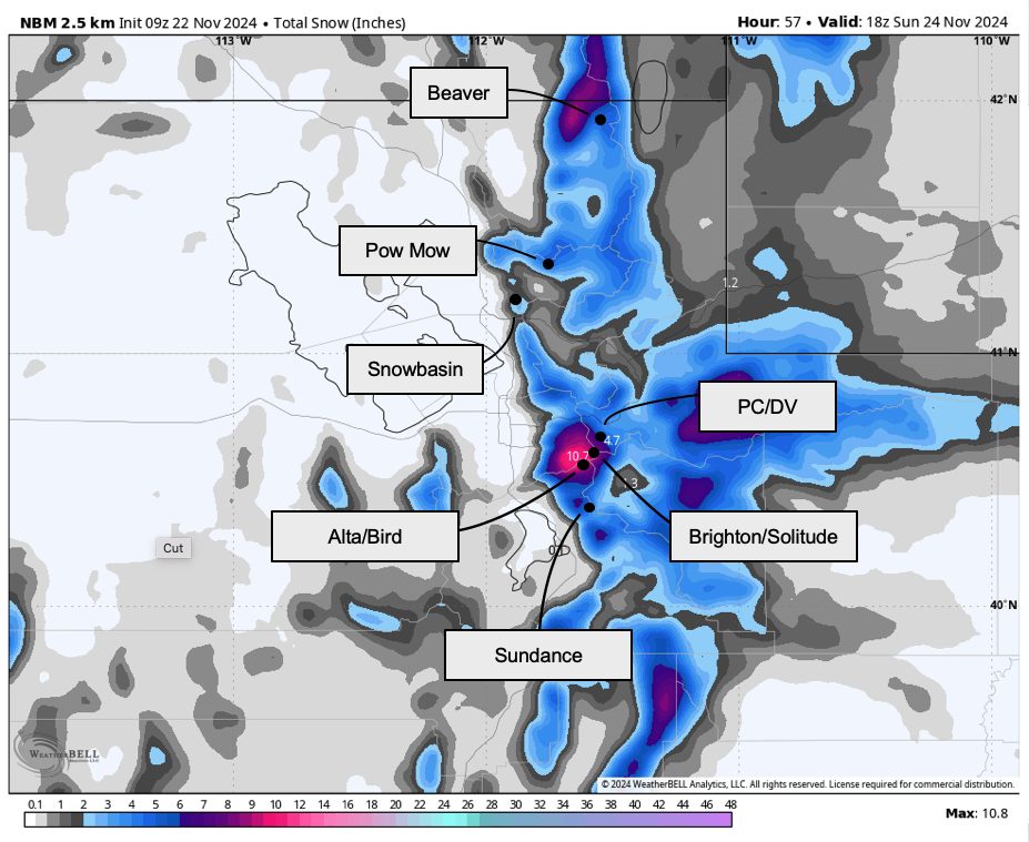
A couple of mountain snow showers are likely through Saturday afternoon, but they probably won’t be enough to meaningfully improve ski conditions until later in the night. Expect a quick burst of snow overnight and a snow shower or two lingering into Sunday morning.
Here’s what I’m expecting to see by midmorning Sunday:
- Alta, Snowbird, Brighton, Solitude: 5-10″
- Park City & Deer Valley: 4-9″
- Snowbasin, Powder Mountain: 4-7″
- Sundance: 5-8″
- Eagle Point: 2-4″
- Brian Head: <2″
Tuesday-Wednesday Snow
Sunday afternoon through Monday should be dry, but another chance for snow comes by midweek.
I’m not sure what to make of this storm quite yet. Forecast models agree that some sort of atmospheric river feature will impinge on the Southwestern US next week but differ in how far north it will get:
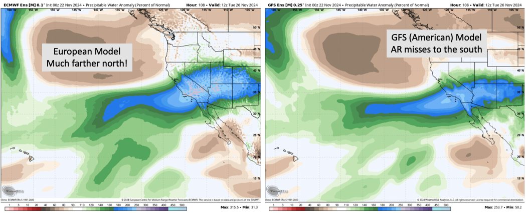
I’m not sure which of these is going to happen. A track farther north could easily bring 10″+ of snow for most of the resorts, while a southern track would bring no more than an inch or two. As forecast confidence increases, an update will be posted.
- Related: SnowBrains Forecast: Idaho Snowpack Set to Benefit With Up to 18″ Fresh Snow From Bomb Cyclone
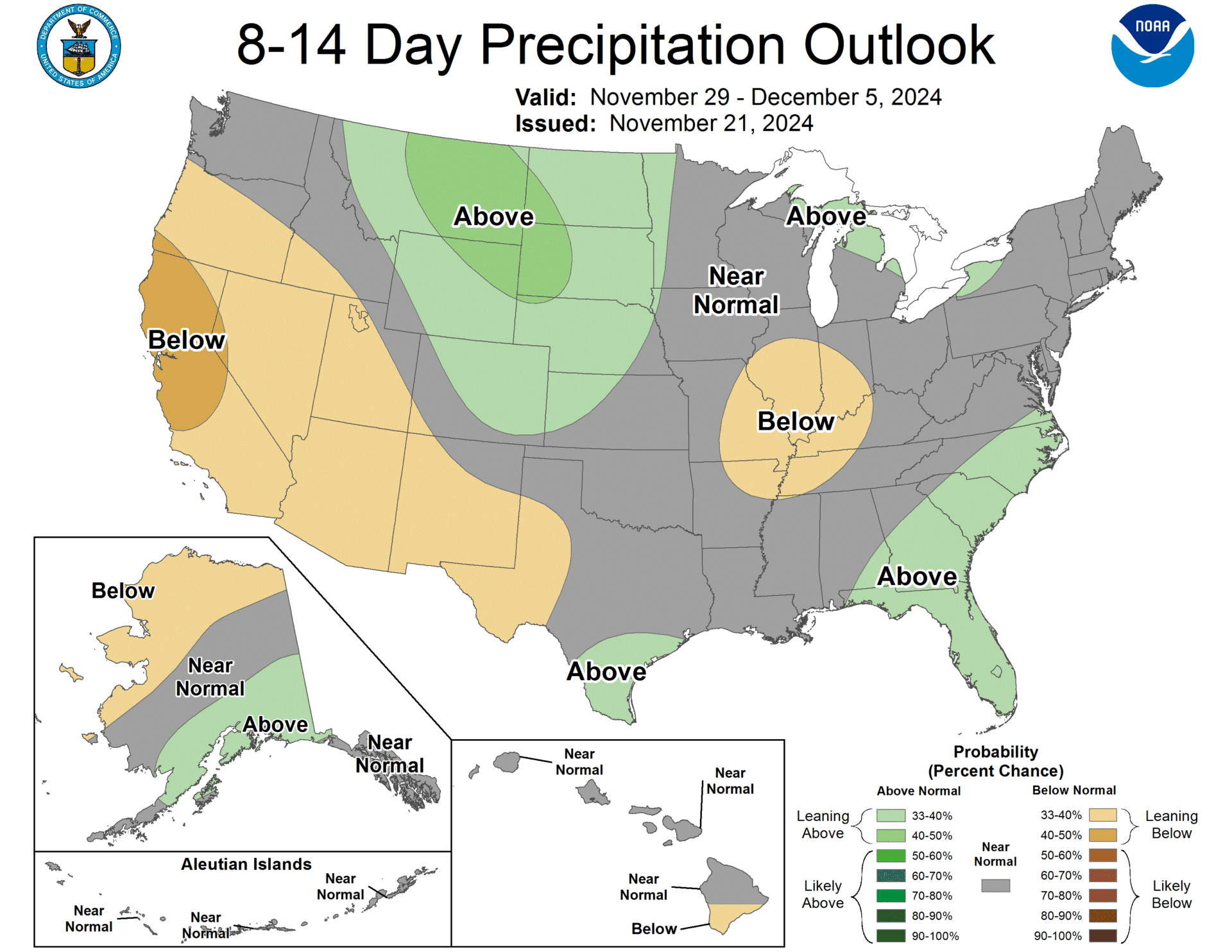
Long Range Prospects
As a Wasatch Warrior, I can’t say I love what I see in the long-range. After our midweek storm, I expect to dry out for a bit. It looks like we’ll transition to a pattern dominated by ridging over the Northwest & troughing over the Great Lakes/Northeast:
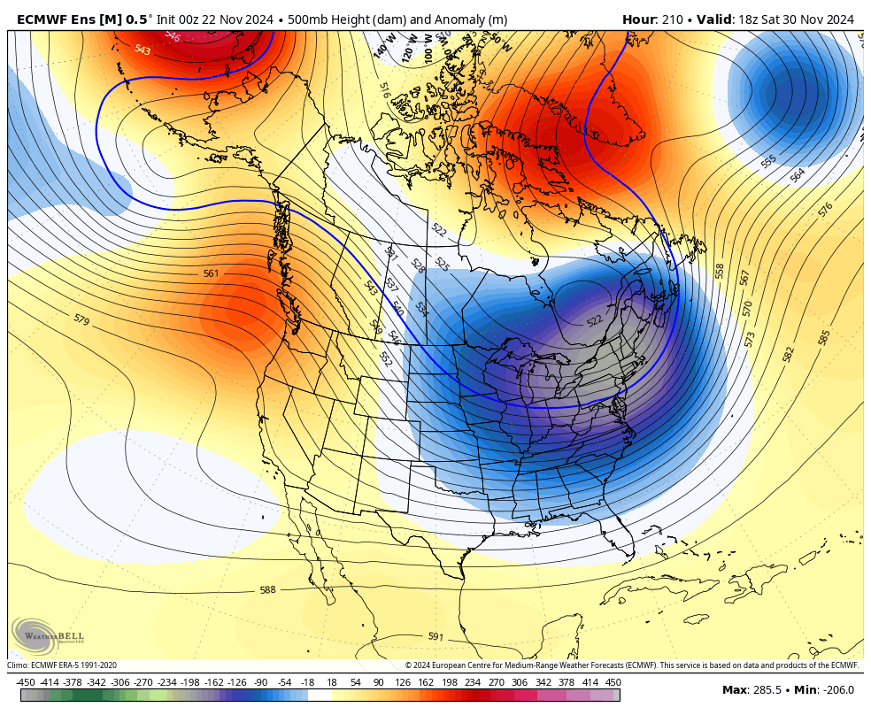
This isn’t my favorite look for snow. Models hint at some potential for moisture to crest the ridge at times into the first week of December, but I think the CPC is right to have most of Utah in the brown: