This SnowBrains forecast was completed at 4:00 p.m. on Wednesday, October 16, 2024
Forecast Summary
A cold front sweeps down from the Northwest Wednesday night, dropping temperatures to near normal and bringing widespread rain and high mountain snow.
Cold air continues rushing in through Friday, with waves of rain and snow continuing. Snow levels gradually drop to as low as 3,500-4,000 feet on Thursday night and Friday.
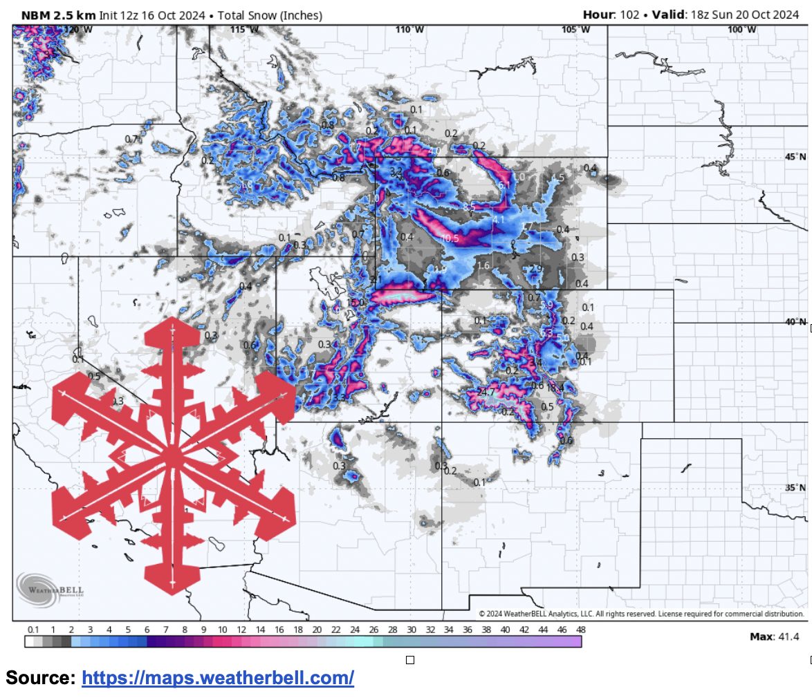
Southwest Montana and Western Wyoming get hit the hardest, with a foot of new snow possible at resorts like Grand Targhee and even more across the higher peaks of the Wind River Range.
Short-Term Forecast (Wednesday Night-Saturday)
Abnormally warm and dry weather takes a backseat starting tonight as a strong low-pressure system drops down across the Rockies. This storm will track from the Pacific Northwest down to Northern Utah, generally staying west of the Rockies until it moves around the southern tip of the Rockies in the Four Corners region.
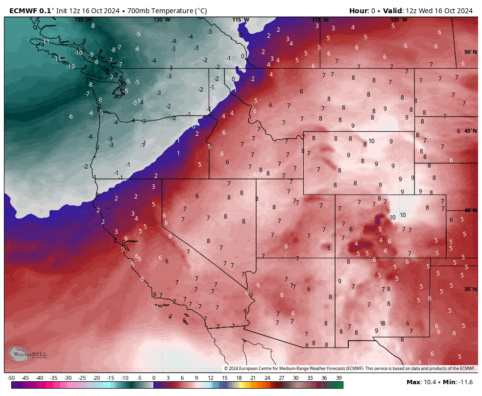
Temperatures will fall as much as 30 degrees day-over-day in some spots, going from ~15 degrees above normal to ~15 degrees below normal. The coldest temperatures will be felt Friday morning, with much of the Northern Rockies seeing below-freezing temperatures.
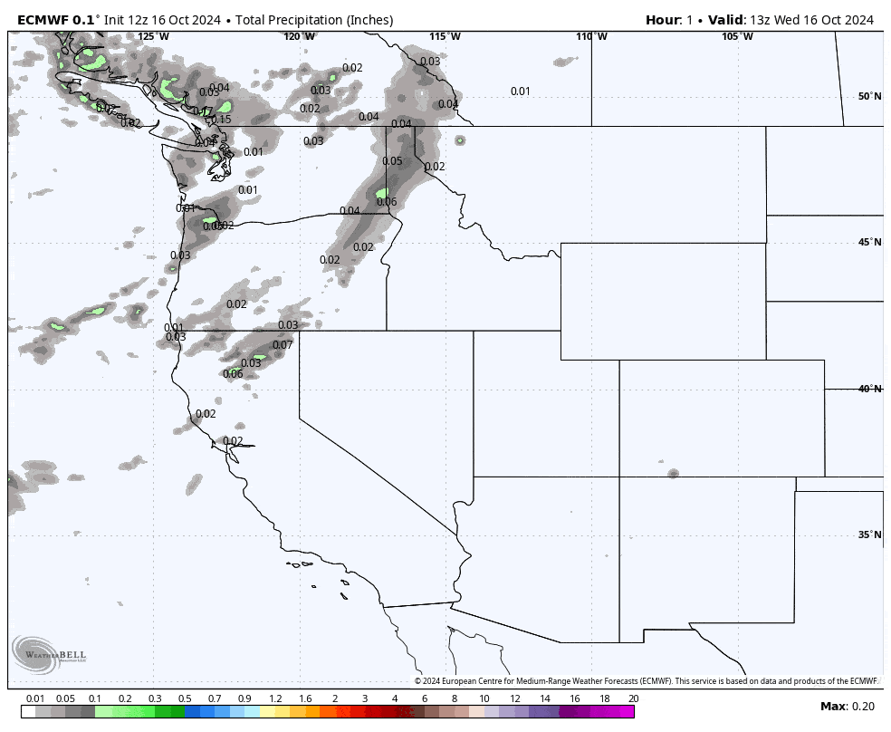
The initial cold front on Wednesday night and Thursday morning is expected to produce a line of rain and high mountain snow, but this should produce minimal snow accumulations limited to the highest peaks.
The more significant accumulations occur Thursday night and Friday morning when colder air has dropped snow levels close to valley floors. Snow tapers off by midday Friday as the storm focuses on the Southern Rockies.
Snowfall Totals:
- Grand Targhee (WY): 9-15″
- Jackson Hole (WY): 6-12″
- Big Sky (MT): 4-8″
- Sun Valley (ID): 1-4″
Extended Forecast:
Near normal temperatures will continue next week, with mostly dry weather.
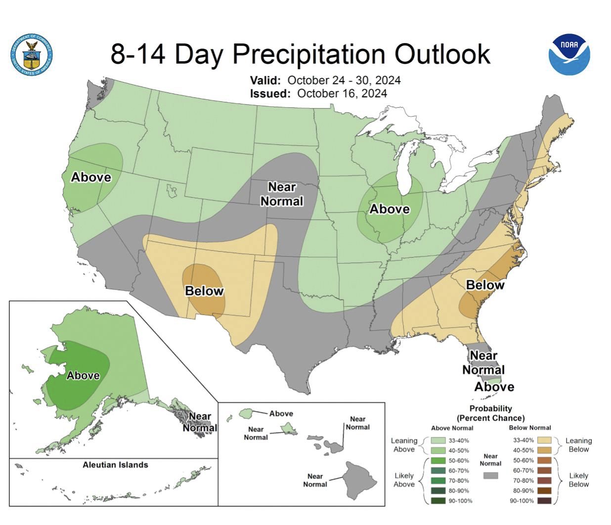
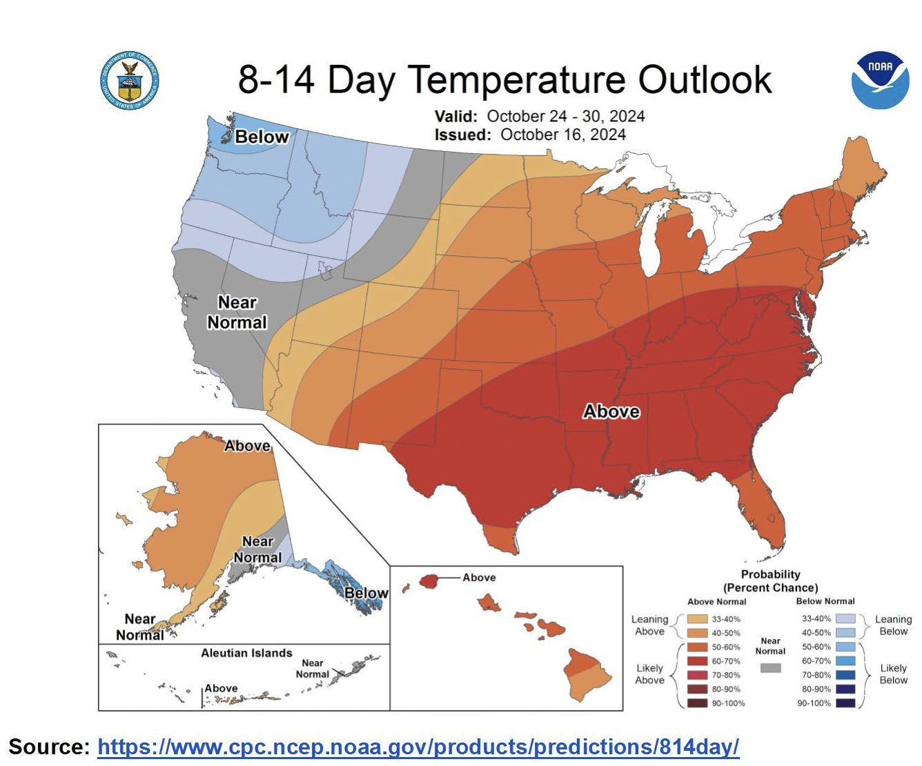
The next bigger storm we are tracking is about 10 days out. It is reflected in the CPC 8-14 day outlooks, which show above-normal precipitation and below-normal temperatures.