Forecast by SnowBrains forecaster Clay Malott – 4/1/23 4 pm MT
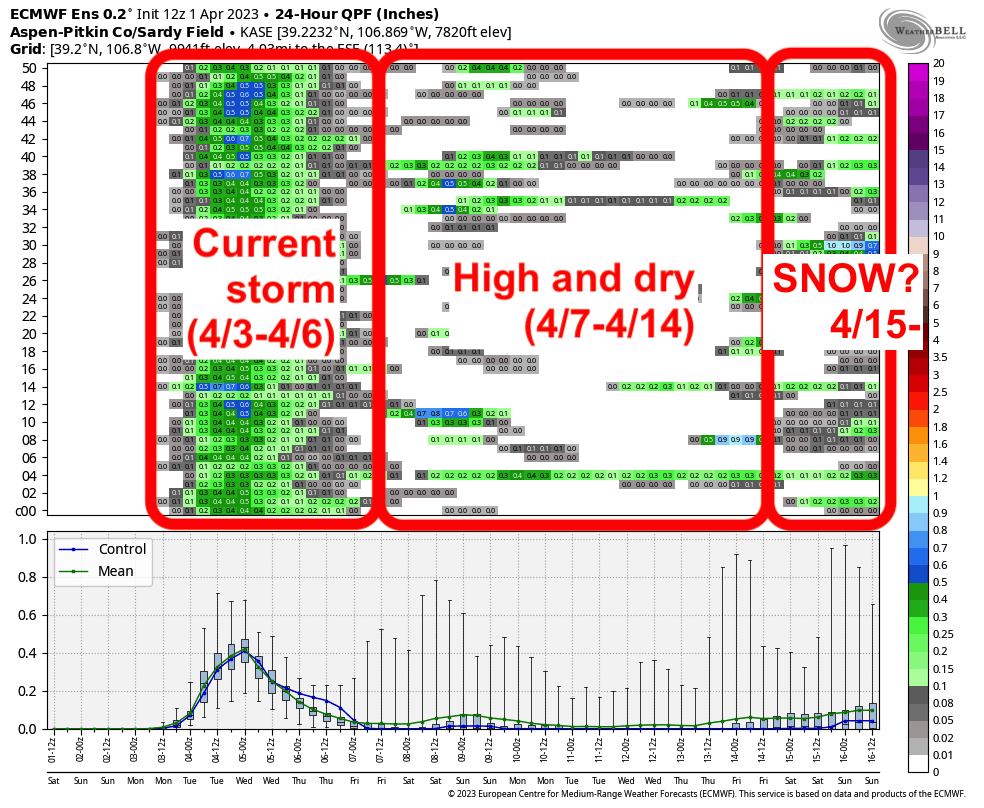
In the latest edition of “the season that keeps giving”, Colorado is in for yet another solid storm. Most of the snow during this storm will fall from Monday night through Wednesday night. Beyond that, a very minor storm is possible next weekend before the West enters a drier pattern heading into mid-April (something we really haven’t seen since November!).
Storm summary table
I’m trying something new here, meant to simplify the forecast into a short, TL;DR for readers. The following shows a super simple breakdown of the snowfall by day (previous night + current day).
| Tuesday | Wednesday | Thursday | |
| Steamboat | 8-12″ | 1-3″ | 0-1″ |
| I-70 | 4-9″ (most at WP, Eldora) | 2-4″ (4-8″ at WP) | 2-4″ |
| Central CO | 4-10″ (most at Powderhorn) | 2-4″ | 1-2″ |
| Southern CO | 4-7″ (8-12″ at Wolf Creek) | 1-4″ | 0-2″ |
Full forecast
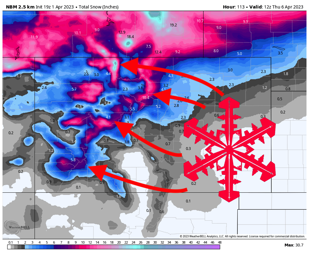
Showers will begin in the western mountains on Monday afternoon, but will not bring accumulation during the day. Most models have a nice snow band setting up right over Steamboat, so if that materializes and delivers, it’s possible Steamboat could exceed the forecast. By the time lifts are spinning on Tuesday morning, here are what I see as realistic totals at resorts around the region:
- Steamboat: 4-8″
- I-70: 2-4″ (Winter Park and Eldora have a good shot at exceeding that range)
- Central CO: 2-4″ (5-8″ at Powderhorn)
- Southern CO: 3-5″ (7-10″ at Wolf Creek)
Light to moderate will continue on Tuesday, particularly in the afternoon. Expect 1-3″ during the day at resorts across the state with exceptions of 4″+ at Winter Park, Steamboat, and Powderhorn.
Precipitation on Tuesday afternoon and evening – especially in Summit County – will bring some solid extra inches between resort closing time on Tuesday (4pm) and resort opening on Wednesday (8am):
- Steamboat: 1-3″
- I-70: 2-4″ (4-8″ at Winter Park)
- Central CO: 2-4″
- Southern CO: 1-4″
Very light snow during the day on Wednesday will add an extra layer of fresh snow on top of an already solid storm total. However, don’t expect much more accumulation on Wednesday.
A “final hurrah” push of precipitation from the southwest will bring some bonus snow to central and northern Colorado on Wednesday night for fresh tracks on Thursday morning. Expect 1-3″ for Aspen and around 2″ for I-70 resorts.
Extended outlook
Some models have a small storm arriving next weekend, but the details are still completely up in the air; it’s looking increasingly likely that this storm will miss Colorado entirely.
Beyond that, high pressure sets up for the foreseeable future over the west, steering moisture and storm energy to the north, missing Colorado. Ensembles are hinting at elevated snow chances returning to Colorado around the 15th, but details remain very unclear!